->

01 April 2010

Download Ordnance Survey Data

Download Ordnance Survey Data

updated (servers now active & running!)

Pretty Postcodes
Code-Point Open

Codepoint Open - OSM Rendered

http://random.dev.openstreetmap.org/postcodes/?layers=000F0F0FBT
(development - may change at anytime)

Problems downloading on the OS OpenData site?
Alternative site: http://parlvid.mysociety.org:81/os/
Donate if you can (thanks)

now includes:
Code-Point Open
  • NationalGrid ↔ WGS84: AGPL Perl code, GPL PHP code
  • CSV headers: Postcode, Quality, PO box indicator, Delivery points stuff x 7, Easting, Northing, Country, NHS region, NHS health authority, County, District, Ward, Postcode.
  • WGS84 edition – with latitude and longitude instead of National Grid, and empty columns removed (so CSV headers are: Postcode, Quality, Latitude, Longitude, Country, NHS region, NHS health authority, County, District, Ward).
:) thanks @jonobennett

OS Meridian2 xml_rendered in OSM Mapnik
Fast implementation above Meridian2 rendered in OSM Mapnik

Another mashup using the OS 50k Gazetteer
A Tour of the OS 50k Gazetteer Linked Data
http://www.ldodds.com/blog/2010/04/a-tour-of-the-os-50k-gazetteer-linked-data/


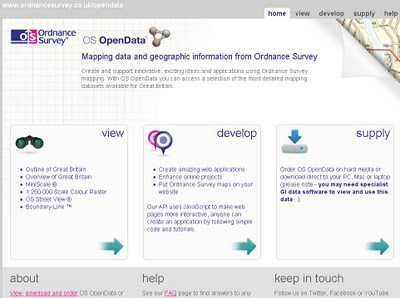
Ordnance Survey Open Data


Ordnance Survey Open Data Download

Labels: , , , ,

17 December 2009

Live Snow Radar Map UK

Live Snow Radar Map UK
*almost live

Live Snow Radar - UK Map
Pink and Red highlights snowfall - blue and purple represents rain.

"Radar is a remote sensing tool used by weather forecasters to analyse the extent and intensity of precipitation. Radar detects objects by transmitting radio waves which are reflected back to the starting point by any object they encounter. Distance can be calculated using the speed of the radio waves and the amount of time that each pulse takes to reach the object and return back to the starting point. Rain, snow and hail all stop the radio waves. The more pulses that are reflected back, the greater the intensity of the precipitation."

http://www.raintoday.co.uk/static/about_radar.html


View the map in near real-time
http://www.raintoday.co.uk/

powered by Meteogroup and Google Maps API

source: @mapperz

Labels: , , , , , , ,

22 October 2009

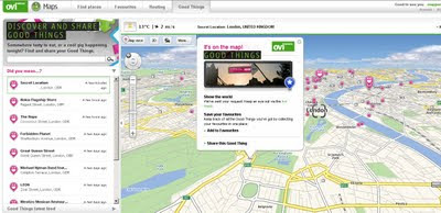
Nokia - Ovi Good Things

Nokia - Ovi Good Things

Nokia - Ovi Good Things
http://maps.ovi.com/goodthings/f84c5631-eec4-4ee6-8c04-872622dc1cb0/Secret-Location

(that's the location but you need a special token)

Labels: , , , , ,

31 May 2009

Nokia N97 Hunt - Clues 1,2,3,4 (UK Only)

Nokia N97 Hunt - Clues 1,2,3,4 (UK Only)

(Search for N)

Clue 1:
http://share.ovi.com/media/womworldnokia.public/womworldnokia.11602
(3,3,7)

Clue 2:

http://thereallymobileproject.com/2009/05/search-for-n-clue-2/
(3)


Clue 3: on this post (3 other parts needed)
(not a word but a format)

Clue 4: http://twitter.com/WOMWorldNokia
(5)


(no this is not photoshopped)

Clue 5: Unreleased yet.
(but predictable)


Enter your answers to the clues here
http://blogs.nokia.com/nseries/index.php/search-for-n
(mapperz has this confirmed by 4 green ticks


Please note: this is NOT the same clues for NokNok.tv running a similar competition (riddles only).

Source: (via email) +additional information:
"Actually, it isn't the WHOLE of the next clue, just a quarter of it you'll have to find the other three parts before you can crack it!
This is something of a collaborative clue, and you'll only be able to solve it by sharing what you have, and making sure you find the other parts. Good luck!

P.S. Clue number 4 will hit Twitter tomorrow afternoon, so keep an eye out."

Only helping out Nokia Hunters not the clever PR Spin from Nokia Marketing

Mapperz

well done royal mail - only 4 days late!

Search for N has been and gone - post was seriously late for this...


nice handwriting though....

Labels: , , , , , ,

18 May 2009

+30 Top Mapping Blogs (Mapperz=7th?)

+30 Top Mapping Blogs">+30 Top Mapping Blogs (Mapperz=7th?)

Another debatable chart to comment on:

(All these blogs should be number 1.)

According to
http://www.whatsyourplace.de

"Selling the world parcel-wise on Google Maps and being an officially featured project on Google code, we closely follow new developments in the rapidly expanding market of Maps Mashups and the use of digital maps in general. Fortunately, there is a number of great blogs focussing on mapping issues. We would like to share our list of what we consider the top blogs on maps. The top ranking is in accordance with the number of google reader feed subscribers (shown in brackets) at the point of writing this post."

  1. StrangeMaps (13.576) - taking a humerous approach to map depictions - recommended: WW II - if maps could fight
  2. Google LatLong (5.350) - official blog edited by the Google Maps and Google Earth team - recommended: Whale Spotting on Google Earth
  3. Google Earth Blog (3631) - unofficial blog on everything Google Earth - recommended : 3 D Buildings Layer Update
  4. Ogle Earth (3448) - on how Google Earth and related products affect geopolitics - recommended: Exploring Shanghai’s recent geographic history
  5. Google Maps Mania (2915) - mostly edited by GMaps developer Keir Clarke focussing on maps mashups - recommended: Big Art Project on Google Maps
  6. The Map Room (2678) - map blog targeting wider audience - recommended: Is GPS accuracy at risk?
  7. *Mapperz (2131 >2,145 now) - introduces new digital maps - recommended: Africa in Open Street Map, lots of miles * (Still debatable on this - Mapperz)
  8. Spatially Adjusted (2067) - fairly technical GIS blog by professional James Fee - recommended: Licensing issues on the Geoweb
  9. Google Geo Developers (1924) - official blog - recommended: Solution to too many markers problem
  10. AllPointsBlog (1.290) - professional and high-frequency source on location technology. Recommended: Did Navteq really launch a rival to Google Maps?

  11. Free Geography Tools (951) - recommended: Google Maps Route Creation with NetKvik
  12. Virtual Earth (837) - An Evangelist’s Blog - recommended: MSN City Guides Relaunches
  13. GISLounge (656) - GIS information portal - recommended: Finding Bin Laden
  14. Very Spatial (565) - recommended: Digital Cities Concept
  15. Thematic Mapping (379) - focus on maps and economic/political development issues - recommended: Using KML at Thematic Mapping
  16. Programmable Web (34) -tremendous resource and catalogue of API-based mashups - recommended: WhatsYourPlace
  17. The Map Scroll (284) - nontechnological maps-blog - recommended: Taliban Influence in Pakistan
  18. Digital Earth (262) - personal blog focussing mostly on new developments in Microsoft’s and Google’s digital maps products - recommended Google Earth Imagery Update May
  19. Paul Ramsey’s GeoTips (259) - Founding Member of the Open Source Geospatial Foundation - recommended: Web Mapping Architecture at OpenGEO
  20. GeoThought (211) - blog on location technology by industry expert Peter Betty - recommended: The GeoSpatial Technology Revolution (Keynote)
  21. The Electoral Map (207) - focussing on the “intersection between politics and geography” - recommended: 2008 in political geography
  22. ManDown (176) - technical perspective on GIS, ESRI in particular - recommended: arcGIS Mobile 9.4 - Whats next?
  23. CartoTalk (122) - more a forum than a blog, but great place to follow qualified geo-discussions
  24. WebMapper (211) - focussing on the latest trends in location based services - recommended: UK Crime Maps scrutinized
  25. Spatiallaw (102) - low-frequency blog focussing on intersection of legal issues and spatial technologies - recommended: Why Spatial Law?
  26. What is Special About Geospatial (67) - Geo-student blogging about the geoweb - recommended: introduction of Pixelcase, where Photography meets Geoinformation
  27. Google Maps Gone Wild (60) - Examples about things one can do with Google Maps - recommended: recursive queries in Google Maps
  28. Mibazaar (57) - introduces practical Google Maps Mashups - Swine Flu Tweets on Google Maps
  29. atlas(t) (52) - recommended: Shoe Map
  30. WhatsYourPlace (19) - Google Maps Mashup Selling the World - recommended: Obamas Road to Presidency
  31. Geo2Web (16) - GIS technology blog - recommended: Mapping the Death Penalty
  32. Maps and Earth (4) - recommended: Find Custom Maps
source:
http://www.whatsyourplace.de/blog/?p=607#more-607

Labels: , , , , ,

02 April 2009

Google Maps Map Maker [Vector Data]

Google Maps Map Maker [Vector Data]

update: more screen shots and discussion on Map Maker vs OpenStreetMap data
http://brainoff.com/weblog/2009/04/01/1391

***FOR NON COMMERCIAL USE***

Google are now allowing you to download the vector data (Kenya only so far) in either Keyhole Markup Language (KML) or in ESRI Shapefile format.

Google are now returning the favour of Map Makers who have contributed to Google Map Maker

The idea of Google using users to map areas of the World where the likes of TeleAtlas Data is limited or non existent has been rewarding to both Google (gaining mapping content) and NOW non-commercial-non-profit entities.


View Larger Map
Google Map Maker- Kenya Vector in ArcMap
Screenshot of the Vector Data in ArcMap - Same data as above just different style applied.

View this as a layered/attributed PDF [will request to download or view] -1mb

***FOR NON COMMERCIAL USE***

Mapperz had a speedy look at this.

and loaded the shapefiles into a Geodatabase (topology can be cleaned and edited in ArcMap).

Created a quick Cartographic Representation and did a very quick style.

The Result is quite different to the Google Maps Style of Mapping (on purpose). But the underlining data is the same.
(no editing was done to the downloaded data - only shapefile to file geodatabase was done.)

Future: Does this step on the toes to projects like OSM? yes and no - can see both working.
Analysis -
There are many aspects of this vector data that can be applied - buffering, spatial searches and geocoding for starters...

Google Map Maker Kenya Vector Data Styled reloaded into Google Earth
The Exported 'Styled' Data from ArcMap (MapDoc to KML export) in Google Earth
Note: There are better KML/KMZ exporters than the standard ArcMap one

http://mapperz.kml.googlepages.com/Google_MapMaker_Vector_Kenya.kmz

(best loaded into Google Earth - file too big for Google Maps/API)

The Data is available after accepting the terms here
https://services.google.com/fb/forms/mapmakerdatadownload/

Thanks to Mano Marks via Twitter

Mapperz

Labels: , , , , ,

18 March 2009

Google Street View UK Launched

Google Street View UK Launched

Official Post on this:
http://google-latlong.blogspot.com/2009/03
/street-view-cures-homesick-blues.html

See 'Street View Plus' in action
http://mapperz.googlepages.com/Marble_Arch_Streetview_Plus.html
blog post:
http://mapperz.blogspot.com/2009/03/uk-street-view-plus.html
recommended by:
http://googlemapsmania.blogspot.com/2009/03/street-view-plus.html

Update 19/03/2009
A First UK Google Street View Mashup? "A Quick Drive Through Clifton Bristol"
**now mentioned on the The Guardian by Richard Wray**

Bristol Google Street View UK By Mapperz
http://mapperz.googlepages.com/Bristol_StreetView_UK.html
"On the way in to the UK launch of Street View, Kudos to @Mapperz for the first Mashup within a hour !"
Google's Geospatial Technologist
http://twitter.com/edparsons

Google UK StreetView Launched
http://maps.google.co.uk/ and drag pegman on the map


View Larger Map

Mapperz

Labels: , , , ,

09 September 2008

Mapperz - A Top 25 Mapping Blog?

Top 25 GIS Geoweb Cartography Logo
Mapperz - A Top 25 Mapping Blog?

Well its debatable - Chart compiled by Sean Gorman.
"We decided to have a little fun and do a friendly ranking of some relevant blogs. The Top 25 Blogs in GIS, GeoWeb and Cartography will be ranked according to the number of sites/blogs linking to each, as reported by Technorati. If a blog does NOT have Technorati Authority (if they have not registered for example), then we’ll take the number of blog reactions listed and divide by 3 for an estimate.

We realize Technorati is not a perfect barometer, but it is open, and this is not a FortiusOne subjective ranking. We think this will be a great way to share blogs and get feedback from others regarding their top GIS, GeoWeb and cartography blog picks. We’ll note changes in rankings, new blogs and up and coming blogs.

If you’re on the list and feel so inclined, you’re welcome to place the following badge on your blog to share your ranking."

  1. O’Reilly Radar Geo Blog 2,733 – overall O’Reilly
  2. Strange Maps 1,895
  3. Google Earth Blog 950
  4. Google Maps Mania 553
  5. Ogle Earth 186
  6. All Points Blog (Directions Magazine) 176
  7. James Fee GIS Blog — Blogging GIS, Google Earth, Virtual Earth and Programming156
  8. The Map Room: A weblog about maps 139
  9. The Beer Mapping Project 91
  10. Geobloggers 73
  11. Mapperz 72
  12. Very Spatial (Blog and Podcast) 66
  13. Bret Taylor’s Blog 64 (estimate based on 195 Blog Reactions)
  14. Mibazaar 61
  15. Dave Bouwman - GIS Blogs: Where’s the Conversation? 53
  16. Ed Parsons 52
  17. What is so special about Geospatial? 52
  18. Chris Spagnulo’s Geoscrum 51
  19. AnyGeo - Anything Geospatial 46
  20. Mandown 35
  21. The Earth Is Square 35
  22. Mapdango 34
  23. GIS Lounge 31
  24. Mapping Hacks 28
  25. Geography Matters – Est. 27 (based on 83 blog reactions)
Source:

Labels: , , , ,

29 May 2008

Google Earth API Arrives! (The Web Browser Version)

Updated 29th May 2008 - With Examples (3D Plugin Required)

A few minutes ago after this updated post- Mapperz has an email from Rob at Map Channels with this updated See Bournemouth Map with the 3D Google Earth Maps.
Google Earth 3D - See Bournemouth Maps
The New Google 3D Maps Live and Working on
http://www.seebournemouth.com/GoogleMap.aspx

Well Done Rob and full credit for integrating this so quickly - more like this please.


Click the Earth [Map Type] option next to Terrain

Google Earth API Arrives! (The Web Browser Version) WOW!

Another prediction from Last Year has finally
made it.
Google Earth Web Browser Version (FireFox)
This a image is not from Google Earth Desktop but Firefox.

http://code.google.com/apis/earth/

more soon...

Here are some New Examples
Google Earth Web Version Options
http://mapperz.googlepages.com/3Doptions.html
Taken from
http://www.google.com/earth/plugin/examples/options/

Allows you to define a location and set different option (Grid, Navigation, Status Bar etc)


What is required?
Not much - but there is a 3D plugin needed to view the new 3D Earth

Google Earth Web Browser Version Plugin Require for 3D
The Free Plugin is needed if you want to view the 3D Earth.

That's it, enjoy...

For Fun Test out the Monster Milk Cart (Fast PC/Mac with a Fast Internet Connection needed when going super fast)
Other Examples to get you going
http://code.google.com/apis/earth/documentation/examples.html

Mapperz

Labels: , , , , , ,

31 December 2007

Testing the N82 with Sports Tracker (Beta)
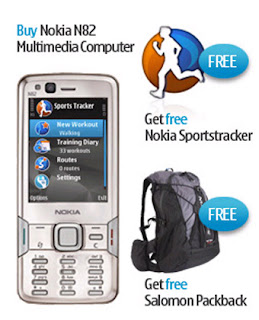
Testing the N82 with Sports Tracker (Beta)
Nokia N82 with Adventure Pack

Mapperz goes testing....N82 Sports Tracker (Beta) and Nokia Maps (phone, sports tracker software and bag generously supplied by WOM World)
http://www.womworld.com/nseries/category/n82/

Not going to go into details of build quality, looks or if it makes phone calls. There are plenty of other sites doing this.
Gets Go!

Sports Tracker enables the user to log or track your progress, it displays a pace, speed, altitude etc.
Official Full Details
http://research.nokia.com/research/projects/SportsTracker/

Sport Tracker Beta Site
http://sportstracker.nokia.com/nts/main/index.do (login required to use the service Free)

Mapperz coverage of the Sport Tracker Beta (previous post)
http://mapperz.blogspot.com/2007/11/nokia-sports-tracker-beta-map.html

Integrated GPS
Get as quick fix with the assistance of:

BlueTooth GPS (not needed)
A-GPS on
Integrated GPS on
Network Based on

Access point
GPRS (check default as will use WAP which is more expensive)
nokia server for A-GPS
supl.nokia.com

WOM wanted Mapperz to test out.
"Testing the sports trackers ability to track journey routes, along with other info regarding altitude, distance etc would be really interesting!"

So here is a train journey...
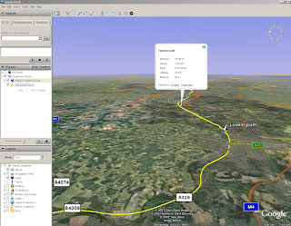
N82 Sports Tracker Beta in Google Earth

A tracking issue or gps issue?

N82 Sports Tracker Beta GPS errors?
Think the issue here is that the GPS and lack of 'field of view' to the sky.
A 'wobble' in the tracking - due a high filter correction method as default?
here is an interesting article
http://wubbahed.com/2007/07/12/gps-quality-on-the-n95/
Highlights the GPS being 'hyper-active' (note this was from an N95 with firmware updates)
The N82 seems better than the N95 for 'gps filtering'

Maybe there is a call for the A-GPS to be active on startup with an option to disable it on tracking mode (unless within an urban area). This should create a smoother tracking line.

Improvements: that could make this the perfect mobile map device:
  • Nokia please add the Nokia maps (map data) to the sports tracker. Not the navigational functions just the base map. (Mapperz has done this via Nokia Feedback). This would improve the usefulness of the application beyond 'tracking'.
  • Automatic screen rotation option to switch it off. Walking briskly with it in hand for using it in Nokia Map mode was jumping into landscape mode.
  • Ghost Tracking - where a previous track can be overlaid, very useful to runners, walkers etc would like to do the same routes in part of their routine.=
  • Imperial/Decimal Mode but with the option of Meters in Height (UK distance in Miles but UK height in Meters)
Spot the difference between Sports Tracker and Nokia Maps
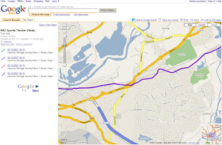
Noticed when in Nokia Maps - the 'tracking' would snap to roads running along next to the railway. But the Sport Tracker did not.
This is a small issue - there must be some sort of rank - Motorways more important than Rail or A Roads on the Vector Map Data.
Have noticed that when going over a bridge going over a motorway/primary route the cursor snaps the major road rather than the road your are on.

N82 v N95
Not an easy one but there are improvements in the N82 over the N95.
Start up is faster & less crashing when running multiple applications
Camera Flash at night is much better on the N82 by miles.
Battery life has improved on the N95 (even after firmware v20).
But the N82 battery seems to go further than the N95 by about 6 hours (general use).
Screen size is a little smaller than the N95 but in general not any less functional.
It's slightly cheaper

If you want go for an unlocked N82 for 2008.
Test a N82 (limited places left)
http://www.nseries.com/index.html?l=campaigns,n82,demand#l=campaigns,n82,demand

If buying it - its worth getting directly from here at £399 +£3.99 standard delivery.
(you get a free bag.)
http://shop.nokia.co.uk/nokia-uk/product.aspx?sku=3759722&section_id=530&culture=en-GB

Clincher - N82 with TomTom - in Car
The N82 is a better navigational device for getting around London against the TomTom
XL Europe. why?
TomTom data was out of date and 'drop out' from GPS mode in between high buildings.
N82 had up to date data and no drop out was noticed (A-GPS and cell based positioning was on)

Full Spec of the N82 in depth.
http://www.gadgetnutz.com/modules/news/article.php?storyid=00420

Yes you can make and receive phone calls to.

Thanks to WOM World for the chance to test the phone and sports tracker.

Labels: , , , , , ,

17 August 2007

Exclusive - Reverse Geocoding using Google Maps API only!

Exclusive - ALL New! Reverse Geocoding using Google Maps API only!

Google Maps is great! and the programmers that take the API and do find and create useful applications. Like this Reverse Geocoding

What is reverse geocoding?
"The conversion of latitude and longitude coordinate data of locations into descriptive addresses"

Reverse Geocoding UK Addresses

Try it out here
http://nicogoeminne.googlepages.com/reversegeocode.html

Thanks to Nico Goeminne for finding this algorithm and giving Mapperz the chance to suggest and give exclusive feedback on this incredible function.

Is this legal? - Yes, We have had this confirmed by Pamela Fox (Google Maps API Team) that this is not breaking the Terms of Use - which is great news.

"I checked with a product manager and he looked through our licensing
agreements. The conclusion is that as long as you're not using the
reverse geocoder for real-time tracking of any kind, then you're okay
to use it."

Please use it - suggest comments, feedback always welcome.

Nico's idea came from this
"Google Maps is great! One day I was working on a treasure hunting game, it combined both real world as virtual items placed in and around the very nice city of Ghent (Belgium). At regular times I told them the location (GPS) of an item, so they could go out hunt. Some of them complained because they didn't have a GPS and couldn't find an online tool to convert the GPS coordinates to an address. "No problem I said, I'll fix one up", at that time I did not cross my mind that GM couldn't reverse geocode since before all things I ever needed were just there in that great API. So I was kinda disappointed when I read trough the documentation and even more when I searched the net on the subject. So in the end, I decided to give a try myself and see if I could figure out something and then I stroke me : The GM API has reverse geocoding capabilities. They just call it Driving Directions! Google Maps is great! "

Thanks and all credit to Nico - Excellent Job!

Mapperz Tests a UK version of this method (demo)

Labels: , , , , , , , ,

05 July 2007

Free Our Flood Mapping!

A recent article on this Mapperz Blog showed OnOneMap Maps (using Google Maps API) was better than the Environment Agency own Online Mapping.
http://mapperz.blogspot.com/2007/06/environment-agency
-adds-pollution-maps.html

But due to the nature of 'public' data the Environment Agency has told OnOneMap to remove this service as the data is their copyright - excuse me but this is UK tax payers money

"We have had to withdraw our popular and innovative flood map layer, ironically and sadly during one of the worst periods of flooding the UK has ever experienced. The Environment Agency claims they have copyright over the information, and despite the fact that tax-payers’ money has paid for it to be collected in the first place, apparently the tax-payer cannot benefit from innovations like our housing and flood map combination.

For more information on the lack of access the British public have to their data, visit The Guardian’s Free Our Data campaign."

Mapperz hoped the Guardian is reading about this!

Yes they have

http://technology.guardian.co.uk/weekly/story/0,,2118152,00.html

Free Our Data Please. So we can make use of it and provide useful services to the public - like property mapping. Knowing if your house is 'likely' to flood before buying it.

Labels: , , , , ,

19 June 2007

Local Search for the United Kingdom Launched

Local Search for the United Kingdom Launched

"For users already using the AJAX Search API for local search you should now be able to search for businesses in the United Kingdom without having to make any changes to your code. Go ahead and now try "Starbucks near London" in your A
pp that uses the Google AJAX Search API. You should get something like the following:"

Starbucks Near LondonMapperz Map Search now works for the UK!
Mapperz Map now can return UK Businesses from the Search ( found right hand column of this blog)

Labels: , , , ,

08 June 2007

Google Developer Day 2007 - Map Slides

Reference Links for the main features that were unveiled from Google Developer Day 2007 in London.


Yes there is Adsense Code for Google Maps API but is not available until the 2.82 version of the API.

http://www.google.com/apis/maps/documentation/mapplets/
http://code.google.com/apis/kml/documentation/kml_tags_beta1.html
http://gears.google.com/

Google Maps API Adsense
Adsense in Google Maps API
Source: Mapperz (N95)

The Maps API allows you to embed geographical information into your site using JavaScript, you can add overlays to your map including markers, polylines and shadowed information windows. It is a great way to enhance your current site content and best of all, using the Google Maps API is free. To learn more and to find out whether your site meets the terms of use, visit the Maps API FAQ.


more information
http://googledeveloperday2007-uk.blogspot.com/2007/05/mapplets.html


Driving Directions now available in Google Maps API
http://www.google.com/apis/maps/documentation/#Driving_Directions

Mapperz Example
http://mapperz.kml.googlepages.com/uk_driving_directions_api.html
(though does not support UK driving directions thus far)

Labels: , , , , , , ,

12 April 2007

Google Maps goes 2.5D

Google Maps goes 2.5D
First there was plain old maps, then building outlines, now they have grown... upwards
Google Maps 2.5D

See New York in 2.5D in Google Maps.

Other US Cities have also been updated.

Mapperz

Labels: , , , ,

05 April 2007

My Maps Service - New from Google Maps

All New from Google Maps 'My Maps' - Make your own Custom Maps with help from Google Maps

Like this....
My Maps New from Google Maps
(note mapperz not really having Tea with the PM purely for example reasons and testing this useful service out)

So how do you get this to work?
Easy if you have a Google account. If you want one you can sign up here
Login and go to http://maps.google.co.uk
or your localized area eg http://maps.google.com

Click on My Maps New
In the Left Table of Contents

You will notice some new icons appear
My Maps New Icons Edit Mode
Pan, Create Marker, Create Line, Create Polygon
Now Search for your area of interest, 10 Downing Street, London, UK in this instance
this will zoom into and place a 'found' marker to show you the centre point.

Now you can add your own marker (like mapperz has to locate Number 10)

This is easy to create and edit, you can have as many markers as you like.

Google provide a tool tips help when using the point, line and polygon in edit mode.
Drag to move vertices polygon edit mode

Want to edit the colour and transparency of the polygon?
easy

Editing polygon fill transparency
Transparency or Fill Opacity can be changed so that the background mapping can be seen.
Default is 45, (100= solid fill, 0= no fill)

Okay now you have a go!

Top Tip: If you want a KML file so you can view in Google Earth you can use the KML Icon in the Top where 'Link to Page' is located.

To add an image - use the 'Rich Text' Mode
Add images to my maps rich text mode
Click on the image icon on the toolbar and find a copyright free image or your own which is hosted on a webserver/site.Copy Image Location on the image and paste into the prompt on the My Map Editor as above.

The same can be done with Video from the likes of You Tube, MySpace etc.

For a more interactive tutorial (video) please visit the following (after the ad)
http://news.com.com/1606-2_3-6173473.html?tag=ne.vid

Want more information on this?

Google Earth Blog does a good round-up of this new service...

"The really interesting aspect to the announcement is that the underlying data is all KML! KML is the file format for Google Earth content - and now Maps too. This means you can create your maps and then click on the "KML" in the upper right of the map and immediately view the content in Google Earth. Furthermore, when you search for content you will not only be able to get local business search results, but also get KML search results (just like the recent KML search update for Google Earth). Look for a "See user-created content" link after the other results - it only appears when there is relevant content searched in the current view (see example)."

Source: Google Earth Blog

more info to feed on here...

Official Post: map-making-so-easy-caveman-could-do-it
Official 'My Maps' Help: http://maps.google.com/help/maps/userguide/index.html

And of course Google Maps Mania blogged it.

mapperz

Labels: , , , ,

27 January 2007

RSS Feeds to GeoRSS Maps

RSS Feeds to GeoRSS
GeoRSS Blog Feed Mapperz Google Map
RSS?
GeoRSS?
Give your posts the spatial location element with http://exploreourpla.net/
converts your rss/atom feeds into maps in seconds.

RSS to GeoRSS Mapperz Blog Feed

To add your rss feed simply go to
http://exploreourpla.net/georss +url of RSS feed in full

Example
http://exploreourpla.net/georss/http://mapperz.blogspot.com/rss.xml
http://exploreourpla.net/georss/http://mapperz.blogspot.com/atom.xml

More info
Source:geonames.org
Related:addressfix.com

Mapperz

Labels: , , , , , ,

25 January 2007

GPolygon Example - Google Maps API

Updated with New Content and New Links

Mapperz was Googled on the Official Google Map Blog

"Some of you have probably noticed (<-mapperz link) that we've added a new tool to your Google Maps API toolbox, the GPolygon. Just think of all the colorful triangles, octagons, hendecagons, icosagons, etc. that you'll be able to overlay on your map. I'll be really impressed if someone is able to build a googolgon, a polygon with 10100 sides."

More details about the GPolygon class can be found in the Maps API reference.

Permalink

Posted and thanks to Brandon Badger, Product Manager, Google Maps API.

Mapperz also wants to thank all the Google Maps API Group and all the helpful mappers out there.
Important Google Map People
Mike Williams
ESA also inspired mapperz with the polygon fill and bouncy icons
Pamela Fox (now Google Employee, )

Google Maps API 2.69 GPolygon Simple Topology Example

The orginal post

update 19/01/2007
Live Link to the Gpolygon example - a filled polygon with an outline - this is testing if a polygon is inside or outside a mouse click or mouse movement defined by a user, but can be used to find markers/icons that fall inside a polygon - this method is called simple topology (points that fall inside a polygon).

update2
Circle Topology using the Gpolygon method

Google Maps GPolygon Topology Circle

live link and more clever google maps api trickery

more Gploygons

Stars Circles GPolygons

Example to show people what can be done with GPolygon
(stars, circles, polys):

25/01/2007

Last update on this hot topic

Official Post by
  • We define several utility functions to aid in generating random numbers and colors
  • When the map is clicked, we find the clicked pixel using fromLatLngToPixel on the result of G_NORMAL_MAP.getProjection().
  • We start generating random variables for small radius, large radius (used for stars), number of sides, and color.
  • If the draw mode selected is polygon, we iterate from 0 to number of sides. In each iteration, we calculate the new pixel location using good old trigonometry. We convert the pixel back to latitude/longitude using fromPixelToLatLng and add it to our points array.
  • If the draw mode selected is a star or circle, the process is almost the same. For stars, we iterate twice as much as the number of sides, calculating points at the large radius on the odd iterations. For circles, we ignore the randomly generated number of sides and always iterate 20 times around the clicked pixel for a nice round look.
  • Now for the magic - we create a new GPolygon with the points array and style parameters, and add it to the map.
  • Now here's the challenge: my own example is pretty useless, except for its teaching value. How can you put GPolygon to work for your app? Exploit the GPolygon for all it's worth (and don't forget its friend, GPolyline), and ping us with your creations on the forums.

http://googlemapsapi.blogspot.com/2007/01/gpolygon-example.html

Labels: , , , , ,

19 January 2007

Map Blog Feed For Mobile Devices

Get your Mapperz Blog Feed For Mobile Devices

Mapperz feed on your mobile device

This is a cut down version of what is available on the main mapperz blog and to reduce data charges, images removed and content is reduced to 50 characters.
  • Supports older web/wap enabled mobile phones.

Top Tip:Use GPRS (data transfer) mode rather than pay per minute on wap.

Blog feed to mobile feed provided by winksite.com

simply add this url
http://winksite.com/mapperz/mobile

Network charges vary.

Labels: , , , ,

05 January 2007

Mapperz joins GIS WIKI


Mapperz joins GIS WIKI

This Blog will be available through NewsFeeds

Labels: , , , ,