->

27 July 2011

BBOX.ME (OSM to Google Earth) via FME

BBOX.ME (OSM to Google Earth) via FME

BBOX.ME (OSM to Google Earth) via FME
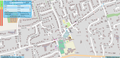
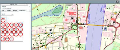
Left toolbar highlight large data download - red (large) amber medium and green is small data.
(OSM Servers will restrict large downloads automatically)

Take OpenStreetMap and via it's API, users can download an area of interest.

in this case:

"http:\\api.openstreetmap.org\api\0.6\map?bbox=-0.4994028225856829,53.73689294256218,-0.4839962145221512,53.74135397370099"

is requested from the OSM server via the OSM API.

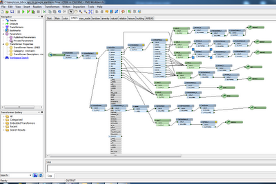
OSM FME Workbench
FME Workbench for converting to Google (or 3D PDF etc)
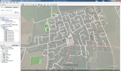
BBOX.ME OSM to Google Earth
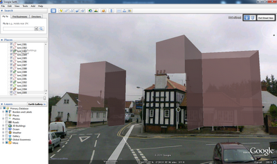
Output is A clean representation of OSM in Google Earth - but with 3D Building Extruded from the data. This can also be viewed in Streetview in Google Earth.

Extruded 3D Building (from Open Street Map) overlaid in Streetview in Google Earth
Extruded 3D Building (from Open Street Map) overlaid in Streetview in Google Earth.


This does use FME Desktop (a 30 day trail is available) which can convert the OSM files into Google Earth

Try BBOX.ME (created and founded by Peter Segersted and Ulf Mansson)
http://bbox.me/osm/

Labels: , , , ,

06 June 2011

MagicShop FrontDoor Beta (BING & OSM)

MagicShop FrontDoor Beta (BING & OSM)

Something to do when your really bored: move address locations for Bing and contribute to OpenStreetMap (OSM)

MagicShop FrontDoor Beta

What's this? Every time you help Frontdoor correct an address point to the front door you're improving the local search results in Bing Maps. You're also contributing address position data under the ODbL to the OpenStreetMap project.

No more details....

Map and Fix some Addresses
http://frontdoor.cloudapp.net/

Source:
http://www.spatiallyadjusted.com/2011/06/06/microsoft-magicshop-frontdoor-improved-address-locations-released-to-openstreetmap/

Labels: , , ,

30 March 2011

Travel Times Paris - OSM

Travel Times Paris - OSM

Find Travel Times in Paris using http://www.isokron.com/


(lower quality Blogger video - but faster)

You can also add an additional point to find the best (fastest) location to meet up half way with a friend.


(Higher Quality Video via You Tube - Slower)

Map Base is Open Street Map and Isocron Mapping

Labels: , , , ,

24 February 2011

Embed ArcGIS Online Maps for Free

Embed ArcGIS Online Maps for Free


View Larger Map

required > OpenStreetMap and the license (CC-by-SA). < http://wiki.openstreetmap.org/wiki/OpenStreetMap_License#Attribution">OSM attribution).

A fix is required on the ESRI side [code]

Thanks to David highlighting the issue.
http://lists.openstreetmap.org/pipermail/talk/2011-February/056894.html

Full Screen Map
http://www.arcgis.com/home/webmap/embedViewer.html?webmap=1907d8d1c2954484b4b6569b5d8de305&zoom=true&scale=true


ArcGIS Online Example & Make your Own Map(s)
http://www.arcgis.com/home/
source:
http://nygeog.blogspot.com/2011/02/embedding-arcgis-online-maps-open.html
deleted by poster.

Labels: , , , ,

05 January 2011

Facilmap.org Beta

Facilmap.org Beta is an OpenLayers-based slippy map that aims to combine useful geographical information, renderings and tools of different projects into one reusable and extend-able map.


Facilmap.org Beta

Some available layers (there are more)
  • Mapnik
  • Osmarender
  • OpenCycleMap
  • Minutely Mapnik
  • OpenStreetBrowser
  • Hike & Bike Map
  • OpenPisteMap
  • ÖPNV-Karte
  • MapSurfer Roads
  • MapSurfer Topographic
  • Ordnance Survey OS Streetview (UK only)

More information on this project:
http://wiki.openstreetmap.org/wiki/FacilMap

Source and Credit to Candid Dauth:
http://www.openstreetmap.org/user/Candid%20Dauth/diary/12723

Map
http://beta.facilmap.org

Labels: , , , , ,

16 November 2010

MapQuest Embed Two OSM Editors

MapQuest Embed Two OSM Editors

MapQuest are getting ahead of the rest with an instant online OSM (Open Street Map Editor
MapQuest Potlatch 2 embedded OSM Editors

If you know the area and spot an error on the http://open.mapquest.com sites you can now edit directly using the Potlatch 2 Editor without too much trouble.

Mapquest are pleased with themselves: (and why not?)

"We’ve done it again! Updates are fast and furious on our MapQuest Open sites, powered by OpenStreetMap data. Just this week, we’ve released new edit buttons, ‘send to website’ and ‘right click’ to find the closest thing in your map display.

Our new edit button is really three different edit button or links: below the search result & top right of your map; and edit links that are built into the popup information box. The popup information box allows you to choose which OSM editor you want to use in order to edit the location (or surrounding area). Your two edit tool choices are Potlatch 2 (hosted by MapQuest) or JOSM (known as the “Java OpenStreetMap Editor”). Potlatch 2 uses a GUI user interface for easily making edits whereas JOSM allows you to download chunks of the OSM data onto your desktop to edit and then upload the newly changed data back onto the OSM servers for processing. (Note: be sure JOSM is already installed and running when you click the JOSM edit link.)"

http://blog.mapquest.com/2010/11/11/latest-updates-on-open/

Quite an achievement for both MapQuest and OpenStreetMap

Full Details

http://open.mapquestapi.com/dataedit/

Labels: , , , , ,

26 October 2010

Evolution: European OpenStreetMap

Evolution: European OpenStreetMap

Evolution of European OpenStreetMap coverage from skobblertutorials on Vimeo.

Hence why Mapquest(Open) and Bing Maps (OSM App) are becoming more mainstream

Labels: , , , , ,

18 October 2010

Open Street Map Potlatch 2 Public Alpha

Open Street Map Potlatch 2 Public Alpha

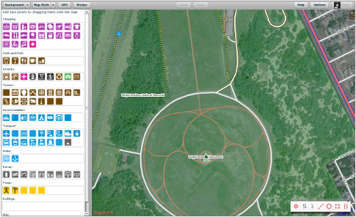
Major changes in the interface for editing Open Street Map online.

"You know it. You love it. It's the editor on the main OSM web site. It's Potlatch and it's had some serious renovations. It's so new that now it has a new name, "Potlatch 2". But before Potlatch 2 can go live on the OpenStreetMap web site, it has to be put through it's paces. After more than a year of development, Potlatch 2 is a complete re-write of Potlatch. It has new features too numerous to mention, but for the most important feature; it is an editor for OpenStreetMap. So let's test it. "

Open Street Map Potlatch 2 Public Alpha
Editing is made easier with the legend based editor. Now based in Flash [Potlatch 2 is written in ActionScript 3 using the Flex framework] and more stable than its predecessor.
Backgrounds are easier to control (OS Streeview OpenData shown above)

Open Street Map Potlatch 2 POI
Point of Interest editing (Image source: OSM Wiki)

Try it you might like it.
If you want to test this new editor that is now in public alpha you can at
http://geowiki.com/

Hopefully this will be implemented in the Open Street Map main site soon.

Techies might be interested to know that this can deployed on your own website.
http://wiki.openstreetmap.org/wiki/Potlatch_2/Deploying_Potlatch_2

Labels: , , , ,

03 August 2010

Open Street Map now in Bing Maps

Open Street Map now in Bing Maps

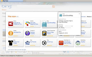
Open Street Map is now available in Bing Maps via the 'Open Street Map' App

Open Street Map now in Bing Maps
MapNik Tile Render via Bing Maps (OSM) APP


Open Street Map now in Bing Maps

http://www.bing.com/maps/explore/#5003/0.6002=
q:NYC:nelat:51.6120377517871:nelong:0.18654357910159:
swlat:51.4079622462129:swlong:-0.446543579101535:nosp:0:adj:0/5872/style=Mapnik&lat=40.65415&lon=-74.024291&z=11&pid=50735

In Addition there are some improvements to Bing Maps Explore:

  • Appearance: Cool colours create a more visually appealing backdrop that helps content ‘pop’ on the map, providing clear differentiation for pushpins, labels and red, yellow and green traffic overlays. 
  • New labels: Larger fonts correspond to larger roads, making it easier to identify major streets and throughways. Crisper labels eliminate the need for bolding and less-attractive glows, allowing users to quickly find locations in a relevant format.
  • Improved international coverage: Data updates deliver improved road and street detail across Central and Eastern Europe, the Middle East, Oceania and Asia.
  • Dynamic Labels (beta): This innovative map navigation allows you to quickly zoom to a region or location on the map with just a few clicks, making it easier to identify and explore areas or neighborhoods of a city. Turn on the dynamic labels beta from the map style selector on bing.com/maps/exploreand labels become clickable.

Labels: , , ,

21 July 2010

MapQuest Open (Beta) Using Open Street Map Data

MapQuest Open (Beta) Using Open Street Map Data


MapQuest Open Beta Open Street Map Data and Routes
MapQuest have over the past few months vastly improved the map user interface and are one of the first major mapping service to engage and encourage the use of Open Street Map Data with the new MapQuest Open mapping project.


"At the 4th annual international State of the Map 2010 conference, their plan to be the first major mapping site to embrace and encourage open source mapping at scale.  As part of this initiative, MapQuest just launched their first site that is completely powered by open source data from OpenStreetMap.org"


"This new project – open.mapquest.co.uk – was developed using the new MapQuest.com design but using data provided by the OpenStreetMap community.  The main difference between this new site and our existing MapQuest UK site is that the mapping and routing data was created, edited and enhanced by every day people like you.  OpenStreetMap was designed to give the local community the ability to update areas (roads, parks, hiking trails, bike paths, points of interest, etc) that they know in their own neighborhood and around the world, ultimately leading to what we believe will be the best and most accurate mapping experience for all.


AOL (owners of Mapquest) also announced a $1 million open-source mapping investment fund.  This fund will support the growth of open-source mapping in the United States in the local communities that Patch.com covers.  More information about the AOL grant application process is available by emailing osm@mapquest.com."


View the new Mapping Service - http://open.mapquest.co.uk/

More information - http://blog.mapquest.com/2010/07/09/mapquest-opens-up/
Well done to Mapquest for taking the challenge on and implementing a clean and easy to use mapping service.


Source:
http://www.openstreetmap.org/user/Harry%20Wood/diary/11288

Please give your feedback here http://mapquest.open-street-map.sgizmo.com/s3/

Labels: , , , ,

14 April 2010

Society of Cartographers Newsletter April 2010

Society of Cartographers Newsletter April 2010

Fully packed with News from the UK Cartographic Society

Society of Cartographers April 2010
Includes:
  • Geology Digimap
  • The British Library – details of a major map exhibition
  • Summer School - University of Manchester (8 - 10 September 2010)
  • Map2 – the zoomable map on paper
  • UK Web Archive (about some UK blog...)
  • Crisis Mapping - Open Street Map
  • Cartographic Ramblings
  • In the News
  • Events
  • New Members
  • Awards
Society of Cartographers April 2010 - OSM
SoC Newsletter out steev8's ramblings, crisis mapping, BL map exhibition details, surgical sieve, 2010 summer school info... and more.

http://www.soc.org.uk

http://www.soc.org.uk/newslett.htm Archive PDF's

Labels: , , , , ,

08 April 2010

OSM edits with OS Streetview 10k Rasters

OSM edits with OS Streetview 10k Rasters (GB only)

This layer is now in the main OSM editor (Potlatch) on http://www.openstreetmap.org
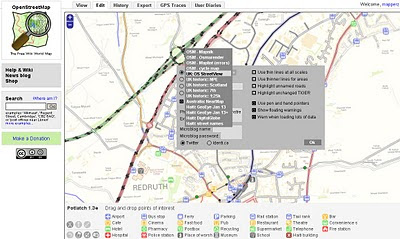
switching to 1:10,000 UK:Streetview Raster Background in Open Street Map Editor

Before you go to far please read this
http://wiki.openstreetmap.org/wiki/Ordnance_Survey_Opendata

take note of:

When tracing over OS StreetView

  • When everything is derived from OS StreetView source=OS_OpenData_StreetView
  • When just the name is derived from OS StreetView source:name=OS_OpenData_StreetView

When adding OS vector data

Choose an appropriate tag for the object based upon the OS OpenData product. For example source=OS_OpenData_Boundary-Line

OS OpenData StreetView OSM editor Potlatch
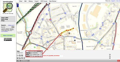
OSM edits with OS StreetView 10k Rasters - adding a Residential Road.

OS OpenData StreetView OSM Potlatch Redruth
http://www.openstreetmap.org/?lat=50.23952&lon=-5.22222&zoom=15&layers=B000FTF

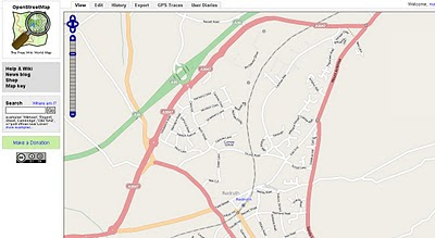
Redruth, Cornwall has always been a bit thin on the ground with OSM data but the Ordnance Survey Open Data Rasters (re-projected)to WGS84 can now help as a background to trace. If tracing from OS Rasters please use the tag source=OS_OpenData_StreetView (if both Name and Road have be derived from OS opendata)
if just the name source:name=OS_OpenData_StreetView

source & thanks to: http://twitter.com/richardf/statuses/11754544110
OS StreetView is now in #osm potlatch editor at zoom levels 15/16 - just click the options icon and select 'OS StreetView'

Labels: , , , , ,

05 April 2010

OSM compare with OS Opendata Meridian2

OSM compare with OS Opendata Meridian2

update3:

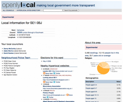
Also Openlylocal is using the OS Opendata Postcodes
Openlylocal.com

http://countculture.wordpress.com/2010/04/06/new-feature-search-for-information-by-postcode/

update2 : Geocode Great Britain Postcodes >> http://www.uk-postcodes.com/ (not Northern Ireland) in HTML, XML, CSV, JSON or RDF formats. [now improved]

update at bottom: OS Streetview(10k rasters) with OSM in WGS84 (latitude, longitude like google,bing multimap maps)

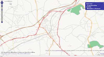
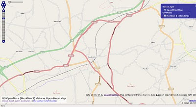
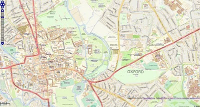
View OpenStreetMap tiles and the new Ordnance Survey OpenData Meridian 2 tiles.
(but go with Meridian2 now or wait for VectorMap District next month?)

OSM compare with OS Opendata Meridian2
Redruth could be improved with the import of Meridian2 data - but is it worth waiting for the New OS Dataset 'VectorMap District' due in May 2010?

Meridian 2 Scale
"
The product is typically viewed at 1:50,000 and at this scale the generalisation of its features maintain geometric integrity and accuracy."


OSM compare with OpenData Meridian2

Traditional Open Street Map tiles can Meridian 2 help improve the more rural areas with many missing roads?

Compare the maps yourself woth the slider in the top left corner.
http://gibin.geog.ucl.ac.uk/~ollie/osopendata/meridian/?zoom=14&lat=50.23598&lon=-5.2233&layers=BT

[Very helpful and quickly set up]


May2010 - sample data is now available for
Bath (SP76) & Milton Keynes (SP83)
VectorMap District format and scale
Raster (lzw tiff)
Nominal scale is 1:25 000.

Recommended scale range is 1:20 000 to 1:30 000.

Vector (ESRI Shapefile)
Nominal scale is 1:25 000.
Recommended scale range is 1:15 000 to 1:30 000.


"
Coming soon – mid-scale customisable mapping

May 2010 will see the launch of OS VectorMap District, a customisable map that you can style to meet your own specific needs. What's more it will be available to use as part of the OS OpenData initiative!

OS VectorMap District provides a backdrop against which other datasets, together with your own information, can be overlaid. OS VectorMap District provides a great combination of high-quality data with the freedom to show the content you want, in the way you want to show it.

OS VectorMap District will be available in both raster and vector formats, so you can use it “out of the box”, or customise the look and feel to meet your specific needs. The vector format is supplied as points, lines, polygons and text, and includes 35 different types of feature code. This allows you to select and style different features in different ways."

More details

http://oliverobrien.co.uk/2010/04/accuracy-vs-completeness-osm-vs-meridian/

Ordnance Survey Streetview (Rasters) with Open Street Map

Ordnance Survey Streetview (Rasters) with Open Street Map (Development)

http://edgemaster.dev.openstreetmap.org/streetview_tiles/ossv.html?zoom=15&lat=51.75539&lon=-1.2401&layers=BTF


Labels: , , , , , ,

02 April 2010

Surrey Embraces the Open Data Initiative

Surrey Embraces the Open Data Initiative
(Open Street Map gets High Resolution Aerial Photography)

osm_mapper ITO World

Surrey Heath Borough Council and ITO World are proud to announce the first release of high resolution aerial photography, for all of Surrey, UK, to OpenStreetMap under an open licence that allows reuse.

The idea came to James Rutter, GIS Manager for Surrey Heath,
“we created most of the OpenStreetMap data for Surrey Heath, and it struck me that if we had high resolution aerial imagery then many more people would contribute.”

The project also has the financial backing of nine other Surrey districts: Epsom and Ewell,Elmbridge, Guilford, Mole Valley, Runnymede, Spelthorne, Tandridge and Woking. All of
whom will benefit from processed aerial imagery tiles that can be used internally, and the imagery will also be available to OpenStreetMap users so they can contribute to a better
map of Surrey.

There are multiple benefits to be gained by Local Authorities working with OpenStreetMap,
such as a more democratically made map with instant updates. James Rutter said, “we
wanted to start mapping details that were relevant to our local communities, not just what data providers feel is worth mapping. We can edit OpenStreetMap and see the updates
almost instantly, the Ordnance Survey raster products take months for new releases. By doing this we are also making a high quality map base available for all communities in Surrey, with data that we have checked for accuracy.”

ITO World are providing services to allow authorities to monitor and review the accuracy of
contributions to OpenStreetMap for their local area. Christopher Osborne of ITO, says
“OSM Mapper has thousands of users globally, and a growing number of Local Authorities
are using it to engage with the OpenStreetMap project. We provide OpenStreetMap tiles
for websites, but now we are being asked how to crowdsource improvements to data, such as changes to roads and bus stops.” OSM Mapper is a free online product, developed with the support of Ideas In Transit, a five year research project funded by the UK Government.

High quality aerial imagery has been proven to be an extremely effective resource when creating detailed mapping. After the Haiti earthquake, satellite photography was released under an open licence by GeoEye and DigitalGlobe, which resulted in a detailed map of Haiti within days. ITO World visualised the story of ʻOpenStreetMap: Project Haitiʼ, for Sir Tim Berners-Leeʼs talk at this yearʼs TED conference. The visualisation provides a vivid story of how thousands of volunteers from the OSM community were able to create the most comprehensive map of Haiti, using the imagery.

Peter Miller of ITO World, says “the Government's commitment to opening up official data and the imminent release of various Ordnance Survey datasets, under an open license is a very significant development. We are confident this will to lead to considerable innovation to the benefit of the UK economy and its citizens.”


Links:
http://twitter.com/osbornec
ITO World - http://www.itoworld.com
MySurreyHeath - http://isharemaps.surreyheath.gov.uk/mySurreyHeath.aspx
OSM Mapper - http://www.itoworld.com/static/openstreetmap.html

Labels: , , , ,

01 April 2010

Download Ordnance Survey Data

Download Ordnance Survey Data

updated (servers now active & running!)

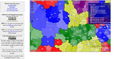
Pretty Postcodes
Code-Point Open

Codepoint Open - OSM Rendered

http://random.dev.openstreetmap.org/postcodes/?layers=000F0F0FBT
(development - may change at anytime)

Problems downloading on the OS OpenData site?
Alternative site: http://parlvid.mysociety.org:81/os/
Donate if you can (thanks)

now includes:
Code-Point Open
  • NationalGrid ↔ WGS84: AGPL Perl code, GPL PHP code
  • CSV headers: Postcode, Quality, PO box indicator, Delivery points stuff x 7, Easting, Northing, Country, NHS region, NHS health authority, County, District, Ward, Postcode.
  • WGS84 edition – with latitude and longitude instead of National Grid, and empty columns removed (so CSV headers are: Postcode, Quality, Latitude, Longitude, Country, NHS region, NHS health authority, County, District, Ward).
:) thanks @jonobennett

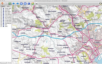
OS Meridian2 xml_rendered in OSM Mapnik
Fast implementation above Meridian2 rendered in OSM Mapnik

Another mashup using the OS 50k Gazetteer
A Tour of the OS 50k Gazetteer Linked Data
http://www.ldodds.com/blog/2010/04/a-tour-of-the-os-50k-gazetteer-linked-data/


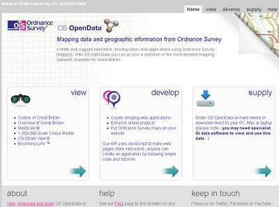
Ordnance Survey Open Data


Ordnance Survey Open Data Download

Labels: , , , ,

30 March 2010

OpenAddresses.org (Beta)


OpenAddresses.org (Beta)

"An Open Source web portail for the management of Open worldwide geolocated postal addresses."

openaddresses.org

New York City (NYC) show address points (geocodes) link

http://www.openaddresses.org/?northing=4975719.1423499&easting=-8240566.8885371&zoom=15&overlayOpacity=0.62

www.openaddresses.org offers an easy to use address editing service and geocoding/reverse geocoding services based on address data.

www.openaddresses.org stores ONLY geolocated postal addresses. Features associated to postal addresses like persons, companies, point of interests are not part of openaddresses.

www.openaddresses.org aims to collaborate nicely with www.openstreetmap.org by exchanging data, but since localized addresses are a very specific topic, it is appropriate to have a plattform dedicated only to addresses.

www.openaddresses.org is based on an original idea of Hans-Jörg Stark who initiated www.openaddresses.ch and www.openaddresses.at

Project home:http://code.google.com/p/openaddresses/


To do (as Beta)

source:

Labels: , , , ,

18 January 2010

OSM Routing for Port-au-Prince in Haiti

OSM Routing for Port-au-Prince in Haiti

update: 7pm 18/01/2010

Earthquake Geospatial Research Portal

Free GIS datasets and online resources related to the Haiti Earthquake can be found here.
http://cegrp.cga.harvard.edu/content/haiti-earthquake-data

Open Street Map doing outstanding work (and too many people to thank)

Fully Routing with barriers and obstacles where known.


Port au Prince Haiti Routing Map

Routing & Mapping can help rescuers and target areas with distribution aid.
http://openls.geog.uni-heidelberg.de/osm-haiti/#
*includes high resolution imagery from Geoeye (many thanks)

You can help:

Labels: , , , , , , , , ,

11 January 2010

Switch Maps (Google,Yahoo,OSM, Bing...) in One Map

Switch Maps (Google,Yahoo,OSM, Bing...) in One Map

Map Channels have released Switch Maps

Switch Maps by Map Channels
Switch Maps - Straight forward, easy to use and embed in your website or blog.
(Just copy and paste the code)

Switch Maps allow you to create a map that contains:
  • Google Maps
  • Google Earth (3D Globe) - plugin required
  • Street View
  • Bing Maps
  • Bing Maps - Bird's Eye View
  • Open Street Map
  • Yahoo Maps.
Creating a map is very easy select your map type then customise the map controls and set the width & height of your map.
Then use the 'Update' Button then Switch Maps creates the code that will allow you to embed your map in a website or blog.


Try Switching Map modes: Useful if one map type doesn't coverage your area another will.

Switch Maps also includes the option to include layers that show user photos from Panoramio and Picasa.
You can see some of the many map views available in Switch Maps in the Switch Maps Gallery.

Related links:
http://googlemapsmania.blogspot.com/2010/01/google-maps-plus-some.html
http://www.mapchannels.com/SwitchMaps.aspx
http://www.mapchannels.com/News.aspx

Well done to Map Channels on creating this excellent and versatile map creation tool.

Labels: , , , , ,

30 November 2009

OpenSteetMap Potlatch 2 Development Preview

OpenSteetMap Potlatch 2 Development Preview
"It's not just an online map editor - it's a Live Cartographic Online Editor"
Potlach 2 Editor

OpenStreetMap users are getting a brand new online 'cartographic' editor in the form of Potlatch TWO (2.0)
Potlatch 2 is a complete rewrite.

Aim:

  • Speed

  • Ease-of-use

  • Flexibility

Four big new features :

1.New feature – friendly tagging system Potlatch 2 has a friendly, intuitive tagging system. The mapper can use graphical menus, dedicated fields, and icons to get the tagging just right – without the need to remember tag names and values.

Graphical Presets - no need to lookup or remember tags

Potlach 2 has a friendly, intuitive tagging system. The mapper can use graphical menus, dedicated fields, and icons to get the tagging just right – without the need to remember tag names and values.

2.New feature – 'What You See Is What You Get' (WYSIWYG) rendering Potlatch 2 has an all-new rendering engine far in advance of the current one.


Potlach 2 Editor MapCSS


source:http://www.opengeodata.org/2009/11/30/introducing-a-new-osm-editor-potlatch-2/
With road names, patterned fills, rotated icons, and much more,form a Cartographic editing experience can be like working live on the familiar Mapnik rendering, the cyclemap, Osmarender, or anything you like -making it much more approachable for the beginner.Thumbs ups for this!

3.Cascading Style Sheets - CSS but for Maps = MapCSS


Just like the tagging, the rendering is easy to customise. It uses a special form of CSS, called MapCSS, which lets you create wonderful-looking maps with just a few lines of text. The tagging and rendering together make Potlatch 2 ideal for ‘vertical’ mapping applications, such as a cycle-specific editor or a building/addressing editor. Stylesheets aren’t just about making the map look pretty: you can create stylesheets to help your mapping, such as one that highlights roads without names.
So if your only interested in Footpaths then only show footpaths


Because this integrates fully with MapCSS stylesheets, you can choose to temporarily hide background data, or show (say) only footpaths… whatever you like.

So Potlatch 2 will have an accompanying ‘OSM Guide’, explaining the basics with friendly, illustrated text. It will be concise, focused and clear.

4.New feature – vector background layer Mappers are working more and more with imports. But the approach until now has been to import data directly into the map – and many people have pointed out the problems this can lead to.Highly requested


Potlatch 2 will support vector background layers.

You can load OSM-formatted data from servers or files, and work on bringing it into the map the way you want, at your own pace.
Fully rewritten in ActionScript 3 Potlatch 2 is written in ActionScript 3, a Java-like language with an open source compiler and full docs available online. The Potlatch 2 source comes with instructions on getting started and is, of course, permissively licensed under the WTFPL.
Potlatch 2 thus far has been written by Dave Stubbs and Richard Fairhurst (Great Work). But we would love to see more people hacking on the source. There’s a potlatch-dev mailing list especially for this.

New Existing Features likely to be coming:
Some other features, like Yahoo and tiled backgrounds, are finished but not currently exposed through the editor: they’ll be along shortly. Others, such as GPS track support, the Beginners’ Guide and the vector background layer are not coded yet but are intended for the initial release.Load Import Shapefile? Export Shapefile options?? Would be good. [Hint]


Potlatch 1 has some three years of development behind it, of course, and much of this feature set has not yet been ported to Potlatch 2. There’ll be countless little UI tweaks (no keyboard shortcuts yet, for example!); and as you’d expect for an in-development version, performance can sometimes be sluggish and there’s a lot of optimisations we’d like to do.
But with work progressing so fast, this seemed a great time to talk about it. Both the tagging system and the renderer are enormously flexible and we’d like to see people hacking on them as soon as possible.
Live Version
at:http://www.geowiki.com/potlatch2/
Renderer alone at:
http://www.geowiki.com/halcyon/

Should you want to try a particular area, just put the lat and lon in the URL like this:


http://www.geowiki.com/potlatch2/?lat=52.2&lon=0.1http://www.geowiki.com/halcyon/?lat=52.2&lon=0.1

Source Code is at:http://trac.openstreetmap.org/browser/applications/editors/potlatch2

More on MapCSS and documentation at:http://wiki.openstreetmap.org/wiki/MapCSS

Full Credit and Original Post
http://www.opengeodata.org/2009/11/30/introducing-a-new-osm-editor-potlatch-2/

Labels: , , , , , , ,

24 November 2009

Open Flood Mapping - OSM Maps Update First

Open Flood Mapping - OSM Maps Update First

Yes the OpenStreetMap'ers have been on the ball and with on the ground surveys and have updated the Bridges (collapsed or to be demolished).
Now this sounds a cruel but in reality shows the raw power of 'crowdsourced' mapping.


Open Flood Mapping - OSM Maps Update First
OpenStreetMap Updates [source] have come online within days of the bridge collapse.
Yes there was a fatality more here
http://en.wikipedia.org/wiki/2009_Cumbria_and_southwest_Scotland_floods

Now all we require is Flood Mapping Areas from Environment Agency (EA) overlay [available in April 2010?] on the map to show potential flooding on Ordnance Survey (OS) Maps.
Then the analysis of Met Office data [available in raw format in April 2010?]
Then the OFS [Open Flood Map] can provide real-time flood alerts and help communities likely to be affected.

Required from Government sources
1 in 1000 year flood polygons (EA)
1 in 100 year flood polygons (EA)
1 in 50 year flood polygons (EA)
1 in 10 year flood polygons (EA)
1:10,000 vector/raster mapping (OS)
Raw live-feeds MetOffice (geo-xml/json please)

[available April from 2010?]

Now that's a potentially risk-saving mashup of data.

Background on Bridges and Travel Distruption
Cumbria Bridges
Fully closed and Collasped bridges.
Collapsed Bridges: 1. Northside Bridge, Workington 2. Navvies Footbridge, Workington 3. Camerton Footbridge, Camerton 4. Memorial Gardens footbridge, Cockermouth 5. Low Lorton Bridge 6. Little Braithwaite Bridge 7. Camerton Church Bridge, Camerton
Closed bridges: 8. Calva Bridge, Workington 9. Goat Bridge, Cockermouth 10.Holmrook Bridge, Holmrook 11. Ouse Bridge, north of Dubwath 12. Isel Bridge, near Cockermouth 13. Cocker Bridge, Cockermouth 14. Southwaite Bridge 15. Broughton Bridge 16. Bridge End, Egremont 17. Spark Bridge 18. Backbarrow Bridge (off A590) 19. Bouthrey Bridge, Water Yeat 20. Station Road Bridge, Keswick 21. Scarness Bridge, Keswick 22. Scale Hill Bridge, Scale Hill 23. Greta Bridge, Keswick 24. Wath Bridge, Cleator Moor
Source: Cumbria County Council, 24 November via BBC News

latest travel news
http://www.bbc.co.uk/cumbria/travel/roads.shtml

Flood Recovery Appeal
http://www.cumbriafoundation.org/

Note - Ireland has also had huge problems with flooding over the past week.
http://www.breakingnews.ie/ireland/emergency-flood-fund-to-little-says-opposition-435667.html
And more rain forecast doesn't look good.

Labels: , , , , , , , ,