->

26 November 2008

OzCamp Map (Independent Camping)

OzCamp Map (Independent Camping)

Independent camping sites for Australia
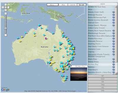
ozcamp main Camping Map

The site nows supports the new progress bar loader - also has an excellent interactive sidebar.
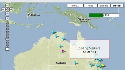
ozcamp Progress Bar Camping Map
Shows the users in real-time markers loading - this is useful when the database expands and the number of markers (campsite in this case) goes up.

"This map has been designed for campers who enjoy free/independent camping. Free camping includes National and State Parks which may attract a fee.

This free camping map has been designed so that anyone is able to add/edit/delete places. Please ensure accuracy when completing the location. Blue markers are where Dogs are allowed, Yellow markers no Dogs. Also added option (as of 18th Sept 2008) to have Purple marker if you are not sure of if Dog's are allowed or not."

  • The site is designed for independent camping sites only.
  • Feel free to update any incorrect information.
  • Commercial caravan parks should not be included. Whilst some of them offer great value for money and can be cheaper than camping in some National Parks it is outside the scope of this site.
  • Rest stops not to be included. Sites to be included should be places that you would like to stay at least a couple of nights.
  • Please only include places you have been to. Do not just transcribe locations from Camps 4 as that would be a breach of copyright. Also by limiting to places you have been to you can lead to more personalised descriptions of the place.
  • If any of the sites breach the above guidelines please delete from the map so that the map doesn't become cluttered with places that aren't for independent camping.
Try the Map
http://ozcamps.net/index.php?option=com_wrapper&Itemid=29

on a separate note:
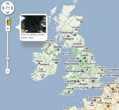
Google Maps now becoming more like Google Earth...Google Maps - New Control Redesign
For more information and debate on the New Google Maps Controls Redesign go to
http://googlemapsmania.blogspot.com/2008/11/major-google-maps-redesign.html
(these changes are not available currently in the Google Maps API)

Labels: , , , ,

21 November 2008

New AA Route Planner Beta

New AA Route Planner Beta

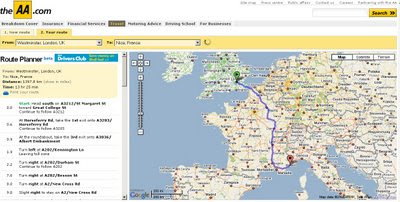
The AA Route Planner is under going an update - here is the first blog mention of it.

AA Route Planner Beta Map AA Overview
Google Maps based, but AA have their own Custom Maps in the Info Windows (click the sidebar and an info window at the location is displayed)

AA Route Planner Beta Map
European Directions includes channel crossings, Ireland is also covered.


The switch from old the ArcIMS to Google Maps API but preserving the additional functionalities of the old routing [sidebar in graphic form - the road sign structure]. It is still under beta and things might change and improve, Points of Interest (POI's) along the route might be useful.

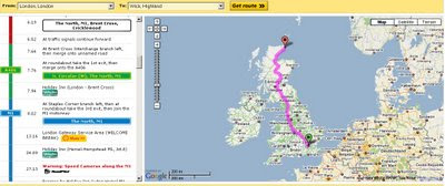
AA Route Planner Beta Map UK
The Sidebar is interactive and is displayed as the driver would recognise the signage [Primary Route Green, Motorway Blue etc.]

Try it out
http://www.theaa.com/route-planner/index.jsp

Old Version is still available
http://www.theaa.com/travelwatch/planner_main.jsp?database=B

Mapperz

Labels: , , , , , ,

19 November 2008

CloudMade Web Lite API (pre Alpha)

CloudMade API (pre Alpha)

"Our [CloudMade] aims are to continue the democratization of geo data and to expand access to open geo data through a range of simple yet powerful tools and APIs."

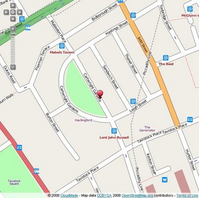
CloudMade Web Lite API
Early Days but looking promising in the 'lite' way to get web mapping on your site without the large restrictions other mapping api's have.

Now there is two Mapping API's that are in early stages of development.

Web Lite - API
http://www.cloudmade.com/products/web-maps-lite

Features:
  • Take advantage of the most up-to-date source of map data on the web
  • Benefit from the rich OpenStreetMap dataset, with features such as footpaths and cycle paths that are not found on other online maps
  • Be free from restrictive licensing - use our maps for routing, real time tracking and as a basemap to derive new layers
Mobile Maps API*
http://www.cloudmade.com/products/mobile-tiles
Features:
  • Create applications for mobile devices that use CloudMade's mobile optimized maps
  • Benefit from the rich OpenStreetMap dataset, with features such as footpaths and cycle paths that are not found on other online maps
  • Take advantage of the most up-to-date source of map data on the web
*untested by Mapperz currently

Examples:

Try the drag marker with panning and zooming functionally added.
http://mapperz.googlepages.com/cloudmade_web_lite_api.html


speed test onload: 0.85 milliseconds (YSlow!)

To test it - Mapperz used the OSM data in Virtual Earth as a comparison
http://mapperz.googlepages.com/osm_in_VE.html
speed test onload: 1.25 milliseconds (YSlow!)

Yes currently the bigger API's have more functionality but their Terms restrict in what you can and cannot do with your mapping, so the future for a lightweight Mapping API is looking good.

Web Maps Lite API is currently in 'closed pre-Alpha'
Let's look forward to a Public Beta.

Though you can view the Official Step-by-Step Examples
http://www.cloudmade.com/products/web-maps-lite/examples/1

Another good move by Cloudmade is the OSM data

"This is where you can find extracts of maps from different places around the world. From here you can download:"

  • OSM XML extracts by country
  • Garmin Map Files (OSM.err edition)
  • Osmosis country bounding polygon
  • Shapefile extracts by country
  • Navit maps by country
  • GPX POI by country
  • TomTom POI by country
  • OSM XML feature extracts by country
http://downloads.cloudmade.com/

Labels: , , , , , , ,

17 November 2008

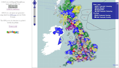
Open Source Postcode Map (UK)

Open Source Postcode Map (UK)

Open Source Postcode Map

Postcodes have been created using New Popular Edition (NPE) Maps
http://www.npemap.org.uk/

The NPE postcode data here is updated weekly.

The Current List
http://www.npemap.org.uk/data/currentlist
Full List
http://www.npemap.org.uk/data/fulllist


View the Open Source Postcode Map for the UK

most recent postcodes added:
You can help whilst you view the map...

"Whilst looking around, you can tell us about the postcode of where you are looking. We want to collect information about where postcodes are now by finding them on old maps."

Related:
http://www.freethepostcode.org/

Labels: , , ,

15 November 2008

Yellow Pages - Canada (Beta)

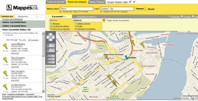
Yellow Pages - Canada (Beta) - using the Virtual Earth Platform

Yellow Pages Canada Maps French (Beta)
Both English and French Languages are supported.

Yellow Pages Canada Maps English (Beta)
Cluster Mapping works very well, clicking on them zooms to the area and icons are shown individually.

The hidden plus is the accessibility of the Text can be increased for users .
  • Use the instructions below to change the font size on Maps.ca: Use the Text Size Increase buttons at the top right-hand side of the page
  • Or You can adjust the text size in your browser. Please consult your specific browser’s help file for specific instructions on adjusting text size.

"Maps.ca Launches Beta Version of Yellow Pages Portal Featuring Microsoft Virtual Earth
Maps.ca has beta launched a new version of its Yellow Pages portal, utilizing Virtual Earth maps and imagery to help customers locate and save business and travel information. The “find on a map” feature uses Virtual Earth AJAX Control’s geocoding capabilities, and provides relevant results for address or place-of-interest queries. By searching through the new site, customers can quickly locate business information, and are provided with driving directions and updates, including Virtual Earth traffic data. In addition, visitors are able to customize maps, selecting and saving locations most pertinent to them for access later."

French Canadian Version http://www.mappes.ca
English Canadian Version http://www.maps.ca

*Note Live Traffic is only available for Toronto currently.

Source:
http://blogs.msdn.com/virtualearth/archive/2008/10/14/maps-ca-yellow-pages-canada-and-virtual-earth.aspx

Labels: , , , , , , ,

14 November 2008

My Geo Position

My Geo Position

A quick and simple site to find any position around the world.

My Geo Position

MyGeoPosition.com offers:

* Geocoding of worldwide addresses
* Finetuning of the position using a drap & drop marker
* Geoposition as float or in degrees
* Setting an inaccuracy (~1m, ~10m, ~100m, ...) for data protection reasons
* Automated creation of geo-metatags for websites and weblogs
* Automated creation of geotags for websites, weblogs and images
* Automated creation of kml files (Google Earth)
* iGoogle gadget for quick geocoding from your personal landing page
* Slim design, quick loading process
* NEW: Enter a geocoded website url and its location will be displayed on the map

Labels: , , , ,

13 November 2008

Ordnance Survey - Doom Masters

Ordnance Survey - Doom Masters

Double Update:
Ed Parsons (a former CTO of the Ordnance Survey) writes:
http://www.edparsons.com/2008/11/who-reads-the-terms-of-service-anyway/

"As the Guardian article points out the OS was unhappy with local authorities signing up to the Google Maps API terms of service as it required a “broad” re-licensing of the data to Google and the users of Google maps based sites."

Google Maps Terms have been adjusted:
"Thank you for your interest in the Google Maps/Google Earth APIs. The Google Maps/Google Earth APIs are a collection of services that allow you to include maps, geocoding, and other Content from Google in your webpages or applications."
http://code.google.com/apis/maps/terms.html
(Last updated: November 12, 2008)


Update:
Google Maps API Users have raised the issue
http://code.google.com/p/gmaps-api-issues/issues/detail?id=852
(please star the issue so the 'Terms of Use' will be updated asap.)

The Ordnance Survey are striking back after the announcements of 'Show Us a Better Way' about derived data - breaking copyright.

Breaking Copyright
OS Maps Online - But you cannot create points, line or polygons from it as your breaking copyright.

Using Old OS Maps to capture data freely
However you can use these Old OS Maps to capture data freely.

http://www.showusabetterway.co.uk/call/2008/11/and-the-winners-are.html
Most have some element of Geographical Data (Postcodes) or Mapping.

From the Free Our Data Blog (The Guardian)
"The OS, we’ve learnt, has circulated local government with a helpful Q+A about how they shouldn’t embed info on Google Maps (or of course other mapping companies such as Microsoft or Yahoo or..) if it has been “derived” from OS data."

How to kill innovation in one huge swipe! Well done OS. Remember the UK Taxpayer has funded you for years (now its 47%).

more on the debate:

Question: I want to pull Google Maps onto my system and host my Ordnance Survey derived business information on top, so that no data will pass to Google. Can I use this solution instead?

A No. Although you will not be passing any data directly to Google, by displaying such data on top of Google Maps in this way and making such mapping available to the public, it appears that you will be granting Google a licence to use such data. This is the case despite the fact that you will be hosting the data on your system. Google’s terms and conditions appear to provide that any display of data on or through the Google services grants Google a perpetual, irrevocable, worldwide, royalty-free licence to reproduce, adapt, modify, translate, publish, publicly perform, publicly display and distribute such data.

The terms of your licence do not permit you to license Ordnance Survey data to a third party in these circumstances.


Full Article by Charles Arthur

http://www.guardian.co.uk/technology/blog/2008/nov/12/ordnance-survey-google-maps-copyright


View and get bored read the PDF the Ordnance Survey published

http://www.freeourdata.org.uk/docs/use-of-google-maps-for-display-and-promotion.pdf

so '*S%^&@' you are.... thanks OS.

Labels: , , , ,

12 November 2008

UMapper Maps Adds Spatial Searches

UMapper Maps Adds Spatial Searches

UMapper Spatial Search
Spatial Searching from a specific location, uing Yahoo Local Search for Businesses.

From the UMapper blog:

"Ever wanted to search for a local business or map all the pizza places in your town? Now that UMapper is integrated with Yahoo’s Local Search, you can do all of those things. To illustrate this new functionality, we have created a map of all Starbucks coffee shops within 3 mile radius of our office.

Here are some ideas of what you can do with this new functionality:

* Search for business within a certain geographic region
* Create maps with up-to-date local info
* Read business reviews
* Create interactive maps (like the one above) in less than 2 minutes
"


Just want flash icons that are really, really flashy?


It is now possible to add SWF's as custom markers for your map.
UMapper has an example here http://www.umapper.com/maps/view/id/13608/

Labels: , , , ,

10 November 2008

ArcGIS 9.3 Service Pack 1 Released

Update [26/11/2008]:
Due to a couple of issues that have been resolved ESRI have updated
Service Pack 1 for 9.3
http://support.esri.com/index.cfm?fa=downloads.patchesServicePacks.viewPatch&PID=66&MetaID=1457
If you have already downloaded the service pack check the time stamps
(right click properties on the installer)

New Timestamp (SP1)
21 November 2008 20:13:08

Old Timestamp (SP1)
23 October 2008 06:27:52


If already installed service pack 1 then you can download the patches and install them to update the software rather than the long winded re-installing SP1
Topology Validation Patch
http://support.esri.com/index.cfm?fa=downloads.patchesServicePacks.viewPatch&PID=66&MetaID=1468


To Check the actual file causing the issue check
  • Under the \ArcGIS\Bin folder, right click the GdbTopo.dll file
  • Select Properties
  • On the Version tab, the File version for GdbTopo.dll should read: 9.3.1.1851
(note the issue with subscribers to Virtual Earth in ArcMap has yet to be resolved, so a workaround is mentioned in the comments)

ArcGIS 9.3 Service Pack 1 Released

ESRI have released the first service pack for ArcGIS products.
The list of improvements is huge due to the 'error reporting' function built into 9.3 software.

Here is the full list of fixes
http://gisupdates.esri.com/93sp1/ArcGIS/ArcGIS-93sp1-issues.htm

Mapperz top pick of fixes

NIM009383 - With ArcGIS 9.2 SP2 and higher, certain JPEG images cannot be loaded.

NIM006247 - Saving shape file edits more than eight times in ArcMap leads to slower and slower performance.

NIM033727 - Converting symbology to representation with the 'Features in current extent' option chosen does not complete properly.

NIM035106 - Application failure when using the SHAPE" field in the Select By Attributes command."

NIM036029 - Millimeter values are interpreted as points for size and width property overrides.

NIM036446 - Representation rules with identical internal identifiers can lead to data corruption.

NIM036971 - Exporting attributes to PDF results in incorrect values for fields using a number format.
NIM037410 - Exporting attributes to PDF is not preserving alias names for fields.
NIM037888 - Exporting attributes to PDF drops the value of a field called NAME when layer is using unique value renderer.

NIM037099 - When a line feature class is labeled using Maplex with the centered straight placement option and a label expression whose font tags differ from the symbol size, the labels are drawn offset from the line.

NIM037125 - Using buffer (in the editor or the Geoprocessing tool) fails on some very large input features.

NIM037580 - Crash due to lack of memory while building a spatial index for a complex polygon

NIM037814 - The Label Placement Optimizer algorithm does not work correctly when run inside a Composte algorithm

NIM037818 - Append does not work with feature set as target.

ArcGIS Desktop (ArcInfo, ArcEditor, ArcView)
ArcGISDesktop93sp1.msp 94 MB

ArcGIS Desktop Help updates
ArcGISDesktopHelp93sp1.msp 243 MB

Download the latest Service Pack from:
http://support.esri.com/index.cfm?fa=downloads.patchesServicePacks.viewPatch&PID=17&MetaID=1457

Labels: , , , , , ,

07 November 2008

Wheres the path? Mapping Wins Award

The Excellent Mapping Mashup 'Wheres the path' will get more funding to be developed further :)

Congratulations to the author of the map Bill Chadwick

Annoucement:
Show Us a Better Way


"This competition is about how you can help us make better use of your data"

Out of the huge list of submitted ideas
http://www.showusabetterway.co.uk/call/ideas/index.html

Where is the path - a winner
Where is the path has been a hugely successful mashup.
(note the yellow bar in the bottom left corner is number of tile impressions - if goes red it is very close the daily limit.)


Now with even more new features:
1) Diagram of Magnetic, True and Grid North relationships

2) Estimated (Naismith) hiking times

3) Sunset calculator (to check if a planned route should end before dark).

Mapping Mashup
http://wheresthepath.googlepages.com/wheresthepath.htm

Another reminder to Ordnance Survey - raise the limit on OpenSpace tile impressions please - even for this one url. (currently OS tiles have a 30,000 limit per 24hrs - it needs to be 75,000 at least).

Mapperz

Labels: , , , ,

06 November 2008

Geo 3D Photosynths [Microsoft Live Maps]

Geo 3D Photosynths [Microsoft Live Maps]

Live Maps just got better -
Photosynths Pictures have now been 'GeoTagged' .
Geo Photosynth Map
The new options are available from the sidebar or on a marker on the map.


Geo Photosynth 3D Map
Available in 3D Mode - Load times vary

Requirements:
Photosynth installed - http://photosynth.net/howtosynth.aspx
3D Plug-in for Live Maps (Updated Version)

Geo Photosynth Viewer
Photosynth Viewer - linking from Live Maps.

related:
http://livelabs.com/photosynth/

Labels: , , , ,

05 November 2008

Northern Ireland Flood Maps [Now Available]

Northern Ireland Flood Maps [Now Available]

Northern Ireland Flood Map Belfast

Flood Maps for Northern Ireland have now been released and available online


Historical Data is available
NI Flood Map Belfast Historic
Searching by Postal Address is made easy:

"The Strategic Flood Map (NI) - Rivers & Sea has been developed by Rivers Agency in co-operation with the Department of the Environment (DOE). The primary aim of the Strategic Flood Map is to provide an illustration of the areas throughout Northern Ireland that are estimated to be at risk of flooding from rivers and the sea."

"Rivers Agency has made all reasonable efforts to ensure that the Strategic Flood Map (NI) is of a quality and reliability consistent with its purpose. However, there is no guarantee that the information contained within the Strategic Flood Map (NI) is accurate, complete or up to date and therefore the responsibility rests with the user to undertake appropriate validation."


The slippy Maps look good, the interactive legend works well.

"Rivers Agency will not be responsible if the information contained in the Strategic Flood Map (NI) is misinterpreted or misused and therefore users must satisfy themselves that the map is suitable for their intended purpose. In no event shall Rivers Agency, under any cause of actions of any kind, arising out of or related to the use of the Strategic Flood Map (NI) be liable for any loss of profits or direct, indirect, incidental, consequential or other loss suffered by the user."


Note on all images on this post:
"All intellectual property rights within the flood map and within this website generally are owned by Rivers Agency or its licensors and are subject to Crown Copyright."

"You may make use of the information contained within the Strategic Flood Map (NI) provided that it is not for any commercial, business, professional or other income generating activity and provided that the usage is not detrimental to Rivers Agency, its activities or the environment. Please contact us if you need permission for any other use." Provided that you comply with the aforementioned restrictions you may take up to 50 copies of the Strategic Flood Map for use by yourself (for non-commercial and internal use) by printing out the page you are viewing. PDF link

Full Users Guide [PDF Format]
http://www.riversagencyni.gov.uk/user_guide-strategic_flood_map__ni.pdf

Maps Slow? - This is due to the High Demand and Limited Bandwidth - if slow try in a couple days

Note: Mapperz was given permission to use the above images - please seek permission if you want to post/blog or email them.

Thanks to dardni for making this post possible.
http://www.dardni.gov.uk/

Labels: , , , ,

03 November 2008

SatSki [Free Maps Coming Soon]

SatSki [Free Maps Coming Soon]

SatSki is making it's maps available for free for smartphones

"Satski is a touch screen colour GPS system which uses ‘real time’ while on the piste to plot user’s routes and guide skiers and boarders of all different levels around the resort, providing an easy to use, interactive piste map."


SatSki on SmartPhoneSatSki Google Earth Demo
[images sources: SatSki]

"As of 6th November Satski will provide FREE ski map downloads for smart phones. The Satski free downloads offers basic features such as piste/trial map and resort specific information"

Emergency Feature:
This feature provides crucial information for those in need of help and assistance from rescue services at the press of a tab the Satski software will allow the user in an
emergency situation to send their exact location coordinates to Mountain rescue/ Piste security (Longitude and Latitude) as well as their mobile phone number.
[if have a mobile/cell network]

source:http://www.satski.com/News.aspx

Labels: , , , , ,