->

20 September 2010

Hurricane IGOR - NOAA KMZ Overlays

Hurricane IGOR - NOAA KMZ Overlays

Hurricane IGOR Advisory Archive NOAA KML/KMZ - National Weather Service
Hurricane IGOR Advisory Archive NOAA - National Weather Service - KMZ Display using Google Maps v3.

Overlayed 4 KML/KMZ files from
http://www.nhc.noaa.gov/gis/archive_forecast_results.php?id=al112010&name=Hurricane%20IGOR

Mapped the overlays here
http://mapperz.110mb.com/GMAP/Hurricane_Igor.html

Labels: , , , , , ,

07 July 2010

Google Maps v3 New Map Mashups - July 2010

Google Maps v3 New Map Mashups - July 2010

Here are some of the newest v3 Google Maps

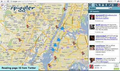
Spiggler.com Searches Twitter with your location.
Spiggler - Twitter Google v3 Map
Updates as you pan the v3 Google map nice integration with the twitter api.

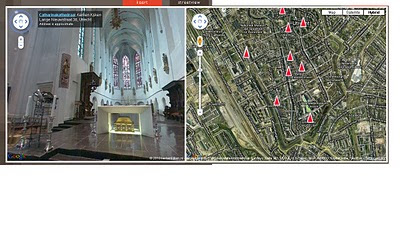
Streetview Inside
http://weblab.ab-c.nl/streetview v3 google map


Location Search Tool for Twitter
Find Geo-Twitter comments via this v3 Twitter Location search Google Map


The Grand Canyon - v3
Maptiler Custom v3 - The Grand Canyon
Using USGS DRG tiles as a custom tiled Google Maps v3.

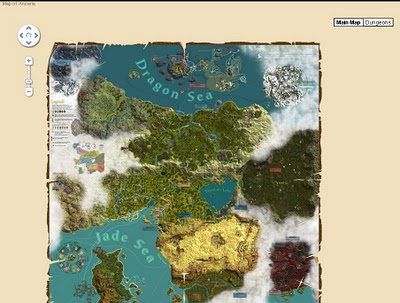
Game:Map of Ancaria
Map of Ancaria_v3 Google Maps
Very well illustrated Map of Ancaria [Sacred Game] - users can switch between this main map and dungeons custom map.

Missouri State Campus Map - Mobile
Missouri State University Campus v3 Mobile Map
Clean, Fast with campus overlay implemented in v3 for mobile users.

Don't forget that you can style your own map in v3 see the previous post.

Have you made your own v3 custom map like this? Add a comment and mapperz will post an update.

Labels: , , , , , ,

24 January 2010

Google Geocoder Suggests (Esa's Experiments)

Google Geocoder Suggests (Esa's Experiments)

Google has had the 'suggest' option on the main site for a while, yet when you go to the maps you need to know your destination, now you can get help with a geocoder extended with a suggest.

Ahead of the game with Google Map API is Esa with his impressive well thought out experiments.

Google Esa Geocoder Suggests
The example above typing in Bri... suggests 10 locations in Google's Geocoder that are located.
Very clean,very fast and extremely useful.
http://koti.mbnet.fi/ojalesa/boundsbox/geocode_basic_3.htm

Without a Search button - http://koti.mbnet.fi/ojalesa/boundsbox/geocode_basic.htm

*Geocoders are not perfect, they should never be trusted, they are as only good as the accuracy of the original data they were derived from.

Custom Map Types:
Custom Map Types with Geocoder
Custom map Types - here Google Maps with Traffic is synchronised with OpenStreetMap
  • Image map type, like OpenStreetMap tiles in the example page
  • Image overlay map type, like the Traffic tiles in the example page
  • Non-image tile based map type
http://koti.mbnet.fi/ojalesa/v3/osm_dual.htm

Image Map Type behaves just like the standard map types. Image Overlay tiles are displayed on top of the Image Map Types.
The non-image map type makes it possible to create tile layers with SVG, canvas or any html elements
.

Geocoder with Bounding Box - Extent
The v3 Geocoder has extent (Bounding Box) optional, Esa makes this visual with his Bounding Box Page, can be useful narrowing search requests within a specific area.

http://esa.easypagez.com/v3boundsbox/

Sources:
http://koti.mbnet.fi/ojalesa/exam/index.html
(many other examples too)

http://nuppineulat.blogspot.com/ (
Finnish)
http://apitricks.blogspot.com/ (English)

Many thanks to Esa for creating the examples and making them available to budding developers.


Labels: , , , , , ,

14 January 2010

Edmonton Opens Up City Data

Edmonton Opens Up City Data

The City of Edmonton in Alberta, Canada is following suit of Vancouver and Toronto and opening up city (public) data.

Data available now (more available after review of the community preview Feb 2010).
  • 2009 Census - Age and Gender
  • 2009 Census - Dwelling Unit Ownership
  • Bus Stops Edmonton Transit Locations
  • City Council Meeting Schedule
  • City Parks Locations of various City parks in Edmonton
  • Community League Centres Locations in Edmonton
  • Locations of all Fire stations in Edmonton
  • Locations of historical buildings in Edmonton
  • List of Planned Road Closures throughout the City of Edmonton
  • Police Stations Locations in Edmonton
  • Locations of School buildings in Edmonton

Though Edmonton take it a stage further and provide feeds and data overlay map ready so users can quickly make use of the data.

Edmonton Bing map
Default View of Bus Stops Overlay on the Edmonton City of Edmonton Website

Getting to the Data
Edmonton KML
This example show the direct feed http://datafeed.edmonton.ca/v1/coe/BusStops/ as a KML (Google Earth) file loaded directly on Google Maps.
To view this Data as above - http://maps.google.com/?q=http://datafeed.edmonton.ca/v1/coe/BusStops/?format=kml

There is a stage futher, not only do City of Edmonton provide Scripts ready made so it makes it much easier for non programmers to create their own web maps.
Edmonton bing map source
Default is Bing (Virtual Earth) Maps though drop-down Language Environment reveals Google Maps API source code.
Mapperz edited mashup
This a mapperz example taken from the code above. Though there are two important changes for the examples to work.
1. jquery-1.3.1.min.js needs to be fully mapped to your server/website
2.Google Maps API requires a specific API Key for YOUR site (API Key signup)

Other changes mapperz made are simply moving the latitude and longitude to centre on Edmonton and not Washington DC.

Links - and Well done to the City of Edmonton making this available.
http://data.edmonton.ca/

mapperz version (tweaked to work)
http://mapperz.googlepages.com/edmonton_google_map_source.html

source:
http://www.calgaryherald.com/Edmonton+releases+downloadable+databases/2438135/story.html

Labels: , , , , , , ,

30 October 2009

Google Maps JavaScript API v3 - Now with Directions

Google Maps JavaScript API v3 - Now with Directions

**Remember Google Maps JavaScript API v3 is designed to be super lightweight for mobile devices

This makes mapping for mobile devices a lot more useful

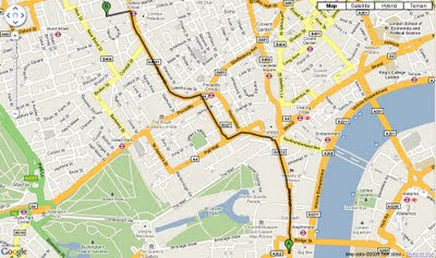
New Directions (Walking or Driving) in London - Google Maps API V3
New Directions (Walking or Driving) in London - Google Maps V3

@mapperz example above
http://mapperz.googlepages.com/google_mapv3_directions.html

With a Directions Panel
http://mapperz.googlepages.com/google_mapv3_directions_panel.html


Code:
New required parameters

var directionDisplay;
var directionsService = new google.maps.DirectionsService();

Set Start and End locations:

function calcRoute() {
var start = document.getElementById("start").value;
var end = document.getElementById("end").value;
var request = {
origin:start,
destination:end,

Travel Modes:

travelMode: google.maps.DirectionsTravelMode.WALKING
travelMode: google.maps.DirectionsTravelMode.DRIVING

Get the response from the Geocoder if both locations geocoded then display route between locations:

directionsService.route(request, function(response, status) {
if (status == google.maps.DirectionsStatus.OK) {
directionsDisplay.setDirections(response);


See the changelog
http://code.google.com/p/gmaps-api-issues/wiki/JavascriptMapsAPIv3Changelog

revelant links
Official documentation
http://code.google.com/apis/maps/documentation/v3/reference.html#DirectionsRenderer
http://code.google.com/apis/maps/documentation/v3/reference.html#DirectionsService

Offical Examples:
http://code.google.com/apis/maps/documentation/v3/examples/directions-simple.html
http://code.google.com/apis/maps/documentation/v3/examples/directions-panel.html

source:
http://groups.google.com/group/google-maps-js-api-v3/browse_thread/thread/ee7ce7cf8a872268?hl=en#

Labels: , , , , , ,

30 June 2009

The Met Office (Google Maps) Weather

The Met Office (Google Maps) Weather

The Met office are experimenting with the Google Maps API - this is a very interesting move. The results are quite impressive and this is a potentially a bold move and a great way to represent weather forecasting on the web.
This includes animating the weather for the next 24hrs using the time bar above the map.

The Met Office Weather using Google Maps 1st July
Google Maps API with Meteorological Data overlayed to represent very visually the foretasted weather for the UK. Animation is controlled by the 'Play' Button.

Not only is rainfall overlayed but isobars representing the pressure is also animated.

The Met Office Weather using Google Maps Isobars
Isobars (Barometric Pressure) overlay on Google Maps

There is Temperature, Winds(strength/direction) missing currently, this is planned for the future and will be very useful for users.

This is an impressive experiment and greatly improves the very static generated images that currently dominated the Met Office Website.

Well done to all involved, this is what the public want.

The Met Office Google Map (Experimental)

Currently the BBC have Temperature and Winds [Flash required]
http://news.bbc.co.uk/weather/forecast/10209

Suggestions - Opacity Control - current radar blocks the background map.
Temperature and Winds layers would be very handy.
5 day forecast possible?
An a final request on the raw data - it possible to have a basic GeoRSS feed for budding developers to create weather overlays for their own maps
GeoRSS weather warnings?

Labels: , , , , , ,

20 May 2009

Healthy Pet Mobile Vet - Service Area Map

Healthy Pet Mobile Vet - Service Area Map

Healthy Pet Mobile Service Areas Google Maps API
Brian Peyser has created Service Area Polygons for Healthy Pet Mobile Vet.
Provides both response by time and traffic overlay from New Market, MD.

Works really well:
how this was achieved?

"I did this with an adaptation of Marcelo's code:
http://maps.forum.nu/gm_driving_radius.html
I made the script return a pretty accurate set of points within the
limit of my algorithm based on both distance and time. You can see the results at:
http://www.healthypetmobilevet.com/area.shtml
Just keep this in mind--when I did a really accurate set of points it only took a few tries to exceed Google's limit. Also, it can take a little while to get the polygon. Make sure you've got it right before you start running the requests. When I did it, I actually made the polygons using OpenJUMP (which is a free GIS program) based on teh points output be the script, then converted to KML from Shapefile. You might be able to do this better than I did, but to get an accurate polygon you'll need a lot of requests. If you have a lot of regions to create it will take a long time, since you'll have to spread it over multiple days. However, you may be able to improve it by narrowing the search region. Instead of searching in a circle from each point, you just search a region that overlaps based on distance. In other words, do what you've already done to limit your search space."

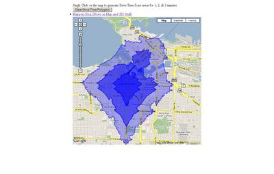
If you want interactive 'Drive Time Zone' see the older post
http://mapperz.blogspot.com/2008/07/arcgis-javascript-extension-for-google.html

links to this:
Interactive ESRI Drive Time Google Map
Mapperz Version is based in Vancouver, Canada, but also covers the USA.
(Uses the ESRI ArcServer sample server as the backend for geoprocessing)

http://mapperz.googlepages.com/DriveTime_ESRI_GMAP.html*

*note googlepages will be closing 1st July 2009 - will move this demo by then and update the link.

source: Google Maps API group
http://groups.google.com/group/Google-Maps-API/browse_thread/thread/9ef5ee515db6fe07#

Labels: , , , ,

21 November 2008

New AA Route Planner Beta

New AA Route Planner Beta

The AA Route Planner is under going an update - here is the first blog mention of it.

AA Route Planner Beta Map AA Overview
Google Maps based, but AA have their own Custom Maps in the Info Windows (click the sidebar and an info window at the location is displayed)

AA Route Planner Beta Map
European Directions includes channel crossings, Ireland is also covered.


The switch from old the ArcIMS to Google Maps API but preserving the additional functionalities of the old routing [sidebar in graphic form - the road sign structure]. It is still under beta and things might change and improve, Points of Interest (POI's) along the route might be useful.

AA Route Planner Beta Map UK
The Sidebar is interactive and is displayed as the driver would recognise the signage [Primary Route Green, Motorway Blue etc.]

Try it out
http://www.theaa.com/route-planner/index.jsp

Old Version is still available
http://www.theaa.com/travelwatch/planner_main.jsp?database=B

Mapperz

Labels: , , , , , ,

29 July 2008

GIS Geoprocessing >Google Maps API >Google Chart API

GIS Geoprocessing >Google Maps API >Google Chart API

update2 - ESRI just announced they are adding Virtual Earth to ArcGIS
"ESRI (Environmental Systems Research Institute, Inc.) and Microsoft announced a partnership, enabling the integration of the Virtual Earth platform into ESRI’s ArcGIS Desktop and Server software. The seamless integration of Virtual Earth into ArcGIS allows ESRI ArcGIS customers access to high-quality base map layers with rich aerial and hybrid views.
Using Virtual Earth and ESRI to publish public applications will give citizens better insight into government services to ultimately inspire involvement and participation while allowing mapping developers to publish maps faster and easier."
More details
http://www.prweb.com/releases/ArcGISOnline/GIS/prweb1153954.htm


update1 - If your interest GIS Integration with online Mapping there is a Live Seminar on 31st July 2008 - "Building Mashups using the ArcGIS JavaScript APIs"
http://training.esri.com/campus/seminars/seminardetail.cfm?course_id=100

How do you make GIS Analysis work with Google Maps API online now?

Mapperz GIS Analysis - Buffer,Intersect using ArcServer & Google Maps & Chart API
Complex GIS Geoprocessing in Google Maps - data processed on the fly. Final data is assembled in a clear visual way using Google Chart API.

Behind the scenes.
Using ESRI ArcServer to buffer (see below) handrawn lines, the 'buffer' then is 'intersected' with US Population Cenus Data (2007) and Census blocks are visualised by Google Charts API.

Try Mapperz version of GIS Geoprocessing in Google Maps API and using Google Charts API

Recently ESRI have released Resource Center for ArcServer which in combination with the ArcGIS Server API's can:
"Develop custom JavaScriptâ„¢ applications that mashup ArcGIS services, Google Maps, and Microsoft Virtual Earthâ„¢ data. The ArcGIS JavaScript APIs take full advantage of powerful mapping, geocoding, and geoprocessing services."

What is Geoprocessing?
The fundamental purpose of geoprocessing is to allow you to automate your GIS tasks.

So how can we prove this works online?
Mapperz's was looking up some ArcScripts (Users upload useful scripts/code) for users to download and use and modify. Found this created by Andy Gup (ESRI)
"hand drawn polyline buffer google.zip"

This contains a few files and a readme.
"This demo shows how to use a hand drawn polyline to establish a population study area buffer using ArcGIS JavaScript Extension for Google Maps API with Google base maps and drawing tools. The polyline can be edited on the fly to adjust the study area (buffer), all the calculations parameters will automatically update."

This sample demonstrates a number of things using the ArcGIS JavaScript API:
- Passing a hand drawn polyline to an ArcGIS query task
- Using a full compliment of Google drawing tools
- Using multiple queryTasks
- Use a toggle to show/hide polygons and GMarkers
- Include query info with Google Charts API and then wrapping that up in a popup information window.

The hosting web server requires IIS 6.0 and ASP.NET for this to work.
Mapperz choose brinkster.net for supporting the IIS 6.0 and ASP.NET plus live chat support if required.

Mapperz wants to thank Andy Gup for creating and making this code available to the GIS community.

The only issue found was the file 'proxy.ashx' has to have full url to 'proxy.config' to make this work. Issue reported to Andy Gup and acknowledged.

Please note this works only within US Coverage, due to using the US Census Population data (2007) - modify it if you wish for outside the USA.

Labels: , , , , , , ,

15 July 2008

New Google Map API Ad Icons (Experimental)

New Google Map API Ad Icons (Experimental)

Google Maps API are rolling out some changes with the Ad Manager.

New Ad Manager - Google Maps API Icons
You can now have a maximum of 10 'Advert Icons' on your custom map.

"Over the coming weeks, we're going to making a few changes to the
style of the ads rendered by GAdsManager.

Starting in version 2.119, we're going to be making two small changes. "
Mike(Google Employee)

(make that 3)

  1. replacing the current white pushpin style with a new style where the ads will appear to be flat "on the map. see example image
  2. "nudging" the ads slightly, so that ads will no longer ever sit on top of any text rendered in the map tiles.
  3. also starting to serve ads outside the USA
Mapperz can show an example that is working in the UK.
http://mapperz.googlepages.com/ads_manager_test.html
(If you don't see new icons displayed - try zooming once or panning the map - please remember that it is experimental!)

The one issue that you can clearly see at present is the icons still overlap text on the map tiles.
(this is due to the the tiles being rasters, to solve this google would new to vectorize the text as a bounding box and buffer the vector rectangles to create 'avoid ad/text clashing polygons'.
A tip from cartographic text placement there.)
VectorMagic does a very good job (Sample)

Here is an new icon
http://pagead2.googlesyndication.com/pagead/imgad?id=CIXc9e63iK6PywEQEBgQMggWzfQHA9oWTQ
and another
http://pagead2.googlesyndication.com/pagead/imgad?id=CPOInt6BsJf1IhAQGBAyCGKbz0m-eFN1
(looks like each ad has its own id for adwords purposes.)

How do you enable?
Not everyone wants to have 'Google Ads' on there maps so it's an option to include it.

var map = new GMap2(document.getElementById("map")); //Add the Map
map.addControl(new GLargeMapControl());//Add the Large Control
map.setCenter(new GLatLng(37.423148, -122.084874), 13);//Centre on LatLng
var ads_opts = { //Add Ad Options
mode: "experimental", //Mode:Experimental -Subject to change
maxAdsOnMap: 10 //Maximum number of Ads (10 is Max)
};
var adsManager = new GAdsManager(map,
"google", ads_opts);
adsManager.enable();

"google" will be where you put your adsense id so any click through would be registered
to your account


Official Example
http://gmaps-samples.googlecode.com/svn/trunk/
adsmanager/adsmanager_new.html

Source:
http://groups.google.com/group/Google-Maps-API/browse_thread/thread/12534906310673ff#
Mapperz New UK Version
http://mapperz.googlepages.com/ads_manager_test.html

Labels: , , , , ,

15 May 2008

Google Maps for Flash New!

Google Maps API for Flash New!

"This API lets Flex developers embed Google Maps in Flash applications. Similar to the JavaScript version, this ActionScript API provides a number of utilities for manipulating and adding content to maps through a variety of services, enabling you to embed robust, interactive maps applications on your website."

Google Maps API for Flash Demo Gallery
The demo gallery has several examples and what can be achieved by using the New Flash Version of Google Maps API for Flash.
The Spinning Map looks like a good potential starting point (was this inspired by Flash Earth?)

For Map Savvy Developers out there will already now that Yahoo has had a Flash based API for almost over two years now is on Version 3.5.2 beta. http://developer.yahoo.com/maps/flash/asGettingStarted.html

So the question is why now?
The Javascript version is still useful on its own and is constantly being updated and supported, but the Flash version can expand on what Google Maps has now and can extend the functionality
"Smoothness and speed are a big part of it. We've [Google] designed it so that Flash graphics can be used for each tile layer, marker and info window - opening up possibilities like dynamic shading, shadowing, animation, and video. When the user zooms the map, magnification changes happen smoothly and place names fade in."

Note some developers do not like flash and will avoid it if they can, but flash today has evolved to become a very useful tool to visualize information, displaying this data on maps can greatly enhance and explain complex situations.

More information and Official Source:
http://googlemapsapi.blogspot.com/2008/05/introducing-google-maps
-api-for-flash.html
(contains flash map/video and funky jazz sounds)
Thanks to Rob at Map Channels for pointing the new API out.

So look out for a Google Map Flash API vs Yahoo! Maps Flash API soon.

Labels: , , ,

06 March 2008

Master Class: Creating Custom Maps

Creating Custom Maps with John Coryat

How do you do 'Custom Tiles' in Google Maps?

An excellent presentation explains it all.

Software/scripts required
Perl 5.8 with DBI, GD and CGI modules
USNaviguide_Google_Relpix Perl module
USNaviguide_Google_Tiles Perl module
PostgreSQL 8.2 with PostGIS Extension (Mapperz recommends PostgreSQL)
Apache 2.0 webserver
ProjectedImage.js (Javascript)
US Census Cartographic Boundary County Shapefiles
Geonames.org US.zip data file

Or the PDF version

http://www.usnaviguide.com/ws-2008-02/presentation.pdf(5.5mb file)

Examples and Presentation Materials
http://www.usnaviguide.com/ws-2008-02/download.zip (111mb file)

Well done http://maps.huge.info/blog

Labels: , , , , ,

29 February 2008

Google Maps API Demo Gallery +Resources

Google Maps API Demo Gallery


A useful resource for finding and building Google Maps Applications
"Why re-invent the wheel when you can copy and paste our wheel instead?"

Other Recommended Resources
http://econym.googlepages.com/index.htm

http://www.usnaviguide.com/

Want more Advanced Examples then join the Google Maps API Group and ask.

Labels: , , ,

14 December 2007

Google Maps API - See the Sky, Moon and Mars

Google Maps API - have released Sky, Moon and Mars tiles in Version 2.95 of the API.

Google Maps API Mars Elevation Mode
Mars Elevation Tiles

This means you can now call up the tiles that Google Maps Moon/Mars and Google Earth Sky mode use.

Google Maps API Mars Mode
Mars there is an Infrared option too.

Google Maps API Sky Mode
It's dark out there!

Google Maps API Moon Mode
no cheese but good detail.

The original page
http://econym.googlepages.com/example_moon.htm

one bug found by Mike Williams [Google Maps API Guru]
http://econym.googlepages.com/bug_moon.htm
polylines disappears on switching modes
[this bug is already reported]

Mapperz version soon followed - as the curiosity got to them.

http://mapperz.googlepages.com/Google_SKY_MOON_MARS_Official_API.htm
l

More info:
http://groups.google.com/group/Google-Maps-API/browse_thread/thread/9da5d9f4d8dae310#

Official Blog Post
http://googlemapsapi.blogspot.com/2007/12/maps-from-another-world.html
Official Examples
http://gmaps-samples.googlecode.com/svn/trunk/planetary/planetary_maptypes.html

Labels: , , , , ,

20 November 2007

Google Reverse Geocoder Update

Google Reverse Geocoder Update New! v1.0.2

Reverse Geocoding is the inverse relationship where each geographical coordinate is mapped to the nearest known address. Currently this feature is not directly supported by the Google Map API. But can be done by Nico's Reverse Geocoder for Google Maps API using Google's Directions functionality.

Based on the Original Post by Mapperz


Nico has been keen to add some more useful functionality to the Reverse Geocoder.

Reverse Geocoding Updated - New v1.0.2

Pan and Zoom click your location and the address and country code is shown.

What is New?
  • all supported countries
  • house number support (experimental)
Test Country support here
http://nicogoeminne.googlepages.com/full2.html

Available Counties:

CountryGClientGeocoderGDirectionsGReverseGeocoder
Austria x x p
Australia x x p
Belgium x x x
Brazil x x x
Canada x x p
The Czech Republic x x p
Denmark x x p
Finland x x p
France x x x
Germany x x x
Hong Kong x n n
Hungary x x p
India x n n
Ireland x x p
Italy x x x
Japan x n n
Luxembourg x x x
The Netherlands x x x
New Zealand x x x
Norway x x p
Poland x x p
Portugal x x p
Singapore x x p
Spain x x p
Sweden x x p
Switzerland x x p
Taiwan x n n
Thailand x x p
United Kingdom x x x
United States x x x

(x=available, n=not available, p=probably available but not tested)

Experimental House Number Support

Since v1.0.2. Once the Reverse geocoder is set up experimental house number support is enabled by calling the setExperimentalHouseNumber method as shown in the example.

reversegeocoder.setExperimentalHouseNumber(true);

Important note:
THIS FEATURE IS EXPERIMENTAL AND USES MULTIPLE
GClientGeocoder AND GDirections
REQUESTS WHICH COULD EXCESS THE GOOGLE REQUEST LIMITS.
That's exactly why it is disabled (uncommented) in the full example.
Use it on own risk.

Labels: , , , , , , , ,

06 July 2007

Official: UK Geocoding Available to Google Maps API

Official: UK Geocoding Available to Google Maps API

From the Official Post by Pamela Fox Maps API Team
Friday, July 06, 2007 at 1:38:00 PM
"We're quite proud that the Google Maps API community is an active bunch in Europe, and particularly, the United Kingdom. To thank all those enthusiastic developers in the UK, we're happy to announce that the Maps API geocoder now supports address geocoding for United Kingdom addresses. I can now geocode all the places I've visited recently: London, Salisbury Castle, Ipswich, Box Hill, Stonehenge, and my relatives' house in Cambridge (not telling the address!). Try it out with your favorite UK addresses or places below: "

http://googlemapsapi.blogspot.com/2007/07/uk-geocoding-now-available-in-maps-api.html

"Developers should be aware that the API geocoder is not using the same resources as maps.google.com and may not return the same results. You should also know that neither of the geocoders will help you locate the "loch ness monster." Sorry, Google can't do everything (yet)." :)

Mapperz Happy :)

Labels: , , ,

07 June 2007

Google Map API Developers Listen - DragZoom

This post proves that Google listen to people who use Google Maps everyday.
DragZooom Action DragZooom Complete
Using the Drag Zoom Icon The Result - exactly the area you want


Thank you Google Maps API Engineers/Developers for providing this feature.
Thank you Pamela for posting it on the Official Blog.

http://googlemapsapi.blogspot.com/2007/06/dragzoomcontrol-v10-easier-zooming_06.html

Mapperz originally post this 'suggestion' in the API Feature Requests
wayback in February 20007.

Labels: , , , ,

14 May 2007

More International Geocoding from Google Maps API

Holiday Post
Geocoding in the API is now enabled for the following countries

  • Brazil
  • Portugal
  • Hungary
  • Poland
  • Czech Republic

More over on the official blog...
http://googlemapsapi.blogspot.com/2007/05/
looking-for-somewhere-in-brazil.html


Posted by Mapperz in Canada

Labels: , ,

17 March 2007

WMS & WFS Google Maps + KML

Oxford Archaeology opened up their data with a Web Mapping Service

Online Archaeology
has a good couple articles on both services. In summary here:
  • Web Mapping Service (WMS) produces maps of spatially referenced data dynamically from geographic information.
wms service in google maps online archeology
Live link for WMS
http://www.online-archaeology.co.uk/GoogleMap/Pages/oa.htm


  • Web Feature Service (WFS) is an interface allowing requests for geographical features across the web using platform-independent call.
wfs service in google maps
Live Link for WFS
http://www.andrewlarcombe.co.uk/index.php/oa


The future of Web Features/Map Services?
These services will have to make room for the KML (Keyhole Markup Langauge) format that seems to becoming a standard in its own right.

And the inclusion of this 'GGeoXML' integrating kml format with Google Maps API
hinted on the Google Maps API group in the next version of the API (2.76) has great potential in making thousands of features available to view to the world.
When available will have a post here on the mapperz blog about it.


Labels: , , , , ,

05 March 2007

UK Geocoder Map - via AJAX

UK Geocoder Map - via Google AJAX Search

Type your postcode in and there it is on the map!

Type in a postcode
sw1A 2aj
For example

UK Geocoding Map AJAX
Supports UK Addresses too

For example
10 downing street london

UK Geocoding Addresses Map AJAX

that easy.

Thanks to http://www.farnhamknights.com/ash/google_maps.asp

top tips: lowercase seems to be faster and do not add commas to the search.

suggestion: to be a geocoder coordinates need to be returned ( the longitude and latitude in this case)
mapperz

Labels: , , , , ,