State of the Map 2008 : Presentations - Open Street Map
State of the Map 2008's July 12th-13th Castletroy, Limerick has now got presentations available for people that could not attend the event.
These include:
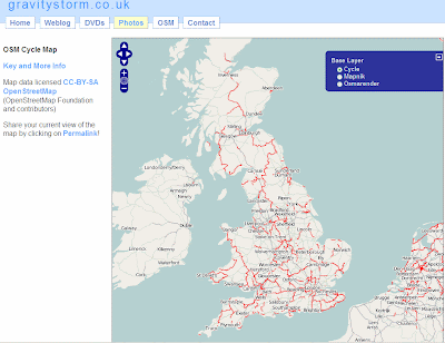
OSM Cycle Map - See how much coverage there is now and the weekly process involved.

http://www.gravitystorm.co.uk/osm/
OpenRouteService - The 'driving directions' using OSM data in German (see previous post)
The State of France - Highlighting activity and where needs to be mapped.
'So I have all this data' - Showing the numerous OSM Style's (Mapnik, OSMRender, Cycle Map) and Green Maps (Sutton & Enfield examples).
The State of Italy - Looks into the success of OSM in the City of Milan from 2007 to 2008.
MapWarper - Showing some technical details of georefencing images. (Also see http://wrp.geothings.net/)
The Commerical Viability of OpenStreetMap - How to make money and issues highlighted with OSM data - Make it easier to use!
FreeMapIndia 2008 (part1 & part 2) - A Photo Journal of Mapping and Talking OSM in India - Part 2 shows more technical mapping aspects.
OpenStreetMap vs The World - "iTunes for your GPS" The Comparison to OSM and Google Maps for Haywards Heath. (mentioned here by Mapperz). OSM vs Reality and 'Wrong Names', 'Missing Roads' and Wrong Spellings of Street Names.
The State of Spain (Take 2) - The continuous task of data collection and the task that lies ahead. The mention of gvSIG GIS. Highlighting that GIS is important in managing OSM data.
London Mapping Marathon - Mapping shown at small scales - London looks complete, larger zoom levels show that there is a lot of roads un-named, incorrect junctions etc. (See older post)
But also shows the huge improvement of the past year.
Using Crowd Sourced Data in a Commercial Mapping API - Investigates the Flickr, Geonames and Wikipedia methods. Conclusion is 'crowd sourced' data can work. Positive effects for little effort.
Look out for Video and more content coming to
http://wiki.openstreetmap.org/index.php/State_Of_The_Map_2008
Related Events:
Society of Cartographers
44th Annual Summer School, Aberdeen
1-4 September 2008
http://www.abdn.ac.uk/cartographers08/
"Presentations include ones on changing coastlines, 3D panoramas, kayak mapping, and cycle mapping – with presenters including Tom Patterson (US National Parks Service), Ed Parsons (Google), Paul Hardy (ESRI) and Professor Danny Dorling (University of Sheffield). There is a very full programme that includes many interesting topics, workshops and plenty of networking opportunities"
(thanks to SteveC via email)
Labels: Available, Open Street Map, Presentation, Slides, State of the Map 2008


