->

31 March 2010

OS OpenData™ Consultation Government Response

OS OpenData™ Consultation Government Response

BREAKING NEWS
Ordnance Survey launches free downloadable maps
Move marks radical departure from previous OS financial model under which every piece of map data had to be paid for

What's Free?

*still needs to be defined.
source:
http://ernestmarples.com/blog/2010/03/government-response-to-ordnance-survey-consultation-published/
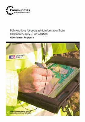
Ordnance Survey Government Response
Release of data for free
In response to this support, government will release a range of Ordnance Survey data:
on 1 April 2010, known as OS OpenData™.
The datasets to be released are those set out in the original consultation document as the Free package, with the following changes:

replacement of 1:25 000 and 1:50 000 Scale Colour Raster products with OS VectorMap District

• addition of OS Locator™ and Land-Form PANORAMA to the product list

• replacement of Code-Point by Code-Point Open, which provides accurate locations for 1.7 million postcodes in England, Scotland and Wales.
@mapperz

Straight to the PDF
http://www.communities.gov.uk/documents/corporate/pdf/1528263.pdf

Live links tomorrow!
Happy Mapping... and downloading from

Labels: , , , , , ,

30 March 2010

OpenAddresses.org (Beta)


OpenAddresses.org (Beta)

"An Open Source web portail for the management of Open worldwide geolocated postal addresses."

openaddresses.org

New York City (NYC) show address points (geocodes) link

http://www.openaddresses.org/?northing=4975719.1423499&easting=-8240566.8885371&zoom=15&overlayOpacity=0.62

www.openaddresses.org offers an easy to use address editing service and geocoding/reverse geocoding services based on address data.

www.openaddresses.org stores ONLY geolocated postal addresses. Features associated to postal addresses like persons, companies, point of interests are not part of openaddresses.

www.openaddresses.org aims to collaborate nicely with www.openstreetmap.org by exchanging data, but since localized addresses are a very specific topic, it is appropriate to have a plattform dedicated only to addresses.

www.openaddresses.org is based on an original idea of Hans-Jörg Stark who initiated www.openaddresses.ch and www.openaddresses.at

Project home:http://code.google.com/p/openaddresses/


To do (as Beta)

source:

Labels: , , , ,

25 March 2010

@Nomads_land got Ordnance Survey Maps!

@Nomads_land got Ordnance Survey Maps!

What's the story here?

Ordnance Survey have helped the request for Ordnance Survey maps for a long walk (7,000 miles) around the United Kingdom for 3 UK Charities by Nathaniel Severs
Ordnance Survey
http://www.ordnancesurvey.co.uk/oswebsite/

The Three Charities:
  1. Southampton General Hospitals Paediatric Physiotherapy department
  2. The Stroke Association
  3. The Mammal Society
The request:
requested: 10:33 AM Mar 16th via Twitter on the web
S: Right Twitter,Nat is after some maps for the Scottish leg of the walk. SO, has anyone got OS Maps of scotland they could donate?Please RT

@mapperz picked up this request after following the daily tweets from @Nomads_land on his walk around the UK coast.

Basically mapperz has a number of good contacts, those contact have even better contacts.
Enter @StevenFeldman to the request and things really start moving and thanks to him Ordnance Survey have given the maps away for the Scottish leg of the 7,000 mile journey. That's over 40 1:25,000 Explorer Maps and a geo success of social networking that can be achieved.

More info on the guy doing the work:
"My names is Nathaniel Severs, I am 24 years old and in 2010, I am walking the entire coastline of mainland Britain (7,000 miles) for three great charities."Nomad's Land Big Walk Blog
Keep up to date on the Big Walk on http://natsevs.wordpress.com/

"I set out from Portsmouth on 10 January accompanied only by a large rucksack carrying my tent and kit. I camp most nights but am open to offers for accomodation! The entire journey will be completed using leg power and if there is a bridge, I will be crossing it (so Anglesey and the Isle of Skye will both be on the agenda). I will stay true to the coastline at all times, so if there is a ferry across a river (the River Dart, for example) that is not classed as coastline, then I will allow myself to take a ferry if one is available. But a ferry cannot be used at any other time. I aim to be home by Christmas!"

The journey so far
Nats Big Walk Route
Natathan is currently along Pembrokeshire Coast Path [Fishguard] (a very nice walk rain or sun)
Follow his progress here http://natsevs.wordpress.com/progress/

Many thanks to:

@Nomads_land for taking up the challenge to walk around the entire UK coast
http://natsevs.wordpress.com/

Steven Feldman (@StevenFeldman)
http://giscussions.blogspot.com/

Ordnance Survey for being so quick to respond and making the solution to the request.
hopefully a post on http://magazine.ordnancesurvey.co.uk/magazine/tscontent/editorial/exploremagazine/ about this soon?

Social networking Site Twitter - http://twitter.com/ connecting us all up.

and myself Mapperz @mapperz for helping a good cause.

Labels: , , , , , , ,

Google Bookmarks Your Maps

Google Bookmarks Your Maps

Simple, no lon
g urls can be private or public (to share)

"
Today we’re debuting lists in Google Bookmarks, an experimental new feature that helps you easily share those sites with friends."

Google Bookmarks Share Maps
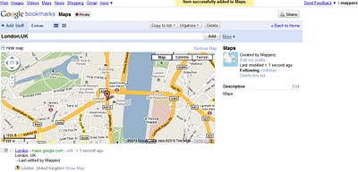
Google bookmarking your maps - Tip: With the Google Toolbar simply click the star and it will be saved in your favourite bookmarks. No need to worry about very long urls that can be broken in emails etc.

https://www.google.com/bookmarks/l (Google Account Required)

Privacy
http://www.google.com/support/bookmarks/bin/answer.py?hl=en&answer=159231

Using Maps with Google Bookmarks
http://www.google.com/support/bookmarks/bin/answer.py?hl=en&answer=162168

source:
http://googleblog.blogspot.com/2010/03/collaborative-bookmarking-with-lists.html

Labels: , , , ,

24 March 2010

Geofuse - Discover GeoEye Images by Map

Geofuse - Discover GeoEye Images by Map

"GeoFUSE Online Maps differs slightly from Google Maps™ as the primary purpose of GeoFUSE Online Maps is to allow both novice and expert users alike to quickly locate and identify available GeoEye archive imagery around the globe. "

Geofuse - GeoEye Images by Map
When suitably zoomed in the toolbar becomes active to generate a polygon or find GeoEye images by extent.
http://tinyurl.com/geofuse-oz

Footprints and Previewing GeoEye Images
Image Catalog search results footprints are displayed on top of the map along with any selected image previews. Footprint and image previews can be turned on and off using the icons in the Image Catalog search results table to the left of the map.

More map help http://geofuse.geoeye.com/help/online-maps.aspx#gettingstarted

Geofuse - GeoEye Images by Map - New Zealand
New Zealand Example
http://tinyurl.com/geofuse-nz

Only real suggestion is the long permalink can they be strunk? Urls with polygons are very long hence this post using tinyurl.

GeoFuse Map
http://geofuse.geoeye.com/maps/Map.aspx#

Labels: , , , ,

22 March 2010

1st April 2010 Ordnance Survey Data FREED

1st April 2010 Ordnance Survey Data FREED

Public Survey - OS data Freed
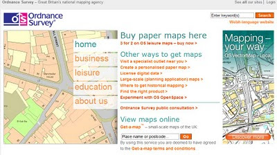
(for illustration only) actual - http://www.ordnancesurvey.co.uk/oswebsite/
The Public will be able to access Ordnance Survey Data from 1st April 2010. (no fools day?)
*not MasterMap

direct from Number 10 Downing Street:

"And following the strong support in our recent consultation, I can confirm that from 1st April, we will be making a substantial package of information held by ordnance survey freely available to the public, without restrictions on re-use. Further details on the package and government’s response to the consultation will be published by the end of March."

source: http://www.number10.gov.uk/Page22897

related.
http://www.ordnancesurvey.co.uk/oswebsite/

http://www.guardian.co.uk/technology/2010/mar/22/gordon-brown-superfast-broadband
bottom paragraph

Labels: , , , ,

Online Spatial Database Clouds - SQL Azure

Online Spatial Database Clouds - SQL Azure
(spatial database support coming due to demand of user feedback)

SQL Azure Spatial POI Along Route
Using a Spatial database (SQL Azure) to find Gas (petrol) Stations along a route.
New Functionality - Azure Spatial Database Support using cloud computing related topic - http://en.wikipedia.org/wiki/SQL_Azure


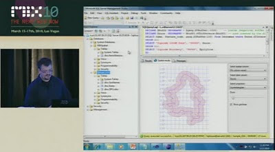
Last Wednesday (March 17th), Dave Robinson of the SQL Azure Team announced upcoming support for spatial data in SQL Azure. You can view the announcement at the MIX Conference in the video of Dave’s presentation, Building Web Applications with Microsoft SQL Azure (go to 18:40 on the timeline for the start of the spatial data portion of his talk).
SQL Azure - Spatial Buffer
Spatial buffering a polyline - but across the web (not local database) - Windows SQL Azure will have spatial capabilities - to be released April 2010.

"SQL Azure provides a highly available and scalable relational database engine in the cloud. In this demo-intensive and interactive session, learn how to quickly build web applications with SQL Azure Databases and familiar web technologies. We demonstrate how you can quickly provision, build and populate a new SQL Azure database directly from your web browser. Also, see firsthand several new enhancements we are adding to SQL Azure based on the feedback we’ve received from the community since launching the service earlier this year."

This uses the same technology as Microsoft SQL 2008 Server
basically it supports latitude and longitude.

A "Flat Earth" (GEOMETRY or planar) data type represents geospatial data which has been projected from its native, spherical, coordinate system into a plane.
A "Round Earth" data type (GEOGRAPHY) uses an ellipsoidal model in which the Earth is defined as a single continuous entity.

source:
Video
http://live.visitmix.com/MIX10/Sessions/SVC07 (46.45) jump to 18.36if have no time.

Related blog
http://blogs.msdn.com/edkatibah/archive/2010/03/21/spatial-data-support-coming-to-sql-azure.aspx

SQL Azure Labs
http://blogs.msdn.com/sqlazure/archive/2010/03/19/9981936.aspx

Labels: , , , , , , , ,

17 March 2010

Worldwide Telescope (WWT) now in Bing Maps

Worldwide Telescope (WWT) now in Bing Maps [Preview mode]

The Sky at night (and day) in Bing Maps Explore

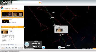
With the new Bing Maps Worldwide Telescope (WWT) App you can explore the constellations and other known space objects just like you would navigate through a regular Bing Maps.Worldwide Telescope Preview in Bing Maps
To access this use the "Map Apps" and choose Worldwide Telescope

Drag Telescope Icon Preview in Bing Maps
Drag the Telescope image to a location on the map you want to view (this sets the view up as "looking up" from that point from the Earth)

Worldwide Planets and charts
Exploring Planets is made easy from the data catalogue on the left hand side in the legend panel and click the very small "fly to" links. Zooming is very fast but not quite light speed.

View the Sky in Bing Maps
http://www.bing.com/maps/explore
Select >Maps Apps >Worldwide Telescope

For much more details and vast about of pulling tons of collections from the Worldwide Telescope Community including Constellations, Solar System, All-Sky Surveys, Spitzer Studies, Chandra Studies, Hubble Studies, Astrophotography, Radio Studies, NOAO Studies, Gemini Studies, Messier Catalog, Planets/Moons, Earth (Bing!), Panoramas, and Tours.
Then go to:
http://www.bing.com/community/blogs/maps/archive/2010/03/10/new-bing-maps-application-worldwide-telescope.aspx

Labels: , , , , , , , , ,

15 March 2010

CycleStreets.net Easy Cycle Routes Maps

CycleStreets.net Easy Cycle Routes Maps

Some really nice implementations making cycle route planning much easier and user friendly.
CycleStreets.net Namefinder Geocoder

As well as adding postcode search support recently, CycleStreets.net this week upgraded the general street/place finding system geocoder. Default map is Open Street Map (Cycle Map) but Google Streets and Google Satellite are available via the map controls. Image source: http://www.cyclestreets.net/blog/2010/03/14/geocoder-upgraded/

Some tips for quicker searches are:

  • If the map is zoomed out, ideally include a city name as well, so that it knows what area to look in
  • If you do specify a city, add a comma before it, e.g. “York Street, Cambridge” rather than just “York Street Cambridge”
  • Note that lower-case text works the same as Capitalised Text.
f you decide to follow the suggested journey below please take extra care on unfamiliar sections - proceed at your own risk as route quality cannot be guaranteed.

Journey can be customised into 3 types of cycling
  1. Fastest route
  2. Balanced route
  3. Quietest route

CycleStreets.net Route with Photo

Gradient, Wiggliness and number of Traffic lights are also factored in for your journey on your bike.

Example:
Quietness: 83 % Quiet (shhh at the back!)
Traffic signals:at junctions
Wiggliness: 0%. (like it)
Specific Leaving 11.09am, Arriving Times 11.29am.

CycleStreets.net Route with UK Streetview
Now the UK has Full Google Streeview coverage it can be added to almost any cycle route you now plan.

Plan your route on bike, tandem, trike by using this mapping site:

http://www.cyclestreets.net/

Very good work
For more information and details on the technological (gecoder) aspects visit
http://www.cyclestreets.net/blog/

Please Note:
CycleStreets beta: Not all areas have complete cycle route data yet. CycleStreets is UK-wide with over 1500+ locations http://www.cyclestreets.net/area/

Labels: , , , , , , ,

11 March 2010

UK Streetview - FULL Coverage

UK Streetview - FULL Coverage

updated...

http://maps.google.co.uk/?ie=UTF8&hq=&hnear=United+Kingdom&ll=53.343993,-5.185547&spn=8.217413,23.269043&z=6
(and drag the yellow pegman)

Longest unbroken Trip in Streetview for the UK now possible

http://mapperz.110mb.com/GMAP/LongStreetView_UK.html
838 mi (about 15 hours 2 mins)

England, Wales, Scotland and Northern Ireland Full Coverage.

(Republic of Ireland streetview coverage is likely in due course.)

New Content:

Visit Wales in Streetview
http://tinyurl.com/visit-wales-view
NationalTrust in Streetview (better coverage)
http://tinyurl.com/NationalTrust-view

Note:some images are over 1 year old since google recorded them.

Big Brother is now complete for the United Kingdom.

mapperz

Labels: , , , , , ,

10 March 2010

Biking Directions on Google Maps - New!

Biking Directions on Google Maps - New! (in beta)
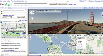
Biking Cycling Directions on Google Maps in Beta
Green 'highlighted' lines are specific for Cyclists using Google Bicycle directions

  • Bike lanes: For more than 150 cities in the US, we know which streets have dedicated bicycle lanes. These are also prioritized when coming up with a routing suggestion. On the bicycling layer, you’ll see these roads indicated in bright green.
  • Recommended routes: For many cities we also provide information on streets that have been designated as good for cyclists, so we them into account in our algorithm. These roads are indicated with dashed green lines on our bicycling layer.
  • Uphill slopes: l don't know anyone who enjoys biking up a hill, especially when you're trying to get somewhere you need to be. Going uphill is worse than simply being much slower; it's also exhausting and can take a toll on the rest of your ride. Our biking directions are based on a physical model of the amount of power your body has to exert given the slope of the road you’re biking on. Assuming typical values for mass and for wind resistance, we compute the effort you’ll require and the speed you’ll achieve while going uphill. We take this speed into account when determining the time estimate for your journey, and we also try hard to avoid routes that will require an unreasonable degree of exertion. Sometimes the model will determine that it's far more efficient to make you ride several extra blocks than to have to deal with a massive hill. My teammates in San Francisco were relieved to see that this does indeed work!
  • Downhill slopes: Many cyclists will tell you that going downhill is annoying for a different reason: you may have to ride your brakes all the way down. All else equal, we try to avoid routes that require a lot of braking. Of course, in some cities, including my hometown of Seattle, this isn’t always possible! And if you feel like you need a big workout and want to climb some hills, or if you just love that wind-in-your-hair feeling of a long downhill (you better be wearing a helmet and staying safe!), you can always turn on the terrain layer to check out the hilliness of an area for yourself.
  • Busy roads: Cyclists often tend to prefer to stay off of fast roads, and not even cross them unless it's necessary. This is roughly the inverse of driving directions, where you want to stay on arterials and freeways, so we had to rework a lot of those fundamental calculations when coming up with our biking directions algorithm.
  • Busy intersections: We try to avoid making you cross busy streets with a lot of car traffic and long wait times.


Try it (US only currently)
http://maps.google.com/biking
(goes into official mapplet mode)

The Official Blog Post is now available:
http://googleblog.blogspot.com/2010/03/biking-directions-added-to-google-maps.html

and official cross blog post
http://google-latlong.blogspot.com/2010/03/its-time-to-bike.html

updates
@Mapperz

Labels: , , , , ,

09 March 2010

New Google Geocoding Web Service

New Google Geocoding Web Service

The service is now 'not limited' but you are required to show the results on a Google Map.
Examples given to help user understand the importance of this update.
Lots of updated content and improvement from feedbackNew Service v3 Geocoding
  • Unlimited Usage*
  • Status Codes (in Plain English!)
  • Java Support (Parsing XML with XPath)
"*Note: the geocoding service may only be used in conjunction with a Google map; geocoding results without displaying them on a map is prohibited."
[2,500 requests may be sent to the Geocoding Web Service per day from a single IP address]

but purley for example based on the official example given
Geocoding London (UK)
http://maps.google.co.uk/maps/api/geocode/xml?address=London&sensor=false
New Google Geocoding Web Service

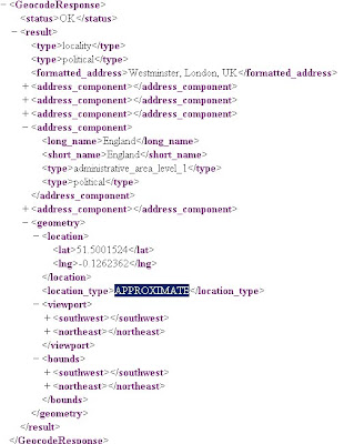
Reverse Geocoding 51.5001524,-0.1262362 (London)
http://maps.google.com/maps/api/geocode/xml?latlng=51.5001524,-0.1262362&sensor=false

Countries Support
http://spreadsheets.google.com/pub?key=p9pdwsai2hDMsLkXsoM05KQ&gid=1
Note: en-GB ENGLISH (GREAT BRITAIN) enabled

New Status Codes - now in Plain English
  • "OK" indicates that no errors occurred; the address was successfully parsed and at least one geocode was returned. example
  • "ZERO_RESULTS" indicates that the geocode was successful but returned no results. This may occur if the geocode was passed a non-existent address or a latlng in a remote location. example
  • "OVER_QUERY_LIMIT" indicates that you are over your quota. (your geocoding too fast!)
  • "REQUEST_DENIED" indicates that your request was denied, generally because of lack of a sensor parameter. example
  • "INVALID_REQUEST" generally indicates that the query (address or latlng) is missing. example
Now for the new content:

geometry contains the following information:

* location contains the geocoded latitude,longitude value. For normal address lookups, this field is typically the most important.
*location_type stores additional data about the specified location. The following values are currently supported:
o "ROOFTOP" indicates that the returned result is a precise geocode for which we have location information accurate down to street address precision.
o "RANGE_INTERPOLATED" indicates that the returned result reflects an approximation (usually on a road) interpolated between two precise points (such as intersections). Interpolated results are generally returned when rooftop geocodes are unavailable for a street address.
o "GEOMETRIC_CENTER" indicates that the returned result is the geometric center of a result such as a polyline (for example, a street) or polygon (region).
o "APPROXIMATE" indicates that the returned result is approximate.
* viewport contains the recommended viewport for displaying the returned result, specified as two latitude,longitude values defining the southwest and northeast corner of the viewport bounding box. Generally the viewport is used to frame a result when displaying it to a user.
* bounds (optionally returned) stores the bounding box which can fully contain the returned result.

Java Support
Parsing XML with XPath

Although it is not as lightweight as JSON, XML does provide more language support and more robust tools. Code for processing XML in Java, for example, is built into the javax.xml packages
please see http://code.google.com/apis/maps/documentation/geocoding/#XMLParsing for full details.

Full Documentation (updated)
http://code.google.com/apis/maps/documentation/geocoding/
Official Blog Post
http://googlegeodevelopers.blogspot.com/2010/03/introducing-new-google-geocoding-web.html
Mano Marks (Google Geo Developer Advocate)
http://randommarkers.blogspot.com/2010/03/client-side-geocoding-rocks.html

Full terms and conditions
http://code.google.com/apis/maps/terms.html#section_10_12
Maps API Terms
http://code.google.com/apis/maps/terms.html

Labels: , , , , , ,

08 March 2010

BBC SuperPower Map Visualising the Internet

BBC SuperPower Map Visualising the Internet

Map Visualising the Internet 1998
The growth of the Internet in a decade - Visualised in Geographical Form
Map Visualising the Internet 2008
The internet as 2008, astonishing growth
View the Map
More on the BBC SuperPower programmes:

Labels: , , , ,

04 March 2010

SaferMK Community Safety Mapping by Zubed

SaferMK Community Safety Mapping by Zubed

A nice web GIS mapping solution....

SaferMK Community Safety Mapping by Zubed
Overlay of Crime data using Openlayers and using Ordnance Survey Mapping from the GetMapping Map Service

Clear thematic data is overlayed and fully interactive to query online but importantly easy to use by non-gis users (key fact!)

SaferMK Community Safety OS 25k Mapping by Zubed
1:25,000 Ordnance Survey (Explorer range) is used - making buildings and rights of way information viewable - you don't see this level of detail online often.

**Hopefully after the Ordnance Survey Consultation (Deadline 17th March 2010) this data and others is made available freely to use - Due April 2010.

The main features of the SaferMK Community Safety Mapping site are:
  • It provides details of All Crime and anti-social behaviour (ASB) incidents and trends over the previous 12 months.
  • It is a web-based mapping system allowing Neighbourhood and Area (estate, village or town) level analysis of crime and anti-social behaviour, using data obtained from Thames Valley Police, the Milton Keynes Council and Buckinghamshire Fire & Rescue Service.
  • It displays anti-social behaviour data that isn't published by any other source.
  • It displays information (data and graphs that show trend) in data balloons for each Neighbourhood or Area and gives comparison data against the whole of the borough.
  • It provides the ability for residents and users to download standardised data; and to produce a standardised anti-social behaviour report for a specific Neighbourhood, which includes graphs and tables.
Guidance:
http://www.milton-keynes.gov.uk/safermk/DisplayArticle.asp?ID=67095

View the Interactive Map - http://safermk.zubed.com/

Credit to Zubed for the creation and implementation of this easy to use web mapping solution.

Labels: , , , , , , ,

03 March 2010

Protected Planet Map (Beta)

Protected Planet Map (Beta)
"The latest initiative of the World Database on Protected Areas."

Protected Planet Map (Beta
Simple concept map every protected area on the planet:

Database:
Compiling a database containing every protected area on our rather crowded globe is no easy task. It has taken 25 years to reach this stage. There are gaps (UK has none!) and errors and we want you to help us make it right through protectedplanet.net.

Browse, explore and be amazed at some of the most bio-diverse places on the planet.
If you give feedback, we [protectedplanet.net] will try our best to consider what you say as we keep developing.

One thing to keep in mind, not every protected area from the World Database on Protected Areas (WDPA) is in the beta.

"Explore protected areas. Discover how we are protecting the planet. Be part of the solution. Over the last three months we have been working hard developing a new and inspiring way to discover almost all protected areas on the planet. We were planning on launching the website later in the year however we were enjoying using the website so much, we thought we would share some of that delight and release a beta version for you. We hope you enjoy it. If you do like what we are doing then keep checking the website; every two weeks there will be something new to see!"

The latest initiative of the World Database on Protected Areas.

Future:
IN TWO WEEKS

You will be able to see how the world is protected with the new thematic mapping feature.

IN FOUR WEEKS

The community will be able to make a difference in global conservation

Widget Maps Examples
Spain
http://widgets.gbif.org/pa/#/country/ES

Yellowstone NP Widget Map
Yellowstone National Park Gridded Diversity
Yellowstone National Park (USA)
http://widgets.gbif.org/pa/#/area/377207

Australia
http://widgets.gbif.org/pa/#/country/AU

Download
Users can download the data in either txt, kml, csv or xls files..

More about ProtectedPlanet.net
http://www.protectedplanet.net/about

Developed by Vizzuality

Labels: , , , , , ,

01 March 2010

UK Crime Mapping March 2010 update includes API

UK Crime Mapping  March 2010 update includes API
+Reverse Geocoder "Nearest Police Station" 
+ Geocode Policing Team "Policing team that covers a given point"

Crime Maps Updated - March 2010


Viewing the maps is now more useful with thematic classification including  Burglary, Robbery, Vehicle Crime, Violence, Anti-social behaviour.

Example shown above:

There is now an Police API  note: an API key is required

The Police API allows you to retrieve information about neighbourhood areas in all 43 English & Welsh police forces. All forces are required to keep this data accurate and up to date, so the API provides a rich and definitive data source for information such as:
  • Neighbourhood team members
  • Upcoming events
  • Crime levels & statistics
  • Nearest police stations
"The API is implemented as a standard XML REST web service using HTTP GET/POST requests.
Code examples are provided, but you may need to tailor these to your language of choice. There are plenty of articles on how to make cURL requests with PHP, .NET, Python and others."

More information API 

Here is an example request:


XML request and response - http://policeapi.rkh.co.uk/hello-world/

Nearest Police Station (Reverse Geocoder)
"Return a list of the nearest police stations from a text search query."
Search string, can be one of many things:
  • Village/town/place name, e.g. Syston, Leicester
  • Postcode, e.g. SW1H 0BG
  • Latitude & Longitude, e.g. 51.487797,-0.234833
<police-api>
02        <request>
03            <key>{api_key}</key>
04            <function>nearest-police-station</function>
05            <parameters>
06                <q>hyde park, london</q>
07            </parameters>
08        </request>
09        <response>
10            <centre-point>
11                <latitude>51.503263</latitude>
12                <longitude>-0.150975</longitude>

13            </centre-point>
14            <stations>
15                <station>
16                    <distance>1.26</distance>
17                    <force-id>city-of-london</force-id>
18                    <name>Snowhill</name>

19                    <address></address>
20                    <postcode></postcode>

http://policeapi.rkh.co.uk/nearest-police-station/

Geocode a policing team

Return the policing team that covers a given point location:

1    <police-api>
02        <request>
03            <key>{api_key}</key>
04            <function>geocode-team</function>
05            <parameters>
06                <q>stonehenge</q>
07            </parameters>
08        </request>
09        <response>
10            <centre-point>
11                <latitude>51.179025024176</latitude>
12                <longitude>-1.8274748325348</longitude>

13            </centre-point>
14            <team>
15                <force-id>wiltshire</force-id>
16                <team-id>EM11</team-id>

17            </team>
18        </response>
19        <error></error>
20    </police-api>

http://policeapi.rkh.co.uk/geocode-crime-area/

Labels: , , , , , , ,