->

30 October 2008

Woices.com - Echoes Mapped (Beta)

Woices.com - Echoes Mapped (Beta)
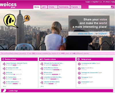
Woices.com - Echoes Mapped (Beta)

Brand New Google Map Mash-up with a twist. Mapping Echoes across the World.
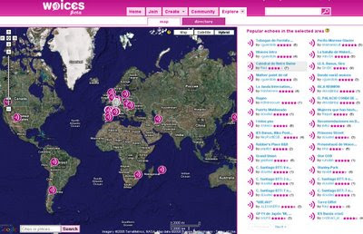
Woices.com - Echoes Mapped - The Map

What is woices?

"Woices.com is a FREE internet service that allows people to create, share and consume echoes, audio records that are linked to a very specific geographical location or real-world object. Woices ultimate goal is to extend reality by creating a new layer of audio information, what we call the echoesphere, that will make the world a more interesting place."

What is an echo?

"Echoes are words, left by one person at some precise place, that can be later listened to by anyone, as if their author was still there. Echoes can be about anything you want, from history, art or curiosities to personal memories or advices. An echo can even a poem."

There are three ways of locating echoes:
  • Using the Map. Select 'Map' in the 'Explore' tab. A full screen map will appear. Next to the map there will always be a list with the most popular echoes for the region viewed. Zoom in as much as you need to locate the echoes. Remeber that using the search box that comes inside the map is always a shortcut.
  • Browsing the Directory. Select 'Directory' from the 'Explore' tab. The directory allows you to quickly select a location by going through its continent, country, area and finally location.
  • Use the search box. On the top right corner of the page you will find a search box that can help you to quickly locate any echo.

The Basics
The Help
The Map

Labels: , , , , ,

27 October 2008

MultiMap adds OSNI Maps

MultiMap Adds OSNI Maps


View map of Ballymena, Antrim, Northern Ireland, UK on Multimap.com
Get directions to or from Ballymena, Antrim, Northern Ireland, UK

Ordnance Survey Northern Ireland(OSNI)
Similar to the Ordnance Survey 50k Rasters

Also added are:

Multimap have recently released new street level maps for countries in the Middle East. The countries are:

Bahrain
Kuwait
Oman (limited coverage)
Qatar
Saudi Arabia
UAE

Source:

http://blog.timwarr.net/

Labels: , , , ,

25 October 2008

New BBC Weather Maps (Beta v1.0)

New BBC Weather Maps (Beta v1.0)

New BBC Weather Beta Maps
The BBC are looking into revamping thier current weather service for 2009.
The are currently looking into adding more interactive features the visual weather portal.


New Features: *subject to feedback and beta status.
A 'one-stop shop' (no need to wait for another page to load)
Better Navigation to Maps in the users 'area of interest'
Flash based maps - animation is smoother and faster [tested with Flash Player 10]
More updates from the Met Office = Better accuaracy and currency of weather.
More localised weather particularly in the United Kingdom.

New BBC Weather Beta - North America Pressure Maps
Maps are now embedded in Flash - faster loading and smoother animations.

BBC Weather is now location based vs the old version by type of forecast.

"all forecast information is now organised by location rather than by type of forecast it might look like there is less information on the site."

More to be added in later beta versions
"The map presenter will also be more interactive and you will be able to view maps for surrounding areas without leaving the page. Later in 2008 we will be adding embedded video forecasts."

"We are currently sourcing forecast temperatures for coastal waters and will add these to the site when they are ready."

Try the BBC Beta Weather Maps
Click to See BBC Weather Beta Maps
(click the image to view)

Please review the site and request new features like - georss, archive weather maps by date, 3D option, transparent overlays (cloud+radar etc) are just a few as examples.
maybe rainfall charts, wind factor, chill factor...

More information
http://www.bbc.co.uk/weather/bbcweather/features/website_redesign.shtml

Mapperz

Labels: , , , , , ,

24 October 2008

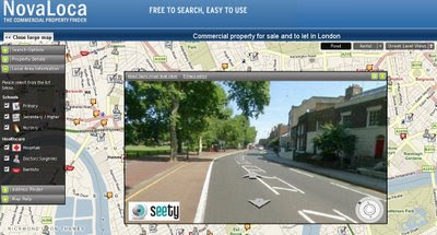
NovaLoca - Map with Seety StreetView

NovaLoca - Map with Seety StreetView

Find Commercial Property [For Sale or Rent]
  • Offices
  • Retail
  • Industrial
  • Leisure
  • Land
  • Other
View the Map
View the Area in Birds Eye View
View the Street - Seety StreetView

NovaLoca Commercial Property with Seety Streetview Map
Search and view on the map commercial property areas


"NovaLoca.com is a comprehensive UK commercial property listing service. Whether you intend to buy or rent commercial property, you can search for your ideal office space, industrial unit or retail premises."

'Local Area Information' also available:
  • Schools Primary, Secondary / Higher & Nursery
  • Healthcare
  • Hospitals
  • Doctors Surgeries
  • Dentists
NovaLoca  with Seety Streetview Mode
Seety StreetView Mode - Limited for London, UK Only

Try it at
http://www.novaloca.com/
Search London
Show on Map.

Labels: , , , , , ,

23 October 2008

Official Google Maps API Reverse Geocoder - New!

Official Google Maps API Reverse Geocoder - New!

What is Reverse Geocoding? "finding an associated textual location such as a street address, from geographic coordinates."
source:wiki:geocoding

Reverse Geocoder Example Map
Clicking the map sends the latitude and longitude to the 'Google Geocoder Servers' the nearest address is returned. (click the image above to view the new official example)

Finally after many months of asking Google Map API Team have released the Google Reverse Geocoder :)

There is also a HTTP Server Reverse Geocoder - it works like this
send request:
http://maps.google.com/maps/geo?output=xml&oe=utf-8&ll=37,-122&key=asdad
Reply is:

Reverse Geocoder Example HTTP Response
http://googlegeodevelopers.blogspot.com/2008/10/geocoding-in-reverse.html

Support Documentation is coming very soon.

Supported Countries:


IF this spreadsheet has a 'Yes' in the Geocoding column then that country is supported with Reverse Geocoding as well.


"Note: that GClientGeocoder should be used for any user-entered reverse
geocodes, due to the way our [Google] IP limit system works. The HTTP service
should be used for tasks like reverse geocoding points in a database."

Well done to the Google Maps API Team on working on this and providing some good feedback.


Labels: , , , , ,

21 October 2008

Fast Property Search Map - Zoocasa [in Beta]

Fast Property Search Map - Zoocasa [in Beta]

Zoocasa Property Map Beta
Extremely fast and smooth mapping tool for searching property in Canada

"Zoocasa.com is a new, innovative way to search for homes in Canada. Combining listing information and mapping technology provided by Google Maps, Zoocasa.com allows users to personalize their search experience and discover community, demographic and lifestyle information to help them choose the right home."


Highlights - The interactive google map is linked to the interactive sidebar when a property icon is clicked on the map - the sidebar moves to show the user more information. Beyond the summary is an even more detailed on the specific property.

More going on behind the scenes
The map can display more than just property for sale - schools, book stores, department stores, post offices, bakeries, gas stations etc. to name a few - (the list goes on).

Searching can be done by specific location or number of rooms, highest/low price or even the number of days a property has been on sale for.

Though it is the smoothness and speed that impresses most - there is large amount of information that is getting processed behind the scenes, but the data on the map never seems to be overloaded - this is difficult to achieve but Zoocasa has done a fine effort. Well done
.

Also look out for the Research Tool if not familiar to the area - very helpful
"
average housing prices in a variety of ways .... neighbourhood specific information including demographic and lifestyle details"

There is also a fully documented FAQ (good to see in beta) for users benefit and highlights ways to get the more out of the site.
And to top it all if you do find a bug you can report it (this feature is missed on many sites!)

Mapperz

Labels: , , , , ,

20 October 2008

Argentina Live Maps - Beta [But...]

Argentina Live Maps - Beta [But be careful]
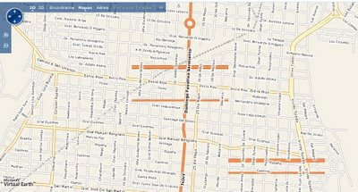
Live Maps Argentina Beta
Buenos Aires but locals notice there are incorrect road names.
source: http://blogs.msdn.com/virtualearth/

"This site comes with geocoding places and addresses, road maps, satellite imagery and photography and traffic incident and flow information. In terms of content, this is what you get which is a great framework to build on"
source:
http://blogs.msdn.com/virtualearth/archive/2008/10/18/live-search-maps-argentina-is-live.aspx

Argentina Bad Data
Though be careful, this dataset is highly inconsistent.
(yes those are floating parallel roads that lead nowhere)

Okay this is seasonal lake - but the spec tends to lean towards an all year lake that vanishes completely at zoom level 11.
http://www.livemaps.com.ar/Impressao.aspx?sc=&&z=10&cp=-29.39174%20-66.46316&omap=1
http://www.livemaps.com.ar/Impressao.aspx?sc=&&z=11&cp=-29.39174%20-66.46316&omap=1

There also seems to be a lot font problems on the roads.

Data is not joining up and the fonts are not correct in the raster files.
http://www.livemaps.com.ar/Impressao.aspx?sc=&&z=11&cp=-36.67172%20-64.29679&omap=1

**but be careful - data across the country seems very inconsistent**
(google did use this data but proved to be difficult to update due to the original data being incorrect or incomplete and removed the tiles.)
good luck Microsoft...fortunately listed as 'Beta'

source
http://blogs.msdn.com/virtualearth/archive/2008/10/18/live-search-maps-argentina-is-live.aspx


Though Microsoft might want to know Navteq have just finished capturing a new dataset for Argentina.
http://lbsuc.geospatial-solutions.com/gsslbsuc/article/articleDetail.jsp?id=559099

might be a better dataset to use in the long run.

Labels: , , , ,

17 October 2008

Embed Multimap Maps - New

Embed Multimap Maps - New

Multimap have announced via the Microsoft LiveSide that it is now possible to embed Multimaps in your own websites and blogs.


View map of Greater London on Multimap.com
Birds Eye view of Greater London on Multimap.com
Get directions to or from Greater London on Multimap.com

The above map is the new service of embedding multimap maps.

What is New?
  • We [Multimap] launched a new service for small businesses, personal websites and hobbyists this week.
  • The service, available for free from Multimap.com, provides a single line of HTML to cut and paste into a web page.
  • The user gets a slippy map in a choice of map styles (TeleAtlas, Ordnance Survey and Barts) or aerial for anywhere in the world (US included, using VE maps and aerial).
  • The pasted HTML includes four hyperlinks back to Multimap.com:
    1. See this location on Multimap (for a bigger map, POI, business listings, etc)
    2. See this location in Birds Eye
    3. Get directions to this location
    4. Get directions from this location
  • The service is limited to 50,000 transactions per year (which we track) and cannot be used for internal apps (eg BI, CRM)
1. 50,000 transactions a year is not very many, would be better if this was a week or a day.
2. 4 hyperlinks seems to be overkill... 1 or 2 would look better.


Can you embed Multimaps maps? Yes but Multimaps FAQ has yet to be updated.

"No. Licensing restrictions imposed by our data suppliers mean that users are not permitted to display the maps within their own website - even if the user is linking to our website behind the image. However, maps without our advertising or branding are available for a fee. Please see our Business Services section for more information on our mapping options."
http://www.multimap.com/help/#aq64

Source:
http://www.liveside.net/main/archive/2008/10/16/virtual-earth-get-a-multimap-map-on-your-site-for-free.aspx

Don't want to embed the Multimap have a tiny url creator - for the map above
http://www.multimap.com/s/Ap27JczF

Labels: , , , , , ,

16 October 2008

BBC Olympic and Paralympic Heroes Parade Map

BBC Olympic and Paralympic Heroes Parade Map
(A BBC first to report a live event using mapping tools)

BBC Olympic Parade Map
BBC has created a map showing the route of the parade using the Microsoft Virtual Earth API.
The line on the map marks the route the parade will take, from Mansion House to Trafalgar Square.

The procession leaves Mansion House at 1100 BST (so the map will hopefully be updating shortly after that time)

Ollie Williams created this map with the intention for people who cannot attend the parade and will be uploading images live from the parade so the map will have more content during today.

"
If you're not going, you can use the map to follow instant photo and text updates from points along the route."

"
It's clever stuff, and it allows us to tell the story of events in a complex, live, graphic environment for the first time."

A mobile phone camera with built in GPS and Flickr and ShoZu websites will be used.

More on how the map and content is going to be created and used here
http://www.bbc.co.uk/blogs/olympics/2008/10/mapping_the_olympic_parade.html

Labels: , , , , , ,

15 October 2008

StreetView France Expands

StreetView France Expands

StreetView Paris
The StreetView areas expand in Paris

Other Towns and Cities
What about London UK?
Well if you cannot wait for Google to launch it - there currently is an alternative
Seety has limited coverage and quality is not as good in places they openly admit.

Approx coverage is Hammersmith [West], Blackwall Tunnel [East], Swiss Cottage [North] and Vauxhall [South]
Seety London StreetView
StreetView for London, UK try it here
http://www.seety.co.uk/?lat=51.50971&lon=-0.13503&u=0.995&v=0.517

Source: Google Maps Mania

Labels: , , , , , ,

13 October 2008

Where is the Railway Path? [Old Maps Better]

Where is the Railway Path? [Old Maps can be better sometimes]

Yes it a fact. Here is some proof.
UK Railway networks/passengers peaked in the 1940's
Then there was a decline in the number of the routes and services and therefore passenger numbers.
"desire for profitability led to a major reduction in the network during the mid-1960's"

So where is this leading, well as it happens Bill Chadwick has looked into using old Ordnance Survey Maps [via NPE] to show the original Railway Networks - these are happily out of crown copyright now.

Here is a Map where the network does not get represented with rail spec on new OS Maps.

Where is the old railway path?
Both the Google Maps [Right and the New OS Map fail to show an original railway line going to Portland Bill]
The Old Map [shows the course of the railway in full spec]
Digitised to make it clearer.
Mapperz is not saying new maps are bad, just they only show a snapshot of our current time and not the full picture, aerial and satellite images can be used to this but to the general user it would be hard to tell whether this was an existing railway or not.

Note:The NPE tiles are served by Getmapping.com - there maybe limited time for these older maps to be displayed. Hope this is not the case.

View the Old Maps and New Maps
http://wheresthepath2.googlepages.com/wheresthepathNpe.htm
**Please look at the useage bar in the bottom left corner if going red then tile useage from the OS OpenSpace API will refuse to display after 30,000 tile impressions a day - OS please raise the limit!


Labels: , , , , , ,