->

10 February 2010

New York Times - 3D Olympic Venues Map

New York Times - 3D Olympic Venues Map

If you want just one map to locate events for the Winter Olympics in Vancouver 2010 then this Interactive and Animated 3D Map created by The New York Times is it.

New York Times Olympic Venues Mapped - 3D Animated
  • Highly Detailed
  • Smooth Animated Zooms to Event Locations
  • Interactive (Users can control 3D aspects panning and zoom)
  • Informative Details on the Sport persons to look out for
  • High Quality Action Photographs.
Clicking from the Map above smoothly zooms to:
New York Times Olympic Venues Mapped - 3D Animated Bobsled
Users can control Aspect using the controls in the top right corner.

New York Times Olympic Venues Mapped - 3D Animated Halfpipe
Using Flash there is a quick response to load up a very impressive 3D Animated Map

Well done to
SHAN CARTER, MATTHEW ERICSON and JOE WARD; Additional reporting by Melissa Hoppert


Sources: Elevation data by Intermap Technologies Inc.; satellite photographs by Digital Globe, Province of British Columbia and TerraMetrics via Google Earth

Visit the New York Times - 3D Olympic Venues Map
http://www.nytimes.com/interactive/2010/02/09/sports/olympics/2010-olympics-venue-map.html


Labels: , , , , , , ,

06 July 2009

US National Weather [RADAR] Animated

US National Weather Animated

"A very good visual way to mix Openlayers and Google Maps with near real-time Radar information"

US National Weather Service Animated
Animated Weather and Hazard Warning (Fire Risk, Flash Flooding etc)
Very Smooth and Animates in near real-time over the next 24hrs

Speed of animation can be controlled as is the Opacity of the overlays.

Individual Weather Monitoring Stations can also be displayed

South Dakota Flood Warning

At the time of this post South Dakota has Flood warnings across the state
http://radar.srh.noaa.gov/?zoom=3&lat=43.8511&lon=-98.4131&layers=B000TTTTTTTT

Feedback Survey - Good to see they want feedback from users

http://www.weather.gov/survey/nws-survey.php?code=RIDGEII


KMZ Overlays for Google Earth (and Other KMZ accepting applications)

"While the RIDGE radar display allows for the use of interactive toggles with the image, RIDGE images can be best utilized with GIS software. This page allows you to create "kmz" files which are compressed "kml" files compatible with several GIS software applications"

http://radar.weather.gov/ridge/kmzgenerator.php

UK Met office related post (take note UK MET OFFICE ;)
http://mapperz.blogspot.com/2009/06/met-office-google-maps-weather.html

Labels: , , , ,

25 October 2008

New BBC Weather Maps (Beta v1.0)

New BBC Weather Maps (Beta v1.0)

New BBC Weather Beta Maps
The BBC are looking into revamping thier current weather service for 2009.
The are currently looking into adding more interactive features the visual weather portal.


New Features: *subject to feedback and beta status.
A 'one-stop shop' (no need to wait for another page to load)
Better Navigation to Maps in the users 'area of interest'
Flash based maps - animation is smoother and faster [tested with Flash Player 10]
More updates from the Met Office = Better accuaracy and currency of weather.
More localised weather particularly in the United Kingdom.

New BBC Weather Beta - North America Pressure Maps
Maps are now embedded in Flash - faster loading and smoother animations.

BBC Weather is now location based vs the old version by type of forecast.

"all forecast information is now organised by location rather than by type of forecast it might look like there is less information on the site."

More to be added in later beta versions
"The map presenter will also be more interactive and you will be able to view maps for surrounding areas without leaving the page. Later in 2008 we will be adding embedded video forecasts."

"We are currently sourcing forecast temperatures for coastal waters and will add these to the site when they are ready."

Try the BBC Beta Weather Maps
Click to See BBC Weather Beta Maps
(click the image to view)

Please review the site and request new features like - georss, archive weather maps by date, 3D option, transparent overlays (cloud+radar etc) are just a few as examples.
maybe rainfall charts, wind factor, chill factor...

More information
http://www.bbc.co.uk/weather/bbcweather/features/website_redesign.shtml

Mapperz

Labels: , , , , , ,

23 July 2008

WunderMap - Hurricane Dolly Live Tracking

WunderMap - Hurricane Dolly Live Tracking
Hurricane Dolly Radar by WunderMap
WunderMap Animates the Current Radar (Rainfall)

This is one of the best way to see a hurricane with Google Maps.
Vast amounts of data collected and represented in a fashion that the user can have as much or as little information displayed.

Below are a few options:
Webcams

Well done to the WunderMap Team,
http://www.wunderground.com/

Hurricane Dolly's current status

Labels: , , , , ,

07 January 2008

UK and Ireland Flight Maps (Google Earth)

UK and Ireland Flight Maps (Google Earth)

UK Flights from London Gatwick - Click for Animation

Created by http://www.barnabu.co.uk/
KML file available:
http://www.barnabu.co.uk/uk-and-ireland-flight-maps/

"The Placemark balloons include information about airlines and destinations.
Labels follow Wikipedia’s convention of using place names rather than real airport names.
Routes are displayed with exaggerated altitude. "


Guidelines:
"One downside of Google Earth’s highlight mode is it doesn’t stay switched on a after a mouse click. However, there are a few navigation tricks that allow you to keep routes displayed and move around."

  • Click the middle mouse button on an airport icon, and hold it down while moving the the mouse.
  • Hover the mouse pointer over an icon, then switch to keyboard control (cursor keys, shift + cursor keys, Page up/down, + key, - key, etc…).
  • Click on an airport icon, quickly drag it and let go. Just as you would to set the Earth rotating.

Data source:
"The source data for all this is scraped from the Airport pages on Wikipedia, and compiled using a lot of Perl scripting to scrape, mash and meld it into KML. Obviously its never going to be 100% reliable, but at least it should be pretty easy to keep the file regularly updated, and expand to other parts of the world."

Nice use of Wikipages and Google Earth.
Mapperz

Labels: , , , , , ,

22 November 2006

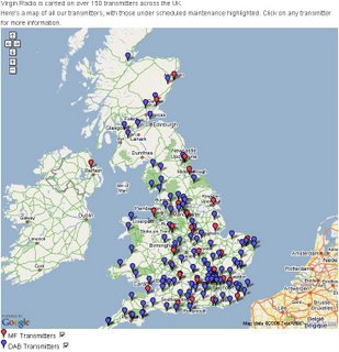
Animated Icons - Transmitter Map

Nice to see animated icons coming into Google Maps.
Virgin Radio Transmitters Animated
Transmitters increase and decrease in size.

Expect to see more. Weather forecasting animations will be coming soon...

Static Example (official)

Labels: , , ,