Mapperz - The Map & GIS News finding blog. With so many Mapping sites online. This blog tries to provide you with the best maps and services that are currently available online.
@mapperz
12 December 2012
Mining Atlas
Mining Atlas - Explore over 10'000 Mines and Projects A nice integration of using Google Earth that allows users to explore mining activities across the planet, either use the search bar or zoom into areas using the map to find mines. The tour feature is a good addition that zoom,pans and tilts the Google earth camera around the selected mines - tour is automatically on as default. There are also printing and distance measurement tools (in KM) that can be used.
Google Maps Android API v2 New Features With the new version of the Google Maps Android API, developers can
utilize Google Maps to its fullest. We’ve incorporated many of the
highly-requested features developers want, such as:
More dynamic and flexible UI designs for large screen Android devices, such as tablets, using Android Fragments
Adding more Google Maps layers in their apps including satellite, hybrid, terrain, traffic and now indoor maps for many major airports and shopping centers
The ability to create markers and info windows with less code
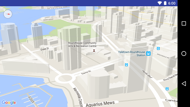
The maps in the Google Maps Android API v2 can be tilted and rotated with easy
gestures, giving users the ability to adjust the map with an orientation that
makes sense for them. At any zoom level, you can pan the map, or change its
perspective with very little latency thanks to the smaller footprint of the
vector-based map tiles. Many cities, when viewed close up, will have 3D
buildings visible, as viewable in the below picture of Vancouver, Canada.
26 minute youtube video of the Google Maps v2 update: