->

30 October 2009

Google Maps JavaScript API v3 - Now with Directions

Google Maps JavaScript API v3 - Now with Directions

**Remember Google Maps JavaScript API v3 is designed to be super lightweight for mobile devices

This makes mapping for mobile devices a lot more useful
New Directions (Walking or Driving) in London - Google Maps API V3
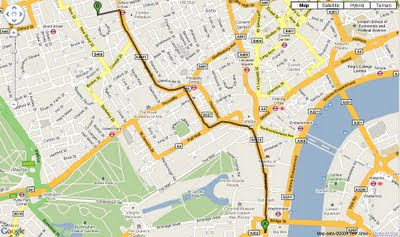
New Directions (Walking or Driving) in London - Google Maps V3

@mapperz example above
http://mapperz.googlepages.com/google_mapv3_directions.html

With a Directions Panel
http://mapperz.googlepages.com/google_mapv3_directions_panel.html


Code:
New required parameters

var directionDisplay;
var directionsService = new google.maps.DirectionsService();

Set Start and End locations:

function calcRoute() {
var start = document.getElementById("start").value;
var end = document.getElementById("end").value;
var request = {
origin:start,
destination:end,

Travel Modes:

travelMode: google.maps.DirectionsTravelMode.WALKING
travelMode: google.maps.DirectionsTravelMode.DRIVING

Get the response from the Geocoder if both locations geocoded then display route between locations:

directionsService.route(request, function(response, status) {
if (status == google.maps.DirectionsStatus.OK) {
directionsDisplay.setDirections(response);


See the changelog
http://code.google.com/p/gmaps-api-issues/wiki/JavascriptMapsAPIv3Changelog

revelant links
Official documentation
http://code.google.com/apis/maps/documentation/v3/reference.html#DirectionsRenderer
http://code.google.com/apis/maps/documentation/v3/reference.html#DirectionsService

Offical Examples:
http://code.google.com/apis/maps/documentation/v3/examples/directions-simple.html
http://code.google.com/apis/maps/documentation/v3/examples/directions-panel.html

source:
http://groups.google.com/group/google-maps-js-api-v3/browse_thread/thread/ee7ce7cf8a872268?hl=en#

Labels: , , , , , ,

28 October 2009

Google Navigation Beta for Andriod

Google Navigation Beta for Andriod
(turn-by-turn GPS navigation with voice guidance for the Google Android Platform)

News update: 29/10/2009
"Shares in sat-nav device companies have fallen substantially after Google unveiled its free live sat-nav for mobiles on Wednesday.

US firm Garmin fell 18% after details of Google Maps Navigation were revealed. Dutch firm TomTom fell 9.5% when markets closed on Thursday."

http://news.bbc.co.uk/1/hi/business/8331824.stm

Google Maps Navigation is an internet-connected GPS navigation system with voice guidance. It is part of Google Maps for mobile and is available for phones with Android 2.0.

Google Navigation - search along a route
Searching for Points of Interest along your route. (users choose poi topics)

Google Maps Navigation uses your phone's internet connection to give you the latest maps and business data. But that's not all that's different about Google's approach to GPS navigation. Watch the below video to learn more.

1. Search in plain English
2. Search by Voice
3. Traffic View (see busy routes either green,yellow,red segments)
4. Search along a Route (Points of Interest of users choice along the active route)
5. Satellite View (includes direction visualisations)
6. Street View (includes direction visualisations)
7. Car Dock Mode - Landscape. (voice processing active, backlight enabled)

http://www.google.com/mobile/navigation/index.html#p=default


source:
http://googleblog.blogspot.com/2009/10/announcing-google-maps-navigation-for.html

Labels: , , , , ,

27 October 2009

The Met Office Weather Maps - October 2009 update

The Met Office Weather Maps - October 2009 update

The biggest difference is speed, layers of weather data have improved and load even faster.

Faster Met Office Radar Rainfall Map

The rainfall layer shows you a radar image of rain across the country. The different colours show different intensities of rain, from dark blue (least severe rain) to white (most severe).

Faster radar and coverage expanded users will find the 'Tools' easier to control opacity (even in timeline mode).

Timeline: (animated weather in time lapse)

The timeline has been improved due to the layers speed, one of the most important parts of the weather map. By clicking on timeline, you can see recent observations or forecast weather.

The weather that is being displayed on the map has its date and time shown on the timeline, and its segment is highlighted in green.

Note that segments on the left-hand side (weather already happened) have a grey bottom. Segments on the right (which show show weather forecasts) have a green bottom.

As your mouse moves over each segment, you will see the date and time of the information, shown in light blue. Click the segment to display the weather you're hovering over.

With some options, there is a play button shown next to the timeline. Clicking it will step through the information one segment at a time. This can be very useful to see how rainfall or cloud is moving across your area. Click the pause button to stop the animation.

Layers that can't be animated show a play button with a red line through it.

The locations box now allows you to store up to 8 places, for quick navigation to those points on the map.

Faster Met Office Pressure Map
The pressure layer now shows text and lines called isobars. Each isobar connects points that have the same atmospheric pressure.

Faster Met Office Temperature Map
Require imperial measurements?, then they are available in preferences.
Welsh is in the pipeline but not available currently.

Faster Met Office National Parks Maps Weather Warnings
National Parks (Leisure areas) have now got there own unique weather warnings, specifically to highlight Blizzards, Heavy snow, Storm force winds,Gales, Severe chill effect, Persistent extensive hill fog, Thunderstorms and Heavy persistent rain.

See previous posts on this topic versions
http://mapperz.blogspot.com/2009/06/met-office-google-maps-weather.html

http://mapperz.blogspot.com/2009/07/best-uk-google-map-api-mashup-ever.html
(note suggestions have been picked up on)

Labels: , , , , ,

23 October 2009

Broadband Trends Map (UK)

Broadband Trends Map (UK)

Using the 'Top 10 Broadband Speed Test'
is a free-to-use speed (and compare) testing service that analyses your broadband speed in seconds. It can measure speeds on every type of broadband connection whether ADSL, cable / fibre-optic or mobile broadband (3G).

Broadband Trends Map
  • Test your broadband speed in seconds
  • See your neighbours' speeds with Broadband StreetStats™
  • Find out the fastest broadband provider in your area!
http://www.top10-broadband.co.uk/speedtest/#

Labels: , , , , ,

22 October 2009

Nokia - Ovi Good Things

Nokia - Ovi Good Things

Nokia - Ovi Good Things
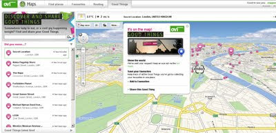
http://maps.ovi.com/goodthings/f84c5631-eec4-4ee6-8c04-872622dc1cb0/Secret-Location

(that's the location but you need a special token)

Labels: , , , , ,

21 October 2009

Make An ESRI Map

Make a Map—The Make a Map feature includes a simple interactive Web map showing seven different U.S. demographic layers. Visitors can zoom in to an area of interest, select a demographic layer, then embed the map into their own Web pages simply by copying and pasting the automatically generated HTML for free map services.


Quick to embed, limited datasets and seems to be USA only (datawise).
(Even geo-locates Area 51 above)

Make your map here

Related
http://www.esri.com/software/mapping_for_everyone/index.html

source:
http://www.esri.com/news/releases/09_4qtr/mapping-for-everyone.html

Labels: , , , , , ,

20 October 2009

Crime Maps (England & Wales ) Released

Crime Maps (England & Wales ) Released

Crime Maps (England & Wales ) Released
The long awaited crime maps have been released.

Crime Maps Guilford, Surrey (England & Wales ) Released
Bing Maps are used with Police boundaries that are thematically styled with crime rates.
centring the map with the 'gun' sight target pulls up information from the authority. Up to 5 authoritiies can be compared at once.

"The map was launched today by Home Office minister David Hanson and National Policing Improvement Agency (NPIA) deputy chief executive Steve Mortimore"

Quick Links
http://maps.police.uk/view/avon-somerset/
http://maps.police.uk/view/devon-cornwall/
http://maps.police.uk/view/dorset/
http://maps.police.uk/view/wiltshire/
http://maps.police.uk/view/hampshire/
http://maps.police.uk/view/surrey/
http://maps.police.uk/view/sussex/

related previous posts:
http://mapperz.blogspot.com/2009/08/bbc-crime-map-truth-about-crime.html
http://mapperz.blogspot.com/2008/08/london-metropolitan-police-crime.html

Source:
http://www.inthenews.co.uk/news//crime/government-launches-crime-maps-to-public-$1335231.htm

News links (they finally catch up)
http://uk.news.yahoo.com/5/20091020/tuk-online-maps-let-public-compare-crime-45dbed5_2.html
http://news.bbc.co.uk/1/hi/uk/8315089.stm
http://www.dailymail.co.uk/news/article-1221604/Crime-maps-allow-householders-check-areas-boon-burglars.html

Labels: , , , , , ,

16 October 2009

The Running Map

The Running Map

A useful map for the likes of runners, joggers, cyclists, hikers, horse riders & walkers.
A clean fast way to prepare for your running routes

Running Map Route in Miles
Nice clean interface, self explanatory - simple to use map.
Even a show elevation option displays at the bottom of the map.

Based in Flash (Flex) and using the Yahoo Flex API
http://developer.yahoo.com/maps/flash/flexGettingStarted.html

The speed of the map load is much improved and the tools and functions (ie switching from miles to kilometres) is extremely fast.
The very helpful 'save route' is a permalink like:
http://www.runningmap.com/?id=145338
(the map above) WITHOUT requiring to have a user account.
Though having a registered user account does give you more control on multiple routes.
Tip: is if you have previous permalinked route(s) and then sign up - you can apply those routes to your newregistered account.

"RunningMap.com is a website for runners, cyclists, hikers or outdoor enthusiasts who want to plan, save and share their routes. Since 2003 Runningmap.com has been helping runners determine the distance of their routes in a way that was not previously possible."

more helpful information and guide is available at
http://www.runningmap.com/news/how-to-get-started-with-runningmap/
http://www.runningmap.com/news/faq/

Running Map - Trackometer on iPhone
If your interested in this and also have an iPhone then you will be wanting to try out
http://www.runningmap.com/news/iphone/

or the direct link on itunes.


Labels: , , , , , , , ,

15 October 2009

Atlanta Mapathon - Creating the Best Mapped City

Atlanta, the capital of the US state of Georgia will soon be the world's most digitally mapped city, according to organisers of a massive "Mapathon".
Source: BBC News

OSM Map Altanta Mapathon

http://www.openstreetmap.org/index.html?lat=33.792&lon=-84.336&zoom=10

What is a Mapathon?
Mapping on-mass [crowdsourcing] the downtown Atlanta area including parks, university campuses and historic sites. Volunteers will be on hand to help new mappers learn how to use a GPS or Walking-Papers and have helpful tips for beginners. Come for the whole day or just stop by for an hour to learn the basics of community mapping and add a few points of interest to the map.

Atlanta Citywide Mapathon

October 16th 17th 18th

During this three day mapping event, local businesses, community groups and OSM members will join together to launch a citywide initiative to help make the map of Atlanta one of the best in the US. For details of how to get involved in this fun, family-friendly event, see the Atlanta Citywide Mapathon page.

Useful links:
http://wiki.openstreetmap.org/wiki/Atlanta_Citywide_Mapathon
http://wiki.openstreetmap.org/wiki/Atlanta#Atlanta_Citywide_Mapathon

New to OpenStreetMapping?
http://wiki.openstreetmap.org/wiki/Beginners%27_Guide

Labels: , , , , , , , ,

13 October 2009

Google Building Maker - New!

Google Building Maker - New!

Contributors will be able to help creat buildings for over 50 cities.
(likely to expand in the future)
Building Maker Cardiff UK

"We [Google] like to think of Building Maker as a cross between Google Maps and a gigantic bin of building blocks. Basically, you pick a building and construct a model of it using aerial photos and simple 3D shapes – both of which we provide. When you're done, we take a look at your model. If it looks right, and if a better model doesn't already exist, we add it to the 3D Buildings layer in Google Earth. You can make a whole building in a few minutes."


The YouTube Video shows how fast it is to add/contribute your own buildings, Google will check them and when verified they will acknowledge your work.Creating Building Maker Cardiff Model Building
Building Maker in Cardiff - with simple tools to create buildings

Requirements before you can contribute:
  • Building Maker is an online tool, and it runs entirely in your web browser (Google Chrome, Firefox, Safari, Internet Explorer, etc.)
  • Before you can add a building to Google Earth, you need to sign in to your Google Account (so you get credit for what you contribute).
  • Models you create with Building Maker "live" in the Google 3D Warehouse (a giant, online repository of 3D models).
  • You can use Google SketchUp (the free, general-purpose 3D modeling tool) to edit or otherwise modify anything you make with Building Maker.
  • Make sure you have the latest version of Google Earth installed on your computer.
  • If using an Apple Mac, you need to download the Google Earth plug-in directly.
Google Building Maker
http://sketchup.google.com/3dwh/buildingmaker.html

source:
http://google-latlong.blogspot.com/2009/10/introducing-google-building-maker.html

Labels: , , , , , ,

12 October 2009

OS 3D Laser Map - Most Accurate Mapping Ever

The national agency used state-of-the-art laser technology and aerial imagery to create what it claims is one of the most accurate maps every produced.

"Ordnance Survey says that the results are substantially more accurate than the 3D maps available through online applications such as Google Earth and Microsoft Virtual Earth, and will revolutionise the way it charts the British Isles."

Video of Bournemouth's Seafront attractions


The Good News:

“Given the level of detail that we've [ordnance survey] achieved, I think Bournemouth can confidently lay claim to being the best mapped place on the planet.”
Glen Hart, head of research at Ordnance Survey

The Bad News:

The 3D mapping service will not be rolled to the rest of Britain for at least five years, while Ordnance Survey perfects the new method. The black dots in the video represent points where no laser data was obtained.

Full article and source:
http://www.telegraph.co.uk/news/uknews/6308577/Ordnance-Survey-3D-map-of-Bournemouth-is-most-detailed-ever.html

Labels: , , , , ,

09 October 2009

OpenStreetMap Formula 1 Circuits

OpenStreetMap Formula 1 Circuits

F1 OpenStreetMap Circuits
OpenStreetMap Formula 1 Circuit - Circuit de Monaco (Monaco)

OpenStreetMapper '

Labels: , , , , , , , ,

08 October 2009

Google StreetView for Canadian Cities - New!

Google StreetView for Canadian Cities - New!

Seems a long time waiting but finally Google Street View comes to Canada.
Google Street View Canada

The service is now available in much of the Greater Toronto Area and in Vancouver and the surrounding area, north to Whistler (2010 Winter Olympics Venues) and east to Chilliwack, British Columbia


Google Street View is also available in the Ontario cities of Hamilton, Kitchener, Waterloo, Ottawa also Calgary, Canmore, Banff and Lake Louise in Alberta, Montreal and surroundings, Quebec City and finally Halifax in Nova Scotia.


Source and embedded StreetView Scenes available at
http://googlemapsmania.blogspot.com/2009/10/street-view-comes-to-canada.html

Don't forget you can embedded your own StreetView tours easily with
http://www.streetcities.com/

Labels: , , , , , ,

06 October 2009

Discover,Evaluate & Develop - New Ordnance Survey Licences

Discover,Evaluate & Develop - New Ordnance Survey Licences

Ordnance Survey have found the word 'Innovate' and have changed the way they 'give away' (at cost*) data for
Discovering,Evaluating and Developing Ordnance Survey data.

The New Licencing Models:-

Discover:
if you are a private individual, new customer, social entrepreneur, or represent a social group or start up company. You can use the data for your internal evaluation and testing purposes only. You cannot develop or demonstrate the data. It is free of charge and can be used as long as you adhere to the terms. Terms PDF

Evaluate:
You may be interested in this licence if you are a new or existing customer who would like to take a larger area of OS data to evaluate, test or demonstrate internally. You can take this data initially for a maximum of three months. Standard supply is up to 10% of Great Britain. This licence is free of charge.
*Though if your order 10.1% of Britian you will be charged £500 payable within 30 days.
Terms PDF

OS Vector Data Formats Available
Many of the Ordnance Survey Datasets are available to download in various GIS formats so no data conversion is required. Simply load into your GIS sofatware.

Developer:
You may be interested in this licence if you would like to develop, test and demonstrate our data to your potential customers.

Our standard supply of Developer Data is for the Plymouth area. Products, formats and exact areas covered are on the Developer Data overview page.

You can use the data for 12 months (except for any third party products listed in the licence where the term can be reduced to 3 or 6 months) and the licence to do this is free of charge.
Terms PDF

FAQ's

How long can I use the data for?

Discover Data– until we terminate the licence.
Evaluation Data – You can take this data for three (3) months except where you request and we agree to supply more than four (4) individual kilometre tiles of OS MasterMap Imagery Layer, which will be for a period of one (1) month.
Development Data – 12 months from the date of despatch, after this time the licence will automatically renew on the same terms. Term for the 3rd party products is also 3 months from the date of despatch.

How much data can I have?

Discover Data– You can download what is on the website.
Evaluation Data – up to 10% of national cover as standard.
Developer Data – Plymouth area as standard.

Which products are available?

** Rasters require world files for GIS software to geo-reference each image available here
***not sure why this data is made available is 'frozen' (dis-continued)

Can I have, for example, three different areas of 10% cover?

Under the Evaluation licence you can have one geographical area of 10% for different products.

What do I do if I want to order the same area for a different product a few weeks after I placed my first order?

You need to complete another request form for the second batch of data.

What happens with the evaluation licence at the end of three months?

You should cease use, destroy and delete the data or contact us if you still need to use the data.

Source:
http://www.ordnancesurvey.co.uk/oswebsite/products/innovations/

Though at the end of the day does it innovate you?

Labels: , , , , , , ,