->

27 February 2009

Vector Magic - Raster to Vector - update

Vector Magic - Raster to Vector - update

"One of the best products out there that really does vectorize raster images to enable editing/scaling and just makes life easier in the cartographic world."


Vector Magic takes a raster image and recreates it in a vector format.
image sources: Vector Magic


The new version (26th Feb '09) v1.11 (pc) v1.14(mac) has a number of new features including:
  • Now export to AI (Adobe Illustrator), DXF (CAD) (in addition to EPS, SVG, and PDF)
  • On PC, export to Microsoft Office EMF format
  • More export options (group by colour, stroking mode)
  • More compatible EPS output
Get an order in by 6th March for the Desktop Version using the promotion code VMDE0306 before March 6th and get a $50 discount.

Mapperz has seen Vector Magic develop from Stanford University Artificial Intelligence research project into a fully commercial and viable product in less than 2 years. Well done to the creators in making and continuing to develop this excellent product.

Desktop Version
http://vectormagic.com/desktop/

Online Version Available (less functionality)
http://vectormagic.com/online/how_it_works

Source:
http://vectormagic.com/blog/posts


Labels: , , , ,

26 February 2009

Yahoo Maps Update February 2009

Yahoo Maps Update February 2009

Yahoo Maps has had an update that seems to concentrate on localization
International Support is improved overall.

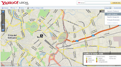
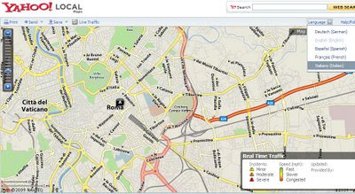
Yahoo Local Maps Language Switch Italian
Italian Maps Mode and Controls
Yahoo Local Maps Language Switch English
Yahoo make it far easier to change language, the page/map tiles do have to refresh in order to view the localised maps. Enlgish to Italian shown.

Yahoo Local Maps Language Spanish Mapas
Español Mapas, Maps for Rome Spanish Version.

Yahoo Local Maps Language French Canadian
French Canadian Maps available too.
  • Yahoo updates to US, US-Español, Canadian and Canadian French Mapping sites.
  • A language selector, easy selection from English, French, Italian, Spanish and German.
  • A miles/km selector, distances can be quickly changed.
  • Print page improvements
    • Drag/Pan/Zoom functionality for Print page maps.
    • Collapsible driving directions vertical to save space.
    • Driving Directions made wider and in a larger font.
    • Interactive map controls on the Print page. Useful for tweaking before printing.
Source:
http://www.ygeoblog.com/blog/2009/02/25/yahoo-maps-%E2%80%93-enhanced-international-support/

Labels: , , , , ,

25 February 2009

Google Map Maker Directions - New!

Google Map Maker Directions - New!

Last week, Google switched on the MapMaker Tiles for API developers. See previous post (12th Feb '09).

MapMaker is based on user generated content.

"With Google Map Maker, you can become a citizen cartographer and help improve the quality of maps and local information in your region. You are invited to map the world with us!"

Now those tiles have graduated to Google Maps. 31 countries (of 160+) have made it so far - though this is likely to expand through the year and beyond.

The Full List is available
http://sites.google.com/site/mapmakeruserhelp/countries-on-google-maps

But wait there is more...

Driving Directions in MapMaker New!
(but use with caution)
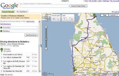
Google Map Maker Directions - New
Directions in a simpler form have been enabled, usually only the likes of TeleAtlas navigation is used on Google maps but now user contributed content is being used for the first time available in Map Maker Mode only at present [google login required].

Some of the countries do not have the simplified driving directions available.

Here is a working example
http://www.google.com/mapmaker?hl=en&ctype=0&saddr=Quetta&daddr=Zhob&dirflg=&gw=56&ll=30.192618,68.895264&spn=4.756322,7.426758&z=7
but don't expect this to be the shortest route.

Here is a better example
http://www.google.com/mapmaker?hl=en&ctype=0&saddr=Colombo&daddr=Mullaitvu&dirflg=&gw=56&ll=8.070086,80.330403&spn=2.724552,3.713379&z=8

Source:
http://sites.google.com/site/mapmakeruserhelp/using-directions

Labels: , , , , ,

24 February 2009

Map Channels Version 3 (Beta)

Map Channels Version 3 (Beta)

update 02/03/2009 - Map Channels v3.01 - added features:

* Google Map Maker tiles can be selected
* Fixed caching bugs affecting update and display of map scripts
* Added map cursor shape option
* Added filter and info window link colour options
* Fixed info window and tooltip style bugs
* Added 'infoInitial' map setting and '&id' parameter to display a selected place marker
when the map first loads
* Added local map hosting instructions


Not just an update, but a complete re-write of the code.
MyMaps Feed MapChannels V3 beta

New Features

• Restructuring of the design process
• User-definable dictionaries to present maps in any language
• Support for spreadsheet data in either tab-delimited format or from Google Spreadsheets
• Support for GeoRSS feeds using the Google Feeds API
• Marker clustering to display large numbers of markers on a map
• Google Street View (UK Streetview is on it's way...)

• Microsoft Virtual Earth (includes the birds eye view mode; oblique aerial imagery)


Clustering is now available as an option so maps can display more markers easily.
This involves gathering markers dependant on the number that obsure the map detail.
But also gives the user feeback that there are x amount of markers in an area
See the image below ( image source: Google Maps Mania)
Map Channels Clustering
Note: The Markers have dynamic numbers displayed on them indicating number of markers within a cluster at a particular zoom level of the map.
There is an option to display Street View and Virtual Earth as in Dual Maps.
(Look out Germany and the UK in the coming weeks)
Multi-language support is improved, users can create a custom dictionary to translate all phrases used on the map.
Feeds supported include KML, GeoRSS, Google Spreadsheet and Tab-delimited text. Feeds can be created separately from the map and from spreadsheet feeds.
Developers can customise the javascript used to display info window, tooltip and icon text.
Demos using Map Channels Version 3 (beta) are available here

Labels: , , , ,

18 February 2009

More Google Transit Cities - Canada & Brazil

More Google Transit Cities - Canada & Brazil

Google have quietly added a few more cities to Google Transit.

The New Cities are:
Calgary, Alberta Canada (provided by Calgary Transit)


View Larger Map

[Embedded Map cannot be seen in RSS Readers please go to
Mapperz Blog to see the Map]

Edmonton, Alberta Canada (unlisted here) provided by Edmonton Transit


and Belo Horizonte Brazil provided by BH Trans


Labels: , , , , ,

17 February 2009

London 2012 Olympic Progress Map

London 2012 Olympic Progress Map

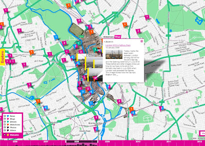
London Olympic 2012 Puilding Progress Map
A little busy in places but gives a clear indication on the progress of the building of the Olympic Venues

"There is such an opportunity here. It would be superb if you could include photos uploaded to sites such as flickr, the image-sharing website."
why not?

The Interactive Map
http://www.london2012.com/in-your-area/map/index.php
*Tip as this is based in Flash - right click and select 'Go Full Screen'

Firebug tells the developer there is an underlying API for the Map
http://data.map.london2012.com/


Timeline at the bottom
"timeline so visitors can see milestones in the project, and live webcams of construction sites"

Source: This is London

Labels: , , , , ,

16 February 2009

Genes Reunited gets Virtual Earth Maps

Genes Reunited gets Virtual Earth Maps

Genes Reunited using Virtual Earth Maps

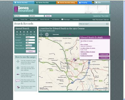
ITV (A UK TV channel) has added new developments to its genealogy site Genes Reunited,

"The Genes Reunited site has launched a new maps feature which enables people to see where their ancestors lived up to 168 years ago."

When members [login required] search family not only can they view their results as they appear in the original records, but their findings are shown on a detailed map.

A helpful way of mapping your family history.
http://www.genesreunited.co.uk/home/

Labels: , , ,

13 February 2009

OSM - Hardware Upgrade Appeal: Thank you!

OSM - Hardware Upgrade Appeal: Thank you!

It took 2 days 15 hours and 20 minutes to reach the £10,000 target.

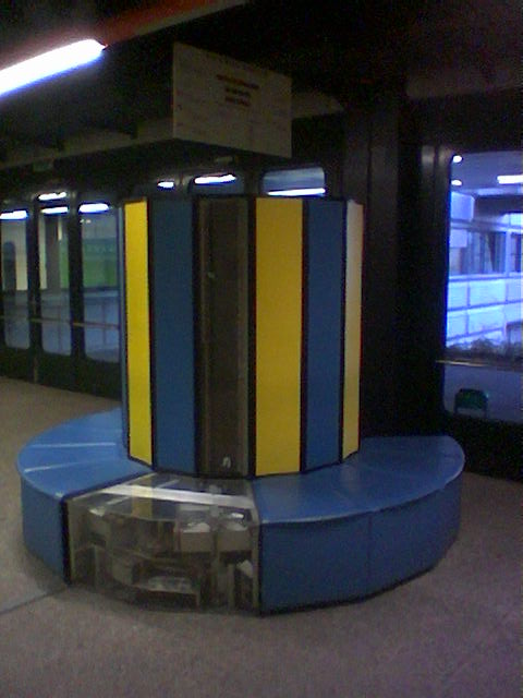
Cray X-MP-48 Supercomputer
Faster Servers on the way for Open Street Map - Picture of a Cray X-MP/48 Supercomputer

"This all happened so quickly we were astonished and totally humbled by the generosity and goodwill towards the project. It happened so quickly in fact that we felt that a lot of people wouldn’t even have had an opportunity to donate, so we decided to keep the appeal open a bit longer.

So after exactly a week we are formally closing the appeal having raised £16,222. The donate site will still stay up but we’ll change the wording so that it’s for general fund raising and not focused on any particular need.

We have some very big thank yous to make. Firstly, we are enormously grateful to Google. The guys from the Google Open Source Programs Office really appreciate what we are doing and donated £5,000. Awesome."

"
We’ve raised enough for a new database server. It will probably be a better spec than we had planned or hoped for, so it should see us good for some time."

Source:
http://www.opengeodata.org/?p=391

Mapperz helped out too, and thank you and a big well done to all that have helped.

Labels: , , , , ,

12 February 2009

Google Map Maker Tiles come to the API

Google Map Maker Tiles come to the API

Update:
One of the best areas of difference is in Sri Lanka
Here is the differences in Colombo


Google Maps Normal Tiles limited in content.
This shows the power of user contributed content.

http://mapperz.googlepages.com/mapmaker_api_sri_lanka.html
(Warning this example is in the latest *experimental* version of the api v146b and GLog is always displayed)

Google Map Maker gives users the power to add, edit and amend data in Google Maps.
This has been running for awhile, but as yet it has not been used by Google in the Main Google Maps Site.

A first. The Google Maps API has had the option of (G_MAPMAKER_NORMAL_MAP);
for a while but this has not been enabled, until today.Normal Google Map Tiles
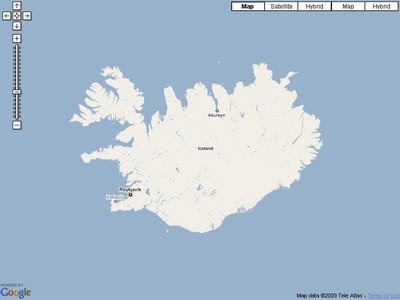
Here is one Country in Google Maps with very little data coverage. Iceland.

But now with the API you can switch on the User Made Tiles from Google Map Maker.

Google Map Maker Tiles - Available
Not much more detail , but it is better than the normal tiles from Google Maps.
Note:Copyright is Google only. (Coastline TeleAtlas still?)

There are a number of Countries and this is one example, so check the list and see if the country your are interested has more content than the original Google Map Tiles.

You can view the example here:
http://mapperz.googlepages.com/mapmaker_api_iceland.html


Mapperz would like to thank Mike Williams for the tip off .
http://groups.google.com/group/Google-Maps-API/browse_thread/thread/4d44eed7fca98d35?hl=en#


Full list of Countries in Google Map Maker
* Algeria
* American Samoa
* Angola
* Anguilla
* Antigua and Barbuda
* Argentina
* Armenia
* Aruba
* Azerbaijan
* Bahamas
* Bahrain
* Bangladesh
* Barbados
* Belize
* Benin
* Bermuda
* Bhutan
* Bolivia
* Botswana
* British Indian Ocean Territory
* British Virgin Islands
* Burkina Faso
* Burundi
* Côte d'Ivoire (Ivory Coast)
* Cambodia
* Cameroon
* Cape Verde
* Cayman Islands
* Central African Republic
* Chad
* Chile
* Christmas Island
* Cocos Islands
* Colombia
* Comoros
* Congo
* Cook Islands
* Costa Rica
* Cuba
* Cyprus
* Democratic Republic of Congo
* Djibouti
* Dominica
* Dominican Republic
* Ecuador
* El Salvador
* Equatorial Guinea
* Eritrea
* Ethiopia
* Falkland Islands
* Faroe Islands
* Fiji
* French Guiana
* French Polynesia
* French Southern and Antarctic Lands
* Gabon
* Gambia
* Ghana
* Greenland
* Grenada
* Guadeloupe
* Guam
* Guatemala
* Guinea
* Guinea-Bissau
* Guyana
* Haiti
* Heard Island and McDonald Islands
* Honduras
* Iceland
* India
* Iran
* Jamaica
* Jordan
* Kazakhstan
* Kenya
* Kiribati
* Kuwait
* Kyrgyztan
* Laos
* Lebanon
* Lesotho
* Liberia
* Libya
* Madagascar
* Malawi
* Maldives
* Mali
* Malta
* Marshall Islands
* Martinique
* Mauritania
* Mauritius
* Mayotte
* Micronesia
* Midway Islands
* Mongolia
* Montserrat
* Morocco
* Mozambique
* Myanmar
* Namibia
* Nauru
* Nepal
* Netherlands Antilles
* New Caledonia
* Nicaragua
* Niger
* Nigeria
* Niue
* Norfolk Island
* Northern Mariana Islands
* Oman
* Pakistan
* Palau
* Panama
* Papua New Guinea
* Paraguay
* Peru
* Philippines
* Pitcairn Islands
* Qatar
* Reunion
* Rwanda
* Saint Helena
* Saint Kitts and Nevis
* Saint Lucia
* Saint Vincent and the Grenadines
* Samoa
* São Tomé and Príncipe
* Senegal
* Seychelles
* Sierra Leone
* Solomon Islands
* Somalia
* South Georgia and the South Sandwich Islands
* Sri Lanka
* Sudan
* Suriname
* Svalbard and Jan Mayen
* Swaziland
* Syria
* Tajikistan
* Tanzania
* Timor-Leste
* Togo
* Tokelau
* Tonga
* Trinidad and Tobago
* Tunisia
* Turkmenistan
* Turks and Caicos Islands
* Tuvalu
* Uganda
* Uruguay
* Uzbekistan
* Vanuatu
* Venezuela
* Vietnam
* Wallis and Futuna
* Western Sahara
* Yemen
* Zambia
* Zimbabwe


You can view the example here:
http://mapperz.googlepages.com/mapmaker_api_iceland.html

Labels: , , , ,

11 February 2009

Gmail gets location support

Gmail gets location support

Google Mail (Gmail) has now the ability via Google Mail Labs to add your location to your signature.
You have to enable experimental 'labs' (in gmail settings).

Gmail gets location support

Gmail signature location
Tick the 'Append your location' to activate the location factor.

Note: Google Gears (if installed) will ask for permissions to access your location (via ISP or Mobile/Cell network).

Gmail compose email signature with location

What No Map?
Request: A little Static Map that can be embedded into the email (if html)

like this:

Map Created with the Static Map Wizard

Source:
http://gmailblog.blogspot.com/2009/02/new-in-labs-add-your-location-to-your.html

Some other thoughts
http://searchengineland.com/gmail-labs-adds-location-to-signatures-16518
http://blogoscoped.com/archive/2009-02-11-n42.html

Labels: , , , , ,

10 February 2009

Nokia Maps v3.0 updated (including ovi maps)

Nokia Maps v3.0 updated (including ovi maps)

Nokia Maps v3.0 Updated
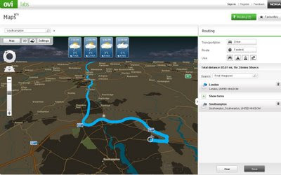
Nokia Ovi Maps (web browser) now can save routes and sync with your nokia maps v3 - mobile/cell device (sign in required to save routes) - Map in nighttime mode with weather and route.
  • You can rotate the map and view 3D landmarks from all directions.
  • In 3D view mode, you can tilt the view by pressing 2 and 8 button
  • 2D/3D mode works with all map modes, now with Satellite and Terrain
  • My Places has option "Point me to" for any saved place/landmark saves the viewing angle as well.
  • Synchronisation of Favourites and Collections with Ovi Maps and vice versa (use in online mode, enable Internet connection), you can now plan routings on Ovi Maps and synchronise to your device
Compatibility and system requirements
Maps Updater and Map Loader 3.0 require Microsoft Windows XP or Vista.
Maps Updater requires Nokia PC Suite to be installed on your computer.

Maps 3.0 Beta works with Nokia devices based on:
S60 3rd Edition Feature Pack 1 (E71, E66, 6110 Navigator, N95, N95 8GB, N82)
S60 3rd Edition Feature Pack 2 (N96, N85, N79, 6650, 6210 Navigator, 6220 Classic, N78)

Ovi MapsBeta works on IE6 (Windows XP), IE7, Firefox 2 and Firefox 3 (Windows XP or Vista).

Note: you cannot use the Nokia Maps 2 and Nokia Maps 3 on the same device. If you have a license for sat-nav (directions/traffic updates etc) you might lose your full licence.
Backup your device before trying beta software.

"Your travel guide licences are not valid in the beta version of Maps 3.0. However, the guide licences will be valid again in the final version of Maps 3.0."

Future implementations (commercial release)
  • Safety spot warner's in selected countries
  • Extended country coverage for Traffic info service
  • Weather information
  • Premium POI content for travel, selected events and cinema
http://betalabs.nokia.com/betas/view/nokia-maps-30-ovi-maps

source and many more screenshots:
http://www.allaboutsymbian.com/news/item/8921_Nokia_Maps_30_beta_updated.php

Labels: , , , , ,

09 February 2009

Sledge Mapping

Sledge Mapping

Official Edited Video
http://www.mapsinternational.co.uk/whatcanyoudo/

It's a real map and it makes a great sledge or snowboard


(Unedited version)
http://www.youtube.com/watch?v=-WKngdaC7nM

"No maps were harmed making the video"

If you want one, then buy one here
http://www.mapsinternational.co.uk/wall-maps.asp

Labels: , , ,

06 February 2009

CloudMade - A Preview the Future of Mapping

CloudMade - A Preview the Future of Mapping

update:


Have faster maps - if you use Open Street Map - Please donate to help get whizzy fast servers.
http://donate.openstreetmap.org/
  • Funding Target: £ 10,000
  • Raised: £15,579 (155.79%) - Well Done!
  • Google donates £5,000 (source: twitter)
(invest your money here rather than a UK bank - your get a better return)

And there are thanks from the Open Street Map Team
"UPDATE: Thank you to everyone who has donated. Any additional contributions raised will be used to fund additional hardware on other under resourced OpenStreetMap servers."

Cloudmade Map - Cycling Directions Export
Sneek Peek - Cycling directions with option to export to JSON or GPX format

"On the evening of the 12th February, CloudMade invite you to preview the future of mapping application development. Our developer launch event will feature a keynote talk from CloudMade Founder Steve Coast, who will share his pioneering vision of mapping."

The evening will also feature presentations from a selection of CloudMade partners who will demonstrate never seen before web and mobile applications built using CloudMade's web services. You'll have the opportunity to talk one on one to the CloudMade team and to our partner developers to find out exactly how CloudMade can help you build better applications.

The London launch event will be held at the Holborn Bars, 138-142 Holborn, The City, London, EC1N 2NQ (view on map). There will be a drinks reception and networking from 6 - 6.30pm followed by presentations and the launch event. The event will conclude around 8.30pm, with some time for additional networking.


"CloudMade's web services are going to change the way your users experience geo apps. We've been working on a set of Tools and APIs to give you access to verified OpenStreetMap data on the platform you choose in the formats you want."

Two developer events in San Francisco and London will introduce you to CloudMade's unique services. If you're a developer building web, mobile or desktop mapping applications, these are the events for you.

Sneek peek video showing the neat map editor 'Edit Map Styles'


CloudMade StyleEditor ScreenCast from CloudMade on Vimeo.

Labels: , , , , , ,

04 February 2009

Google Maps Mobile Version 3 - With Latitude

Google Maps Mobile Version 3 - With Latitude

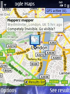
Join Google LatitudeGoogle Maps Mobile V3 with  Latitude
Easy to install and easy to use - if you have a google account.

Locate with Google Latitude Active
Not Competley Invisable now you have been spatially found.

Google Maps for Mobile v3.00 is now available to download.
Google Latitude, a spatial way to find your friends/contact on the map.

Google Maps v3.00 download (mobile/cell users only)
m.google.com/maps
Non-mobile users will be directed to
http://www.google.com/mobile/default/maps.html

Mapperz tested and installed on a Nokia N82 - without any issues.

Go Play - Go locate..

Source and More Information
http://www.allaboutsymbian.com/news/item/8887_Exclusive_Google_Maps_for_Mobi.php

Labels: , , , , ,

Introducing Google Latitude - New!

Introducing Google Latitude - New!

See where your friends are in 'real-time' on a Google Map
Locate your Friends/Contacts

Google Latitude - Map- New!
iGoogle gadget can be used to locate friends in your gmail contacts
(contacts are emailed first for permission to be located)


"Enjoy Google Latitude on your phone, computer, or both."

Share locations
Location sharing starts only when both you and a friend agree. Invite friends via email or easily add them from your Gmail contacts.

Control privacy
You can share, set, or hide your location - or turn off Google Latitude - from the privacy menu. You can also hide your location or share only a city-level location with certain friends. For more information, see the Privacy FAQs.

Share status
Create a status message and upload your photo within Latitude. It also syncs directly with Google Talk. Check your friends' status messages to see what your friends are up to.

Contact your friends
Quickly contact your friends with an SMS, IM, or phone call. You can also get directions to lead you to your friends.

Location Privacy

A useful guide is here
http://www.google.com/support/mobile/bin/topic.py?topic=19501

more on Google Latitude
http://www.google.com/mobile/default/latitude.html

Google Maps Mania has a good introduction into the new service

mobile access starts here
visit google.com/latitude

Official Post
http://googleblog.blogspot.com/2009/02/see-where-your-friends-are-with-google.html

"It is a Location Based Service made 'cool' by Google"
Mapperz

Labels: , , , , , ,

SpinCloud - Weather Mashup Map

SpinCloud - Weather Mashup Map

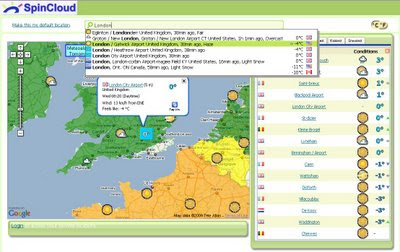
Spin Cloud - Weather Map
Nice integration of weather feeds and mapping from Google Maps. Easy to use.

"Weather mashup with tagging, forecasting, and commenting, plus personalization and weather tracking. RSS enabled. Registration via OpenId or Facebook Connect."

Find the Hottest, Coldest, Windiest, Rainiest, Snowiest or just a Snapshot of your local weather.

http://spincloud.com/

Labels: , , , , , , ,

02 February 2009

Google Earth 5 (Beta) More New Layers

Google Earth 5 (Beta) More New Layers

KML Update:
The KML documentation has now been updated for users wanting to create tours underwater.
http://code.google.com/apis/kml/documentation/kmlreference.html#kmlextensions

Official Posts
http://google-latlong.blogspot.com/2009/02/new-in-google-earth-50-historical.html

http://google-latlong.blogspot.com/2009/02/deep-dive-into-ocean-in-google-earth.html

http://googlegeodevelopers.blogspot.com/2009/02/ocean-time-machine-and-touring-new-kml.html

Google Earth 5 New Layers
Google Earth 5 - Real-time buoys data provides current conditions the ocean.

"If you've ever wondered how your neighborhood has changed throughout time, Google Earth now gives you access to the past. With a simple click, check out suburban sprawl, melting ice caps, coastal erosion, and more."

Google Earth 5 New Layers

New toolbar gives easier access to control features
Dive beneath the surface of the ocean

In the new ocean layer, you can plunge all the way to the floor of the sea, view exclusive content from partners like BBC and National Geographic, and explore 3D shipwrecks like the Titanic.

  • Dive beneath the surface and visit the deepest part of the ocean, the Mariana Trench
  • Explore the ocean with top marine experts, including National Geographic
  • Learn about ocean observations, climate change, and endangered species
  • Discover new places including surf, dive, and travel hotspots and shipwrecks
Track and share your paths with others

Take placemarks a step further and record a free-form tour in Google Earth. Simply turn on the touring feature, press record, and see the world. You can even add a soundtrack or narration to personalize the journey.

Please Visit the Excellent http://www.gearthblog.com

for more detailed and in depth information on the newest release of Google Earth.

Historical Imagery
New Google Mars
New Google Ocean

To Download Google Earth 5 go:
http://earth.google.com/ocean/
**High Speed Broadband recommended if using this free product.

Labels: , , , , ,

New BBC Weather Maps Website (Revamp)

New BBC Weather Maps Website

[8.30am currently this has not 'switched over' - probably because of 'snow' on the internet]
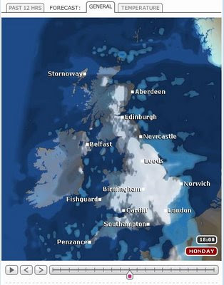
BBC Weather - Revamp New Maps
New, Faster and more Interactive Maps from the BBC
(now supports tabs and is updated much more often)


Today the BBC have launched the biggest re-vamp for the Weather Pages of the BBC site.
Huge improvements across the board.

"The BBC Weather site has been redesigned and from Monday 2nd February accessible to all users."
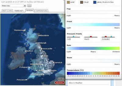
BBC Weather - Revamp New Maps Legend
Compasion legend made more accessible for users.
The Beta version of the new site has been live since September 2008 to give you a preview of the new look and a chance to try the new site slowly the BBC have been adding new features and content and fine-tuning it based on users feedback.

"The new site is designed to give you all the information you need for your local area, from a detailed forecast for the next 24 hours and 5 day outlook to maps, video and any other relevant information we have."

Technology has also developed since the Weather site was first created and we have been able to take advantage of this to improve your experience of our site.

The Changes:
Indication of confidence frequency with which the forecasts are recieved from the Met Office.

All forecasts have a margin for error. BBC Weather developing a new feature that will allow our forecasters to publish an ongoing discussion of confidence in the forecast.

Detailed Forecasts
Today's forecast for UK locations on the main weather site will no longer be illustrated by one summary symbol.

A three-hourly breakdowns to show more clearly how the weather will change over the 24 hours to come.

Local Forecasts:
The design of the new site is based on giving you all you need for your local area - BBC has been creating a 'one-stop shop' for each location.

Forecast Videos
Embedded forecast videos on each local forecast.

For UK locations, you will be able to watch your latest regional TV weather forecast, as broadcast on TV, during the week in addition to our UK and World Summaries.

Easy access to all forecast data - page modules so that you can 'close' content you don't use so often.
(These settings will be stored so each time you come back, the page will be as you left it. The content won't disappear from the page so you know you can always get it if you need it).

Better navigation
The site is now much 'flatter' which means that it is easier to navigate.

All forecast information for a location on one page this means that once you've searched for your location you won't need to go looking for other content that relates to it.

The search is also being improved to accommodate spelling mistakes and identify the nearest forecast for a location you are looking for even if the Met Office don't provide an exact forecast.

Personalisation
You will be able to save up to 6 favourite locations in the 'My Weather' module so you can access these forecasts quickly.

More interactive elements
Each module is interactive - you can open and close them depending on whether you are interested in the forecast info or not.

The map presenter will also be more interactive and you will be able to view maps for surrounding areas without leaving the page.

"Although on the 2nd February the main content will be available in the new look and feel, some content will still only be available on the old site. We will continue to move information from the old to new site over the next few months as well as develop new features on the site."

View the new Website
http://www.bbc.co.uk/weather/

(users can access the new site by clicking the 'new site arriving' image)

Labels: , , , ,