->

30 June 2009

The Met Office (Google Maps) Weather

The Met Office (Google Maps) Weather

The Met office are experimenting with the Google Maps API - this is a very interesting move. The results are quite impressive and this is a potentially a bold move and a great way to represent weather forecasting on the web.
This includes animating the weather for the next 24hrs using the time bar above the map.
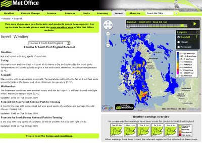
The Met Office Weather using Google Maps 1st July
Google Maps API with Meteorological Data overlayed to represent very visually the foretasted weather for the UK. Animation is controlled by the 'Play' Button.

Not only is rainfall overlayed but isobars representing the pressure is also animated.
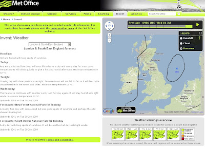
The Met Office Weather using Google Maps Isobars
Isobars (Barometric Pressure) overlay on Google Maps

There is Temperature, Winds(strength/direction) missing currently, this is planned for the future and will be very useful for users.

This is an impressive experiment and greatly improves the very static generated images that currently dominated the Met Office Website.

Well done to all involved, this is what the public want.

The Met Office Google Map (Experimental)

Currently the BBC have Temperature and Winds [Flash required]
http://news.bbc.co.uk/weather/forecast/10209

Suggestions - Opacity Control - current radar blocks the background map.
Temperature and Winds layers would be very handy.
5 day forecast possible?
An a final request on the raw data - it possible to have a basic GeoRSS feed for budding developers to create weather overlays for their own maps
GeoRSS weather warnings?

Labels: , , , , , ,

29 June 2009

National Trust Map (Beta)

National Trust Map (Beta)

National Trust Google Map Beta
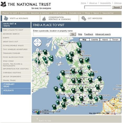
The hundreds of locations of National Trust owned properties are now available on a Google Map, the large national trust icons are 'clusters of' properties zooming in allows individual places of interest be click-able with summary and open times tabs.


"
Welcome to our brand new map."

"We are still developing this super tool that will help you make the most of your days out with us.

Let us know whether we're on the right track or if we have room for improvement by leaving some feedback."

So how does it work?

  • Each small pin represents a National Trust property. Click on the pin and you will get some property information, local weather, travel directions and more.
  • Larger pins represent clusters of places to visit. When you click on one you will get a zoomed-in map showing the area in more detail. Each National Trust property is then shown with a small pin, and as before, you select the pin you are interested in for further information."
National Trust - Inspirator
Need Inspiration? Then the "Inspiratior" can help you find a day out - just use your desired location Town or Postcode in the tool and choose a distance.


Mapperz - leaving feedback:
Nice work National Trust - now putting both those excellent tools into one box would be a really powerful tool.
Good for school summer holidays and getting families out into the countryside.


Labels: , , , , ,

28 June 2009

Enjoy England Maps

Enjoy England Maps

"You can now select a destination by clicking on a map icon and then clicking on the destination link for information about that area or using the Select a county from this list drop-down menu."

Enjoy England using Google Maps
Enjoy England are now using Google maps to enhance their site. This helps users identify attractions near where they choose to visit.

England by Region:

Enjoy England searching near Glastonbury 4 Stars
The 'Show Only' options allows filtering of information that your interested. Another useful feature is the currency converter for international users.

Related - http://www.england-rocks.co.uk/
from Maps - http://www.england-rocks.co.uk/index2.php

Previous post - http://mapperz.blogspot.com/2007/02/england-rocks-map.html

Labels: , , , ,

26 June 2009

Society of Cartographers Summer School

Society of Cartographers Summer School

[updated 27/06/2009]


"UK's best meeting place for all those interested in any aspect of mapping"


Where?
The University of Southampton is the venue for the 45th Annual Summer School

The session themes for this year's conference are:
  • Emergency mapping
  • 2D or 3D mapping?
  • Crowdsourcing data
  • Ordnance Survey and its data
  • Transport mapping
  • Alternative data for users
  • Collecting and using crowdsourced data

When?

Monday 7th September 2009

Lecture 1 13.45 Emergency mapping - an overview (Keir Clarke, Google Maps Mania)

Lecture 2 14.15 Maps in Action Chris Phillips, MapAction

Lecture 3 14.45 Mapping hazard sites Helen Balmforth, Health and Safety Lab


Lecture 4 15.45 Content - map or virtual globe? Rich Treves, University of Southampton

Lecture 5 16.15 Maps in Action Tim Fendley, Legible London

Lecture 6 16.45 Mapping for Thingfinding Jonathan Rez, FWDesign


Tuesday 8th September 2009

Lecture 7 9.00 Neodata - from Crowdsourcing to Cloudsourcing and where it will take us
Chris Osborne, Cloudsourced.com

Lecture 8 9.30 Crowdsourcing geodata Frederik Ramm, Geofabrik

Lecture 9 10.00 Collaborative mapping; flirting with the music industry Edward Mac Gillavry, Webmapper

Wednesday 9th September 2009


Session 6: Alternative data for users
Lecture 15 11.00 Does the UK need a second large scale mapping database?
Alun Jones, The Geoinformation Group

Lecture 10 11.00 KEYNOTE:
Ordnance Survey: underpinning the nation's decision-making
Vanessa Lawrence, Director General and CEO, Ordnance Survey

Lecture 11 11.30 OpenSpace and Geovation Tim Martin, Ordnance Survey

Lecture 12 12.00 Heterogeneous map mashing
Bill Chadwick, Freelance mapper [Where's the path]

Lecture 16 11.30 OpenStreetMap data in local authorities Matt Lindsay, Surrey Heath District Council

Lecture 17 12.00 Delegates corner 5 minutes to talk about a project or discuss an issue of interest to you ...

Session 7: Collecting and using crowdsourced data
Lecture 18 13.30 New developments in mapping Andy Allan, Cloudmade
Lecture 19 14.00 Mapping Antigua Steve Chilton, Middlesex University Abstract ...
Lecture 20 14.30 OSM data [NOT CONFIRMED]

The draft programme:
http://www.soc.org.uk/southampton09/program.htm

To register for the event
http://www.soc.org.uk/southampton09/index.htm

Labels: , , , , , ,

25 June 2009

Google City Tours (Labs)

Google City Tours (Labs)

Google City Tours Google Labs - London


Google Labs " Google City Tours" which uses Google Maps. The idea is that anyone can locate points of interest and plan up-to three day trips in major cities.

City Tours has a number of tours for pre-set for San Francisco, New York, London and Dublin. Major landmarks, museums and art galleries are available in each of the cities.


Landmarks can be edited on your own tour using the google map. Info windows display this information for the markers includes user rating and the opening hours. The Sidebar shows the order of the walk and the time it should take to walk from one location to the next.

City Tours Example - London Day 2
Mapperz Suggestion: The walking directions should follow the walkable path for the streets and not as the crow files in this case. Hopefully this gets an update.

Try it here
http://citytours.googlelabs.com
[Google account require to edit and save/rate tours]

Related post:
http://googlemapsmania.blogspot.com/

Labels: , , , , , , ,

24 June 2009

ArcGIS 9.3.1 Desktop Download Layer Package Patch

ArcGIS 9.3.1 Desktop Download Layer Package Patch
ArcGIS Desktop (ArcInfo, ArcEditor, ArcView)

Update 27th June 2009: IMPORTANT PATCH UPDATE
"A problem was identified with the installation of the ArcGIS 9.3.1 Desktop Download Layer Package Patch.

In some cases, after applying this patch, it would cause ArcMap or ArcCatalog to crash on startup. An updated version of the patch has now been posted to the ESRI Web site."

source:
http://blogs.esri.com/Support/blogs/supportcenter/archive/2009/06/26/update-to-arcgis-9-3-1-desktop-download-layer-package-patch.aspx

An important patch for users of the new ArcGIS 9.3.1 software

Date Submitted: June 23, 2009 - Last Modified: June 24, 2009

"This patch addresses issues with downloading secure content from ArcGIS Online when using ArcGIS Desktop. This patch is required if you are using ArcGIS Desktop and the sharing capabilities of ArcGIS Online. It is recommended that all users install this Patch."

This patch addresses issues with downloading secure content from ArcGIS Online when using ArcGIS Desktop. Content that is not shared with everyone cannot be downloaded. This patch allows all content from ArcGIS Online to be downloaded. We recommend that all Desktop users download and install this Patch at their earliest convenience to ensure the highest quality experience when working with ArcGIS 9.3.1.

Issues Addressed with this PatchThis ArcGIS 9.3.1 Patch contains critical fixes. It is recommended that all users install this Patch.
Resolves issue with downloading secure content from ArcGIS Online when using ArcGIS Desktop. Files
Installed with this PatchCommon Files
\ArcGIS\bin:
ArcGISCacheMgr.exe
ArcGISConnectionTest.exe
ArcGISFileHandler.exe
ArcGISFileHelper.dll
ArcGISVersion.dll
DADFLib.dll

ArcGIS 9.3.1 Final must be installed before you can install this Patch.

source:
http://support.esri.com/index.cfm?fa=downloads.patchesServicePacks.viewPatch&PID=17&MetaID=1530
includes the direct link to gis931-DLLP-patch.msp 1 MB

Labels: , , , , , , ,

BBC Audio Map of the World

BBC Audio Map of the World 'Save Our Sounds'

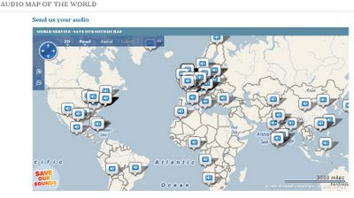
"BBC wants you to help build an interactive map of the world. So get involved and send in recordings of sounds from where you live. Listen to the sounds of the world - and then send us your audio."


BBC World Audio Map - Save Our Sounds
The Map has already a good few audio snippets you can listen to directly from the map.

"Save Our Sounds, but we need your help to create an audio map of the world. We’re especially keen to preserve endangered sounds for future generations.

You can get involved by sending us sounds from where you live, and then listen your way around the world with our interactive map."

View the BBC Audio Map

http://www.bbc.co.uk/worldservice/specialreports/saveoursounds/index.shtml


Source: And more 'BBC' Bing Mashups
http://www.bing.com/community/blogs/maps/archive/2009/06/23/bbc-goes-big-on-bing-maps.aspx

Labels: , , , , ,

22 June 2009

iPhone MobileNavigator [NAVIGON]

iPhone MobileNavigator [NAVIGON]

Navigon iPhone GPS Navigator
Now Available via iTunes Apps

"Turn your iPhone into a first-rate navigation system with MobileNavigator. Try the feature for yourself and enjoy the excellent user control and superior design that allow simple and intuitive operating. The application includes the latest map material from the market leader NAVTEQ and can be used without an Internet connection, which is of enormous benefit abroad, for example, as no extra charges are incurred. With MobileNavigator you can turn your iPhone into an equally handy and convenient route guidance system."

Features and range of functions:

  • 2D and 3D map displays
  • Can be used in portrait and landscape format
  • Precise voice announcements
  • Intelligent address entry
  • Reality View Pro (realistic display of motorway interchanges and exits)
  • Lane Assistant Pro
  • Real signpost display
  • Speed Assistant with adjustable audio-visual warning
  • Day and night mode for map display
  • Direct access and navigation to contacts saved in the iPhone's address book
  • The latest NAVTEQ map material including more than two million (EU version) places of interest (POIs)
  • Navigation is automatically resumed after an incoming phone call
  • Quick access to user-defined POIs in the area and along the route
  • Take Me Home function with a single click
  • Automatic language selection to match the iPhone's user language
Cost:
Navigon’s MobileNavigator Europe app (iTunes link) is now listed on the App Store for a one-time price of $94.99 [£58] but a note in the description claims that the “special introduction price is valid only until June 30th.”

Similar Products for Windows/PDA's

also S60 3rd Edition Phones

Source:
http://blogs.zdnet.com/Apple/?p=4220

Labels: , , , , ,

19 June 2009

Map Channels - June 2009

Map Channels - June 2009

A busy month for Map Channels: They have released the following 3 new features this month alone.


• 17 Jun 2009 : Iran Election Twitter Map

Iran Twitter Map - Map Channels
Mapping tweets about the Iran Election using twitter #tags

• 15 Jun 2009 : Map Feed Converter v1 (beta)

A utility to convert data between KML and tab-delimited format and text to KML.

• 1 Jun 2009 : Map Channels Version 3.02

Which helps you create maps for your own website quickly and easily.

Updated to fix some bugs and add new features.

Also see http://www.mashedworld.com/ for Google Maps and Street View Projects

Look forward to even more to come...

Recently Related:
http://googlemapsmania.blogspot.com/2009/06/iran-protests-on-google-maps.html
To keep up-to-date with the latest from Map Channels use the RSS Feed on the News page
http://www.mapchannels.com/News.aspx

If your bored on a Friday try the Quiz Maps:
http://www.mapchannels.com/QuizMaps.aspx

Labels: , , , , , , ,

192.com Mapping Updates

192.com Mapping Updates

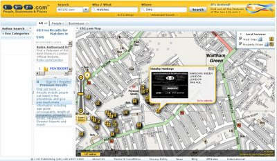
"New on 192.com is ability to see the list of people or businesses that matched your search criteria highlighted on the map. This makes it even easier to identify the person or business you are looking for. For example, you may know that a person definitely lives in the midlands. Or you may be looking for a business that is located on the high street or close to the tube.

You can also use the Locations grouping on the Refine Search panel to filter by any area in the UK, from country level right down to postcode."

What's New on 192.com

Image 192.com: Search results for People or Businesses are now mapped.

Other new searches:

You can now search all of 192.com from any page of the site. You can choose to Search All or select a particular section that you are interested in including:

  • People
  • Businesses
  • Places
  • Property prices
  • Electoral roll
  • Directors
  • Family records
  • Company credit reports
  • Visual timelines
  • Websites Mapped
Websites are now geocoded to a real business locations.

What's New on 192.com on the Map
Websites are now geocoded to real world locations

Websites now mapped on 192.com
Filtering by Website on a map - unique to 192.com

http://www.192.com/content/help/whatsnew/#maps


Try it out:
http://www.192.com/all/search/

Source:
http://blog.192.com/?p=21

Labels: , , , , , , ,

18 June 2009

Sustrans Map - Measure Your Route

Sustrans Map - Measure Your Route

"Sustrans is the UK's leading sustainable transport charity. Our vision is a world in which people choose to travel in ways that benefit their health and the environment. Every day we are working on practical, innovative ways of dealing with the transport challenges that affect us all."

Sustrans Map

The Sustrans Map uses Openlayers and data from Ordnance Survey - a Dotted Eyes creation.

Sustrans aims are:

  • reduce the environmental and resource impacts of transport
  • enable people to choose active travel more often
  • provide car-free access to essential local services
  • create streets and public spaces into places for people to enjoy.
The Unique 'Value Added Tool' for this map is the Interactive Route Creation which dynamically shows the user the distance and time it takes whilst digitising your own route:

Sustrans Map Measure Route
Custom route creation - displays average time and distance as you build your route.

The refresh display speed of the background maps are not the fastest but the usefulness of the tool overrides this bottleneck.

Link to Sustrans Birmingham Map (as above though zoom in)
http://www.sustrans.org.uk/map?searchtype=search&searchkey=Birmingham

Labels: , , , , ,

17 June 2009

Open Street Map & FireFox 3.5 (RC1) Geolocation

Open Street Map & FireFox 3.5 (RC1) Geolocation

update 30th June 2009
FireFox 3.5 is officially released
http://www.mozilla.com/en-US/firefox/all.html

FireFox 3.5 Download Visualization Map (& Stats)
http://downloadstats.mozilla.com/

Question where is Geolocation support in Firefox 3.5?

TOOLS>PAGE INFO> PERMISSIONS> Share Location

@Mapperz original post:

FireFox 3.5 (RC1) now has Geolocation built-in this has very distinct advantages.
"Websites that use location-aware browsing will ask where you are in order to bring you more relevant information, or to save you time while searching. Let’s say you’re looking for a pizza restaurant in your area. A website will be able to ask you to share your location so that simply searching for “pizza” will bring you the answers you need... no further information or extra typing required."

An important note privacy:

"When you visit a location-aware website, Firefox will ask you if you want to share your location.

If you consent, Firefox gathers information about nearby wireless access points and your computer’s IP address. Then Firefox sends this information to the default geolocation service provider, Google Location Services, to get an estimate of your location. That location estimate is then shared with the requesting website.

If you say that you do not consent, Firefox will not do anything."

Okay this a mapping blog and here the best FireFox 3.5 (RC1) Geolocation Example: On a map.

OpenStreetMap - Geolocation using Firefox 3.5 RC1
In Firefox 3.5 (RC1) you will be prompt to 'share location' allowing
will enable the geolocation tool.
Here map quickly finds the IP address and geocodes this returning the map for your ISP.
This then starts bringing up an OpenStreetMap with wiki poi & placenames (from geonames.org)

Here is the link to that Geolocating map (Geolocation will only work if your using FireFox 3.5)
http://3liz.org/geolocation/ (well done 3liz.com)

Mapperz

Labels: , , , , ,

16 June 2009

MSN UK - Local Maps with Local Information

MSN UK - Local Maps with Local Information

Microsoft new service for the United Kingdom:

"a market-leading range of data to allow people to conduct personalised searches of any UK neighbourhood and create an-easy-to-understand map, with all relevant information displayed succinctly on one page."


MSN UK - Local Maps with Local Information
MSN UK overlay Local POI (Points of Interest) for the current map, panning or zooming automatically updates the map with more local information based on users choices in the sidebar.

The coloured polygons represent the local constituencies though out the UK.

One option that is interesting is 'Flood Layer' though not currently available - issues with Crown Copyright and the Environment Agency? ononemap.com has the same issue.

MSN UK Local Map Local constituencies Bing Maps


property portal Propertyfinder.com and Virtual Earth (now Bing) developers shoothill.comMSN UK Local Map Local House Price Heatmap Bing Maps
Find out where "Risers & Fallers" are with this heatmap

Overall , lots of data, managed in a way that it is not totally overload the base maps [TeleAtlas, Ordnance Survey and Collins Bartholomew background maps available].
A good selection of local information is currently available.

Bird Eye View is available but local information is not overlayed - am sure Multimap has this available (Multimap now owned by Microsoft)
See http://www.multimap.com/s/JV2Swe8T
for points in Bird Eye View.

Source:
http://www.techradar.com/news/internet/msn-offers
-localised-property-info-service-608518

Labels: , , , , , , , ,

Talk to the Map! [Google Maps on Android]

Talk to the Map! [Google Maps on Android]


(this video jumps to the 'speak moment' in the video once play is 'clicked'

  • Speak to the Map and and search.
  • Google Maps for Android includes some big improvements to Google Latitude. (location will continue to update as long as your phone is on.)
  • New experimental feature called Updates that lets you communicate with friends and post messages. (Your friends will also need to download this new version of Google Maps for Android)
  • Street View in Google Maps on Android is no longer its own map mode, Now integrated into the map where street view is available.

Video:
http://www.youtube.com/watch?v=Ry2gaJgmgiU

Source:
http://googlemobile.blogspot.com/2009/06/search-by-voice-and-transit-directions.html

Labels: , , , , , ,

15 June 2009

Nokia N97, Ovi Maps - The Mapperz Review

Nokia N97 Ovi Maps Review

"Ovi Maps is the new name for Nokia Maps."
Nokia have updated their mapping application.
Some good improvements and new content and new features and simpler cost structure.

Deleting Outdated Map Data
Old map data is recognised in the new software and will update the data, though depending on the amount of coverage you choose. Total for the entire world is towards 7GB. The UK is 156.5mb.
Pre-loading the maps will save you money in
'data transfer' costs over the mobile networks.

New Nokia Ovi Maps
Nokia Maps now Ovi Maps was updated last Thursday (11/06/09)

Satellite Status - BarSatellite Status - Radial
A quick note: Getting GPS Fixes faster. (less than a minute with 5 satellites
using standard GPS - no network based or A-GPS which uses the mobile
network to access GPS positional data)

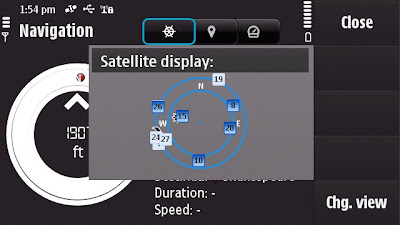
The New N97 has more GPS details - in Applications>Location you can find
this in Position options Satellite Status will give you the signal strength of all
the GPS satellites available.
The view can be changed to Satellite display that gives the orbits on a radial
chart with sun and moon positions also. A nice feature, could this be implemented
in the Ovi Maps Application on the phone?

Back to the Maps:

What is New?
  • The map (vector) data has been completely updated
  • Current weather forecast information.
  • Speed Limit Warner
  • Saftey Spot Warner
  • Travel time or Time of Arrival option
  • Automatic 'Re-route' due to traffic option
  • Walking Directions has the option of straight-line distance to the destination.
  • Automatic 'Day/Night Time' Map mode.
  • Maps Improvement option.
  • *Compass mode (N97) Map rotates with you touch dragging (pan & zoom)
  • Search Nearby - vastly improved and more details available to users
  • Synchronisation with Ovi Maps Online. (confirmed this works very well)
  • Performance has been much improved (panning the map)
  • bugs fixed and is now a more stable application.
  • Better support and help - on phone or online option
Compass requires calibration before the function is available to use.


Traffic Information is now displayed on the Map even in 3D mode - Routes can be
automatic recalculated to avoid traffic incidents.

Smoothness, there has been a big improvement in the panning and zoom,
no jittering - when in driving navigating the map keeps up with the speed
of the vehicle. Navigation does repeat 3 times, one for advanced warning
- 350 yards. Then reminders at 50-30yds then 10 yards.

Walking mode does have the addition of straight line
'as the crow flies'
direction and distance.
(Golf players might use this to their advantage.)
Note the compass is 'green' meaning it is calibrated and active giving the
user the sense of bearing.
Walking Mode Straight line Navigation

Details on the map data:
v3.01 09wk24 b01 MV OpenGL LM MN
Map Version 0.1.22.103 OpenbitLM 6.21.3

Data souces:
NavInfo (Traffic info)
Satellite Imagemap 2002 - Planetary Visions
Imagery - Digital Global 2008
Aronbado por el Insitututo Geografico Milltar 5 Sept 2008.
STRM V4 2008 CIAT

update 25th January 2010 - New devices N97 (June 2009 onwards) Navigation is now Free
for life of the Phone. see
http://maps.nokia.com/explore-services/ovi-maps/downloads#/default/
Costs: (based on UK prices) - For Directions and Voice Navigation.
£52.99 for a year.(covers Europe).
£6.00 for 30 days.
£1.50 per day
*Pricing for other regions vary

1. Bug found: When using the 3D map option on the N97 - the touch screen only pans
upwards, the user cannot pan down the map.

Overall impressed with Nokia Ovi Maps 3 and where this application is going,
not only improving the software, the map data but introducing new and useful
features that engage and interacts with the user getting them to and from
locations conveniently.
Also the maps (vector data from Navteq now Nokia owned) are more up-to-date
than many online mapping
sources including TeleAtlas etc. (which Google uses).
At least areas that Mapperz has tested in so far.

This is the final beta stage of Ovi maps version 3. Expect the full release
in the next few weeks for
all current nokia phones that can support the application.

SportTracker Users will be happy to know that this is working for the N97 with
the touch screen controls.
Please visit Symbian World for more on this:
http://symbianworld.org/1187-sports-tracker-finally-
available-for-nokia-n97-and-5800/

Ovi Maps is a free application for S60 devices, though extra features
'Directions and Voice Navigation'
require licences that can be purchased
through the application.
More information
http://betalabs.nokia.com/betas/view/nokia-maps-30-maps-ovi

More details on the N97 Mapperz recommends:
http://www.allaboutsymbian.com/reviews/item/Nokia_N97
_Review-Part_1-First_impressions.php

http://www.allaboutsymbian.com/news/item/9902_Nokia_N97
_Review-Part_2-Touch-.php

A very special thanks to the team at http://www.womworld.com/nokia/
for a very successful 'Search for N' competition.


Labels: , , , , , , , , ,

12 June 2009

Yahoo Maps Updated [Europe]

Yahoo Maps Updated [Europe]

Yahoo Maps New Drag Directions
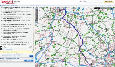
Now it is possible to drag the routes...
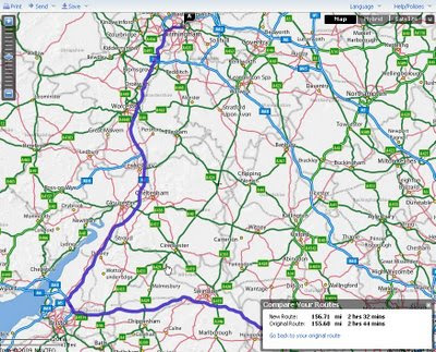
Yahoo Maps New Drag Directions - Compare Old and New Route
Yahoo draggable routes, with option to revert back to original, also compares the route distance.

Other new features & updates
In response to users feedback Yahoo made some major improvements to Yahoo Maps

  • Faster loading time -No more waiting for the application to load - Dial-up mode removed
  • Language preference – Choose from one of the 5 European languages: English, French, Italian, Spanish and German*.
  • Interactive print page – Customize the print page to include only the information you need.
  • Personalised routing – Don’t like the route yahoo provide drag and drop the routes interactively.
  • Saved locations – For convenience, previously entered locations are automatically stored and available within Maps and elsewhere on Yahoo, such as Local and Weather.
  • Quickly look up places through auto-completion.
  • Waypoint support – Get driving directions for trips with multiple stops.
  • Save driving directions – Two places to save, Yahoo! Bookmarks and delicious
  • Zoom bar – now with the ‘+’ on top.
*Yahoo will be rolling out the same set of Maps improvements in Germany in the coming weeks.

Try it
http://tinyurl.com/NewYahoo-Maps-Routes
(above example)

Yahoo Maps Europe main sites:
http://uk.maps.yahoo.com/ (UK)
http://fr.maps.yahoo.com/ (France)
http://de.maps.yahoo.com/ (Germany)
http://espanol.maps.yahoo.com/ (Spain)

Labels: , , , , ,

Mapumental [Channel 4]

Mapumental [Channel 4]

"lovely maps to help you work out where in Britain you might like to live, work or visit for a holiday"
Mapumental Channel4 Map
Mixing Commuting times with House Average House Prices and *Scenicness - Interactive and has a wow factor.

And *scenicness — what’s that?
"Some people like to live in or near places that are pretty. The scenicness slider lets you hide places with a low ‘scenicness’ score."

What is Mapumental?
At the moment Mapumental is best at helping you work out where else you might live to have a better daily commute. This will change in the future, but for now, here’s how to use it.

It’s a tool that uses lovely maps to help you work out where in Britain you might like to live, work or visit for a holiday.
How do I use it?

At the moment Mapumental is best at helping you work out where else you might live to have a better daily commute. This will change in the future, but for now, here’s how to use it.

The Interactive 'wow' Mapumental Map (use the sliders)

More information - http://mapumental.channel4.com/help

In conjunction with
http://www.mysociety.org/
http://www.stamen.com/

Note: No average house prices for Scotland.

Labels: , , , , , , , ,

11 June 2009

Google Fusion Tables [Fast Batch Geocoding]

Google Fusion Tables [Fast Batch Geocoding]

"A fast an effective way to batch geocode spreadsheet data."

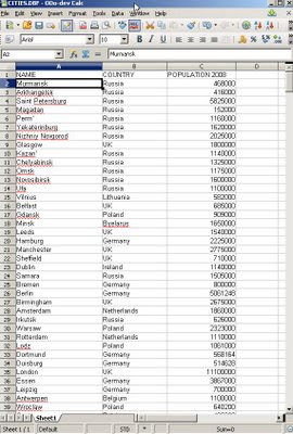
World Cities Population in Open Office
Take some data, with no geographic information. Upload to the New Google Fusion Tables and Map it.

Some spot checking of data in location - as geocoding is not an exact science.
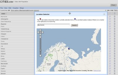
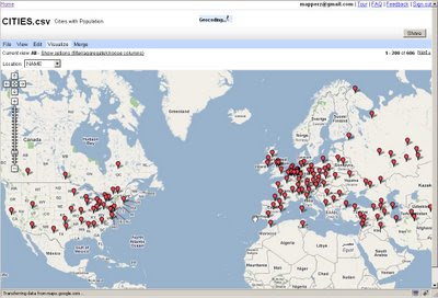
World Cities with population checking locations

Simply import the data will then give you access to 'Map' the data.

Automatic Batch Geocoding
Then the real magic of automatic batch geocoding on the fly - you can visually see the data being placed on the map.
All within a few seconds - then whole process takes less than 30 seconds [based on 606 cities] though only 1-200 markers are display at one time.

And to finish it off - it is easy to create a simple thematic map.Population Summary Thematic Map

Suggestions, would be nice to be able to overlay the thematic map [based in flash] over the Google Map (or creating gpolygons).
Sharing with the option of embedding and link to would be convenient.
*Note currently in Google Labs things will change.

A nice tool with great potential has unique features and powerful visualization functions.

Summary
Google Chart meets Google Maps with Google Spreadsheets binding them.

Related
http://googlemapsmania.blogspot.com/2009/06/
google-fusion-tables-google-maps.html

Official Post
http://googleresearch.blogspot.com/2009/06/google-fusion-tables.html

Labels: , , , , , , , ,

10 June 2009

The UK Blue Badge Map [via direct.gov.uk]

The UK Blue Badge Map [via direct.gov.uk]

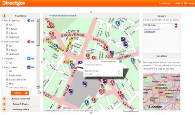
Finally a very useful map that will help aid 'Blue Badge' users finding parking across the UK.

Blue Badge Parking Map - UK

The Blue Badge map can be used to find:

  • Blue Badge parking bays in over 100 towns and cities across the UK
  • Red Route parking bays in London
  • petrol stations and their service facilities on major routes in the UK
  • accessible public toilets in over 100 towns and cities across the UK
  • railway stations and their accessibility
  • Underground stations and their accessibility in London
  • taxi ranks
  • Shopmobility centres
  • accessible beaches
  • Wheelyboat locations
  • Mobility Centres
  • locations of interest, like town halls, hospitals, museums and tourist attractions
  • parking rules for all councils in the UK
The map features Blue Badge bays, council car parks, taxi ranks and public toilets in 115 towns and cities across the UK. Red Route bays in London are also covered.

In addition, petrol stations along major routes are featured, indicating their services. This includes cash machines, 24-hour-opening, accessible toilets and ServiceCall

New on the map are railway stations, including their access level. There are three access levels:

  • accessible - step-free access to all platforms and staff to help
  • partly accessible - step-free access to all platforms but there may not be any staff to help
  • inaccessible - steps to some or all platforms
The Blue Badge Map
http://bluebadge.direct.gov.uk/index.php?br_wid=1280&br_hgt=1024

Well done to DirectGov for implementing this, it is very useful for all.

Also available in Welsh.
http://bluebadge.direct.gov.uk/cy/index.php?br_wid=1280&br_hgt=1024

For more information about the map:
Blue badge scheme map

and how to get this information on your mobile device:
http://www.direct.gov.uk/en/Hl1/Help/YourQuestions/DG_069492

Related News:
http://www.bbc.co.uk/blogs/ouch/2009/06/get_the_blue_badge_map_on_your.html

Labels: , , , , ,

09 June 2009

Cloudmade 'Fast Maps' with KML Overlay

Cloudmade 'Fast Maps' with KML Overlay

"Using the web maps lite API you can achieve lightening fast maps"

CloudMade's Web Maps Lite API lets you embed our maps in your website.
Using our JavaScript API you can:
  • Take advantage of the most up-to-date source of map data on the web
  • Benefit from the rich OpenStreetMap dataset, with features such as footpaths and cycle paths that are not found on other online maps
  • Be free from restrictive licensing - use our maps for routing, real time tracking and as a basemap to derive new layers.
Now you can overlay your KML on these fast maps with very little programming or issues.

CloudMade Fast Maps with KML Overlay
Fast Maps for Mobile and Web Mapping Applications - With KML Overlay
http://mapperz.googlepages.com/cloudmade_kml.html

Note: Web Maps Lite is available is now out of developer pre-Alpha

Google Maps API does not current have the superfast maps (Google Maps API v3 'in labs')
with the KML Overlay option, so this is currently Mapperz recommended route for fast mapping (with mobile applications) and overlaying your own data.


Source:
http://developers.cloudmade.com/projects/web-maps-lite/examples

Labels: , , , , , ,

08 June 2009

Scoot Maps and Filters

Scoot Maps and Filters

Scoot Maps
Find many things fast using the scoot database and overlay it on google maps

http://tinyurl.com/scoot-maps

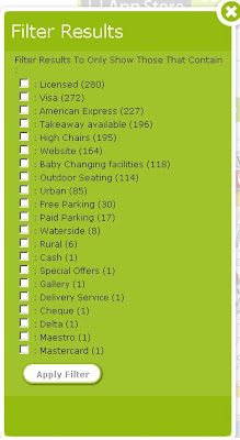
The unique feature here is in the filter options: Even the option to filter by payment.

Scoot Maps Filter

iPhone users will be happy to know there is a Free iphone app created by scoot.
http://www.scoot.co.uk/about-us/scoot-iphone-app.html
(maps and directions available) hopefully more mobile devices will be available in the near future.

Labels: , , , , , ,

05 June 2009

Bing Maps Silverlight - World Tour

Bing Maps Silverlight - World Tour

Bing Maps Silverlight World Tour

"Microsoft will announce the latest imagery updates to its Bing Maps platform, which for the first time, can all be viewed using the brand new ‘Bing Maps World Tour’ application. Just about every month, Microsoft adds tens of terabytes of new content to Bing Maps, bringing new locations to life and reinvigorating pre-existing areas with fresh, high resolution imagery. Now, thanks to Silverlight and Windows Azure technology"

To see a live example of this (silverlight plug-in required)
http://bingmapsupdates.cloudapp.net/

YouTube Video of it in action.


Source with thanks to:
Guy McGerr
www.webershandwick.co.uk

Labels: , , , ,

BBC Live Election Map (England & Wales) - June 2009

BBC Live Election Map (England & Wales) - June 2009

England & Wales Live Elections Map June 2009
Over the next day this map will change colours representing local elections results.
The Map is using live (confirmed and verified) data and is fully interactive based in flash.
Users can select their local county/authority and find more details on the results.

The Interactive Election Map (Flash required)
http://news.bbc.co.uk/1/shared/bsp/hi/elections/local_council/09/map/html/map.stm


Non-Map Link (A-Z Listing)
http://news.bbc.co.uk/1/shared/bsp/hi/elections/local_council/09/html/region_99999.stm

Labels: , , , , ,

03 June 2009

Bing Maps for Mobile (with directions)

Bing Maps for Mobile (with directions)

related update: Just released!
Bing Maps 3D -
http://tinyurl.com/Bing-Maps-3D
(though it is/was the same as Virtual Earth plugin just renamed)
source:
http://www.microsoftwindowsos.com/bing-maps-3d-has-been-released


Bing Maps for Mobile (Cell) Phone is now available with Driving Directions and Walking Directions.

Bing Maps for Mobile Devices
Clean and Simple -Very fast response for Mobile devices.


There seems to be a neat function that it takes traffic information and applies it to the outcome or at least a warning of possible delays.

It is possible to test this function on a normal web browser

Other features are available (weather, local information etc.) from http://m.bing.com/

here is the link

http://tinyurl.com/BingMapsMobile

Labels: , , , , , ,

02 June 2009

3D Open Street Map

3D Open Street Map (Via Google Earth plugin +kmz)

Open Street Map in 3D using Google Earth plug-in - Fort William
With the help of Google Earth Plug-in and a KMZ from OSM Wiki is is now easy to combine

Open Street Map in 3D using Google Earth plug-in - SW England
View anywhere in the World with Open Street Map coverage.

Go play. Look at http://mapperz.googlepages.com/OSM_3d_seemless_GE.html
Note:Tiles do cache via Google Servers parsing the kmz file and is heavy on the browser.

Credit to markus-bader.de for creating the kmz file.

Related Post:
http://googlegeodevelopers.blogspot.com/2009/05/hey-maps-api-and-earth-api-developers.html

Labels: , , , ,

01 June 2009

http://www.theukmap.co.uk/

http://www.theukmap.co.uk/

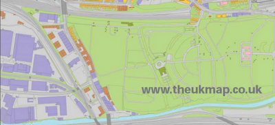
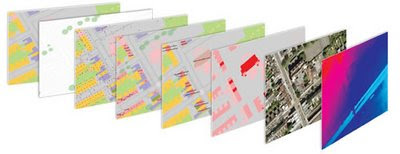
01/06/2009 - Press Release The GeoInformation Group Announces UKMap Programme New large-scale mapping for the UK "Cambridge, 1 June 2009: The GeoInformation® Group today announces a ground breaking and innovative new mapping programme. UKMap® is the UK’s first commercially funded, large-scale topographic mapping and address database created completely independently of the Ordnance Survey®. "UKMap is a modern, highly detailed, feature rich mapping database. It comprises of several map layers designed to be used as a single integrated geographic information database. UKMap layers include a 1:1,000 scale topographic map layer accurately locating all buildings, extensions, garages, property boundaries, roads, road markings, rivers, trees and many other features of our environment. Other layers include a location database holding addresses, commercial and retail names, building heights, tree heights, street names, government offices, and place names. In addition to these layers there is an aerial photography layer and a digital terrain model."

The UK Map

Is the data derived from the Ordnance Survey?
NO!
"No absolutely not. All the buildings, roads and all line work was digitised from our own aerial photography, and all the information collected in the field by our survey team was done so by writing down on our digitised maps everything they could see. The only piece of third party data that is within the UKMap database, and it is optional, is the Postcode"

Detailed Method for the digital mapping layers:
"Well first we use our latest high resolution aerial photography, all captured using a very advanced digital camera at 12.5cm resolution. The aerial photos are orthorectified using GPS and a very detail terrain model from our own Cities Revealed LiDAR database. This gives us a very accurate stereo aerial photo database from which we can digitise; the accuracies of our air photo database and the subsequent features we digitise have been tested and show absolute positional accuracies compared to independent GPS points of 0.7m RMSE (Root Mean Squared Error). We then digitise, using stereo pairs, all features we can see in the photo, such as fences, buildings, road markings, trees bridges etc. These are all digitised with some key tools so we ensure parallel lines, right angled corners and splines for curves. This all makes for a much neater, accurate and cartographically improved line map. The digitised maps are then printed and sent out to our field survey team who then walk every street, park, office complex in fact anywhere where there is public access to collect all the information we need and add that to our map, this includes house numbers, street names, shop names, locality information, office names etc. All this data is then complied into the UKMap database. "


UKMap is made up of the Topo product suite, comprising of 8 map layers, and the Thematic product suite, a 1:5,000 scale map layer with annotations for use on the web.

This is very good.TheUKMap Layers

Why use it?
Cost
  1. Cost Savings
    UKMap contains a number of data layers that you would normally pay extra for:

    • Addresses
    • Points of interest including retail and commercial data
    • BLPUs
    • Aerial photography
    • Terrain
    • Land Use
    • 3D buildings
Discover more on this at http://www.theukmap.co.uk/

Labels: , , , ,