Google Fusion Tables [Fast Batch Geocoding]
Google Fusion Tables [Fast Batch Geocoding]
"A fast an effective way to batch geocode spreadsheet data."

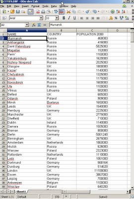
Take some data, with no geographic information. Upload to the New Google Fusion Tables and Map it.
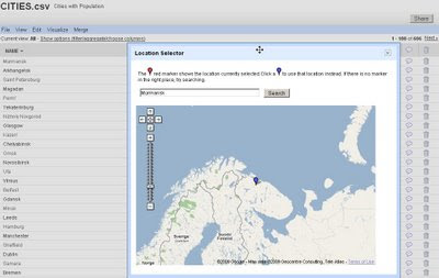
Some spot checking of data in location - as geocoding is not an exact science.

Simply import the data will then give you access to 'Map' the data.

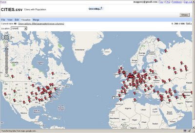
Then the real magic of automatic batch geocoding on the fly - you can visually see the data being placed on the map.
All within a few seconds - then whole process takes less than 30 seconds [based on 606 cities] though only 1-200 markers are display at one time.
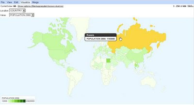
And to finish it off - it is easy to create a simple thematic map.

Suggestions, would be nice to be able to overlay the thematic map [based in flash] over the Google Map (or creating gpolygons).
Sharing with the option of embedding and link to would be convenient.
*Note currently in Google Labs things will change.
A nice tool with great potential has unique features and powerful visualization functions.
Summary
Google Chart meets Google Maps with Google Spreadsheets binding them.
Related
http://googlemapsmania.blogspot.com/2009/06/
google-fusion-tables-google-maps.html
Official Post
http://googleresearch.blogspot.com/2009/06/google-fusion-tables.html
Labels: Batch, Chart, fast, Fusion, Geocoding, Google, Map, Speadsheet, Thematic


4 Comments:
What about getting the geocoded data back into the raw format in the spreadsheet now? Yes the data is geocoded on the map, but it would be nice to get it back in the spreadsheet with lat/long values so you can use the data elsewhere. I suppose this would be fairly easy using the google maps api to loop through the points and get their lat/long values and insert into the spreadsheet, or is there an existing automated method for this?
If you want a down-loadable file to use yourself that has latitude and longitude then there are plenty geocoders available online.
example:
http://dev.paulcarvill.net/sandbox/geocode-spreadsheet/
source:
http://www.google.co.uk/search?q=spreadsheet+geocode
'never trust a geocoder'
You can also get the coordinates from the kml file.
route4me offers publicly available batch geocoding and reverse geocoding with file export capabilities.
Post a Comment
<< Home