OpenFlights - Route Mapping The World
OpenFlights - Route Mapping The World
OpenFlights is a tool that lets you map your flights around the world, search and filter them in all sorts of interesting ways, calculate statistics automatically, and share your flights and trips with friends and the entire world (if you wish). It's also the name of the open-source project to build the tool.

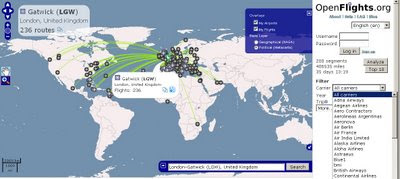
Search by Click the Icons on the Map or Airport Code, Airport Name or IATA Name- a very handy Aiport Map. Mapping base by OpenLayers
Note: Now, you can click on any airport and see every single scheduled flight:
Testing Stages:
OpenFlights has been going through Alpha, Beta and Gamma test phases, OpenFlights is now in its Delta phase: all core functionality is implemented, but development on new features continues. If you'd like to be informed about major updates to the site visit their blog
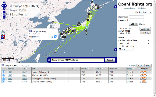
For easy access to this, we’ve added a Quick search widget, shown expanded above but normally hiding in the bottom-right corner under the ![]() icon. Here’s how to use it, in two easy steps:
icon. Here’s how to use it, in two easy steps:
- Enter the airport name, city or IATA code in the box. OpenFlights will automatically suggest matches as you type, and if the airport is already shown on the map, OpenFlights will pop it up.
- Once you’ve entered a valid name, the Search button becomes active. If you click on this, OpenFlights will load a route map showing all flights from that airport.
But there’s more! In the popup for every airport, there’s now a Routes ![]() button, which you can also use to see the map. If you click on the List
button, which you can also use to see the map. If you click on the List ![]() button for the mapped airport (via popup or the top left corner), you’ll get a list of all flights operating from there; if you click on that button for another airport, you’ll get a list of all airlines connecting the two, even including codeshares.
button for the mapped airport (via popup or the top left corner), you’ll get a list of all flights operating from there; if you click on that button for another airport, you’ll get a list of all airlines connecting the two, even including codeshares.
Source and Image:
http://openflights.org/blog/2009/06/26/route-mapping-the-world/
Visit the OpenFlights Route Map


