OS OpenData™ Consultation Government Response
OS OpenData™ Consultation Government Response
BREAKING NEWS
Ordnance Survey launches free downloadable maps
Move marks radical departure from previous OS financial model under which every piece of map data had to be paid for
What's Free?
- OS Street View http://www.ordnancesurvey.co.uk/oswebsite/products/streetview/
- 1:50 000 Gazetteer http://www.ordnancesurvey.co.uk/oswebsite/products/50kgazetteer/ [note: 1km resolution so dots ontop of each other]
- 1:250 000 Scale Colour Raster - http://www.ordnancesurvey.co.uk/oswebsite/products/250kraster/
- OS Locator http://www.ordnancesurvey.co.uk/oswebsite/products/oslocator/
- Boundary-Line http://www.ordnancesurvey.co.uk/oswebsite/products/boundaryline/
- Code-Point Open* - http://www.ordnancesurvey.co.uk/oswebsite/products/codepoint/
- Meridian 2 - http://www.ordnancesurvey.co.uk/oswebsite/products/meridian2/ [ROADS! and classified]
- Strategi http://www.ordnancesurvey.co.uk/oswebsite/products/strategi/ [Meridian2 better]
- MiniScale http://www.ordnancesurvey.co.uk/oswebsite/products/miniscale/
- OS VectorMap District* (available 1 May 2010)
- Land-Form PANORAMA http://www.ordnancesurvey.co.uk/oswebsite/products/landformpanorama/ [an old DTM needs cleaning up but can be useful if polygonised]
source:
http://ernestmarples.com/blog/2010/03/government-response-to-ordnance-survey-consultation-published/
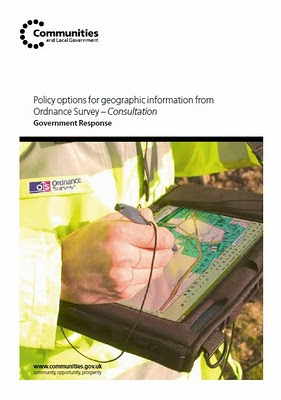
Release of data for free
In response to this support, government will release a range of Ordnance Survey data:
on 1 April 2010, known as OS OpenData™.
The datasets to be released are those set out in the original consultation document as the Free package, with the following changes:
• replacement of 1:25 000 and 1:50 000 Scale Colour Raster products with OS VectorMap District
• addition of OS Locator™ and Land-Form PANORAMA to the product list
• replacement of Code-Point by Code-Point Open, which provides accurate locations for 1.7 million postcodes in England, Scotland and Wales.
@mapperz
Straight to the PDF
http://www.communities.gov.uk/documents/corporate/pdf/1528263.pdf
Live links tomorrow!
Happy Mapping... and downloading from
http://www.ordnancesurvey.co.uk/oswebsite/opendata/ (1st April 2010)
Labels: 2010, April, Changes, Consultation, Government, OS OpenData, Response
posted by Mapperz @ 9:00 pm
0 comments





