->

23 August 2010

Spatial Data Viewer on Bing Maps App

Spatial Data Viewer on Bing Maps App

View
  • ESRI Shapefiles (.shp & .dbf files) [best under 300k]
  • GeoRSS Feeds (.xml with lat & lng)
  • Well Know Text (WKT)
Known as Ricky's Data Viewer
Bing Maps Shapefile Viewer
Loaded Shapefile (World Countries) in the Data Viewer using 'select shapefile' option, .dbf if your want to see attributes (table data).

Bing Maps Viewing GeoRSS Feeds
GeoRSS (.xml) recent earthquakes feed from (USGS)

Full list of Bing Maps Apps.

Labels: , , , , ,

23 July 2010

ESRI Shapefile - HTML5 Viewer


ESRI Shapefile - HTML5 Viewer

This is a neat way to display ESRI Shapefiles online without using any GIS software.
(Note: Not compatible with Internet Explorer)
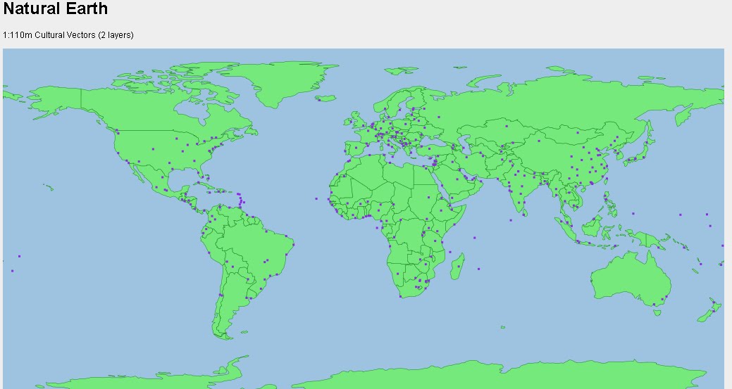
Shapefile HTML Viewer loaded
Two shapefiles are displayed here cities of the world and associated text along with Countries of the World with a line style and  polygon fill style.

Notes: Keep shapefiles as small as possible, smaller shapefiles returns faster display results.
Faster than ArcIMS in some cases. But depends on the hosting server.


Shapefile HTML Viewer Mapperz
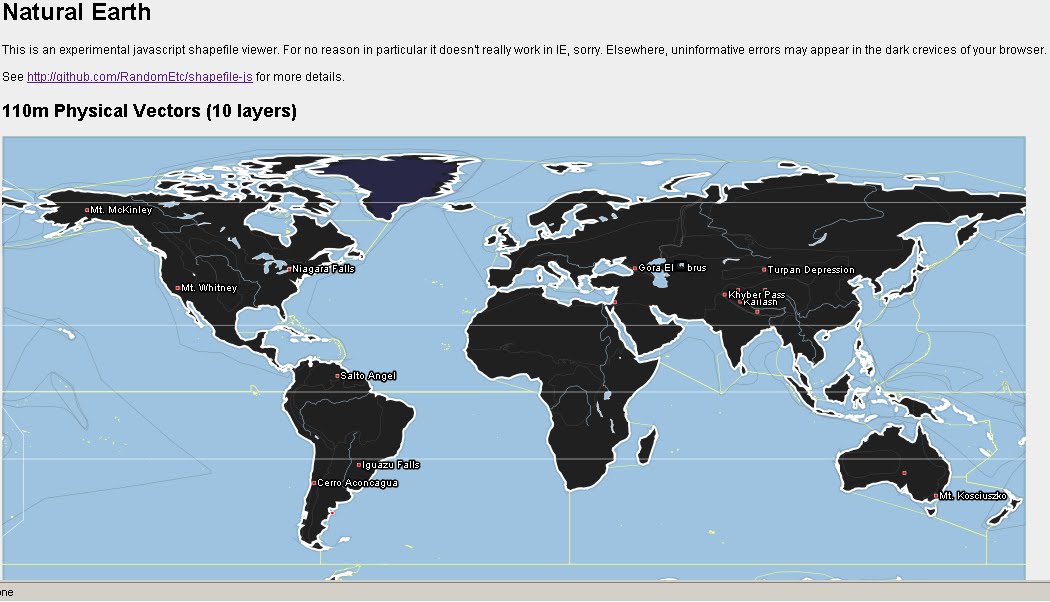
Mapperz Version, styles and fills changed, though seems slower, compare the difference.

The two files required are the .shp (geometry in lat/lng WGS84) and the .dbf (Table)
var map = new Map('map', [
    // country shapes
    new Layer('http://mapperz.110mb.com/shape/110m_admin_0_countries', 
{ fillStyle: '#76e97c', strokeStyle: '#18841D', lineWidth: '0.5' }),
    // dots for cities
    new Layer('http://mapperz.110mb.com/shape/110m_populated_places',
 { fillStyle: '#8A2BE2', /*textHalo: '3', textStroke: 'white',*/ textFill: 'rgba(255, 0, 0, 0.6)', 
textProp: 'Name', font: 'bold 9px sans-serif' })

  ]);
  Links [source code:]

More complex version involves 10 shapefile layers.

Labels: , , , ,

19 November 2008

CloudMade Web Lite API (pre Alpha)

CloudMade API (pre Alpha)

"Our [CloudMade] aims are to continue the democratization of geo data and to expand access to open geo data through a range of simple yet powerful tools and APIs."

CloudMade Web Lite API
Early Days but looking promising in the 'lite' way to get web mapping on your site without the large restrictions other mapping api's have.

Now there is two Mapping API's that are in early stages of development.

Web Lite - API
http://www.cloudmade.com/products/web-maps-lite

Features:
  • Take advantage of the most up-to-date source of map data on the web
  • Benefit from the rich OpenStreetMap dataset, with features such as footpaths and cycle paths that are not found on other online maps
  • Be free from restrictive licensing - use our maps for routing, real time tracking and as a basemap to derive new layers
Mobile Maps API*
http://www.cloudmade.com/products/mobile-tiles
Features:
  • Create applications for mobile devices that use CloudMade's mobile optimized maps
  • Benefit from the rich OpenStreetMap dataset, with features such as footpaths and cycle paths that are not found on other online maps
  • Take advantage of the most up-to-date source of map data on the web
*untested by Mapperz currently

Examples:

Try the drag marker with panning and zooming functionally added.
http://mapperz.googlepages.com/cloudmade_web_lite_api.html


speed test onload: 0.85 milliseconds (YSlow!)

To test it - Mapperz used the OSM data in Virtual Earth as a comparison
http://mapperz.googlepages.com/osm_in_VE.html
speed test onload: 1.25 milliseconds (YSlow!)

Yes currently the bigger API's have more functionality but their Terms restrict in what you can and cannot do with your mapping, so the future for a lightweight Mapping API is looking good.

Web Maps Lite API is currently in 'closed pre-Alpha'
Let's look forward to a Public Beta.

Though you can view the Official Step-by-Step Examples
http://www.cloudmade.com/products/web-maps-lite/examples/1

Another good move by Cloudmade is the OSM data

"This is where you can find extracts of maps from different places around the world. From here you can download:"

  • OSM XML extracts by country
  • Garmin Map Files (OSM.err edition)
  • Osmosis country bounding polygon
  • Shapefile extracts by country
  • Navit maps by country
  • GPX POI by country
  • TomTom POI by country
  • OSM XML feature extracts by country
http://downloads.cloudmade.com/

Labels: , , , , , , ,

17 September 2008

Open Street Map in Shapefile Format!

Open Street Map in Shapefile Format

For more information on progress this see blog.
http://itoworld.blogspot.com/

This is top news for GIS users who support Open Street Map, there is no longer any need to convert the osm.bz2 to shapefiles as it is supplied in shape format now.
Open Street Map Data Shapefile Ready - directory listing
Directory Listing now with Shapefiles

This saves time (and money)

Open Street Map as Shapefiles - no converting
Extracting Footpaths - No conversion needed only re-projecting the data for the UK into British National Grid.

Full Directory
http://download.geofabrik.de/osm/
(updated daily)

Well Done to the
http://www.geofabrik.de/ Team

To Do:
OSM has already got export to EPS,PDF,Postscript, JPEG,PNG,GIF
(see previous post)

http://mapperz.blogspot.com/2008/04/openstreetmap
-now-exports-maps.html

http://mapperz.blogspot.com/2008/04/openstreetmap
-data-in-globalmapper-fast.html (not needed now?)

TO DO: (fictional to-date)
Load into a File Geodatabase
Check Attribution (Q&A)
Build Topology - Clean Data (snapping linework)
Build Network (checking phase) export to SQL
Routing (via Postgres and PG Routing)
Create Buffering Routes - find my nearest... (pub on my footpath route)
(load into an online mapping api and have UK footpaths route-able!)

source:http://freegeographytools.com/

Labels: , , , ,

30 April 2008

OpenStreetMap Data in GlobalMapper - Fast!

OpenStreetMap in Global Mapper 9.0.3 - Fast!
OpenStreetMap (OSM)data to Shapefile using GlobalMapper v9.0.3
OpenStreetMap Data (.osm) can now be loaded directly into GlobalMapper.


Global Mapper has had an update (now GlobalMapper v9.0.3)


You would think that this is a minor thing, but there have been some very interesting additions

OpenStreetMap (OSM) data in ArcGIS from GlobalMapper v9.0.3
This is the Export from Global Mapper with the OSM Data - Full attribution has been preserved.
**This can be automated and projection assigned.

This method makes it very fast to get data from OpenStreetMap into ArcMap where edit and additonal attribution can be done.

What New? (Mapperz top picks)

  • WHAT'S NEW IN Global Mapper v9.03
    Added support for loading Tiger 2007 Shapefiles with full attribution and automatic styling and type assignment from http://www.census.gov/geo/www/tiger/tgrshp2007/tgrshp2007.html
  • Added support for loading Vulcan3D triangulation files.Added support for exported loaded gridded elevation data to Vulcan 3D triangulation (.00t) files.
  • Added support for loading OpenStreetMap (OSM) format vector maps.
  • Added support for loading NITF data sets using JPEG2000 compression.
  • Added support for exporting loaded point features to TomTom OV2 format files for creating new point databases for loading onto TomTom GPS devices.
  • Added option to KML/KMZ vector export to make labels for line and area features display on the map in Google Earth.Added option when generating elevation grids from vector data to ignore zero elevation values.
  • Added new option to the File menu of the rectification dialog to allow easily saving a world file that represents (if possible) the transformation defined by the currently provided control points.
  • Added yards and chains as available units of measure when using the Measure Tool.
  • Improved accuracy of OSGB36 datum conversions by using the OSTN02 tables.
  • Made Bonne projection work properly when the origin latitude is in the Southern Hemisphere.
  • Added support for decoding Albers Conic projections from Ozi .map files.
  • Added support for correcting the projection of multiple raster files at once (only if all of the raster files being corrected have the same projection to start with).
  • Fixed problem with displaying the equator grid line when using the Van der Grinten projection.
  • Fixed problems encoding and decoding Lambert Cylindrical Equal Area projection to/from GeoTIFF files.
  • Added option to the Shader Options tab of the Configuration dialog to reverse the color order of the selected shader (previously only the HSV shader was reversible).Added support for reading the track style information written to GPX files by the ExpertGPS software application.

http://www.globalmapper.com/

OpenStreetMap (Planet OSM)

http://wiki.openstreetmap.org/index.php/Planet.osm

Data (Index of)

http://planet.openstreetmap.org/

**Check dates

Labels: , , , , ,

14 April 2008

Shapefile Overlay in Virtual Earth

15/04/2008
The Official Virtual Earth Blog picked up the this post and there 'maybe' potential for Virtual Earth to support ESRI Shapefiles in future edtions of Virtual Earth...(v6.2 please).
Read the post.
http://virtualearth.spaces.live.com/blog/cns!2BBC66E99FDCDB98!14450.entry
(add a comment to include this support)

Shapefile Overlay in Virtual Earth


A nice little application to display ESRI Shapefiles in Virtual Earth (Live Maps)

Highlight - Load from your local drive - takes a few moments.
**Your data needs to be in WGS84 for this to work correctly.

Virtual Earth Overlay Shapefiles
London Low Emissions Zones (LEZ) Shapefile was projected from British National Grid to WGS84.

Virtual Earth Overlay Shapefiles - Zoomed in
When you zoom in the detail is maintained, zoom out an a automatic poylgon generalisation is preformed on your data in the display.

Virtual Earth Overlay Shapefiles - 3D Mode
Your data can be rasterised 'on thefly' so it can be shown in 3D in Virtual Earth (Plugin required)

Suggestion - A Legend, possible to select your own colours.
A simple "6.1" on the end of the javascript code will update it to VE 6.1 (more functions)
"http://dev.virtualearth.net/mapcontrol/mapcontrol.ashx?v=6.1"


A progess bar when uploading from shapefile - FireFox can bail out with an error.

Select .shp only on upload - .dbf and .shx need to exist for a shapefile. Select.zip?

Load .avl or .lyr for thematic maps?

But other than that - if you want to view data in VE quickly then is a good method.

Well done to JuanDoNeblo & Marco Anastasi

source code see the code and details on how this was achieved.
http://geekswithblogs.net/JuanDoNeblo/Default.aspx

Mapperz

Labels: , , , , ,

01 April 2008

Tiger 2007 Data Release (ESRI Shapefile)

Tiger 2007 Data Release (ESRI Shapefile)


Finally in a much more 'user friendly' format.... Tiger 2007 Data Direct ArcMap
A very quick example of Tiger 2007 in ArcMap - No editing, labels direct from the downloaded files.
Very useable.

"The TIGER/Line Shapefiles are extracts containing selected geographic and cartographic information from the Census Bureau's MAF/TIGER® (Master Address File / Topologically Integrated Geographic Encoding and Referencing) database. The MAF/TIGER database was developed at the Census Bureau to support a variety of geographic programs and operations including functions such as mapping, geocoding, and geographic reference files that are used in decennial and economic censuses and sample survey programs. Spatial data for geographic features such as roads, railroads, rivers, and lakes, as well as legal and statistical geographic areas are included in the product. Other information about these features, such as the name, the type of feature, address ranges, and the geographic relationship to other features, also are inlcuded. The TIGER/Line Shapefiles are made available to the public and are typically used to provide the digital map base for a Geographic Information System or for mapping software.

The 2007 TIGER/Line Shapefiles contain current geographic areas (boundaries of governmental units as of January 1, 2007) and Census 2000 vintage geography. The shapefiles also contain some additional post January 1, 2007 feature updates reported in the Boundary and Annexation Survey (BAS). The 2007 TIGER/Line Shapefiles contain realigned street feature coordinates as a result of the MAF/TIGER Accuracy Improvement Project. The Census Bureau is providing a list of counties that have not been realigned via the MTAIP process."

http://www.census.gov/geo/www/tiger/tgrshp2007/tgrshp2007.htm


Metadata Notes
The 2007 TIGER/Line metadata in Extensible Markup Language (XML) format is included with each compressed TIGER/Line Shapefile.

The Spatial Metadata Identifier (SMID) in the All Lines shapefile identifies the source of the coordinates for each line segment and provides the link between the TIGER/Line Shapefile and the source and horizontal spatial accuracy information. Please note that the horizontal spatial accuracy, where reported in the metadata, refers to the realigned street features identified as matched to a positionally accurate source file with that accuracy. Individual feature-based horizontal spatial accuracy does not apply to the entirety of the TIGER/Line Shapefile.

The North American Datum of 1983 was used in the 48 contiguous states, the District of Columbia, Alaska, Hawaii, (only Oahu Island within Honolulu County, HI (15003)), Puerto Rico, the Virgin Islands of the United States, and the Pacific Island Areas. Even though a NAD83 PRJ file will accompany every TIGER/Line Shapefile, there are a few island areas in TIGER that have not gone through the NAD83 transformation process and are still in local astronomic datums. For detailed information regarding these exceptions please refer to the metadata that is included with each TIGER/Line Shapefile.

DIRECT TO THE DATA


or FTP SITE

Labels: , , , ,

08 October 2007

4D Data in ArcGIS Explorer

4D Data in ArcGIS Explorer - Timeline

"Time Navigator can animate any ESRI Shapefile with point geometry and a timestamp field. The timestamp fields can be date, numeric or textual. Time Navigator is developed as a custom task for ArcGIS Explorer build 410 and can be downloaded from downloaded from ArcScripts (source code is included)." mrrichie


Source: Ogle Earth

Labels: , , , ,