->

01 February 2010

FREE the PostZon (UK Postcode Data)

From the Free Our Data Blog:

A new No.10 petition: FREE the PostZon and help innovate the UK Geo-spatial industry

(We are in 21st Century now aren't we?)

Mark Goodge added this as a comment to the data.gov.uk post, but it seems worth making more visible. So here it is:

This is not asking for Full Postcode (PAF) data but This is about Ordnance Survey's data, not Royal Mail's -- so it won't affect PAF, but it will affect postcode coordinate data.

"Postzon™ data allows you to link geographic and administrative data from government bodies, such as local authorities and the NHS, for all known Postcodes in the UK. Use it to help plan routes, calculate distances between Postcodes, allocate sales force areas, distribute resources or locate facilities."

http://www.royalmail.com/portal/rm/jump2?mediaId=400088&catId=400084

Without this, UK mapping innovation will be quashed.

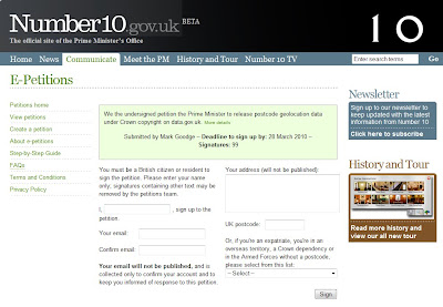
Number10 Geolocation Postcode Petition

http://petitions.number10.gov.uk/geopostcode/ requires your input 28 March 2010 deadline (note: OS Consultation period deadline is 17th March 2010).

“While the launch of data.gov.uk is a big step in the right direction, the government’s response to the petition inspired by the forced closure of ernestmarples.com has been pathetic. As a consequence, I’ve created a new petition which seeks to focus more tightly on the Postzon data (the data use by ernestmarples in their API)." This can be found at http://petitions.number10.gov.uk/geopostcode/

http://ernestmarples.com/blog/

http://www.freeourdata.org.uk/blog/2010/01/a-new-no-10-petition-free-postzon/

Help free the data that was paid for by the public (UK tax payer)...

Labels: , , , , ,

16 September 2009

ALL 1,841,177 UK POSTCODES FREE'D?

ALL 1,841,177 UK POSTCODES FREE'D?


Example of UK Individual Postcodes

Example of UK Individual Postcodes (density)
image source:

http://da.vidnicholson.com/2006/12/uk-postcode-coverage-map.html


According to the Guardian:

"Wikileaks is hosting what it says is a copy of the entire UK postcode list, last updated on July 8 2009, that contains "all 1,841,177 UK post codes together with lattitude [sic] and longitude, grid references, county, district, ward, NHS codes and regions, Ordnance Survey reference, and date of introduction. The database ... is over 100,000 pages in size."

The 230MB file, zipped to 20MB, does indeed contain a huge slew of postcodes in comma-separated form, with those details as headers for each column.

Oh my. We have no idea who has leaked this, but it is the gateway to some valuable information: Royal Mail, as we ascertained previously in the Free Our Data campaign, sells the Postcode Address File (aka PAF) for a considerable sum, and makes a good profit on it: in August 2007 the postal regulator Postcomm revealed that PAF operations made a profit of £1.58m on revenues of £18.36m, all but £4m from resellers."

Data seems to be

Postzon™

"links Postcodes and addresses to geographical data"

http://www.royalmail.com/portal/rm/jump2?mediaId=400088&catId=400084

so there is a licence cost:

System licence £1,000
Multi-system licence £3,000
Corporate licence £25,000

Full story:

http://www.guardian.co.uk/technology/blog/2009/sep/16/wikileaks-postcode-file-free-data

More information on UK Postcodes

http://en.wikipedia.org/wiki/Postcodes_in_the_United_Kingdom

If you want a non-derived Royal Mail/Ordnance Survey and Free Postcodes without an annual licence.

http://www.freethepostcode.org/currentlist


Labels: , , , , , ,

17 November 2008

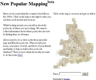
Open Source Postcode Map (UK)

Open Source Postcode Map (UK)

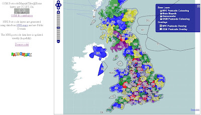
Open Source Postcode Map

Postcodes have been created using New Popular Edition (NPE) Maps
http://www.npemap.org.uk/

The NPE postcode data here is updated weekly.

The Current List
http://www.npemap.org.uk/data/currentlist
Full List
http://www.npemap.org.uk/data/fulllist


View the Open Source Postcode Map for the UK

most recent postcodes added:
You can help whilst you view the map...

"Whilst looking around, you can tell us about the postcode of where you are looking. We want to collect information about where postcodes are now by finding them on old maps."

Related:
http://www.freethepostcode.org/

Labels: , , ,

19 May 2008

Yahoo! Internet Location Platform (New Geocoder)

Yahoo! Internet Location Platform (New Geocoder) New!

"The Yahoo! Internet Location Platform provides a resource for managing all geo-permanent named places on Earth. The purpose in creating the Internet Location Platform is to provide the Yahoo! Geographic Developer Community with the vocabulary and grammar to describe the world's geography in an unequivocal, permanent, and language-neutral manner.

The Internet Location Platform is designed to facilitate spatial interoperability and geographic discovery; users can traverse the spatial hierarchy, identify the geography relevant to their users and their business, and in turn, unambiguously geotag, geotarget, and geolocate data across the Web."

Basically this is a Geocoder for Places across the World. The accuracy is fairly precise and the easy to understand.

Here is an example:
http://where.yahooapis.com/v1/places.q('10%20downing%20street%20london%20uk')

and also you can geocode UK Postcodes - full UK Postcodes!

http://where.yahooapis.com/v1/places.q('SW1A2AA')
*link fixed
Yahoo Where Geocoder
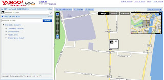
Centroid is the postcode centre. So 51.503201, -0.12617

Checking... on the map.

Yahoo Where Geocoder Map

http://developer.yahoo.com/geo/

Rate Limits
Currently, users of the Internet Location Platform are limited to 50k queries per day.

Terms of Use (Please check this if you intend using this service with other non Yahoo Applications)
http://info.yahoo.com/legal/us/yahoo/api/api-2140.html

Geeky Stuff

"In simple terms, the Service allows you to look up the unique identifier - called the Where on Earth ID, or WOEID - for almost any named place on the Earth; it also allows you to resolve a WOEID you have received from a third party - such as Fire Eagle™ or Upcoming - to the place it represents.

The API is accessed via HTTP GET; the following examples can be cut-and-paste into a web browser to view the results:"
http://developer.yahoo.com/geo/

Mapperz

Labels: , , , , , ,

01 February 2007

UK Geocoder Maps - Postcode and Street Addresses

Mapperz has requests after requests on UK Geocoding Postcodes and Addresses for the UK.

Using Google Maps API and Local Search Two Geocoders have been created

Please use the Official Method.
http://gmaps-samples.googlecode.com/svn/trunk/geocoder/singlegeocode.html

Local Search Example
http://geo.localsearchmaps.com
http://geo.localsearchmaps.com/?street=48+Leicester+Square&
city=London&country=UK
returns
map.centerAndZoom(new GPoint(-0.130427, 51.510036), 4);

Mapperz just returns the GPoint on a Google Map and displays the center of the map

Top Tip: is you can zoom in after the result is returned to display your Postcode or Address locations.

Note: This is only using data freely available on the Internet.

Other Geocoders are available

US Geocoder

Yahoo

InfoSports
Manual Geocoder

Batch Geocoder

Related:
ASK City Supports Reverse Geocoding

Simple Geocoding using Google Maps

3D Geocoding (Microsoft Live Local)


Geocoding Via Google AJAX Searches

Labels: , , , , ,

09 November 2006

Local Live does.... 3D Geocoding of UK Addresses

Mapperz reported back in August 2006 about UK Geocoding using Local Live and the permalink feature. This contains the Longitude and Latitude of the Centre of the Map.

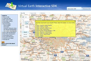
UK Geocoding LIVE Local Virtual Earth

Now it is possible using the Virtual Earth SDK

Virtual Earth SDK
No live examples for the UK to date.

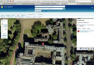
But here is a UK first, Geocoding Addresses in 3D using Virtual Earth 4

"10 Downing Street, London, UK"

simply enter the parameters:
http://local.live.com/?where1=10+Downing%Street+London+UK
then click permalink under Share>View Permalink
this creates a url:
http://local.live.com/default.aspx?v=2&cp=51.503391~-0.127411
&style=r&lvl=14&tilt=-90&dir=0&alt=-1000

notice the updated format that now contains longitude, latitude, zoom level, tilt, direction and altitude
So where is the geocoding in 3D?

Mapperz tried this in IE7 with the VE4 plugin pre-installed
http://local.live.com/default.aspx?v=2&cp=51.503391~-0.127411
&style=r&lvl=14&tilt=-25&dir=45&alt=500

so what if we parse the address with the 3D information will it work?

enter in local live
http://local.live.com/?where1=10+Downing%Street+London+UK
&style=r&lvl=14&tilt=-25&dir=45&alt=500
then click hybrid mode

produces 3D UK Geocoding

Geocoding UK Addresses in 3D in Virtual Earth

Labels: , , , , ,

27 October 2006

Free UK Postcode Database Start Up

Out of Copyright Ordnance Survey Maps (from 1950's tiled together)
England and Wales to help produce Postcode Lite

Copyright Free Ordnance Survey Maps

Add your postcode to by clicking on the map to help produce a free postcode database.

3 done, only 1.8 million postcodes to go.
(and no cheating!)

update: from the Guardian

Labels: , ,