Testing the N82 with Sports Tracker (Beta)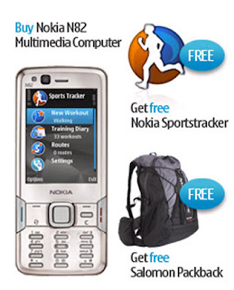
Mapperz goes testing....N82 Sports Tracker (Beta) and Nokia Maps (phone, sports tracker software and bag generously supplied by WOM World)
http://www.womworld.com/nseries/category/n82/Not going to go into details of build quality, looks or if it makes phone calls. There are plenty of other sites doing this.
Gets Go!
Sports Tracker enables the user to log or track your progress, it displays a pace, speed, altitude etc.
Official Full Details
http://research.nokia.com/research/projects/SportsTracker/Sport Tracker Beta Site
http://sportstracker.nokia.com/nts/main/index.do (login required to use the service Free)
Mapperz coverage of the Sport Tracker Beta (previous post)
http://mapperz.blogspot.com/2007/11/nokia-sports-tracker-beta-map.htmlIntegrated GPSGet as quick fix with the assistance of:
BlueTooth GPS (not needed)
A-GPS on
Integrated GPS on
Network Based on
Access point
GPRS (check default as will use WAP which is more expensive)
nokia server for A-GPS
supl.nokia.com
WOM wanted Mapperz to test out.
"Testing the sports trackers ability to track journey routes, along with other info regarding altitude, distance etc would be really interesting!"So here is a train journey...
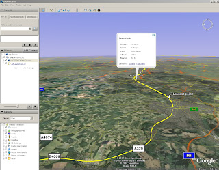
A tracking issue or gps issue?
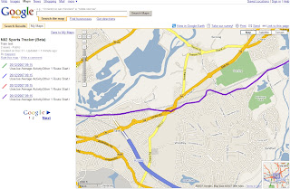
Think the issue here is that the GPS and lack of 'field of view' to the sky.
A 'wobble' in the tracking - due a high filter correction method as default?
here is an interesting article
http://wubbahed.com/2007/07/12/gps-quality-on-the-n95/Highlights the GPS being 'hyper-active' (note this was from an N95 with firmware updates)
The N82 seems better than the N95 for 'gps filtering'
Maybe there is a call for the A-GPS to be active on startup with an option to disable it on tracking mode (unless within an urban area). This should create a smoother tracking line.
Improvements: that could make this the perfect mobile map device:
- Nokia please add the Nokia maps (map data) to the sports tracker. Not the navigational functions just the base map. (Mapperz has done this via Nokia Feedback). This would improve the usefulness of the application beyond 'tracking'.
- Automatic screen rotation option to switch it off. Walking briskly with it in hand for using it in Nokia Map mode was jumping into landscape mode.
- Ghost Tracking - where a previous track can be overlaid, very useful to runners, walkers etc would like to do the same routes in part of their routine.=
- Imperial/Decimal Mode but with the option of Meters in Height (UK distance in Miles but UK height in Meters)
Spot the difference between Sports Tracker and Nokia MapsNoticed when in Nokia Maps - the 'tracking' would snap to roads running along next to the railway. But the Sport Tracker did not.
This is a small issue - there must be some sort of rank - Motorways more important than Rail or A Roads on the Vector Map Data.
Have noticed that when going over a bridge going over a motorway/primary route the cursor snaps the major road rather than the road your are on.
N82 v N95Not an easy one but there are improvements in the N82 over the N95.
Start up is faster & less crashing when running multiple applications
Camera Flash at night is much better on the N82 by miles.
Battery life has improved on the N95 (even after firmware v20).
But the N82 battery seems to go further than the N95 by about 6 hours (general use).
Screen size is a little smaller than the N95 but in general not any less functional.
It's slightly cheaper
If you want go for an unlocked N82 for 2008.
Test a N82 (limited places left)
http://www.nseries.com/index.html?l=campaigns,n82,demand#l=campaigns,n82,demandIf buying it - its worth getting directly from here at £399 +£3.99 standard delivery.
(you get a free bag.)
http://shop.nokia.co.uk/nokia-uk/product.aspx?sku=3759722§ion_id=530&culture=en-GBClincher - N82 with TomTom - in Car
The N82 is a better navigational device for getting around London against the TomTom
XL Europe. why?
TomTom data was out of date and 'drop out' from GPS mode in between high buildings.
N82 had up to date data and no drop out was noticed (A-GPS and cell based positioning was on)
Full Spec of the N82 in depth.
http://www.gadgetnutz.com/modules/news/article.php?storyid=00420Yes you can make and receive phone calls to.
Thanks to WOM World for the chance to test the phone and sports tracker.Labels: Beta, GPS, Mapperz, N82, Sports Tracker, Test, WOM