140,000 miles of African Roads into OpenStreetMap
140,000 miles of African Roads into OpenStreetMap (more to come too)
OpenStreetMap[Africa] is having a huge boost of data from http://www.africover.org/
"We just finished uploading 141,107.17 miles (67 MB) of road data for Congo DRC, Tanzania, Sudan, Kenya, Burundi, and Rwanda"
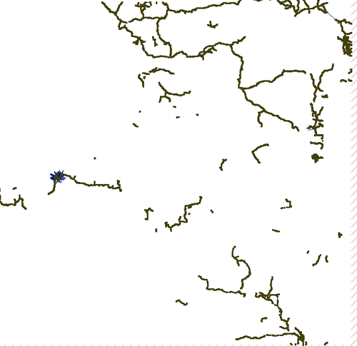
"OSM will play a crucial role in some of our upcoming mapping projects and these additions make significant improvements to the coverage, especially in rural areas. The data should go live sometime in the next several days. Here is a look at the country maps, before and after this work."

Congo DRC before

Congo DRC After
Image sources: http://www.developmentseed.org
As shown above, they have imported new street data for six countries.
Thanks to Africover and DEPHA, they have street layers for five other countries and will be adding them to OSM in the coming weeks.
Keep and eye on
http://www.openstreetmap.org/?lat=7.4&lon=15.7&zoom=3&layers=B000FTF
(available in a few days time) - Zoom in and see the huge amount of difference this will make.
For more thanks and detailed stats and images on this please visit
http://www.developmentseed.org/blog/2009/apr/22/thousands_of_miles_added_open_street_map
How Geospatial should be made available everywhere in the world.
Mapperz
OSM data related:
http://mapperz.blogspot.com/2008/02/tiger-tiger-openstreetmap.html
real-time updates on #osm (twitter)
Labels: 000, 140, Africa, Data, Impo, Open Street Map, Roads


0 Comments:
Post a Comment
<< Home