->

18 February 2010

New Google Maps domains in 29 African Countries

New Google Maps domains in 29 African CountriesGoogle Maps Ghana
Example Ghana Google Maps - http://maps.google.com.gh/ in Beta

Google Maps users can now find local businesses, towns, highways, or roads. This could be a burger place in Lagos, a garage in Kampala, a hairdresser in Accra or an airport shuttle in Dakar. Any business anywhere can add their own business listing for free via the Google Maps Local Business Centre.

South Africa gets its own mobile site - http://www.google.com/intl/en_za/mobile/

The active list so far: 18 of 29...

http://maps.google.co.ke/ Kenya
http://maps.google.com.na/ Nambia
http://maps.google.com.ng/ Nigeria
http://maps.google.com.et/ Ethiopia
http://maps.google.com.sl/ Sierra Leone
http://maps.google.cg/ Congo, Republic of,
http://maps.google.ci/Côte d'Ivoire
http://maps.google.dj/ Djibouti
http://maps.google.ga/ Gabon
http://maps.google.gm/ The Gambia
http://maps.google.com.gh/ Ghana
http://maps.google.mw/ Malawi
http://maps.google.sn/ Senegal
http://maps.google.co.mz/ Mozambique
http://maps.google.co.bw/ Botswana
http://maps.google.co.tz/ Tanzania
http://maps.google.co.zm/ Zambia
http://maps.google.co.zw/ Zimbabwe

Source:
http://google-africa.blogspot.com/2010/02/new-maps-domains-in-29-african.html

Google Maps API Geocoder now uses the Localised versions
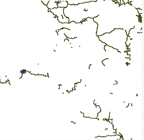
Example Ghana (Major Roads, MapMaker Additions)
Please use the Google Spreadsheet for more countries covered.
http://gmaps-samples.googlecode.com/svn/trunk/mapcoverage_filtered.html

@Mapperz

Labels: , , , , , ,

18 August 2009

Google Maps News - Street View & Map Maker

Google Maps News - Street View & Map Maker

update:19/09/09
Mexico is now available for Map Maker - please see the official blog post
http://google-latlong.blogspot.com/2009/08/map-maker-goes-west.html

StreetView has been expanded again this now covers
Switzerland and Portugal and also Taipei City in Taiwan

New Street View Chapel Bridge, Lucerne
Chapel Bridge, Lucerne with new Streetview coverage.

Google Maps Mania does a very good round-up of the coverage included
http://googlemapsmania.blogspot.com/2009/08/street-view-arrives-in-switzerland.html


Google Map Maker has been opened up some more with download-able vector data available for Africa [Terms of Use Apply]. This is either in KML format or Shapefile.

On the Mapmaker creation side Eastern Europe has now been opened up for editing.
This includes Albania, Belarus, Kosovo, Macedonia, Moldova, Montenegro, Romania and Serbia.
More news on this here
http://google-latlong.blogspot.com/2009/08/map-maker-gets-european-flair.html

Map Maker Africa Download
This data can be obtained by accepting the terms of use at this link
https://services.google.com/fb/forms/mapmakerdatadownload/
This data can be used in a GIS or Google Earth Application.

Labels: , , , , , , , ,

03 August 2009

Cloudmade: Directions Africa Cape Town to Ethiopia

Cloudmade: Directions Africa Cape Town to Ethiopia

OpenStreetMap gets a boost with capable directions now across Africa


Africa Directions from Cape Town to Ethiopia click 'Hide' view the map route on the map.

view the url:
http://maps.cloudmade.com/?lat=-9.622414&lng=11.25&zoom=3&directions=-33.914731015167575,18.423986434936523,
3.5024553022772564,39.056396484375&travel=car&styleId=1

Other Cloudmade news
http://blog.cloudmade.com/
CloudMade partners release new mobile libraries

Raster Libraries

Vector Libraries

Nutiteq have long been a trusted CloudMade partner providing mobile libraries. They have now added CloudMade support for two leading mobile platforms - Blackberry and Android. Blackberry commands a high worldwide market share for smart phones and is the leading platform for email and enterprise. Google’s Android has set a new bar for open source mobile OSes, and we expect a number of new handsets to come to market during the remainder of this year. Both libraries give access to a full range of CloudMade services including custom image tiles, geosearch and routing.

Labels: , , , , ,

23 April 2009

140,000 miles of African Roads into OpenStreetMap

140,000 miles of African Roads into OpenStreetMap (more to come too)

OpenStreetMap[Africa] is having a huge boost of data from http://www.africover.org/

"We just finished uploading 141,107.17 miles (67 MB) of road data for Congo DRC, Tanzania, Sudan, Kenya, Burundi, and Rwanda"

"OSM will play a crucial role in some of our upcoming mapping projects and these additions make significant improvements to the coverage, especially in rural areas. The data should go live sometime in the next several days. Here is a look at the country maps, before and after this work."


Congo DRC before
Congo DRC before


Congo DRC After
Congo DRC After

Image sources: http://www.developmentseed.org

As shown above, they have imported new street data for six countries.
Thanks to Africover and DEPHA, they have street layers for five other countries and will be adding them to OSM in the coming weeks.

Keep and eye on
http://www.openstreetmap.org/?lat=7.4&lon=15.7&zoom=3&layers=B000FTF
(available in a few days time) - Zoom in and see the huge amount of difference this will make.

For more thanks and detailed stats and images on this please visit
http://www.developmentseed.org/blog/2009/apr/22/thousands_of_miles_added_open_street_map

How Geospatial should be made available everywhere in the world.
Mapperz

OSM data related:
http://mapperz.blogspot.com/2008/02/tiger-tiger-openstreetmap.html
real-time updates on #osm (twitter)

Labels: , , , , , ,

24 August 2007

Statris - Map Game

Friday Fun - Map Game Stratris

Like Tetris but with geographical regions as blocks and your knowledge of these different regions.


Africa

Europe

France

Netherlands

USA

UK

Tip - Start of easy and be fast with the cursor arrow keys!

*Based in Flash

Thanks to Raymond Penners

Labels: , , , , , , ,