->

16 June 2010

Transport for London - Data Released June 2010

Transport for London Data Released June 2010

Transport for London Data Release
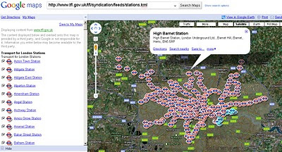
Tube Stations Data (but not up-to-date) in KML format

Data is Available from Here [Feb 2010]
Metadata is Here

Mapped


What is Free?

The London Datastore currently hosts the following travel-related data sets: Via the TfL developer page:

Station Locations

TfL Pier Locations

Live Traffic Cameras

Oyster Ticket Stop Locations

Static files on GLA servers

Cycle Hire Locations

London Underground Signals Passed at Danger

TfL Investment Programme

TfL Business Plan

Riverboat Timetables

The LDS says it is "currently working" on also releasing more datasets by 30 June 2010, including

- Bus Stops

- Bus Routes

- RODS Data (Rolling Origin and Destination Survey Data).

[Note: LIVE FEEDS ARE NOT AVAILABLE signing up required.]

Links to Examples:

http://www.tfl.gov.uk/tfl/businessandpartners/syndication/example-feeds.aspx

Thanks to the Guardian and it's campaign

Labels: , , , , , ,

22 April 2010

Unlock Places API - Geo Data Finder

Unlock Places API - Geo Data Finder

"The Unlock Places API was recently upgraded to include Ordnance Survey’s Open data. This feature rich data from Code-Point Open, Boundary-Line and the 1:50,000 gazetteer includes placenames and locations (points, boxes and shapes) and is now open for all to use"

Unlock API Map OSM

Results Clearly displayed on Open Street Map using the API.

Unlock services are middleware, which means they're intended to be used by another application- a script, or a web site.

Unlock places gazetteer search can be used in "real time" - looking up the coordinates of postcodes to search against your own database - or in "batch mode", using the gazetteer to georeference a large collection of media files.

Unlock API Examples

Display in Google Earth - Image http://unlock.edina.ac.uk/map.html

Example Request:

http://unlock.edina.ac.uk/ws/nameSearch?name=edinburgh&format=html

You can see the results in different formats by using a different format parameter

  • 'html' to see results on a web page, with individual features on a map
  • 'kml' to see KML data suitable for import into Google Earth
  • 'json' for a Javascript Object Notation suitable for re-use in web applications
  • 'xml', which is the default option.

Other Output formats:

  • GeoJSON
  • GeoRSS
  • TXT
More Examples and More Detials on the API

http://unlock.edina.ac.uk/queries.html#examples

http://unlock.edina.ac.uk/api.html

Get Started: http://unlock.edina.ac.uk/getstarted.html

source :http://unlockdata.wordpress.com/2010/04/21/unlock-places-api-version-2-2/

Labels: , , , ,

22 March 2010

1st April 2010 Ordnance Survey Data FREED

1st April 2010 Ordnance Survey Data FREED

Public Survey - OS data Freed
(for illustration only) actual - http://www.ordnancesurvey.co.uk/oswebsite/
The Public will be able to access Ordnance Survey Data from 1st April 2010. (no fools day?)
*not MasterMap

direct from Number 10 Downing Street:

"And following the strong support in our recent consultation, I can confirm that from 1st April, we will be making a substantial package of information held by ordnance survey freely available to the public, without restrictions on re-use. Further details on the package and government’s response to the consultation will be published by the end of March."

source: http://www.number10.gov.uk/Page22897

related.
http://www.ordnancesurvey.co.uk/oswebsite/

http://www.guardian.co.uk/technology/2010/mar/22/gordon-brown-superfast-broadband
bottom paragraph

Labels: , , , ,

25 February 2010

Google Fusion Maps - February 2010 Update

Google Fusion [Tables] Maps - February 2010 Update - More Powerful

An Interesting update here in a previous blog post
Note: Suggestions, would be nice to be able to overlay the thematic map [based in flash] over the Google Map (or creating gpolygons). Sharing with the option of embedding and link to would be convenient.

Well seems like this service has improved:
How?
  • Some new features that will let you upload and map large amounts of geographic data.
  • You can also now hide and show different data depending on your own criteria.
  • Create Custom HeatMaps with your own data.
  • You Do NOT need to be a Developer.
  • Embed Your Map to your website or blog.
Google LatLong Blog has a great example of the new power (without being a developer)
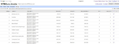
Google Fusion Tables Routes Datasource
Go from the this table of Bike Tracks.. http://tables.googlelabs.com/DataSource?dsrcid=11310

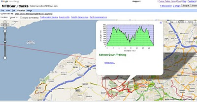
to a nice bike tracks map with routes and altitude on a map with little or no programming.
Google Fusion Tables Routes Mapped

Points are displayed at small scales but zoom in and routes of bike tracks are displayed very fast on the map Note: Goto 'Visualize >Map
http://tables.googlelabs.com/DataSource?dsrcid=132848

http://www.mtbguru.com/ is responsible for this first example using this method, mapperz highly recommends readers to look at the blog post: http://blog.mtbguru.com/2010/02/24/mtbguru-tracks-as-seen-through-google-fusion-tables/
which goes through the motions clearly on how to do this. Then you can try it with your own datasets.

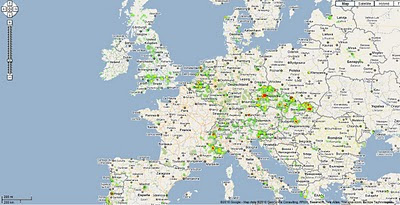
Create Heatmaps
Google Fusion Tables Routes Heatmap
You can even create Heat Maps simply with your own data.

A great way to get started on mapping your own data.

Embed the Map:


(for the coders)

Using iframe
iframe width="500px" height="300px" scrolling="no" src="http://tables.googlelabs.com/embedviz
viz=MAP&q=select%20col0,col1,col2,col3,col4,
col5,col6,col7,col8,col9,col10,col11
%20from%20132848%20where%20col11%20%3E%20'70'&h
=false&lat=49.85392252759648
&lng=14.85626220703125&z=9&l=col10"/iframe

Under the hood:
http://maps.google.com/maps?gwt=1&file=api
&client=google-fusiontables&sensor=false&v=2.x">

var map = new GMap2(document.getElementById("map_canvas"));
map.setCenter(new google.maps.LatLng(49.98,14.88),9);
var l = new GLayer("span style="font-weight: bold;">ft:132848");
<< style="font-weight: bold;">select+col10+from++132848/span"); 
Select column 10 from fusion table ID

map.addOverlay(l);
map.setUIToDefault();
map.addControl(new GMapTypeControl());
map.addControl(new GLargeMapControl());
map.addMapType(G_PHYSICAL_MAP);

Source and More details on http://google-latlong.blogspot.com/2010/02/mapping-your-data-with-google-fusion.html
credit to http://www.mtbguru.com/

Labels: , , , , , ,

14 January 2010

Edmonton Opens Up City Data

Edmonton Opens Up City Data

The City of Edmonton in Alberta, Canada is following suit of Vancouver and Toronto and opening up city (public) data.

Data available now (more available after review of the community preview Feb 2010).
  • 2009 Census - Age and Gender
  • 2009 Census - Dwelling Unit Ownership
  • Bus Stops Edmonton Transit Locations
  • City Council Meeting Schedule
  • City Parks Locations of various City parks in Edmonton
  • Community League Centres Locations in Edmonton
  • Locations of all Fire stations in Edmonton
  • Locations of historical buildings in Edmonton
  • List of Planned Road Closures throughout the City of Edmonton
  • Police Stations Locations in Edmonton
  • Locations of School buildings in Edmonton

Though Edmonton take it a stage further and provide feeds and data overlay map ready so users can quickly make use of the data.

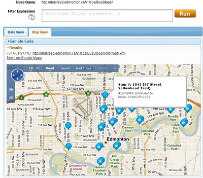
Edmonton Bing map
Default View of Bus Stops Overlay on the Edmonton City of Edmonton Website

Getting to the Data
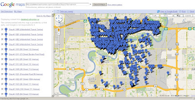
Edmonton KML
This example show the direct feed http://datafeed.edmonton.ca/v1/coe/BusStops/ as a KML (Google Earth) file loaded directly on Google Maps.
To view this Data as above - http://maps.google.com/?q=http://datafeed.edmonton.ca/v1/coe/BusStops/?format=kml

There is a stage futher, not only do City of Edmonton provide Scripts ready made so it makes it much easier for non programmers to create their own web maps.
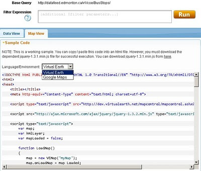
Edmonton bing map source
Default is Bing (Virtual Earth) Maps though drop-down Language Environment reveals Google Maps API source code.
Mapperz edited mashup
This a mapperz example taken from the code above. Though there are two important changes for the examples to work.
1. jquery-1.3.1.min.js needs to be fully mapped to your server/website
2.Google Maps API requires a specific API Key for YOUR site (API Key signup)

Other changes mapperz made are simply moving the latitude and longitude to centre on Edmonton and not Washington DC.

Links - and Well done to the City of Edmonton making this available.
http://data.edmonton.ca/

mapperz version (tweaked to work)
http://mapperz.googlepages.com/edmonton_google_map_source.html

source:
http://www.calgaryherald.com/Edmonton+releases+downloadable+databases/2438135/story.html

Labels: , , , , , , ,

01 January 2010

Met Office Data - Visualisation with Maps

Met Office Data - Visualisation with Maps

See the power and innovation of Opening up Government Data.
*in less than a month.

In late 2009 the UK Government launched an Open Data initiative, headed by Sir Tim Berners-Lee, along with a call for innovations challenging the developer community to make this data more accessible.

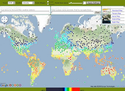
Geo.me Temperature Map
Geo.me Solutions is showcasing a number of concept demonstrations using map-based visualisations. Like the Temperature Map Above.

The Met Office might supply xml/rdf based data in the future.
But to get the raw data into a useable format Chris Wallace and assistance from Dave Challender make it available now.

Met Office Data Temperature Mashup
All the Met Offices data linked via xml to the stations data.

Background of the Data released last month by the Met Office
Land surface climate station records

The data down-loadable from this page are a subset of the full HadCRUT3 record of global temperatures, which is one of the global temperature records that have underpinned IPCC assessment reports and numerous scientific studies.

The data subset consists of a network of individual land stations that has been designated by the World Meteorological Organization for use in climate monitoring. The data show monthly average temperature values for over 1,500 land stations
http://www.metoffice.gov.uk/climatechange/science/monitoring/subsets.html


Now the Visualising of the data....

Met Office Temperature Mashup Chart
Temperature data that is interactive with the user temperature/timeline with a static map of the location.

Climate Data - An XML/XQuery implementation
Introduction

The UK Met Office recently released the temperature records for about 1600 stations world-wide. Each station record is available online as a text file, for example Stornoway.

"It is expected that longer-term, the MET office itself will make the data available in more readily programmable format. In the meantime, this site offers a number of XML-based resources for access to the data."

The station data and temperature record is available in two forms:


Source
http://www.cems.uwe.ac.uk/xmlwiki/Climate/index.html
http://labs.geo.me/climate_trends

So UK Government opening up the data will encourage innovation and business - so get on with open up the data - by April 2010 (please).

Labels: , , , , , ,

23 December 2009

'Ordnance Survey Free' 23rd December 2009

'Ordnance Survey Free' 23rd December 2009

The document that everyone has been waiting for ;

"Policy options for geographic information from Ordnance Survey Consultation"

Ordnance Survey Website April 2010
Will the Ordnance Survey Website have a direct link to your free data in April 2010?

Ordnance Survey Free products from 1 April 2010 is shown below. It includes digital reference
products and digital display products:

Raster Free Products:
Vector
  • Code-Point - that's full grid refrenced postcode data
  • Boundary-Line - a specialist 1:10 000 scale boundaries dataset
  • Meridian 2 - transport network and topographic themes
  • Strategi - 1:250 000 scale topographic database

The products that are released as part of Ordnance Survey Free will continue to be
maintained by Ordnance Survey to a high and consistent standard. The product set
may evolve over time.

Ordnance Survey Free is intended to allow communities to combine (or “mash-up”)
government data about their community and environment from a number of sources
and illustrate their findings in a geographic context:

The raster products will enable developers to produce an application that overlays
their information on a map and to zoom-in from a national view with MiniScale
down to the street level with OS Street Viev, the gazetteer, boundary and postcode information will enable widespread use.

These commonly used geographies and it will act as a link between other
government data sets which reference the same geography
the 1:50 000 Scale Gazetteer provides a definitive source of town and place.

names to search and locate a place of interest on the map

Code-Point provides the location of every postcode to enable accurate search and display of specific locations and it will link to other data with a postcode reference

• Boundary-Line provides the outline and a unique reference to all the
administrative and electoral units of Great Britain.

• Meridian2 and Strategi are small scale vector products which provide the
geometry of features to allow customisation and combination with other data.
Meridian 2 includes a full named and attributed road network.

Issues - none is there?

Issues highlighted by Ordnance Survey:
The most immediate impact on Ordnance Survey as a result of the release of
Ordnance Survey Free products will be the reduction in revenues.
Three different types of existing and future revenue loss have been identified, and their potential impact on Ordnance Survey quantified.
These include: direct revenue impacts as a result of the loss of revenue from the products to be released for free; product substitution affecting Ordnance Survey’s remaining products, which will arise as customers switch to Ordnance Survey Free products; and increased competition impacts as competitors are able to derive their own products from the Ordnance
Survey Free products.

The estimated that the revenue loss to Ordnance Survey from a combination of
these three effects would be £19-24m p.a. Further growth was anticipated in these
products, which could now be foregone.

The provision of Ordnance Survey Free datasets and associated services has been
assessed on the basis of avoidable cash costs at £6-8m p.a. over the next five years,
including both the operating costs and on-going investments required for these
products. In addition there would be one-off development costs for data provision of
up to £1.1m.

source:
http://www.communities.gov.uk/documents/corporate/pdf/1415413.pdf [PDF]
[Section 7]

Labels: , , , , ,

24 November 2009

Open Flood Mapping - OSM Maps Update First

Open Flood Mapping - OSM Maps Update First

Yes the OpenStreetMap'ers have been on the ball and with on the ground surveys and have updated the Bridges (collapsed or to be demolished).
Now this sounds a cruel but in reality shows the raw power of 'crowdsourced' mapping.


Open Flood Mapping - OSM Maps Update First
OpenStreetMap Updates [source] have come online within days of the bridge collapse.
Yes there was a fatality more here
http://en.wikipedia.org/wiki/2009_Cumbria_and_southwest_Scotland_floods

Now all we require is Flood Mapping Areas from Environment Agency (EA) overlay [available in April 2010?] on the map to show potential flooding on Ordnance Survey (OS) Maps.
Then the analysis of Met Office data [available in raw format in April 2010?]
Then the OFS [Open Flood Map] can provide real-time flood alerts and help communities likely to be affected.

Required from Government sources
1 in 1000 year flood polygons (EA)
1 in 100 year flood polygons (EA)
1 in 50 year flood polygons (EA)
1 in 10 year flood polygons (EA)
1:10,000 vector/raster mapping (OS)
Raw live-feeds MetOffice (geo-xml/json please)

[available April from 2010?]

Now that's a potentially risk-saving mashup of data.

Background on Bridges and Travel Distruption
Cumbria Bridges
Fully closed and Collasped bridges.
Collapsed Bridges: 1. Northside Bridge, Workington 2. Navvies Footbridge, Workington 3. Camerton Footbridge, Camerton 4. Memorial Gardens footbridge, Cockermouth 5. Low Lorton Bridge 6. Little Braithwaite Bridge 7. Camerton Church Bridge, Camerton
Closed bridges: 8. Calva Bridge, Workington 9. Goat Bridge, Cockermouth 10.Holmrook Bridge, Holmrook 11. Ouse Bridge, north of Dubwath 12. Isel Bridge, near Cockermouth 13. Cocker Bridge, Cockermouth 14. Southwaite Bridge 15. Broughton Bridge 16. Bridge End, Egremont 17. Spark Bridge 18. Backbarrow Bridge (off A590) 19. Bouthrey Bridge, Water Yeat 20. Station Road Bridge, Keswick 21. Scarness Bridge, Keswick 22. Scale Hill Bridge, Scale Hill 23. Greta Bridge, Keswick 24. Wath Bridge, Cleator Moor
Source: Cumbria County Council, 24 November via BBC News

latest travel news
http://www.bbc.co.uk/cumbria/travel/roads.shtml

Flood Recovery Appeal
http://www.cumbriafoundation.org/

Note - Ireland has also had huge problems with flooding over the past week.
http://www.breakingnews.ie/ireland/emergency-flood-fund-to-little-says-opposition-435667.html
And more rain forecast doesn't look good.

Labels: , , , , , , , ,

17 November 2009

Ordnance Survey Maps to go FREE Online

Ordnance Survey Maps [and Data] to go FREE Online by April 2010.

updated: 18th November 2009.

News coverage on this story

Ed Parsons (former CTO at OS now
Geospatial Technologist at Google)
http://www.edparsons.com/2009/11/now-why-was-that-so-difficult/

BBC News
http://news.bbc.co.uk/1/hi/technology/8366190.stm

Number10
http://www.number10.gov.uk/Page21343
The Times
http://www.timesonline.co.uk/tol/comment/columnists/guest_contributors/article6920761.ece
TechRadar
http://www.techradar.com/news/internet/ordnance-survey-maps-now-free-online-652001
eGov
http://www.egovmonitor.com/node/30951
PublicNet
http://www.publicnet.co.uk/news/2009/11/18/plan-to-make-os-data-available-to-improve-public-services/


Groundbreaking News this is amazing turn-around for UK Government Geo-Spatial Datasets.

Freed our Data

Thanks to Sir Tim Berners-Lee
(& inventing the World Wide Web)

"The government is to explore ways of making all Ordnance Survey maps freely available online from April"


Today's announcement will be followed by a speech, due next week by the chief secretary to the Treasury, Liam Byrne, explaining how the freeing up of data, alongside the scaling back of other functions of central government, could lead to a "smarter state".
1:10,000 Raster Maps might be available for all in April 2010

1:10,000 Raster Maps might be available for all in April 2010....
image source for illustration only.
http://www.ordnancesurvey.co.uk/images/userImages/misc/products/10kraster/map-image-10k-lrg.gif

This is likely to include Flood Mapping Data, 1:10,000 data [Vector & Raster Datasets], Highways Agency Traffic Data and much more.
reports are conflicting whether 1:25,000 data will be freed (to be confirmed)
"sets of public data currently not freely available include wills dating back to 1858, house values recorded in the Land Registry, maps, and flood-risk data for individual homes"

***More important is vector data as users can create thier own maps/styles with it.
Will be interesting to know the re-licencing of these products and deriving from such sources conflicts with crown copyright.

The online maps would be free to all, including commercial users who, previously, had to acquire expensive and restrictive licences at £5,000 per usage, a fee many entrepreneurs felt was too high.

Noted on the Guardian:
Today the union representing staff at the OS stated that Brown's pledge was in "complete contradiction with the OS's own plans to explore commercial opportunities and find new ways of raising revenue".
Read more
http://www.guardian.co.uk/technology/2009/nov/17/ordnance-survey-maps-online
(and thanks for running the Free Our Data Campaign over the years)

Labels: , , , , , ,

05 November 2009

OpenStreetMap Data 'On Demand' with Quantum GIS 'Mimas'

OpenStreetMap Data 'On Demand' with Quantum GIS 'Mimas'

Updated 07/11/2009

Getting the data you want.

One of the hardest things about OpenStreetMap [#OSM] is getting access to the data you want and for the location you require.
You can download large files for entire regions or countries, but why only if your going to use a small amount.

CloudMade gives you this by country. http://downloads.cloudmade.com/

Here is a solution - All software is FREE and Open Source so no excuses.

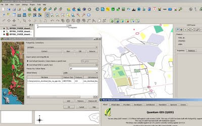
OSM direct access within Quantum and saved in Postgres
Viewing styled (Automatically) Open Street Map Data in Quantum GIS 'Mimas' [QGIS]
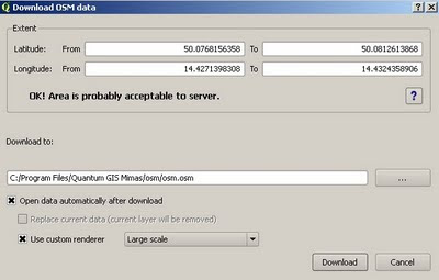
The data has been downloaded directly from the Open Street Map Servers [most up to date data].
**There are area limitions controlled by OpenStreetMap Servers, the plugin will warn you of this issue if required.
You also can edit, select features, query features and do spatial geoprocessing (buffer,intersect etc) on the data.

Clarification on editing the OSM data.

After selecting the area, download to a location on your computer .osm format.
you will get 3 layers called
osm points*
osm lines*
osm polygons*
*not editable
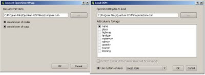
now these are 'representations' only, so you are required to load the .osm file in again.
use the openstreetmap plugin to do this
This will create two layers ways and nodes - These can be edited - right click/toggle editing.
Now you can edit your OpenStreetMap data.

Import Issues to Edit your on-demand openstreetmap data.

Please note: There are 2 'OpenStreetMap' Plugins available - both are required. But to use the editor with the data downloaded please use the 'Import OpenStreetMap' version - not the Load OSM option.


You will need the development version of Quantum GIS 'Mimas'

http://blog.qgis.org/node/138
http://qgis.org/en/download/current-software.html
http://download.osgeo.org/qgis/win32/QGIS-1.3.0-3-No-GrassSetup.exe [Direct link to Windows file 28.1mb]

Spatial Database or Shapefile?
If you want to store your OSM data and use it for other projects then storing it in a Postgres Spatial Database is a good idea.
http://www.postgresql.org/download/

With Postgis 1.4 (1.5 in dev) you can speed up functions of geoprocessing and achieve more accurate results.
Download - http://postgis.refractions.net/download/ [install after Postgres].

Or if you just want it as a common file type you can just save out to shapefile.
Good if you want to share it to others with minimum impact.

Note: There are many new plugins for Quantum GIS

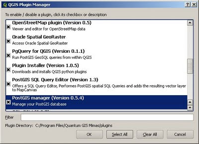
QGIS plugin manager
For this please use the OpenStreetMap Plugin (Version 0.5) [top]
and if you choose the postgres/postgis route a very useful plugin 'PostGIS manager (Version 0.5.4)' gives users a Graphical User Interface for managing Postgres/Postgis functions.
*versions maybe different in future.

This give users the power and speed. This gives Quantum GIS the edge on Open Source and Commercial GIS by breaking down the limitations and access to geographical data directly.

Labels: , , , , , , , ,

07 September 2009

ViaMichelin Maps - Speed Camera Data

ViaMichelin Maps - Speed Camera Data

ViaMichelin has had traffic information available across most of Europe for several months now.
Their Blog seems a little dated. So here is a little update.

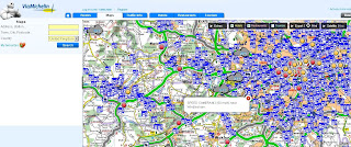
Via Michelin Oxford UK Traffic Info

Speed camera data is now available as an additional overlay - this data can be useful when overlaying the traffic data. The data for speed cameras is fairly up-to-date (apart from Swindon)
note: mobile 'safety' cameras are not mapped.

Via Michelin  Speed Camera Info

Other Geo-related (loosly) news:

ViaMichelin GPS Products


includes
Points of Interest:
Hotel and restaurant recommendations from the Michelin Guide, tourist locations from the Michelin Green Guide and thousands of useful and practical addresses throughout Europe

Safety Camera Locations: UK version or European version featuring Austria, Belgium, Czech Republic, France, Italy, Liechtestein, Netherlands, Poland, Portugal, Spain & United Kingdom.

MP3 Player for AudioTours (see below)

http://www.viamichelin.co.uk/viamichelin/gbr/GPS/htm/nav/gps.htm

ViaMichelin Local (geo-advertising)
Geolocated advertising for the tourism and leisure sector is now available.
http://local.viamichelin.com/?langue_choisie=en

ViaMichelin Geo-Tourism
This includes 'Green-Guides' and AudioTours
http://www.viamichelin.co.uk/viamichelin/gbr/dyn/controller/Tourisme
http://www.zevisit.com/NEWSVIAMICHELINUS/US/newsletter.html

Labels: , , , , , , , ,

25 August 2009

Open Street Map gets Official Isle of Man Data

Open Street Map gets Official Isle of Man Data

The OpenStreetMap gets a pleasant boost for #OSM Mappers for the Isle of Man.

This is excellent to see. Encouraging for the whole aspect of the project.

Isle of Man 1:25000
OpenStreetMap now has access to Isle of Man Government 1:25,000 data - this contains much detail that can be used to improve the already abundant data in OpenStreetMap.

OSM now has access to two datasets from which can be derived from for the project:
  • the 1:25,000 tourist map (2007) [above], provided as a set of four GeoTIFF images
  • the high resolution aerial imagery (2001) [below], provided as a set of three MrSID images

Isle of Man Aerial Imagery
High Resoultion imagery will help capture detials with out the leg work, and anyone can help contribute to the data capture.

"There is a massive amount of information which we can gain from these datasets still, and I will be posting some ideas soon about different possibilities, such as collecting place names, paths and tracks, historic sites, outlines of the national glens, open rambling land, etc. as well as using the data for error checking and correction in the existing OpenStreetMap dataset.

I am planning to make these datasets available as a WMS server that can be used in JOSM (and Potlatch) for editing, once I've had a chance to organise it, and have had an official license document through."

Dan Karran


Isle of Man Aerial Imagery & 1:25000 overlay

This is a good way to see cartographic features and imagery overlaid - making digital data capture much easier for users.

acknowledgement:

Isle of Man Government map data and aerial imagery © Crown Copyright, DLGE; OpenStreetMap data © OpenStreetMap and contributors, CC-by-SA.

Now would the UK Ordnance Survey allow this? I think not.

source and more information:

http://www.dankarran.com/blog/2009/08/using-official-isle-of-man-map-data-in-openstreetmap

Labels: , , , , , , ,

18 August 2009

Google Maps News - Street View & Map Maker

Google Maps News - Street View & Map Maker

update:19/09/09
Mexico is now available for Map Maker - please see the official blog post
http://google-latlong.blogspot.com/2009/08/map-maker-goes-west.html

StreetView has been expanded again this now covers
Switzerland and Portugal and also Taipei City in Taiwan

New Street View Chapel Bridge, Lucerne
Chapel Bridge, Lucerne with new Streetview coverage.

Google Maps Mania does a very good round-up of the coverage included
http://googlemapsmania.blogspot.com/2009/08/street-view-arrives-in-switzerland.html


Google Map Maker has been opened up some more with download-able vector data available for Africa [Terms of Use Apply]. This is either in KML format or Shapefile.
On the Mapmaker creation side Eastern Europe has now been opened up for editing.
This includes Albania, Belarus, Kosovo, Macedonia, Moldova, Montenegro, Romania and Serbia.
More news on this here
http://google-latlong.blogspot.com/2009/08/map-maker-gets-european-flair.html

Map Maker Africa Download
This data can be obtained by accepting the terms of use at this link
https://services.google.com/fb/forms/mapmakerdatadownload/
This data can be used in a GIS or Google Earth Application.

Labels: , , , , , , , ,

12 August 2009

BBC Crime Map - Truth About Crime

BBC Crime Map - Truth About Crime

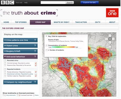
"A unique experiment uncovering crime in a typical British city"

The BBC have chosen Oxford, England because it is as close as they could find to a typical British city. In terms of demographics, and particularly in terms of levels and types of crimes, it is typical of the national picture.

Truth About Crime BBC Heat Map
Heat maps with 'licenced' premises

In making this website and the accompanying television series the BBC worked closely with Thames Valley Police. Oxfordshire Fire & Rescue Service, Oxfordshire County Council Trading Standards Department, Oxfordshire Domestic Abuse Services, South Central Ambulance Service, the John Radcliffe Hospital, and Oxford's Crime & Disorder Reduction Partnership, who supplied the BBC with the original data.

Data Currency:
The data covers the year from November 2007 to November 2008

Why Heatmaps?
'heatmaps' are used to display the crime data, since these offer a clear way for users to see patterns of crime, without requiring users to have the expert knowledge of crime data analysts.

Want to create your own heatmap?
Try - http://www.heatmapapi.com/

View the BBC Heat Map for Oxford
http://www.bbc.co.uk/truthaboutcrime/crimemap/

Labels: , , , , ,

13 May 2009

Navteq Maps (Beta)

Navteq Maps (Beta)

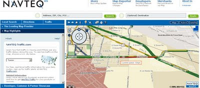
This is new. Navteq are know for their data but not for their mapping.
New Navteq Maps Beta 2009
New from Navteq, Maps not just data.

"Navteq today launched a beta showcase of its latest road navigation technology, as a clear rival to the Google Maps website"

Features:
  • Roads Map
  • Satellite Imagery
  • Hybrid Map
  • Routing with directions across the world (77 countries).
  • Live traffic [USA Only] (colour of average speeds coded)
  • 3D fly-through

Navteq Maps Beta Sign as real
Simple route London to Reading - with the 'Sign as real' function.

Note:
"one-click digital route maps to upload to Garmin, Navman, Navigon and, naturally, Nokia devices. (Nokia bought Navteq in 2007)"

Navteq Maps Beta Real-time traffic usa only
Live Real-time traffic USA cities only.

First impressions:
is this Map24?
The more you use it the better it becomes, there is a lot of data behind the scenes.
Trying to be Google Earth in the web browser?

Mapperz Source:
http://www.techradar.com/news/portable-devices/satnav/navteq-launches-google-maps-rival-598436

Labels: , , , ,

23 April 2009

140,000 miles of African Roads into OpenStreetMap

140,000 miles of African Roads into OpenStreetMap (more to come too)

OpenStreetMap[Africa] is having a huge boost of data from http://www.africover.org/

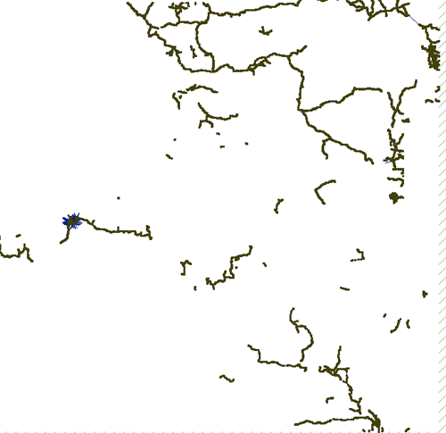
"We just finished uploading 141,107.17 miles (67 MB) of road data for Congo DRC, Tanzania, Sudan, Kenya, Burundi, and Rwanda"

"OSM will play a crucial role in some of our upcoming mapping projects and these additions make significant improvements to the coverage, especially in rural areas. The data should go live sometime in the next several days. Here is a look at the country maps, before and after this work."


Congo DRC before
Congo DRC before


Congo DRC After
Congo DRC After

Image sources: http://www.developmentseed.org

As shown above, they have imported new street data for six countries.
Thanks to Africover and DEPHA, they have street layers for five other countries and will be adding them to OSM in the coming weeks.

Keep and eye on
http://www.openstreetmap.org/?lat=7.4&lon=15.7&zoom=3&layers=B000FTF
(available in a few days time) - Zoom in and see the huge amount of difference this will make.

For more thanks and detailed stats and images on this please visit
http://www.developmentseed.org/blog/2009/apr/22/thousands_of_miles_added_open_street_map

How Geospatial should be made available everywhere in the world.
Mapperz

OSM data related:
http://mapperz.blogspot.com/2008/02/tiger-tiger-openstreetmap.html
real-time updates on #osm (twitter)

Labels: , , , , , ,

07 April 2009

OpenJump GIS

OpenJump GIS [Free Java based GIS]

update 21/04/2009

OpenJump 1.3 (more GIS analysis, faster, better)

http://www.openjump.org/wiki/show/New+OpenJUMP+Release
source: SlashGeo

There are more and more Open Source Projects coming along though which is the better of the bunch?
Not saying this is the 'best' though users are different to the developers.
OpenJump GIS is one of the better all round 'Free GIS' programs because:
  1. It supports common GIS formats (.shp, .tif, .gml etc).
  2. You can EDIT the data - lots are free but this one you can fully edit the data.
  3. You can do some GIS Analysis!
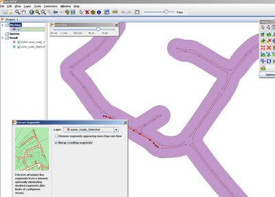
OpenJumpGIS - Buffering
Buffering for Free, OpenJump does do plenty of spatial analysis.

Spatial Analysis built-in (no plugins required!)
  • Intersect, Buffer, Union, Symmetrical Differences, Centroid
  • Generalisation
  • Polygonise (converts lines to polygons)
  • Join attributes by spatial location
  • Thiessen Polygon Creation
  • Attribution Queries
Additonal 'Plug-ins' can be loaded - though it's best the download them separately and unzip them on you computer the folder.

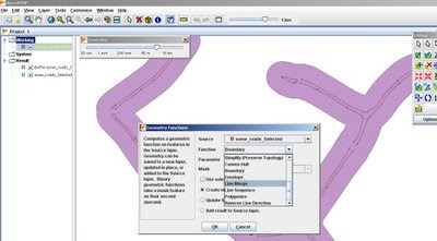
OpenJumpGIS - Geometry Functions
More Geometry Functions: Line Merge

More information on Open Jump

http://openjump.org/wiki/show/OpenJUMP


Future Suggestions? - More of the same, this is great for students and non-commercial, non profit organisations with limited budgets.
Maybe a Print View/Layout function if need to print
Support for (.osm and .gpx for OpenStreetMap) would be very helpful to many 'map makers'

OpenJump can also export to common formats (.gml, .wkt, .shp and postgis tables)

via SlashGeo
We mentioned other open source GIS software such as Quantum GIS, GRASS GIS, uDig and gvSIG amongst others.

Labels: , , , , , ,

22 March 2009

OpenStreetBrowser [View Maps & Metadata]

OpenStreetBrowser [View Maps & Metadata]

OpenStreetMap Browser - Metadata Viewer
OpenStreetBrowser allows anyone to view the information behind the tiles of OpenStreetMap.

Metadata - Information about data (including history)
http://en.wikipedia.org/wiki/GIS_metadata

Viewing Metadata - Oxford Street - London
Viewing metadata of Oxford Street - the useful information within.

"Openstreetmap (OSM) is growing and attracting more and more users contributing to the project (over 100,000 users now!). It's all about collecting and mapping geospatial data, which we submit to the database. But wait, to be honest: Without visualizing the data - without maps - openstreetmap is not much fun. For most new users the Slippy Map is the first map to see from openstreetmap. I believe, that many of us were motivated to become contributors because of this slippy map, because of the moments we wait our recently submitted information to pop up on Mapnik or Osmarender tiles. Although I love our slippy map, it just visualizes a tiny bit of information which is now available from our openstreetmap-database. So, when I first discovered the project Openstreetbrowser by users, I was thrilled: It's fun to use the Openstreetbrowser. The map looks great and I feel, that the authors made every effort and did a lot of thinking on details to create the Openstreetbrowser."
source: http://osmbonnblog.blogspot.com/2009/03/browsing-openstreetmap-v20.html

So now we have an Online Style Editor - CloudMade
We have the Online Editor - OpenStreetmap
Now we have the Online OpenStreetBrowser.
Can these merge to be come a 'one-stop' location for users?


**Note Data outside Europe is not currently available in OpenStreetBrowser - this may change in the future of this project.

Previous Related Posts:
http://mapperz.blogspot.com/2009/03/cloudmade-map-editor.html
http://mapperz.blogspot.com/2008/09/open-street-map-in-shapefile-format.html

Labels: , , , , ,

16 December 2008

Tiger Data 2008 Released

Tiger Data 2008 Released

update 20/01/2009
A new potentially good source is for Road Linework [editable in a GIS]
is the
National Transportation Atlas Database
http://www.bts.gov/publications/national_transportation_atlas_database/2008/
Now Available in ESRI Shapefile format

Tiger 2008 - US Census Bureau Logo
(Topologically Integrated Geographic Encoding and Referencing system)

The US Census Bureau has recently released the Tiger 2008 data to the public to download and use freely.

Shapefiles (most GIS Software can view them)
http://www2.census.gov/cgi-bin/shapefiles/national-files
Don't have a GIS?
A free Open Source GIS is Quantum GIS


Technical details are available

http://www.census.gov/geo/www/tiger/tgrshp2008/TGRSHP08.pdf

FTP available
ftp://ftp2.census.gov/geo/tiger/TIGER2008/

This updates the earlier post (April 2008)
http://mapperz.blogspot.com/2008/04/tiger-2007-data-release-esri-shapefile.html

The one thing the US Census website lacks is a geographical way of selecting the data.
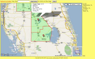
County Finder at Maps Huge.com
Maps Huge helps users find neighbouring (neighboring) counties

Need to know an area in a visual way?
try
http://maps.huge.info/county.htm
or
http://maps.forum.nu/gm_main.html

Labels: , , , , ,

20 October 2008

Argentina Live Maps - Beta [But...]

Argentina Live Maps - Beta [But be careful]
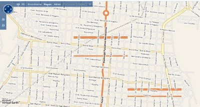
Live Maps Argentina Beta
Buenos Aires but locals notice there are incorrect road names.
source: http://blogs.msdn.com/virtualearth/

"This site comes with geocoding places and addresses, road maps, satellite imagery and photography and traffic incident and flow information. In terms of content, this is what you get which is a great framework to build on"
source:
http://blogs.msdn.com/virtualearth/archive/2008/10/18/live-search-maps-argentina-is-live.aspx

Argentina Bad Data
Though be careful, this dataset is highly inconsistent.
(yes those are floating parallel roads that lead nowhere)

Okay this is seasonal lake - but the spec tends to lean towards an all year lake that vanishes completely at zoom level 11.
http://www.livemaps.com.ar/Impressao.aspx?sc=&&z=10&cp=-29.39174%20-66.46316&omap=1
http://www.livemaps.com.ar/Impressao.aspx?sc=&&z=11&cp=-29.39174%20-66.46316&omap=1

There also seems to be a lot font problems on the roads.

Data is not joining up and the fonts are not correct in the raster files.
http://www.livemaps.com.ar/Impressao.aspx?sc=&&z=11&cp=-36.67172%20-64.29679&omap=1

**but be careful - data across the country seems very inconsistent**
(google did use this data but proved to be difficult to update due to the original data being incorrect or incomplete and removed the tiles.)
good luck Microsoft...fortunately listed as 'Beta'

source
http://blogs.msdn.com/virtualearth/archive/2008/10/18/live-search-maps-argentina-is-live.aspx


Though Microsoft might want to know Navteq have just finished capturing a new dataset for Argentina.
http://lbsuc.geospatial-solutions.com/gsslbsuc/article/articleDetail.jsp?id=559099

might be a better dataset to use in the long run.

Labels: , , , ,