->

02 December 2010

Google Earth 6

Google Earth 6


For
PC

Windows XP, Windows Vista or Windows 7

Mac
Mac OS X 10.5.0 or later

Linux
LSB 4.0 (Linux Standard Base) libraries


Google Earth lets you fly anywhere on Earth to view satellite imagery, maps, terrain, 3D buildings, the ocean and even galaxies in outer space. Explore rich geographical content, save your toured places and share with others. Download the latest version free of charge.

Google Earth 6 Features

  • Zoom from outer space to Street View

  • View buildings, bridges and trees in 3D

  • Find locations, driving directions and more


http://www.google.co.uk/intl/en_uk/earth/index.html

Labels: , , , ,

04 June 2010

Historypin - Streetview with History

Historypin - Streetview with History
*
Historypin was built with Google and they provided invaluable support throughout the process.

update: Nice introduction to HistoryPin with this video.


"Historypin is a online tool that acts as a digital time machine, allowing people to view and share history in a totally new way."

Historypin beta - Streetview with History
Sharing Past memories and important events with Google Streetview and Historical Photography display correctly in 4D space.

"Historypin invites the public to dig out, upload and pin their own old photos, as well as the stories behind them, onto the Historypin map. Uniquely, Historypin allows users to layer their old images onto modern Street View scenes, revealing a series of windows into the past."
http://www.wearewhatwedo.org/generations/

Interactive Timeline
One of the most useful tools for finding historical photographs is the interactive timeline that can span as far back as 1840's.

Historypin beta - Streetview with TimeLine Slider
Use the time-line interactive slider to find more recent or past photographs whilst in the map/streetview mode.
Using Google Maps and Street View technology, Historypin aims to become the largest user-generated archive of the world’s historical images and stories.

The site invites the public to dig out, upload and pin their own old photos, as well as the stories behind them, onto the Historypin map. Uniquely, Historypin allows users to layer their old images onto modern Street View scenes, revealing a series of windows into the past.


Trafalgar Square, London.
http://www.historypin.com/photos/search/streetview/1/radius/969778/bounds/56.523139564372194,9.99755859375,50.90303283111257,-18.12744140625/zoom/0/geo/53.800651,-4.064941/date_from/1840-1-1/date_to/2010-6-3/yaw/292.37/pitch/5.95

same link in human terms: http://tinyurl.com/historypin-trafalgar-sq

More information:
http://googlemapsmania.blogspot.com/2010/06/largest-archive-of-photos-on-google.html

Main website: http://www.historypin.com/

Go straight to the Map - http://www.historypin.com/photos/


Creators -
http://www.wearewhatwedo.org/

Labels: , , , , ,

19 May 2010

Bye Bye Google Maps API v2 - V3 Graduates

Bye Bye Google Maps API v2 - V3 Graduates

was coming sooner or later...

As part of the Google Maps API v3 graduation to the principal maps API Street View has been added to the Maps API v3.

Street View in v3 is entirely implemented in HTML in order to accommodate all of the mobile devices on which v3 is supported. In v2 of the Google Maps API Street View relied on Flash.


Streetview now available in V3 of the Google Maps API (drag pegman to active the HTML version of Streetview)

In order to ensure that existing Maps API v2 applications can be migrated to Maps API v3, we have also been striving to add all of the most popular v2 features to v3. As part of that effort we are also happy to announce that Street View is now available in the Maps API v3.

When you use Street View in v3 you will notice a number of differences with v2. The most significant change is that Street View is entirely implemented in HTML in order to accommodate all of the mobile devices on which v3 is supported. We have also added Pegman support to the map, and a number of new features, including markers, infowindows, and custom imagery.

In conjunction with the graduation of the Maps API v3, we are also announcing the deprecation of the Maps API v2 and Mapplets (which is based on v2). These deprecation announcements confirm that no further feature development is planned for these two APIs. However, we will continue to maintain and support applications using these APIs for at least three years consistent with the deprecation policy detailed in the Maps API Terms of Service.


Sources:
http://googlemapsmania.blogspot.com/2010/05/google-maps-api-v3.html

Links:
http://googlegeodevelopers.blogspot.com/2010/05/they-grow-up-so-fast.html

Labels: , , , , ,

15 March 2010

CycleStreets.net Easy Cycle Routes Maps

CycleStreets.net Easy Cycle Routes Maps

Some really nice implementations making cycle route planning much easier and user friendly.
CycleStreets.net Namefinder Geocoder

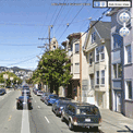
As well as adding postcode search support recently, CycleStreets.net this week upgraded the general street/place finding system geocoder. Default map is Open Street Map (Cycle Map) but Google Streets and Google Satellite are available via the map controls. Image source: http://www.cyclestreets.net/blog/2010/03/14/geocoder-upgraded/

Some tips for quicker searches are:

  • If the map is zoomed out, ideally include a city name as well, so that it knows what area to look in
  • If you do specify a city, add a comma before it, e.g. “York Street, Cambridge” rather than just “York Street Cambridge”
  • Note that lower-case text works the same as Capitalised Text.
f you decide to follow the suggested journey below please take extra care on unfamiliar sections - proceed at your own risk as route quality cannot be guaranteed.

Journey can be customised into 3 types of cycling
  1. Fastest route
  2. Balanced route
  3. Quietest route

CycleStreets.net Route with Photo

Gradient, Wiggliness and number of Traffic lights are also factored in for your journey on your bike.

Example:
Quietness: 83 % Quiet (shhh at the back!)
Traffic signals:at junctions
Wiggliness: 0%. (like it)
Specific Leaving 11.09am, Arriving Times 11.29am.

CycleStreets.net Route with UK Streetview
Now the UK has Full Google Streeview coverage it can be added to almost any cycle route you now plan.

Plan your route on bike, tandem, trike by using this mapping site:

http://www.cyclestreets.net/

Very good work
For more information and details on the technological (gecoder) aspects visit
http://www.cyclestreets.net/blog/

Please Note:
CycleStreets beta: Not all areas have complete cycle route data yet. CycleStreets is UK-wide with over 1500+ locations http://www.cyclestreets.net/area/

Labels: , , , , , , ,

11 March 2010

UK Streetview - FULL Coverage

UK Streetview - FULL Coverage

updated...

http://maps.google.co.uk/?ie=UTF8&hq=&hnear=United+Kingdom&ll=53.343993,-5.185547&spn=8.217413,23.269043&z=6
(and drag the yellow pegman)

Longest unbroken Trip in Streetview for the UK now possible

http://mapperz.110mb.com/GMAP/LongStreetView_UK.html
838 mi (about 15 hours 2 mins)

England, Wales, Scotland and Northern Ireland Full Coverage.

(Republic of Ireland streetview coverage is likely in due course.)

New Content:

Visit Wales in Streetview
http://tinyurl.com/visit-wales-view
NationalTrust in Streetview (better coverage)
http://tinyurl.com/NationalTrust-view

Note:some images are over 1 year old since google recorded them.

Big Brother is now complete for the United Kingdom.

mapperz

Labels: , , , , , ,

03 December 2009

BING Maps Explore (Streetside)

BING Maps Explore (Streetside)
*Sliverlight required & in beta
**Streetside mode is in some USA Cities only currently

BING Maps Explore Streetside
Looks familiar to Google StreetView but is a light blue indicating 'StreetSide' coverage.

BING Maps Explore Streetside - Streetside Mode
Streetside mode - has similar features to streetview, controls are slightly different.

BING Maps Explore Map Apps
Apps for your BING Maps - Nearby App (useful), Traffic, Twitter App displays geo-tweets, many more to explore.

BING MAPS BETA NEARBY CLUSTER MARKERS
Nearby Map App- Markers(Icons) group in clusters when there is not enough space to display all markers at zoom levels.

BING MAPS BETA STREETSIDE
BING Maps Explore has new controls - automatic 'finds' the best map mode for your zoom level

try it
http://www.bing.com/maps/explore/

warning to firefox users - can cause memory leaks and freeze up your browser.

source:
http://www.bing.com/community/blogs/maps/archive/2009/12/02/bing-maps-adds-streetside-enhanced-bird-s-eye-photosynth-and-more.aspx

Labels: , , , , , ,

02 December 2009

Google Streetview Singapore Released

Google Streetview Singapore
http://maps.google.com.sg/maps and drag pegman....

Labels: , , ,

10 November 2009

Street View - Gran Canaria & Tenerife.

Street View - Gran Canaria & Tenerife. (Hawaii too)
Street View Gran Canaria
Gran Canaria
Street View Tenerife.
Tenerife

Don't Forget the 50th State of the United States too. Hawaii

Official Blog
http://googleblog.blogspot.com/2009/11/fifty-states-of-street-view.html

Labels: , , , ,

Google Street View Mexico Arrives

Google Street View Mexico Arrives


Mexico City

Monterrey
Guadalajara
Puerto Vallarta
Cancun
Playa del Carmen
Cozumel

nice views on the Google Maps Mania Blog
http://googlemapsmania.blogspot.com/2009/11/mexico-gets-street-view.html

Labels: , , ,

18 August 2009

Google Maps News - Street View & Map Maker

Google Maps News - Street View & Map Maker

update:19/09/09
Mexico is now available for Map Maker - please see the official blog post
http://google-latlong.blogspot.com/2009/08/map-maker-goes-west.html

StreetView has been expanded again this now covers
Switzerland and Portugal and also Taipei City in Taiwan

New Street View Chapel Bridge, Lucerne
Chapel Bridge, Lucerne with new Streetview coverage.

Google Maps Mania does a very good round-up of the coverage included
http://googlemapsmania.blogspot.com/2009/08/street-view-arrives-in-switzerland.html


Google Map Maker has been opened up some more with download-able vector data available for Africa [Terms of Use Apply]. This is either in KML format or Shapefile.

On the Mapmaker creation side Eastern Europe has now been opened up for editing.
This includes Albania, Belarus, Kosovo, Macedonia, Moldova, Montenegro, Romania and Serbia.
More news on this here
http://google-latlong.blogspot.com/2009/08/map-maker-gets-european-flair.html

Map Maker Africa Download
This data can be obtained by accepting the terms of use at this link
https://services.google.com/fb/forms/mapmakerdatadownload/
This data can be used in a GIS or Google Earth Application.

Labels: , , , , , , , ,

16 June 2009

Talk to the Map! [Google Maps on Android]

Talk to the Map! [Google Maps on Android]


(this video jumps to the 'speak moment' in the video once play is 'clicked'

  • Speak to the Map and and search.
  • Google Maps for Android includes some big improvements to Google Latitude. (location will continue to update as long as your phone is on.)
  • New experimental feature called Updates that lets you communicate with friends and post messages. (Your friends will also need to download this new version of Google Maps for Android)
  • Street View in Google Maps on Android is no longer its own map mode, Now integrated into the map where street view is available.

Video:
http://www.youtube.com/watch?v=Ry2gaJgmgiU

Source:
http://googlemobile.blogspot.com/2009/06/search-by-voice-and-transit-directions.html

Labels: , , , , , ,

29 May 2009

Street View Denmark [Not Google]

Street View Denmark [Not Google]

Another excellent 'Street View' application from Denmark.

Street View Denmark [not Google]

Highly detailed panoramas 360 degree images seamlessly stitched and georeferenced form a nice interactive street view service for Copenhagen created by De Gule Sider AS

The user interface is friendly and easy to use, available in Danish or English


"using the
krpano viewer - is a small, versatile and high-performance viewer for interactive 3D panoramas on the web. It is based on the cross platform Adobe Flash Player."

Source:
Google Maps Mania
http://googlemapsmania.blogspot.com/2009/05/friday-fun-on-google-maps_28.html


Labels: , , , , ,

28 March 2009

Street Tours - Street View New!

Street Tours - Street View New!


Map Channels have been busy once again and produced a handy set of tools where you can record Google Street View sightings in your own custom map and then embed on to your website.

"Create your own mapped Google Street View tours - embed onto your website"


Street View Tours - Coverage Availability
Blue areas indicate where Street View is currently available.

Future coverage are likely to expand for the UK and new areas such Germany, Belgium and Canada will be introduced.

related links:
http://streetcities.com/Main.aspx
http://www.mashedworld.com/Home.aspx [Street Tours available here]
http://www.mapchannels.com/DualMaps.aspx

Labels: , , ,

21 March 2009

UK - Street View Plus

UK - Street View Plus

UK street view plus
View the new Street View images along with Birds Eye View in sync.

Use the Streetview window or Map - Car Icon is draggable - interactively updates your movement in each window.

Created with Map Channels Dual Maps - Free mapping tools for your website or blog.

Thinking: 1:50,000 - 1:25,000 Ordnance Survey Mapping pending Multimap 'Terms and Conditions'

http://mapperz.googlepages.com/Marble_Arch_Streetview_Plus.html

Related post:
http://googlemapsmania.blogspot.com/2009/03/street-view-plus.html

Developer note:
Bug: the svb (StreetView Bearing) is currently unavailable [users can still manually rotate the streetview images], Map Channels is informed and they are currently finishing another project but there is likely to be an update to this in the near future (plus enhancements)
please see:
Src Parameter Name: svb on this (at the bottom).

Labels: , , , ,

16 March 2009

Street View Canada [MapJack]

StreetView Canada [MapJack]
Streetview Canada - Vancouver

MapJack does it again and is the first to provide 'StreetView' for Canada


"Vancouver, Whistler, or Squamish in British Columbia, the only three areas that offer Street View at today’s launch. The company plans to expand to include Street Views of Toronto and Montreal next, followed by as much of Canada as possible."

The link that will let you see MapJack StreetView in Vancouver...
http://www.canpages.ca/business/BC/vancouver/banks/961-064200.html
and click 'StreetView'
Full Screen Option available.

Only available via:
http://canpages.ca/
(currently not available via
http://www.mapjack.com/)


Mapperz Source:
http://krisabel.ctv.ca/post/Canada-AM-e28093-Street-View-Comes-To-Canada-With-New-Tricks-From-CanPagesca.aspx

related previous posts:
http://mapperz.blogspot.com/2008/03/streetview-mapjack-vs-google.html
http://mapperz.blogspot.com/2008/12/streetview-stockholm-mapjack.html

Labels: , , , ,

12 December 2008

StreetView Stockholm (MapJack)

StreetView Stockholm (MapJack)

Mapjack Streetview Stockholm, Sweden


Not the Google version but MapJack now covers a city in Europe. High quality images and excellent navigation through the city of Stockholm in Sweden.

Only one suggestion is a geocoder [search location] as the Mapjack website caters for.


View the StreetView in Stockholm
http://www.hitta.se/gatubild/
(fast internet required)

Source:
http://googlemapsmania.blogspot.com/2008/12/google-maps-friday-fun.html

Labels: , , ,

24 October 2008

NovaLoca - Map with Seety StreetView

NovaLoca - Map with Seety StreetView

Find Commercial Property [For Sale or Rent]
  • Offices
  • Retail
  • Industrial
  • Leisure
  • Land
  • Other
View the Map
View the Area in Birds Eye View
View the Street - Seety StreetView

NovaLoca Commercial Property with Seety Streetview Map
Search and view on the map commercial property areas


"NovaLoca.com is a comprehensive UK commercial property listing service. Whether you intend to buy or rent commercial property, you can search for your ideal office space, industrial unit or retail premises."

'Local Area Information' also available:
  • Schools Primary, Secondary / Higher & Nursery
  • Healthcare
  • Hospitals
  • Doctors Surgeries
  • Dentists
NovaLoca  with Seety Streetview Mode
Seety StreetView Mode - Limited for London, UK Only

Try it at
http://www.novaloca.com/
Search London
Show on Map.

Labels: , , , , , ,

15 October 2008

StreetView France Expands

StreetView France Expands

StreetView Paris
The StreetView areas expand in Paris

Other Towns and Cities
What about London UK?
Well if you cannot wait for Google to launch it - there currently is an alternative
Seety has limited coverage and quality is not as good in places they openly admit.

Approx coverage is Hammersmith [West], Blackwall Tunnel [East], Swiss Cottage [North] and Vauxhall [South]
Seety London StreetView
StreetView for London, UK try it here
http://www.seety.co.uk/?lat=51.50971&lon=-0.13503&u=0.995&v=0.517

Source: Google Maps Mania

Labels: , , , , , ,

19 September 2008

Google Street View on Nokia Phones (N82)

Google StreetView on Nokia Phones (N82)

As Google have released v2.3.1 of Google Maps Mobile
It is now possible to access 'StreetView' and 'Walking Directions' on Mobile Devices

Here is the new Streetview functionality on a Nokia N82

StreetView on Nokia N82
Street view (screen shot from a Nokia N82 here) is new to mobile devices but there is huge data transfers (2000k+) so make sure you have access to wifi or an unlimited data plan (3G/GPRS)
*Expand button makes streetview full screen.
The images are large (in terms for mobile devices) and a little grainy when panning around but does sharpen up when paused.

The .jar install file is available from
http://m.google.com/gmm/apps/v2.3.1/L1/gmaps-231-m2_L1.jar
Thanks to http://www.allaboutsymbian.com/

Labels: , , , ,

24 July 2008

StreetCities.com - Embed StreetView with Ease

StreetCities.com - Embed StreetView with Ease

"The Street/Map control lets users easily embed a street view into any website and switch between street view and the map."


  • Display a Street View and Map in one compact control
  • Easy to customize and embed in any webpage
  • Display the current street view title and co-ordinates
  • Supports Firefox, Internet Explorer, Safari and Opera
  • Use URL parameters to modify the control appearance
  • API and source code available under Apache License for custom projects


Street Cities - Free Mapping and Street View Tools

Need to customise this?
Then http://www.streetcities.com/StreetMapAPI.aspx is your location.
Well done to Map Channels for this easy to use site.

Labels: , , ,