->

29 August 2008

ArcGIS 9.3 - Service Pack 1 - Announcement

ArcGIS 9.3 - Service Pack 1 - Announcement (updated)

(Due November 2008 - subject to changes and additions)

UK Users are still awaiting arrival of ArcGIS 9.3 from ESRI (UK)
(it arrived 25th September...)


Top Picks

NIM006247 - Saving shape file edits more the eight times in ArcMap leads to slower and slower performance. (an average user would save over 100 times a day).


NIM035569 - Network Dataset Build fails with File read/write error occurred" if more than 3 GB available RAM on the machine."(Windows can support 4GB)
NIM036572 - The Vehicle Routing Problem solver does not respect the network dataset hierarchy settings that the user has chosen for analysis.
NIM036573 - Out-of-memory error in Network Analyst crashes ArcMap.

NIM035799 - Using the repair geometry tool shifts feature-linked annotation to its default position when repairing the feature class it is linked to.
User would like to have the annotation remain in the position he [or she] set it.

NIM036029 - Millimeter values are interpreted as points for size and width property overrides.

NIM036030 - Representation masking creates unexpected results with advanced symbol level drawing.

NIM036694 - Using the Calculate Geometry tool in the attribute table produces incorrect results for calculating Hectares.


NIM037404 - The Microsoft Virtual Earth layer, available from ArcGIS Online, displays poorly when the data frame extent goes beyond -180 / 180.

NIM037690 - Remove duplicates deleting too many labels

More details from the PDF
http://downloads2.esri.com/support/downloads/ao_/ArcGIS_93SP1_Ann091608.pdf

To keep your ArcGIS up-to-date view
http://support.esri.com/index.cfm?fa=downloads.patchesServicePacks.listPatches&PID=43&FilterPV=457&FilterType=8%2C5
There are 3 patches for ArcGIS 9.3

Microsoft® Virtual Earth Patch (if have subscribed)
File Geodatabase SQL WHERE clause Patch
Adobe Reader® version 9 support

Labels: , , , , ,

28 August 2008

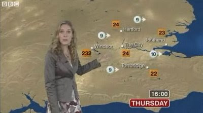
BBC Extreme Weather (in Windsor)

BBC Extreme Weather (in Windsor)

Extreme BBC Weather Windsor
232 degrees in Windsor's was a slight error on the BBC Weather Map this morning...

Blame the Gremlins

Screenshot and news source:
http://news.bbc.co.uk/1/hi/uk/7585641.stm
(non-UK users may not be able to see the video)

Labels: , , , ,

27 August 2008

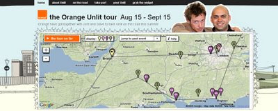
Orange Unlit Tour Map

Orange Unlit Tour Map

A Live Music Map Mashup.

"Unlit is a mixture of a gig and party, free and open to anyone, which takes place in people’s houses around the world."

Orange Unlit Tour Map
Very 'Flashy' Orange Unlit Map - Tour. Using flash and Google Maps to animate the tour so far, includes links to photos, videos, blog and twitter feeds.

"This summer, thanks to the support from Orange, we’re able to take the whole thing to a new level. From mid-August to mid-September we’re going on the road in a big caravan, doing two nights a week and posting the films just a couple of days after we’ve shot them.

We’re also using new technology, something Unlit has always been about… track us on Google maps, check out photos on Flickr, watch our daily video blog… it’s going to be amazing!"

View the Map (flash required) http://www.i-am-everyone.co.uk/orangeunlit/

The tour dates ranges from Aug 15 - Sept 15 2008.

If you want to take part...
http://www.i-am-everyone.co.uk/orangeunlit/takepart/

Labels: , , , , ,

24 August 2008

The Future of Paper Maps? Here Now?

The Future of Paper Maps? Here Now?

The video shows different content (layers/scale) of the map when the angle of paper map is adjusted.


Will 21st technology save the decline in paper maps? [A Techcrunch Video]

Users of new mobile phones are likely to have the technology (GPS-A-GPS), but do they know how or want to use it? The paper map is always a saver when the battery is dead or the internet has returned an error.

"The three Images are interlaced by alternating horizontal strips from each. The resulting compound image is calibrated to a specially designed polymer lens substrate. Lenses contain between 60 to 200 micro-lenses per inch, depending on the desired outcome. This is mounted to a backing, die cut and packaged"

The 'MapAction' Technology is described here:
Source:
http://panamap.com/mapaction-technology/index.html

Source:
http://www.gadling.com/2008/08/23/
urban-mapping-cleates-multi-vision-foldable-maps/

Labels: , , , , ,

21 August 2008

Transport for London - Cycle Maps - New!

Transport for London - Cycle Maps - New!
Transport for London Cycle Map
Transport for London first by using Google Maps for showing Cycle Parking and best routes.

Routes preferences:
  • Cycling on quieter roads
  • Cycling near to busy roads
  • Cycling through parks and canal tow paths
  • Cycling that may be on busier roads
  • Cycling is not permitted
Google Map viewable here
http://www.tfl.gov.uk/tfl/roadusers/cycling/maps/maps-and-guides.aspx


Transport for London Cycle Map - Many Options
Though the routing 'wizard' has different mapping (bespoke TfL created?).

There is a really good amount of options, 'I don't want to cycle more than xx minutes' very handy.

See the Cycle Planner and Map


The video shows the 'wizard' in action - suggestion speed and time might be a useful addition.

Labels: , , , , ,

20 August 2008

Free Maps for Education (in PDF format)

Free Maps for Education (in PDF format)

Maps International
have release free maps in A3 paper size
(297mm×420mm or 11.7''×16.5'')

Maps International Educational Free Maps - Europe
Politically coloured Europe map for Free

Maps International Educational Free Maps - World
This World Map is available for educational use at not cost.
(Politically coloured World map with hill shading and bathymetry.)

"Maps International Education shop provides education wall maps and geography teaching resources and aids for all ages. Our product range is extensive and includes the new exclusive Primary Schools wall maps. Also available to purchase are key geography texts for higher and further education including subjects such as Earth Sciences, Regional and Area Planning and many more Geography based subjects."

Other Free Maps available:
  • UK map with major transport links including motorways, primary routes, ferry routes and airports.
  • UK map with major transport links including motorways and airports.
  • UK map with parliamentary boundaries and names.
  • Wales map with country/ county/ district/ unitary boundaries and names
  • Scotland map with country/ county/ district/ unitary boundaries and names
  • England map with country/ county/ district/ unitary boundaries and names.
  • Europe map with hill shading and hypsometry.
  • Outline black and white World map with country borders, capitals and country names.
  • Outline black and white World map with country borders only.

These Maps in PDF format are available from
http://www.mapsinternational.co.uk/education_downloads.asp

TERMS OF USE
All material is copyrighted and should not be reproduced for commercial use. If you intend to use the free resources for anything other than classroom use, then contact Maps International on Free Phone 0800 038 6277 or sales@mapsinternational.co.uk to discuss the cost and royalties applicable. No responsibility can be assumed for the accuracy of the information given.

Labels: , , , , , , , , ,

19 August 2008

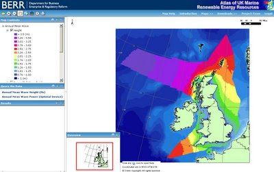
UK Tidal, Wave, Wind Power Maps

UK Tidal, Wave, Wind Maps

See the power visually with these colourful maps.

"A project commissioned by BERR in 2007 has taken the existing UK Marine Renewable Energy Resources Atlas forward. This new stage of development for the Atlas has enabled an enhanced definition of the primary resource variables and is now a product that is being made more accessible though a webGIS interface. The charts in the Atlas indicate the distribution of potential resource for the future deployment of renewable energy technologies – wind, wave and tidal. The project team was led by ABP Marine Environmental Research and included the providers of major marine data holdings (Met Office and Proudman Oceanographic Laboratory (POL))."
http://www.renewables-atlas.info/index.asp

BERR UK WAVE POWER MAP
Wave Power - useful for surfers..

BERR UK TIDAL POWER MAP
Tidal Power

BERR UK WIND POWER MAP EXPORT TO XLS
Wind Power

ArcServer is used to process the geospatial data (cells) and export the results into Excel Format.

GIS Data is downloadable in ESRI Shapefile or MapInfo .tab formats
http://www.renewables-atlas.info/downloads.asp

Map Help
http://www.renewables-atlas.info/Help/Default.htm

Labels: , , , , , ,

18 August 2008

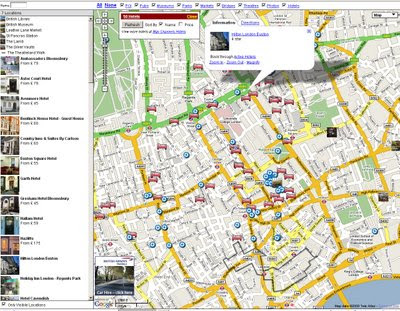
Map Channels Feed Maps

Map Channels Feed Maps New!

Map Channels - Multiple Feed Maps - London
Multiple Feeds from MyMaps or Google Spreadsheets can be brought together on a single map.

How to do this...
To save the KML file, goto 'My Maps', right click on 'View In Google Earth' and copy the link location. Open a new browser tab and paste in the copied link. Edit the link and replace 'output=nl' with 'output=kml', then press 'enter' and save the KML file.

If you locally host your KML data you can use Google Site Maps to get your data included in Google Searches.

GeoRSS Format
My Maps have a GeoRSS option which Feed Maps can use (using the Google AJAX Feeds API). GeoRSS has the advantage that the data is read from the current copy of the My Maps data. Feed caching is used, so changes can take up to an hour to be included in the GeoRSS file.

Advantages and Disadvantages...
The drawback of using GeoRSS is that the style information for markers, line and polygons is not included. You can get around this problem by creating a separate My Map for each place type. Within your Feed Map code load each My Maps as a separate GeoRSS feed and set a different marker style for each feed.
Google Spreadsheet Format
Data from Google Spreadsheets can be used in Feed Maps. The spreadsheet must be published to be used. The first (header) row of the spreadsheet is skipped.

JSON Slow - Tab-delimited Fast
Unlike My Maps, Google Spreadsheets supports JSON format which lets you load in updated spreadsheet data. However the JSON format used does contain a large amount of unnecessary data and as a result map data may not load as quickly as other formats.
Tab-Delimited Text Format
Tab-delimited text files are probably the most efficient feed format. Fields are separated by single tab characters and rows are separated by carriage return (\r) and line feed (\n) characters. You can use a spreadsheet program to edit the file. The Header line is always skipped.


Recommend is the London Tutorial to see how it it done.
http://www.mapchannels.com/mcfm_tutorials/tutorial8.htm

Labels: , , , , ,

16 August 2008

Google MapMaker Coverage Expands (but..)

Google MapMaker Coverage Expands
Google Map Maker Coverage Expands
Google want 'users' to add content to areas that have poor or limited digital mapping coverage.

Please remember the content you generate will become Google's however they will not take responsiblity to any errors.

The concept is great - but OpenStreetMap have been doing this for years, there data is downloadable and very useable in GIS (Global Mapper reads it directly) as other mapping packages can.
Google seem to be stepping on OpenStreetMaps toes this time, with the new areas including, The Isle of Man where OSM have superior data.

So if you want to get your hands on the data for use afterwards your best bet is to help create data and pump it into OpenStreetMap. Now with 50,000 registered users and 5,000 active monthly users.
http://wiki.openstreetmap.org/index.php/Beginners%27_Guide

Anyone noticed Georgia wasn't on the expanded list...?

See OpenStreetMap data in a mapping package directly...
http://mapperz.blogspot.com/2008/04/openstreetmap-data-in-globalmapper-fast.html

Labels: , , ,

15 August 2008

London Metropolitan Police Crime Mapping (TEST SITE)

London Metropolitan Police Crime Mapping (TEST SITE)
Metropolitan Police Crime Mapping TEST SITE
Polygons are generalised but the thematic map shows the crime rates across Greater London.

Areas of London are colour coded to show crime levels in user selected areas relative to other areas of London. Specifically, areas are colour coded according to how their crime rates compare to the average for London. This is done using standard deviations - a statistical measure used here to calculate how close to the London average an area´s crime rate is. The following ranges are used to describe this within the maps:
  • Burglary, robbery and vehicle crime
    (June 2008)
  • High
  • Above Average
  • Average
  • Below Average
  • Low
"The purpose of this site is to help show where crime is occurring at a local neighbourhood level.

It has been developed by the MPS in conjunction with the Metropolitan Police Authority and the Mayor of London.

This is a live test site (known technically within the industry as a 'beta'). It is intended to test the functionality of crime mapping, with a view to adding further features in the near future, based on your feedback.

Please note, that whilst every effort is made to record the details of crime and its location as accurately as possible, there are occasions when victims are unable to provide the actual location of a crime. In these instances, the site will not be able to display all the crime reported to the police."

http://maps.met.police.uk/


Labels: , , , , , ,

14 August 2008

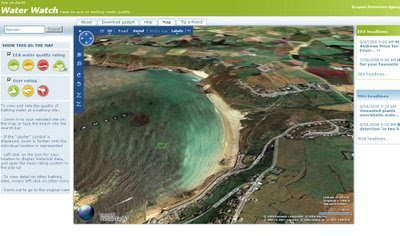
Eye On Earth - Water Watch (Europe)

Eye On Earth - Water Watch (Europe)
Water Watch Eye on Earth
See and rate how clean your beach is. European Environment Agency launched the Eye on Earth water campaign, using the Microsoft Virtual Earth platform. The new campaign monitors beach water quality along the coasts and allows the reporting of quality concerns. Virtual Earth provides a bird’s-eye view of beaches that users plan to visit and helps provide information on the cleanliness of the water before they make a trip.

"Eye on Earth retrieves data from 21,000 monitoring points across Europe, presenting recent water quality ratings for bathing sites in 27 countries, and for some beaches, historical ratings for up to the past 18 years. Countries including Greece, Italy, Malta, the Netherlands, Slovenia, Portugal and Slovakia will also display the latest 2008 data, with more countries expected to update information in the near future. A traffic-light-style evaluation of water quality based on traditional monitoring methods is supported by similar ratings reflecting the experiences of people who have visited the beach. Combining these streams of information provides accurate and up-to-date information on bathing water quality across Europe, and makes it available to anyone who has access to the internet."
Source: Microsoft Press Release

Water Watch Eye on Earth in 3D
Sennen Cove, Cornwall in 3D.
Beaches can also be viewed either in Birdseye View (Oblique Aerial) or in 3D View as above.
For a UK Birdeye View Beach, visit Bournemouth or Brighton.

"Eye on Earth allows users to zoom in on a given section of the coast or riverbank, both in street map or bird’s eye viewing formats. A ‘traffic-light’ evaluation (red, amber, green) of water quality based on scientific monitoring methods is supported by similar ratings reflecting the experiences of people who have visited the bathing site.

As part of the five-year partnership announced last May, the EEA and Microsoft will continue to develop the Eye on Earth portal by adding new sets of environmental information."

http://www.eea.europa.eu/highlights/heading-for-your-favourite-beach-is-the-bathing-water-clean

Suggestion: Great to see water quality, but having a rating on the conditions and potential dangers (rip tides, strong currents, large tidal range etc) would also be useful to the potential tourist.

Labels: , , , , ,

13 August 2008

Google Maps API - Walking Directions

update - from The Google Maps API Team

"This is the testing version of the Maps API JS, is not meant for production, and is liable to change at any time. Only use it for your personal experiments, and don't be surprised if it breaks later."


Google Maps API - Walking Directions
New!
Google Maps API Walking Directions New
Previously only 'Walking Directions' was available in Google Maps - Now available to be customised in the Google Maps API.

Try Mapperz version
http://mapperz.googlepages.com/Google_Maps_API_Walking_Directions.html


Thanks to Mike Williams with his useful and informative posts (usually with an example or two) on the Google Maps API Group with Version changes to the API. Walking Directions is made available in version *v2.124.


*Warning v2.124 is still subject to change.

source:
http://groups.google.com/group/Google-Maps-API/browse_thread/thread/0a12fef4439790cf#

v2.124 adds walking and avoid highways routing to the API.

The new GDirectionsOptions are:
{travelMode:G_TRAVEL_MODE_WALKING}
{avoidHighways:true}

The defaults are
{travelMode:G_TRAVEL_MODE_DRIVING}
{avoidHighways:false}

Example: http://econym2.googlepages.com/temp_walk.htm

Note: API v2.124 is not yet live. It's possible that the code may be
changed before it goes live.

Labels: , , , ,

11 August 2008

Where is the Path? - 3D

Where is the Path? - 3D

A recent update which includes the option of 'Earth' (Google Earth inside the web browser)


Allows the user to create a route of their choice and view it in 3D - attribution of the points is available.
Export to GPX for input into a GPS device.
*Earth plugin must be installed to view the content.
In the drop down list select OS+Earth

There is a limit on the number of Ordnance Survey tiles per a 24 hour period (30,000 tiles) - keep an eye on the percentage bar in the bottom left corner.
OS please raise this limit to 50k or higher.

http://wheresthepath.googlepages.com/wheresthepath.htm

Full credit goes to Bill Chadwick for producing this nifty side-by-side mapping application.

Labels: , , , , , ,

09 August 2008

Sliverlight Map - Editor with Exporter

Sliverlight Map - Editor with Exporter

IDV Solutions Sliverlight with SQL & KML Output Map
Idvsolutions.com have produced a neat Virtual Earth based mapping editor that allows a user to create point,line and polygon overlays, all three have attributes attached and can be exported to KML (Google Earth) or SQL Server 2008 formats.

SQL 2008 output for the Features above:

CREATE TABLE VisualFusionShapes (fid int IDENTITY (1,1), title nvarchar(120), description nvarchar(500), geo geometry);
INSERT INTO VisualFusionShapes (title, description, geo) VALUES ('Georgia', '', geometry::STGeomFromText('POLYGON((39.919084 43.463258,40.358537 43.622528,41.017717 43.542946,41.347306 43.399432,41.632951 43.303566,42.138322 43.287574,42.445939 43.287574,42.731584 43.207550,43.434709 42.918592,43.632463 42.757471,43.720353
42.595930,44.225724 42.725196,44.511369 42.805851,44.972795 42.805851,45.456193 42.628272,45.719865 42.482602,45.697892 42.125089,46.269181 41.978249,46.510881 41.880166,46.269181 41.732761,46.379045 41.486331,46.620744 41.436932,46.686662 41.288510,46.488908 41.156295,46.313127 41.238960,45.631974 41.354517,45.236467 41.371008,44.621232 41.222436,44.159806 41.222436,43.764299 41.172836,43.368791 41.172836,42.995256 41.420457,42.819474 41.585016,42.599748 41.634302,42.511857 41.535692,42.094377 41.535692,41.567033 41.535692,41.742814 41.798316,41.654924 42.157674,41.545060 42.466395,41.457170 42.660597,41.281388 42.773602,41.017717 42.821970,40.973771 43.031126,40.446427 43.239572,39.919084 43.463258))', 0));
INSERT INTO VisualFusionShapes (title, description, geo) VALUES ('Area of Interest', '', geometry::STGeomFromText('LINESTRING(37.414201 46.606405,50.422013 46.636587,50.465959 39.827914,37.502092 39.811038,37.414201 46.591307)', 0));
INSERT INTO VisualFusionShapes (title, description, geo) VALUES ('Icon', '', geometry::STGeomFromText('POINT(317.461308 186.55787)', 0));

Loads straight into SQL 2008 Server.

Required is Sliverlight 2
Google Earth or SQL Server 2008 to import the exported files


Bug? Not Sure if this is a bug but when a polygon is created and then the user wants to place a point on top the polygon the polygon becomes editable and no point is placed.

Suggestions

Annotation (Text not attached to any specific geometry)
Predefined Shapes (Circle, Rectangle, Triangle geometry)
Clicking on the edges allows the move the shape
Export to other formats GPX,XML etc.


More information is available
http://idvux.spaces.live.com/blog/cns!2EB6AAF6C3AC1EBE!980.entry


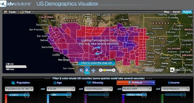
IDV Solutions US Demographics Map
US Demographics Visualizer is also a very good thematic map generator for US Census data.

http://demo.idvsolutions.com/apps/censusdemo/flash/map.html

Labels: , , , , , ,

08 August 2008

Google Maps- Summer Games 2008

Google Maps- Summer Games 2008

(click the << to see the map)

Embed from here for your website or blog
http://maps.google.com/help/maps/2008summergames/

View in Google Earth (Google Earth needs to be install on your computer first)
http://mw2.google.com/mw-earth-vectordb/geographic_web/summer_games08/summer_games_root_en.kmz

View in Google Maps
http://maps.google.com/maps?f=q&hl=en&geocode=&q=http:%2F%2Fmw2.google.com%2Fmw-earth-vectordb%2Fgeographic_web%2Fsummer_games08%2Fsummer
_games_root_en.kmz&ie=UTF8&ll=39.053318,117.355957&spn
=5.885878,9.887695&z=7

Labels: , , , ,

05 August 2008

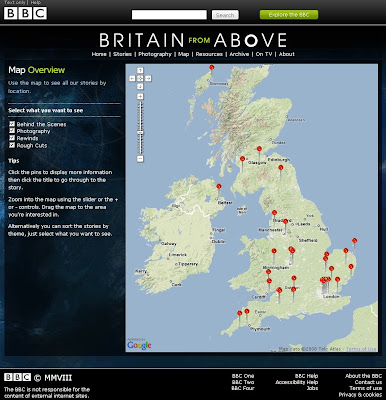
BBC 'Britain from Above' - Map

BBC Britain from Above Map

BBC Britain from Above - Map
Users can have a 'sneak peek' as to what is coming in the New Series

View the Map


"It's like Google Earth, but for real."
Telegraph

Andrew Marr takes to the skies exploring Britain from above.

An epic journey revealing the secrets, patterns and hidden rhythms of our lives from a striking new perspective.

Britain looks very different from the skies. From a bird's eye view of the nation, its workings, cities, landscapes and peoples are revealed and re-discovered in new and extraordinary ways.

Cutting edge technology allows you to see through cloud cover, navigate the landscape and witness familiar sights as never seen before.

[Extract from BBC Britain from Above]


The programme starts on Sunday August 10th at 9pm on BBC One and then switching over at 10pm on BBC Two. It will air for three weeks concluding on Sunday August 21.
[or view it after it has been broadcasted using the BBC iPlayer for 7 days]

UK Users can see some short clips from
http://www.bbc.co.uk/britainfromabove/stories/rewinds/edenproject.shtml

Labels: , , , ,

01 August 2008

ESRI Geoprocessing Center Now Open

ESRI Geoprocessing Center Now Open

ESRI Geoprocessing Center Now Open
Finally ESRI have opened up the 'Geoprocessing Center' for all, users can upload and share geoprocessing models and scripts.

There are 4 parts to the Geoproccessing Center:

Geoprocessing Blog - News and Posts

Models and Scripts Gallery - Where users can upload/download and share.ESRI Geoprocessing Center Models & Scripts

Forums - Discussions on Geoprocessing Models

Knowledge Base - Technical Articles

Not much content currently but in the coming months hopefully will be as popular as the Arcscripts portal has been for many years.

*Important*
Please read these important guidelines if you wish to upload a model or script to the Geoprocessing Center - the more people share the more everyone will get out of this.
http://blogs.esri.com/Dev/blogs/geoprocessing/archive/2008/07/29/Guidelines-for-submitting-tools-to-the-Model-and-Script-Tool-Gallery.aspx
or direct link to the Guidelines for submitting Model and Script Tools [PDF]

Labels: , , , , , ,