->

20 September 2010

Hurricane IGOR - NOAA KMZ Overlays

Hurricane IGOR - NOAA KMZ Overlays

Hurricane IGOR Advisory Archive NOAA KML/KMZ - National Weather Service
Hurricane IGOR Advisory Archive NOAA - National Weather Service - KMZ Display using Google Maps v3.

Overlayed 4 KML/KMZ files from
http://www.nhc.noaa.gov/gis/archive_forecast_results.php?id=al112010&name=Hurricane%20IGOR

Mapped the overlays here
http://mapperz.110mb.com/GMAP/Hurricane_Igor.html

Labels: , , , , , ,

15 July 2010

Climate Change Impact Using Google Earth

Climate Change Impact Using Google Earth

The Google Earth KML shows how the world would be affected by a global average temperature increase of 4 Degrees Celsius is an awareness in climate science.

Using Google Earth this illustrates rising levels of sea water and reduction in crop yields in different parts of the globe if temperatures are not stemmed by reducing greenhouse gases.

Climate Change Impact Using Google Earth

The launch of the map by the Foreign Office (FCO) and the Department of Energy and Climate Change (Decc) comes in the wake of the "climategate" row over emails stolen from the University of East Anglia's Climatic Research Unit and the sustained attack it prompted on scientific research into man-made global warming.

On 14th July, the FCO and DECC launched an interactive map showing some of the possible impacts of a global temperature rise of 4 degrees Celsius above pre-industrial times. It underlines why the UK Government and other countries believe we must keep global warming to 2 degrees Celsius. The map includes videos from the contributing scientists, led by the Met Office Hadley Centre, talking about their research. It also includes examples of what the FCO and British Council are doing to build understanding globally of the urgent need for all countries to accelerate the transition to a low carbon economy.

http://www.fco.gov.uk/en/global-issues/climate-change/priorities/science/

Government chief scientist Professor John Beddington said there was "no doubt there is a problem in public confidence in climate change".

Between November last year and February this year, the number of people who thought climate change was not happening had increased and the number who thought it was man-made had fallen.

The map, which will be updated as new data becomes available, features videos of scientists talking about the research behind the potential impacts of climate change and information about work undertaken by the Foreign Office and British Council.

Climate change minister Greg Barker said politicians had a responsibility to help make it easy for people to take action on climate changes.

And he said: "A lot of this is about the tone - there was a slight sense the climate community, and politicians are a large part of that, got what was coming to it.

"It was being a little too preachy, had a little bit of a high moral tone."

He said people did not need to deal in absolutes to make a strong case for action on climate change and it was in the UK's long-term interest to lead the way on the move to a low carbon economy.

Ed Parsons from Google said: "This is a great example of the benefits of using the latest web technology to visualise scientific information and promote better understanding of the potential impacts of climate change."

The online map is available, for people who have Google Earth installed, at: http://www.fco.gov.uk/google-earth-4degrees.kml

Source:
http://www.fco.gov.uk/en/global-issues/climate-change/priorities/science/
http://www.telegraph.co.uk/earth/environment/climatechange/7891165/Interactive-climate-map-from-Google-shows-future-impact-of-climate-change.html

Labels: , , , , ,

14 August 2009

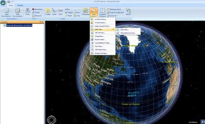
ArcExplorer (build 900) - GIS for Everyone finally...

ArcExplorer (build 900) - GIS for Everyone finally... who has a pc'

There has been quite a wait for this version of ArcExplorer from ESRI. Though finally a product that can be used by all users.
Think along lines of Microsoft Office now has a geo-spatial browser.

ESRI ArcExplorer (build 900)
GIS for Everyone finally...

What is new and why it is finally a useful product?ArcExplorer Import Content
  • New User Interface (very Microsoft Office ribbon like)

  • GIS analysis (such as visibility, direction finding, and proximity search)
  • GeoRSS feeds import
  • New basemap galley for easy access to different base maps
  • 2D/3D modes now caters for the 2D map perspective.
  • Improved KML support and support for layer packages (.lyr support & the .lpk introduced at ArcGIS 9.3.1)
  • GPX data import
  • JPEG 2000, GeoTIFF, MrSID import
  • New presentation mode - useful for presentations.
  • Bing Maps *free to ArcGIS Desktop users - Though visit Bing Maps to view for free.
  • Localisation - dependant on your language
  • Projections - Expansion package required.
Other notes:
ArcGIS Explorer SDK (direct link to .exe file) - 24.5mb
"For developing custom add-ins which extend the capabilities of ArcGIS Explorer. Requires Visual Studio .NET. Note: The SDK must be installed after installing ArcGIS Explorer. For more information read the ArcGIS Explorer SDK Installation Guide"

Optional Expansion Packs:
(direct links to .exe files)

Data Access Expansion Pack (9.9mb)
Expands geodatabase functionality by allowing direct connections to multi-user geodatabases

Fonts Expansion Pack (2.7mb)
Adds more ESRI fonts for use with ArcGIS Explorer. ESRI fonts are used when displaying ArcGIS Layer files and Layer packages.

Projection Engine Expansion Pack(15.2mb)
Adds more projections and geotransformations for use with ArcGIS Explorer

Source:
http://blogs.esri.com/Info/blogs/arcgisexplorerblog/archive/2009/08/13/what-s-new-in-arcgis-explorer.aspx

Official Page:
http://www.esri.com/software/arcgis/explorer/index.html

What's New Guide (with video)
http://www.esri.com/software/arcgis/explorer/whats_new.html

Demos:
http://www.esri.com/software/arcgis/explorer/demos.html

System Requirements
http://www.esri.com/software/arcgis/explorer/system_requirements.html

Download Page:
http://resources.esri.com/arcgisexplorer/900/index.cfm?fa=home
(the main program is 78.4mb)

@Mapperz

Labels: , , , , , , ,

19 June 2009

Map Channels - June 2009

Map Channels - June 2009

A busy month for Map Channels: They have released the following 3 new features this month alone.


• 17 Jun 2009 : Iran Election Twitter Map

Iran Twitter Map - Map Channels
Mapping tweets about the Iran Election using twitter #tags

• 15 Jun 2009 : Map Feed Converter v1 (beta)

A utility to convert data between KML and tab-delimited format and text to KML.

• 1 Jun 2009 : Map Channels Version 3.02

Which helps you create maps for your own website quickly and easily.

Updated to fix some bugs and add new features.

Also see http://www.mashedworld.com/ for Google Maps and Street View Projects

Look forward to even more to come...

Recently Related:
http://googlemapsmania.blogspot.com/2009/06/iran-protests-on-google-maps.html
To keep up-to-date with the latest from Map Channels use the RSS Feed on the News page
http://www.mapchannels.com/News.aspx

If your bored on a Friday try the Quiz Maps:
http://www.mapchannels.com/QuizMaps.aspx

Labels: , , , , , , ,

09 June 2009

Cloudmade 'Fast Maps' with KML Overlay

Cloudmade 'Fast Maps' with KML Overlay

"Using the web maps lite API you can achieve lightening fast maps"

CloudMade's Web Maps Lite API lets you embed our maps in your website.
Using our JavaScript API you can:
  • Take advantage of the most up-to-date source of map data on the web
  • Benefit from the rich OpenStreetMap dataset, with features such as footpaths and cycle paths that are not found on other online maps
  • Be free from restrictive licensing - use our maps for routing, real time tracking and as a basemap to derive new layers.
Now you can overlay your KML on these fast maps with very little programming or issues.

CloudMade Fast Maps with KML Overlay
Fast Maps for Mobile and Web Mapping Applications - With KML Overlay
http://mapperz.googlepages.com/cloudmade_kml.html

Note: Web Maps Lite is available is now out of developer pre-Alpha

Google Maps API does not current have the superfast maps (Google Maps API v3 'in labs')
with the KML Overlay option, so this is currently Mapperz recommended route for fast mapping (with mobile applications) and overlaying your own data.


Source:
http://developers.cloudmade.com/projects/web-maps-lite/examples

Labels: , , , , , ,

20 May 2009

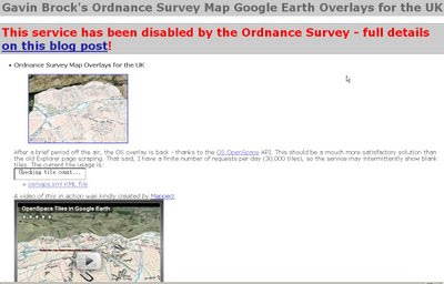
Ordnance Survey [resurrects] OpenSpace Mashup

Updated 20/05/2009
An the Winner is.... Gavin Brock -
Well done to everyone who contacted the Ordnance Survey about this - now you can be proud of yourselves.


The tiles impressions limit has also been upped to 1,000,000 from 30,000.
[http://www.brock-family.org/gavin/google-earth/osmaps.html]

2009-05-19 (Tue)

We’re back!

"First I would like to thank you all for your support! I believe that your emails, posts and comments, regarding yesterdays blog post, made a difference. It’s great to hear from you – it’s what makes writing software for fun, erm.. fun!

I just received a detailed message from the Director of Products at Ordnance Survey, apologising for the communication regarding the disabling of the service. He explained, that this is not a “derived data issue“, but rather to do with the licenses:"

more here: http://gavcode.wordpress.com/2009/05/19/os-overlays-re-enabled/


Ordnance Survey Kills OpenSpace
Mashup

update: Ed Parsons (former CTO at OS, now Google) mentions this mashup in his latest post
http://www.edparsons.com/2009/05/os-puts-the-no-back-in-innovation/

OS Kills OpenSpaceAPI G.Brock Mashup
For a long time this site [http://www.brock-family.org/gavin/google-earth/osmaps.html] was straight forward and overlayed Ordnance Survey Maps in Google Earth.

Users could view the Maps which were overlay-ed on the Google Earth Terrain.
The 3D view helped visualize users with the surrounding features as well as giving them familiar maps as reference. There is no financial gain here, nor any advertising, but Ordnance Survey states

"We really like your project, but unfortunately it will need to be discontinued as soon as you can. This is because it remains our current position that OS OpenSpace Developers may use third party content with our data provided they do no grant the third party any wider rights than those the Developer agrees to when accepting the Ordnance Survey’s OpenSpace Developer Agreement."

OS, Openlayers [the underlying OpenSpace API source code] itself is third party [right?]

and JSR_CLASS.JS
is part of Yahoo! SDK Copyright (c) 2005, Yahoo! Inc.
[see http://openspace.ordnancesurvey.co.uk/openspace/opensourcelicences.html#anc1]

So what is wrong here?
Ordnance Survey you are not losing out here. In-fact it is a free promotion to use your service.

Brock OS disabled KML Tiles
The web version of the above site worked really well but not anymore - thanks OS.

Read more from the source:
http://gavcode.wordpress.com/2009/05/18/os-overlays-disabled/


Labels: , , , , , ,

15 January 2009

Embed Google KML/KMZ On Your Webpage or Blog

Embed Google KML/KMZ On Your Webpage or Blog

update 20/01/2009
Thematic Mapping Blog has a good example with an extruding polygons based on world mortality.
http://blog.thematicmapping.org/2009/01/thematic-mapping-with-google-earth.html


* Earth Plugin Required
**Wait a few seconds for the Canada Provinces KMZ file to load

KMZ
source:
http://mapperz.kml.googlepages.com/Canada_Provinces.kmz
(3mb compressed KML file)

Source:
http://googlegeodevelopers.blogspot.com/2009/01/recent-kml-and-earth-developments.html

Labels: , , , , , ,

09 August 2008

Sliverlight Map - Editor with Exporter

Sliverlight Map - Editor with Exporter

IDV Solutions Sliverlight with SQL & KML Output Map
Idvsolutions.com have produced a neat Virtual Earth based mapping editor that allows a user to create point,line and polygon overlays, all three have attributes attached and can be exported to KML (Google Earth) or SQL Server 2008 formats.

SQL 2008 output for the Features above:

CREATE TABLE VisualFusionShapes (fid int IDENTITY (1,1), title nvarchar(120), description nvarchar(500), geo geometry);
INSERT INTO VisualFusionShapes (title, description, geo) VALUES ('Georgia', '', geometry::STGeomFromText('POLYGON((39.919084 43.463258,40.358537 43.622528,41.017717 43.542946,41.347306 43.399432,41.632951 43.303566,42.138322 43.287574,42.445939 43.287574,42.731584 43.207550,43.434709 42.918592,43.632463 42.757471,43.720353
42.595930,44.225724 42.725196,44.511369 42.805851,44.972795 42.805851,45.456193 42.628272,45.719865 42.482602,45.697892 42.125089,46.269181 41.978249,46.510881 41.880166,46.269181 41.732761,46.379045 41.486331,46.620744 41.436932,46.686662 41.288510,46.488908 41.156295,46.313127 41.238960,45.631974 41.354517,45.236467 41.371008,44.621232 41.222436,44.159806 41.222436,43.764299 41.172836,43.368791 41.172836,42.995256 41.420457,42.819474 41.585016,42.599748 41.634302,42.511857 41.535692,42.094377 41.535692,41.567033 41.535692,41.742814 41.798316,41.654924 42.157674,41.545060 42.466395,41.457170 42.660597,41.281388 42.773602,41.017717 42.821970,40.973771 43.031126,40.446427 43.239572,39.919084 43.463258))', 0));
INSERT INTO VisualFusionShapes (title, description, geo) VALUES ('Area of Interest', '', geometry::STGeomFromText('LINESTRING(37.414201 46.606405,50.422013 46.636587,50.465959 39.827914,37.502092 39.811038,37.414201 46.591307)', 0));
INSERT INTO VisualFusionShapes (title, description, geo) VALUES ('Icon', '', geometry::STGeomFromText('POINT(317.461308 186.55787)', 0));

Loads straight into SQL 2008 Server.

Required is Sliverlight 2
Google Earth or SQL Server 2008 to import the exported files


Bug? Not Sure if this is a bug but when a polygon is created and then the user wants to place a point on top the polygon the polygon becomes editable and no point is placed.

Suggestions

Annotation (Text not attached to any specific geometry)
Predefined Shapes (Circle, Rectangle, Triangle geometry)
Clicking on the edges allows the move the shape
Export to other formats GPX,XML etc.


More information is available
http://idvux.spaces.live.com/blog/cns!2EB6AAF6C3AC1EBE!980.entry


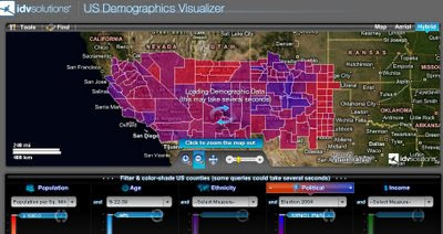
IDV Solutions US Demographics Map
US Demographics Visualizer is also a very good thematic map generator for US Census data.

http://demo.idvsolutions.com/apps/censusdemo/flash/map.html

Labels: , , , , , ,

03 April 2008

Google Maps Annotation (Label) Generator

Google Maps Annotation (Label) Generator

Google Maps Labels Annotation Generator


Easy to Create and Change - Limited Fonts


Can output in 3 formats
KML
Javascript (for Google Maps API)
Images

Try your own Label Generation here
http://ec.geoblogspot.com/GELab/ecLabel.htm

Credit to Valery Hronusov

Source:
http://googlemapsapi.blogspot.com/2008/04/text-images-without-much-coding.html

Labels: , , , , , ,

13 February 2008

Spreadsheet Mapper 2.0

A Google tutorial shows you how to enter data in an on-line spreadsheet to generate a set of markers in Google Earth and Maps and Google Maps API. Google Docs' web-based, collaborative editing allows your team members to simultaneously enter data and instantly publish updates.

"Using this tool you could: showcase your organization's projects, program sites or partners; map your offices, volunteers, or resources; or visualize your data on local, regional or global scales."


Time to create Lines and Polygons...
Lines

Excel to KML (now with Line and Arrows from GPS track logs) http://www.earthpoint.us/ExcelToKml.aspx


Polygons

http://code.google.com/articles/support/ezdigitizer.htm
(copy and paste the code into excel or notepad and save as kml)

Official Link:

http://earth.google.com/outreach/tutorial_mapper.html

source: http://freegeographytools.com/

Labels: , , , , ,

10 January 2008

New Nuclear Plants Get Go-ahead - KML Map

New nuclear plants get go-ahead
from the BBC News Top Story
http://news.bbc.co.uk/1/hi/uk_politics/7179579.stm

Nuclear UK Development Plans
Image Source: BBC News/Jackson Consulting & DTi


To Location Map in Google Maps with link to the Wikipedia for each site.


View Larger Map

Thanks to Mike Williams (HTML in KML assistance)

Labels: , , , , ,

07 January 2008

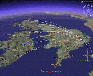
UK and Ireland Flight Maps (Google Earth)

UK and Ireland Flight Maps (Google Earth)

UK Flights from London Gatwick - Click for Animation

Created by http://www.barnabu.co.uk/
KML file available:
http://www.barnabu.co.uk/uk-and-ireland-flight-maps/

"The Placemark balloons include information about airlines and destinations.
Labels follow Wikipedia’s convention of using place names rather than real airport names.
Routes are displayed with exaggerated altitude. "


Guidelines:
"One downside of Google Earth’s highlight mode is it doesn’t stay switched on a after a mouse click. However, there are a few navigation tricks that allow you to keep routes displayed and move around."

  • Click the middle mouse button on an airport icon, and hold it down while moving the the mouse.
  • Hover the mouse pointer over an icon, then switch to keyboard control (cursor keys, shift + cursor keys, Page up/down, + key, - key, etc…).
  • Click on an airport icon, quickly drag it and let go. Just as you would to set the Earth rotating.

Data source:
"The source data for all this is scraped from the Airport pages on Wikipedia, and compiled using a lot of Perl scripting to scrape, mash and meld it into KML. Obviously its never going to be 100% reliable, but at least it should be pretty easy to keep the file regularly updated, and expand to other parts of the world."

Nice use of Wikipages and Google Earth.
Mapperz

Labels: , , , , , ,

22 November 2007

Nokia Sports Tracker Beta Map

Nokia Sports Tracker Beta Map

Nokia Sports Tracker Beta

http://sportstracker.nokia.com/nts/main/index.do

Sports Tracker version 1.63 is available from this site (login required)

  • Integrated with Google Maps: "satellite" or "map" view.
  • Store and display your activities online
  • View detailed data such as speed, distance etc
  • Upload geotagged photographs of your activities
  • Live Sharing of activities
  • Free (no subscription)
Download for Nokia Phones
http://sportstracker.nokia.com/nts/download.jsp
But still not integrated with Nokia Maps!
(now that would be very useful)

for more detailed information on the sports tracker
http://www.e-series.org/archives/450

still not sure why it only uploads gpx files and not kml files

What tools do I need to use the Nokia Sports Tracker Online service?

For viewing the stuff on Nokia Sports Tracker Online you need a web browser.

Mozilla Firefox is recommended.

http://sportstracker.nokia.com/nts/faq.jsp


Labels: , , , , , , ,

12 November 2007

Bird Flu Map - Hits UK Norfolk/Suffolk

Bird Flu - Hits UK Norfolk/Suffolk

"Further restrictions are being put in place in a wider area surrounding the infected premises near Diss as a precautionary measure.

In consultation with ornithologists and other experts, a wider Restricted Zone has been established in addition to the controls put in place earlier today; i.e. the 3 km Protection Zone and 10 km Surveillance Zone around the Infected Premises. The new Restricted Zone covers much of Norfolk and the whole of Suffolk.

This is still an early stage in the outbreak. The new Restricted Zone requires the isolation of poultry from wild birds. Movements within this zone can take place, but movements are not permitted out of the new zone at present. We expect to make available general licences for low risk movements out of the zone shortly.

No movements of poultry are permitted at present in the 3km and 10km zones around the Infected Premises.

These measures are a precaution while the results of further laboratory tests and investigations into the outbreak are awaited.

In addition, the national general licence permitting bird gatherings in England has been revoked, and bird shows and pigeon racing will not be permitted for the time being.

As further information becomes available, and in consultation with ornithological and other experts, the restrictions in place may be adjusted."

Advice from the Food Standards Agency remains that properly cooked poultry and poultry products, including eggs, are safe to eat

Based on the information from the Defra Website and BBC News

A Google Earth KML File can be created for overlay on Google Maps/Google Earth
3KM Restriction Zone
10KM Surveillance
(Subject to change)


View Larger Map

Labels: , , , , , , ,

16 October 2007

New Live Maps - Goes Live +KML Overlay

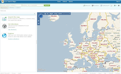
New Live 'Search' Maps - Goes Live

New Live Maps
New cleaner version of Live Search Maps

and the 3D gets smoother....

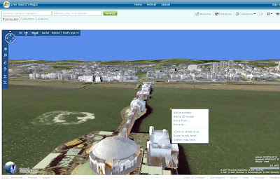
New Live Maps Brighton in 3D
Brighton Pier in 3D in FireFox.

Look for the Loader
3D Loading Rendering Progress
The Globe show the data loading/rendering for the view.

quick guide -

Shortcut keys...
Home [Button] - Birds Eye -straight down
Page up [Button] - Zooms Out
Page Down [Button] - Zooms in
Cursor keys - Pan in keys direction
Shift - Pivot on that location
Control (Ctrl) Key - tilts and rotates (with mouse)
B - Birds Eye View

Click 'N' (North) on the controls resets the direction to North.

Control and Shift keys can be use with the mouse.

Have a Play - http://maps.live.com/


Some more details coming out.

Codenamed Gemini is Version 2 of Live Maps based on the Virtual Earth 6 Engine

New Features include KML overlay (a global accepted spatial dataset now?)

Seems only points are supported so far here is an example

Google Maps KML overlay

Now Live Maps KML Overlay

Same KML URL but the route(polyline) is missing - though does allow you to subscribe to the KML via RSS

Much more information in more detail is available from the official blog
http://virtualearth.spaces.live.com/default.aspx?wa=wsignin1.0

Google Earth Blog has a very good articial on Basic KML supported by Microsoft
http://www.gearthblog.com/blog/archives/2007/10/microsoft_virtual
_earth_supports_ba.html


Mapperz

Labels: , , , , , , ,

19 September 2007

Brighti Solutions - GeoData to GeoRSS

Brighti Solutions - GeoData to GeoRSS

Get your data unlocked and web ready. It's quick and clever
Brighti Solutions GeoRSS Output
At first glance locations seems displaced. But in the Google map (below) locations are in the correct location.

"Yet the problem remains that most geodata is locked away in formats that don't play nice with the major web mapping providers"

"That’s where BRIGHTi GeoFeeder comes to the rescue"

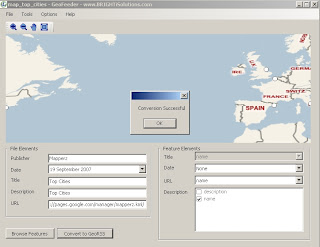
  • Convert to all variations of GeoRSS formats including RSS, ATOM and Simple,GML,
  • Works with the following formats/extensions: .kml, .kmz, .gml, .shp, .mif, .dxf
  • Convert vector data (points, lines and polygons) to GeoRSS
  • Map feature attributes to GeoRSS attributes
  • Specify multiple attributes for elements
  • Displays all features on a Virtual Earth map
  • Browse features and attributes
  • Zoom and pan
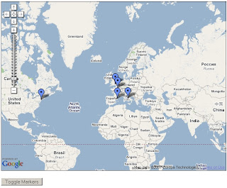
Brighti Solutions GeoRSS Google Map
This map took 30 seconds to create - code from the official example
http://www.google.com/apis/maps/documentation/
examples/geoxml-rss.html
*change api key to your website
*change url of the georss.xml (GeoRSS file)
done!
Nice work.

Suggestions
More formats please
hyperlinking urls (like to products - this can be done if edit the xml file)
feedback forum to share issues and solutions

Labels: , , , , , , , ,

10 August 2007

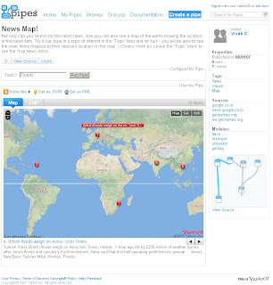
Yahoo Pipes - News Map - Output KML

Yahoo Pipes - News Map
Finally a Yahoo Pipe that uses a map to visualize the found results.

Yahoo Pipe Map - Author Vivek C

Author of the Pipe is Vivek C

Though there were not many feeds to the Map - The useful thing with Yahoo Pipes is that when it is published it is available to public and 'Copies of' can be created (sign in to yahoo required).

Here is Mapperz version of this
Yahoo Pipe Map Mapperz Version
This Map is overlaying rss feed from the yahoo pipe model below
Yahoo Pipe Map Model - Mapperz Version

Add RSS feeds is very easy to apply - use the + icon on the url feed.
Mapperz added some extra rss feeds
BBC News
Reuters UK
Sky News
CNN
and the Mapperz Blog


But the clever thing about this pipe is that it is using a normal rss feed then using geonames.org to apply a latitude and longitude to the rss feed > therefore creating a georss feed. This is then overlayed on a yahoo map showing the locations around the world.

Yahoo Pipe Map KML - Google Earth
One final point, you can export the results to KML and view in 3D using Google Earth.
One helpful scenario would be if you were looking for a new house and you can request different estate agents and overlay and view the surrounding area.

Labels: , , , , , ,

24 April 2007

My Maps in Your Blog +KML

My Maps in Your Blog +KML


Nice simple and quick to do.

http://www.dr2ooo.com/tools/maps/

Easier if you have created a KML output in My Maps
for fast indexing of kml use google pages (google servers index very fast)

source:
http://tim.lauer.name/2007/04/23/embed-google-my-maps-map-into-your-blog/


mapperz

Labels: , , , , , ,

04 April 2007

Viewing KML on Mobile Devices

Viewing KML on Mobile Devices

As most know about view KML directly via google maps

like this file


http://maps.google.co.uk/maps?f=q&hl=en&q=
http://mapperz.110mb.com/Mapperz.kml&layer=&ie=UTF8&z=17&om=1

Well you can now do this via a mobile device.
Here's how
Have a Java based phone.
Go to http://www.mgmaps.com/
Download the latest release, currently
MGMaps version 1.33.01, released on April 2nd, 2007
from
http://wap.mgmaps.com/get.php?version=13&platform
=main&submit=Download
Download the JAR or JAD file
use Bluetooth, USB or WAP to do send the file to your phone/pda.
Install the application, (It is safe)
Run MGMAPS
You get a Google Map, this is default. Yahoo, MSN and ASK maps are also available.

for adding KML add your map - select options menu> 3. Services and a sub menu has View KML. Select this and then enter the address in full and it is case sensitive.
http://mapperz.110mb.com/Mapperz.kml
This load the file and then can be overlay on the map.

pics to be included... happy mapping.

mapperz


Labels: , , , ,

17 March 2007

WMS & WFS Google Maps + KML

Oxford Archaeology opened up their data with a Web Mapping Service

Online Archaeology
has a good couple articles on both services. In summary here:
  • Web Mapping Service (WMS) produces maps of spatially referenced data dynamically from geographic information.
wms service in google maps online archeology
Live link for WMS
http://www.online-archaeology.co.uk/GoogleMap/Pages/oa.htm


  • Web Feature Service (WFS) is an interface allowing requests for geographical features across the web using platform-independent call.
wfs service in google maps
Live Link for WFS
http://www.andrewlarcombe.co.uk/index.php/oa


The future of Web Features/Map Services?
These services will have to make room for the KML (Keyhole Markup Langauge) format that seems to becoming a standard in its own right.

And the inclusion of this 'GGeoXML' integrating kml format with Google Maps API
hinted on the Google Maps API group in the next version of the API (2.76) has great potential in making thousands of features available to view to the world.
When available will have a post here on the mapperz blog about it.


Labels: , , , , ,