Brighti Solutions - GeoData to GeoRSS
Brighti Solutions - GeoData to GeoRSS
Get your data unlocked and web ready. It's quick and clever

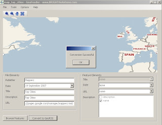
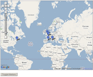
At first glance locations seems displaced. But in the Google map (below) locations are in the correct location.
"Yet the problem remains that most geodata is locked away in formats that don't play nice with the major web mapping providers"
"That’s where BRIGHTi GeoFeeder comes to the rescue"
- Convert to all variations of GeoRSS formats including RSS, ATOM and Simple,GML,
- Works with the following formats/extensions: .kml, .kmz, .gml, .shp, .mif, .dxf
- Convert vector data (points, lines and polygons) to GeoRSS
- Map feature attributes to GeoRSS attributes
- Specify multiple attributes for
elements - Displays all features on a Virtual Earth map
- Browse features and attributes
- Zoom and pan

This map took 30 seconds to create - code from the official example
http://www.google.com/apis/maps/documentation/
examples/geoxml-rss.html
*change api key to your website
*change url of the georss.xml (GeoRSS file)
done!
Nice work.
Suggestions
More formats please
hyperlinking urls (like to products - this can be done if edit the xml file)
feedback forum to share issues and solutions
Labels: Brighti, DXF, GeoRSS, GML, KML, Mif, Output, SHP, Solutions


0 Comments:
Post a Comment
<< Home