CloudMade Map Editor
update 05/03/2009
CloudMade feedback (see comments) looks promising. Thanks for the kind remarks, always willing to help a brilliant minded concept.
Ever wished you can create your own style of map online?
Well CloudMade Map Style Editor might be what you have been waiting for.
"Tired of the same old maps? CloudMade's Style Editor lets you create customized cartography that you can use to distinguish your applications. With the Style Editor, you can easily create a unique map style in a matter of minutes without having to install any special software or have any previous cartography experience"source:CloudmadeIt uses data from
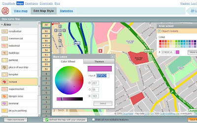
Open Street Map, then allows a logged in user to edit the colour of Roads, Points of Interest [POI], Area features.

Selecting and editing colours is made easy using this CloudMade Map Style editor.
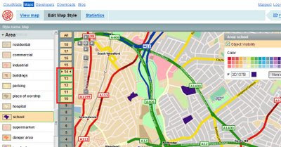
But what happens if you want different representations of a feature at different scales?

Note the zoom scales selected, at these scale you will see a strong purple representation, zoom in and it will be transformed into a more subtle colour (this is only for demonstrating this technique).
Mapperz wish list:
(now this is just a very short version)- Edit Fonts (Annotation) but notoriously difficult to implement
- Text Placement, Centre, North,South,East,West placement of point/symbols with text.
- CMYK colour picker option (for printer), RGB and Hexidemical colours only useful for Screen/Web. See ColorBrewer for this type of usefulness.
- Polygon to Point Representation [e.g.When a School is at an unsuitable scale for area representation is can be displayed by a point/symbol instead)
- Preview/Outline Mode (with Auto Refresh) - currently the user requires to click 'refresh the map with your changes' button. Outline mode for seeing the nodes and segments. Similar function is in Adobe Illustrator.
- Reorder Layers, ranking structure - sometimes having polygons above features can be useful, like a masking out polygon.
- Export File like Illustrator. (maintaining styles and line widths with attributes).
- Grid or Graticule Option.
- Fix the Help [http://www.cloudmade.com/site/products%2Fstyle-editor%2Fhowto] The requested URL /site/products/style-editor/howto was not found on this server.

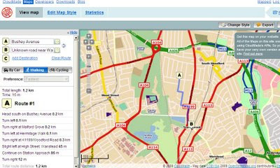
And finally you can already add routing/directions to you customised map, this is because the underlining data has not been changed. Only the graphical representation of the data has been customised.
This is just one of many products CloudMade is offering - here is a full list of all.
http://cloudmade.com/products
Some have already created their own map styles, this are available to view
http://cloudmade.com/products/style-editor/gallery
Below is Mapperz first attempt at showing the schools changing colours when zooming in.
Labels: CloudMade, Editor, Features, Map, Representations, Style, Suggestions


