->

31 August 2006

ArcGIS 9.2 (Release Candidate) Webcast

ArcGIS 9.2 Release Candidate
ArcGIS 9.2 Release Candidate Webcast was broadcasted live at 7-8pm (BST) 31st August 2006
Seminar was presented well by Bronwyn Agrios.
Some new features were demostratated and questions were answered truthfully.

  • New ArcMap navigation options
  • Table and graphing enhancements
  • New “intelligent symbology”
  • Metadata tools
  • ArcGIS Desktop Help enhancements
More details on the ESRI Training Website - The live webcast was recorded and will be posted on the ESRI website soon.

More Live Seminars are to be done in the near future
Some dates are:
October 5th - Enhancements in ArcSDE Geodatabases in ArcGIS 9.2
October 12th - Introduction to Cartographic Representations in ArcGIS 9.2

A draft version of the ArcGIS 9.2 Platform is available to view

helpful link (with flash demos)

MapDotNet Server 2007 Beta

MapDotNet Server 2007 Beta

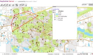
Drawing Polygons/Polylines Feature

"MapDotNet now supports Microsoft’s out-of-band technology for ASP.NET called "Atlas". Drawing, editing and map redraws now occur without a page post-back improving performance and eliminating full-page redrawing."

MapDotNet Server 2007 Architecture

Also an ArcIMS and ArcSDE demo using MapDotNet

Other developments are drag and drop controls

Release date "late fall (autumn) 2006"

30 August 2006

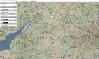
Multiple Map View

Nice and Clean Maps all together in one Place

Ocarto makes use of many open APIs.
Using the slider bars to make each map transparent you can decide which map has better content and cartographic visualisation

Maps Used
Google Maps
Yahoo Maps
Virtual Earth
Terraserver
Yahoo Geocoding

source: Google Maps Mania

UK Geocoding - Microsoft Virtual Earth

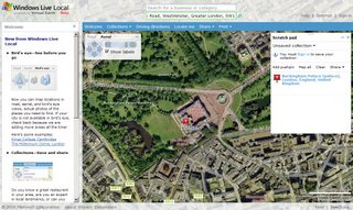
Microsoft Virtual Earth now allows UK Address Searching (Geocoding)

UK Address Geocoding
Finally UK Map users can search for any UK address.

Sharing Maps
Users can also create and share locations using MSN Messenger, via Email, copy to clipboard, add to blog or create a permalink.

29 August 2006

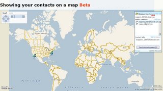
Contacts on a Map


Microsoft have added a service to map your Contacts in MSN and Hotmail
(in Beta of course)
UK Geocoding is possible but yet to be seen to fully work.
More

26 August 2006

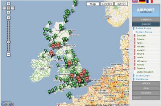
UK Airports Map with Flickr

UK Airports
Geowalk
adds world airports with flickr integration.
German and English verisons available.
(note Swindon does not have an aiport, but Bristol and Exeter both have international airports.)
Good mapping, but data content needs cleaning.

25 August 2006

BBC Travel News - New Interactive Map

An update to the static map.
BBC National Travel Interactive Map
Traffic incidents colour coded by severity
Uses Flash - Zoom in Zoom Out and reserve Pan Functions.
Hover over the icon to see incident based on location.
Updates every minute.

24 August 2006

Captain Cave Map

Nice bit of Google and Microsoft intergration with this Mendip Caving Map.
produced by Bracknell District Caving Club


Users can switch between Mapping from Google Maps and Microsoft
Google Map can have terrian applied with a transparency.

Buy-By-Maps

Search for Airport Hotels and Parking
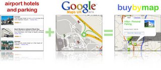
Buy by maps

An Excellent use of Google Maps and AJAX.

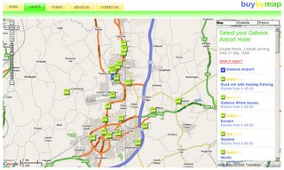
"The system allows you to select an airport and then enter the date of your travel and the type of hotel room you want. We then query a website called Holiday Extras, the UK’s leading supplier of Airport Hotels, for hotel availability. Each Hotel in our database contains a Lat/Long map position which we then overlay onto a map of the selected airport. You may then view the distance of each hotel with comparison to the price. The website makes use of AJAX to request booking forms and hotel information in order to speed up the functionality of the website."

Buy by Map

Currently 191 hotels around 17 British airports are covered by the site, which also offers the customer the option of having door to door directions to the hotel, by simply feeding in their postcode.


23 August 2006

London 3D - Google Earth

London to go 3D in Googe Earth? well nearly all..


for a Movie of the Buildings (nearly complete on the North bank of the Thames)
Digital Urban

22 August 2006

ESRI Polygon Shapefile in Google Maps

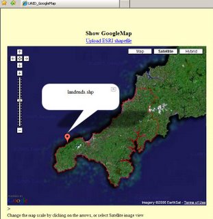
Polygon Shapefile in Google Maps
Polygon shapefile in google map

A small functioning website that has a nice feature to upload a ESRI shapefile (polyline or polygon) and displays it on a google map.

Would be good if could use the xmaps polygon fill.

another shapefile display site is Jshape

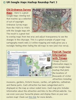
UK Google Maps Mashup Roundup Part 3

Google Maps Mania has another Excellent Round-up for UK Based Google Maps (Gmaps).

Googlmapsmania UK Roundup part 3

21 August 2006

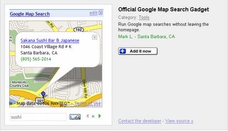
Official Google Map Gadget

Google Map Gadget


"Google Map Search gadget for the personalized homepage -- an easy way do local searches and then quickly scroll through the results on a map"

19 August 2006

Zoomf Property Search Map

Zoomf Logo
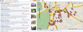
ZoomF Map
A new property website with some new feature such as adding schools and supermarkets to help decision making when looking for a house or flat to rent or buy.
A nice quick site which helps the user to infomation they want.
Currently still in beta.

18 August 2006

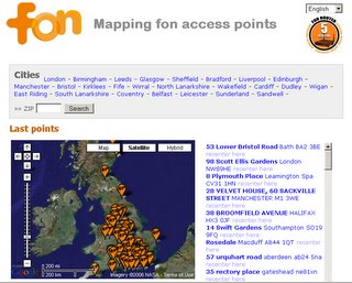
FON Wireless Access Maps

FON maps wireless access

FON is the largest WiFi community in the world thanks to its members known as Foneros who share their WiFi with others. In exchange when they leave their home base they enjoy free WiFi through other Fonero connections

17 August 2006

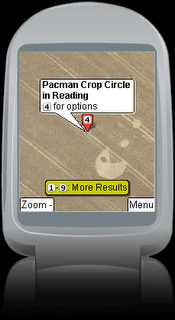
KML Support for Google Maps Mobile

Users of Google Maps on Mobile Devices now supports KML
google kml support on mobile devices

This allows transition of third party data to be displayed in google earth, google maps and now google maps mobile

This web example shows Trekkie sites. click here to see kml intergration in action

16 August 2006

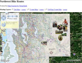
Microsoft MapCruncher

From Microsoft Research


MapCruncher makes it easy to publish maps overlaid on Virtual Earth. Once you are familar with the tool, it will take you about ten minutes to crunch a new map. Just find 5 to 10 corresponding landmarks on your map and on Virtual Earth, and MapCruncher will register your map to the global coordinate system, warp it to fit a Mercator projection, and generate a set of image tiles that can be seamlessly mashed up with VE's standard road or aerial imagery. It even makes a sample HTML page to show you how to use your mashed-up map.

MapCruncher accepts a variety of vector formats (PDF, WMF, EMF) and raster formats (JPG, PNG, TIFF, GIF, BMP).

"The Virtual Earth API allows web developers to supplement Virtual Earth's maps with pushpins and lines. MapCruncher brings mashups to a whole new level by allowing developers to import entire maps to supplement the existing road and aerial imagery with detailed, application-specific information. The possibilities are endless: bicycle maps, transit maps, national park maps, university maps, antique city maps, or whatever drawn-to-scale maps you personally find interesting. You can even augment Virtual Earth with Do-It-Yourself Aerial Photography."

15 August 2006

Google Maps - Add Coupons

A New Feature

Google Maps add coupons
Add Coupons to Your Google Maps Listing - Free!

Allow Google users to print your coupons and bring them to your business. Coupons will appear alongside your business listing on Google Maps.

A new way to attract customers. Adding coupons to your listing in Google Maps will bring new customers to your business. The better savings you offer, the more customers you will gain.

It is free and only takes a few minutes. Just enter a few lines of text for your coupon, set an expiry date and tell us which of your locations accept the coupon. Users will start seeing your coupons within a few hours.

14 August 2006

Windows Live Writer - Publish Maps

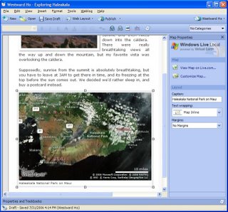
Microsoft have launched 'Windows Live Writer'

This includes Map Publishing

Windows Live Writer Publish Maps

"Whether you are blogging about a vacation or a political conflict, maps are a great help in engaging the imagination of your readers. You can do this using Writer's ability to insert a Windows Live Local map directly into a post.

Even better is that the map can be customized directly within Writer - including changing the view to show road, aerial or bird's eye detail and by adding pushpins (including custom links and/or photos for each pushpin).

When readers click on the map they get a larger view on the Windows Live Local site."

12 August 2006

Animal Maps - Underground Map

Animal Map - London Underground

There is Art in Cartography still.

Thanks to mapgirl

10 August 2006

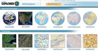
ArcGIS Explorer Soon

Arc Explorer Soon
ArcGIS Explorer arriving soon.

James Fee quotes on ArcGIS Exlplorer (Beta 2)
"It appears that you can now add just about any local dataset to your digital earth viewer; shapefile, personal geodatabase, raster or KML. Navigation tools are improved as well as a ton of keyboard controls. KML support at release will be KML 2.0 and sync up with ArcGIS Server. There are plans to add KML 2.1 support right after the release goes final so don’t get too up in arms about that" read in it in full.

Come on ESRI go live now, not when ArcGIS 9.2 arrives.

National Geographic Atlas

New National Geographic Collegiate Atlas

"Buy this atlas and gain access to the full site." (pre-order)

For this first time National Geographic have produced a 250 page Atlas from 4 seamless databases.

Database scales are 1:2.5,000,000, 1:5,000,000, 1:10,000,000 and 1:20,000,000.

If purchased, you will be given a password to access the National Geographic and get full access to the website.

Maps were produced using customised a verison ArcGIS Arc/Info 9.1 with the Maplex extension.

buy here from NG
or cheaper here

09 August 2006

OnOneMap Birthday

OnOneMap Map

OnOneMap Map

It's good to see mapping applications develop. OnOneMap has be an excellent example of this and continues to provide clear, fast and up-to-date information on a google map.

08 August 2006

E-type Maps

no not jaguars cars.

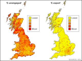
"Households in Britain can be classified into 23 "e-types" depending on their access to technology, say researchers. "

Access to Technology Map

source:BBC News

Goggles Flight Sim

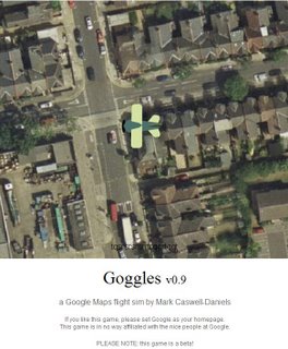
Goggles Flight Sim

A bit of Fun with a cartoon bi-plane, using google aerial images and flight across one of these cities.

London
New York
Paris
Tokyo
and Washington DC.

Aerial View in Goggles Flight Sim

One suggestion, an overview map with flight path, but it is still in beta.
nice and clean refreshing scroll when on a fast internet connection.

07 August 2006

Old and New Maps

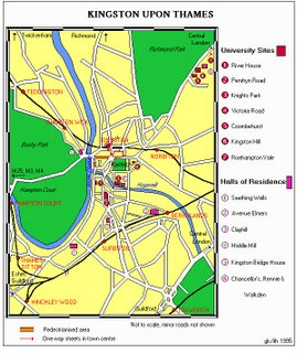
Comparing old web maps to new web maps - key word is 'web' map here

otrCartography asks...
"I wonder which one is the oldest web map*_^ MapQuest anybody? "

oldest web map?
1995

Kingston University Map 2006
2006

any higher bids? (must still be 'alive' and available on the web)

06 August 2006

Ordnance Survey reveal secret sites

Military sites and spy centres will be revealed by Ordnance Survey


"The change in policy means the last remaining 50 sites on the register - including the nuclear warhead factory at Burghfield in Berkshire - will now be marked on all the maps printed by OS."


thanks mctones..

05 August 2006

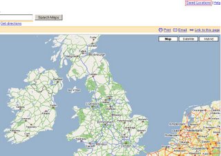
Save Locations in Google Maps

Google now have a new feature to save your map locations.

Save Locations in Google Maps


Sign in to get a personal list of Saved Locations.

  • Keep track of addresses you've previously entered
    Google Maps will automatically remember every address you enter. You can access or remove these addresses at any time by clicking on the Saved Locations link.
  • Get to your destination faster
    Just start typing in an address and Google Maps will offer to autocomplete it for you if it's already in your Saved Locations.
  • Find addresses by name
    Label your favorite addresses and you can later search for them by name.
  • Access your Saved Locations from anywhere
    You can get access to your Saved Locations from any computer by signing in.

04 August 2006

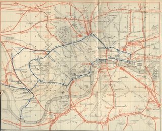
1889 Tube Map London

Tube Map London of 1889

1889 Tube Map
Non Pannable, non clickable, no animated zoom, just a plain old paper map.

Tip:To make an new map look old.
Use a used tea bag - left to right across the page.
Dry naturally.

via CCA Blog

03 August 2006

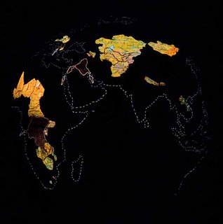
World of Globes

A World of Globes

Pollution Globe
Pollution

Land Locked Countries

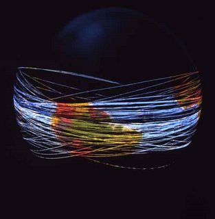
Car Globe
All the cars in the World end to end
(72 times around the globe)

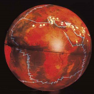
Earth Quakes and Tectonic Plates Globe
Earthquakes and Tectonic Plates

and many, many more... Thanks to 'mapgirl'

ArcWeb Explorer (Out of Beta)

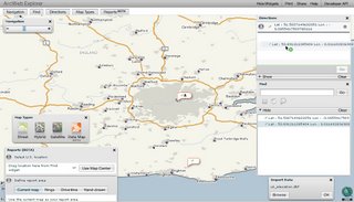
ESRI have released ArcWeb Explorer out of Beta - (some 'widgets' still in beta status)
Uses Flash

ArcWeb Explorer Released

It has some new features - drag and drop locations - get directions from/to them

Add Excel file - you can add your own data to the map, check format first. (can be shape file .dbf)

Find Locations - Find Me/Computer (via IP address, find Geo URL)

View by Map, Hybrid, Satellite and Data type (USA only, Census data)

More Screenshots, PDF's and more info on James Fee GIS Blog
update: ESRI's Official Press Release

02 August 2006

Recycle Maps UK

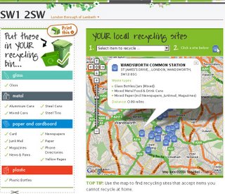
Recycle Maps UK
Enter a postcode and a map showing the nearest recycling locations are plotted, click on the icon to reveal more information. A drop down list can be used to sort by type, icons then fade and highlight the selected type.
Very clean and a useful map for all. No excuse to recycle now.

01 August 2006

ArcGIS 9.2 Documentation Online - New Features

New Features in ArcGIS 9.2 (Added after the Pre-Release)
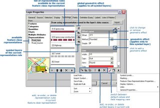

Cartographic Representation
Cartographic Representations

Finally High precision data storage. (at last)

New Flicker command supports change detection and data comparison. (Added after Pre-Release)

Fill symbols with outlines in default ESRI style and others now draw up to 65% faster. (Added after Pre-Release)

New Results tab in ArcToolbox makes it easier to work with your geoprocessing history. (Added after Pre-Release)

Specify layer symbology as properties for input and output data in models. (Added after Pre-Release)

Full support for geoprocessing with ArcGIS Server. (Added after Pre-Release) Toolboxes can be published on the Web to provide geoprocessing services which can be accessed via ArcGIS Desktop.

New commands provide the same enhanced functionality available in the Desktop at 9.2: Add Data dialog, Go XY, Measure, Identify, Find, My Places, Swipe, Flicker (Added after Pre-Release), & ArcWeb Services route & place finding. Support

Also
New free ArcGIS Explorer client
New lightweight GIS data viewer available as a free download. Supports 2D and 3D viewing of maps. Task-based user interface can be customized by developers to expose ArcGIS Server functionality. Fuse data from different sources together to create custom visualizations. Support for server-based data from ArcIMS, ArcGIS Server, ArcWeb Services and OGC WMS Support for shapefiles, file geodatabases, raster data, and Google Earth KML/KMZ.
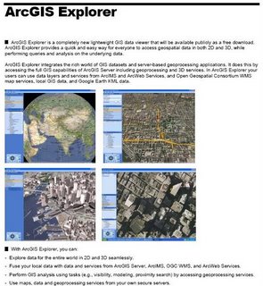
ArcGIS Explorer
Release Date 'Due Last Quarter of 2006'