->

22 December 2008

Egypt Yellow Pages Gets Google Maps and Mobile Mapping

Egypt Yellow Pages Gets Google Maps and Mobile Mapping
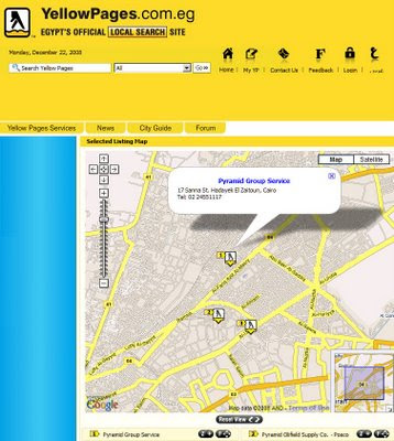
Egypt Yellow Pages gets maps
Yellow Pages now use their own data with Google base maps for users to locate businesses in the local area.

"In the online and mobile world, mapping services from Microsoft and Google have in fact trained Yellow Pages users and advertisers on how to immediately benefit from mapping services on websites and mobile portals"

The local search company announced today it has added location based mapping to both its YellowPages.com.eg and Mobile Yellow Pages websites.

http://www.yellowpages.com.eg/

YellowPages.com.eg is also available on your mobile device yellowpages.com.eg website is accessible by any mobile device in Egypt and around the world. To view the Yellow Pages Mobile portal, simply enter the YellowPages.com.eg in the address line of your mobile browser and launch it.

'It is no easy process to geo-code a Yellow Pages database for an entire country,' commented Mohamed Salah, Egypt Yellow Pages Data Architect and leader of the geo-coding program. 'In our business, businesses never cease opening, closing and relocating; we now have a dedicated team working full time on this project. It is a never ending process'

Source:
http://www.ameinfo.com/179448.html

Labels: , , , ,

18 December 2008

Map Channels - Quiz Maps

Map Channels - Quiz Maps

Map Channels Quiz Maps

"Test your geographic puzzle solving skills" and guesswork with this interactive fun map and locating game

Quiz Maps are geographical quizzes using Google Maps and Panoramio Images.

There are ten questions per quiz, answering all ten questions correctly is the challenge.

Besides the quiz there is a Google search bar, plus optional map layers of Wikipedia articles and Panoramio images.


Map quiz can be embedded on your own website and available in 2 formats:

  1. World Capitals
  2. US State Capitals


• Panoramio images are used as visual clues, these are randomly chosen from popular Panoramio photos of a city. As a result some images may be more helpful than others.

• Further features are planned for Quiz Maps, please Contact Map Channels with any comments and suggestions, or if you would like a custom quiz map created.


Go Play: http://www.mapchannels.com/QuizMaps.aspx


Labels: , , , , ,

17 December 2008

Visit Santa in 3D (Virtual Earth)

Visit Santa in 3D (Virtual Earth)

This one is for the kids and big kids.

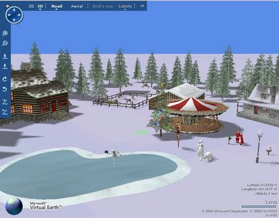
Visit Santa in 3D at the North Pole in Virtual Earth
Created by artists Heidi Simonsen, Stephen May, Augusto Michelis and Matthew Collins

This experience may take up to a minute to load on your screen. Virtual Earth 3D requires the following to run on your computer:
  • Microsoft Windows XP or Microsoft Windows Vista
  • Microsoft Internet Explorer 6, Windows Internet Explorer 7 or later, or Firefox 2.0 or later
  • 250 MB or more hard disk space
  • A 1 GHz processor (2.8 GHz or faster recommended)
  • 256 MB of system memory (1 GB recommended)
  • 32 MB video card (256 MB recommended) that supports Microsoft DirectX 9
  • A high speed broadband Internet connection
Go to the North Pole and Visit Santa
http://www.msnbc.msn.com/id/28146841


(Europeans know - Santa is in Lapland but inside the arctic circle)

Labels: , , ,

16 December 2008

Tiger Data 2008 Released

Tiger Data 2008 Released

update 20/01/2009
A new potentially good source is for Road Linework [editable in a GIS]
is the
National Transportation Atlas Database
http://www.bts.gov/publications/national_transportation_atlas_database/2008/
Now Available in ESRI Shapefile format

Tiger 2008 - US Census Bureau Logo
(Topologically Integrated Geographic Encoding and Referencing system)

The US Census Bureau has recently released the Tiger 2008 data to the public to download and use freely.

Shapefiles (most GIS Software can view them)
http://www2.census.gov/cgi-bin/shapefiles/national-files
Don't have a GIS?
A free Open Source GIS is Quantum GIS


Technical details are available

http://www.census.gov/geo/www/tiger/tgrshp2008/TGRSHP08.pdf

FTP available
ftp://ftp2.census.gov/geo/tiger/TIGER2008/

This updates the earlier post (April 2008)
http://mapperz.blogspot.com/2008/04/tiger-2007-data-release-esri-shapefile.html

The one thing the US Census website lacks is a geographical way of selecting the data.
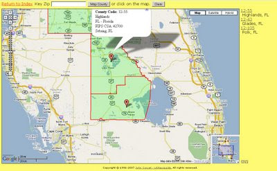
County Finder at Maps Huge.com
Maps Huge helps users find neighbouring (neighboring) counties

Need to know an area in a visual way?
try
http://maps.huge.info/county.htm
or
http://maps.forum.nu/gm_main.html

Labels: , , , , ,

12 December 2008

StreetView Stockholm (MapJack)

StreetView Stockholm (MapJack)

Mapjack Streetview Stockholm, Sweden


Not the Google version but MapJack now covers a city in Europe. High quality images and excellent navigation through the city of Stockholm in Sweden.

Only one suggestion is a geocoder [search location] as the Mapjack website caters for.


View the StreetView in Stockholm
http://www.hitta.se/gatubild/
(fast internet required)

Source:
http://googlemapsmania.blogspot.com/2008/12/google-maps-friday-fun.html

Labels: , , ,

11 December 2008

Blogger Gets Geotagging (GeoRSS Support)

Blogger Gets Geotagging (GeoRSS Support)


Available through http://draft.blogger.com/

"With geotagging, you can add a location to your each of your blog posts. Just as time stamps help readers find posts from a certain date or time, geotags give your readers a way to browse posts near a specific location"
GeoRSS Support included in each post’s location in your blog’s RSS and Atom feeds using GeoRSS, a standard for geotagging. This means that feed readers, map applications and search engines can associate your posts with their locations.

Geotagging has a few known issues. We'll be addressing them shortly, but here are some suggested workarounds for the near-term:
  • The location editor is hidden behind the text field in the Edit HTML tab. Please switch to the Compose tab to view and edit locations.
  • A geotag cannot be removed from a post once it has been saved. If you need to remove a geotag, please copy your post content into a new post and delete the geotagged post.
  • Update 2:33pm: If you have a customized template and you don't see the "Location:" byline, you may need to reset your blog's widget template. Do this by going to the Layout > Edit HTML tab in your dashboard, and then clicking Revert widget templates to default below the main text field.
  • Update 2:33 pm: Some users are having issues with the blog post map gadget. Brian is investigating.
source:

Labels: , , , ,

10 December 2008

TomTom Route Planner (Beta)

TomTom Route Planner (Beta)

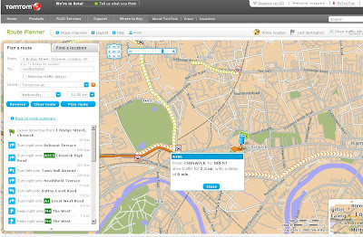
TomTom Route Planner
TomTom Route Planner has some good interactive options, like interactive sidebar and when to leave option, real-time alerts also can be calculated.

There are simple options to change the language without the map and route needing to be refreshed.

TomTom owners can also send to TomTom service with routes and have it stored ready for the journey ahead.

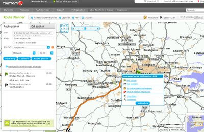
TomTom Route Planner - German
Map does not refresh (a good thing) when a user changes the language - sidebar and marginal do change.

The Service is still in Beta and registration is still required. Hopefully this will be released for public use next year so all can benefit from the TomTom Route Planner.

http://routes.tomtom.com
(requires registration for beta currently)

Sign up here
http://routes.tomtom.com/t/login#/map/?ui=1

Labels: , , ,

09 December 2008

RAC Route Planner - Virtual Earth

RAC Route Planner - Virtual Earth

RAC RoutePlanner - Virtual Earth
New Route Planner from the RAC

Based on MultiMap (Integrated in Virtual Earth) Mapping across the United Kingdom.

Lots of Points of Interest available including Wifi hotspots and Live Traffic Alerts

Example Route (Click Large Map)
http://route.rac.co.uk/routeplanner.cgi?jsOption=true&lang=en_gb&qs_1=London&countryCode_1=GB&qs_2=Southampton&countryCode_2=GB&PlanSubmit.x=24&
PlanSubmit.y=12&rtype=true&rpref=true&maptype=interactive

RAC Routes include Carbon Footprint
The added bonus is that you can calculate your carbon footprint base on the type of transport you are taking by road.

Weather information is also available for that area (users might have to click zoom in on the weather panel to see the weather - this would be even better on the map itself with an option to switch it off.)

Overall straightforward and quick results make this another useful mapping/routing website.


Labels: , , , ,

05 December 2008

Google Earth Puzzler Game

Google Earth Puzzler Game
Puzzler Earth Game
Nice little game for all, the new plug-in seems more responsive.


Play the Game
http://earth-api-samples.googlecode.com/svn/trunk/demos/puzzler/index.html


Apple Mac's can view the game to now.

Google Earth Plug-in, version 4.3.11498.3261 (Windows, Mac)
12/03/2008

* Launch of the Google Earth Browser Plug-in for Mac OS X
* Startup time on Windows has been improved.
* KML/KMZ parsing and rendering speed has been improved.
* XML Namespaces are now supported during KML parsing.
* (Issue 66) Polygons and line strings are now interactive and mouse events on these geometries can now be listened to using google.earth.addEventListener.
* (Issue 76) Fixed a bug that caused a 'Could not create folder' error message upon plugin instantiation if there were spaces in the logged in user's username.
* (Issue 59) Fixed a bug that caused placemarks in interval-refresh Network Links to be duplicated upon user interaction.

http://code.google.com/apis/earth/documentation/releasenotes.html

Source:http://googlegeodevelopers.blogspot.com/2008/12/google-earth-in-your-browser-on-your.html

Labels: , , ,

02 December 2008

Nokia Maps 3.0 (beta) - New! +Ovi Maps

Update: WOM World have just sent Mapperz a Nokia Nokia 6210 Navigator for testing the New Maps out.

Will do a honest roundup of the new map application with the next week or so.
[Thanks to WOM World for that surprise and the link]

Nokia Maps 3.0 (beta)
- New!

Nokia Maps 3.0 - New Features
3D Buildings, New Terrain Mode, and Faster... Nokia Maps 3.0 (beta)

Nokia are having a large launch of many mapping apps and plugins:

updates will follow...

Important bit of info:

"Finally some words about compatibility. Right now the Maps 3.0 beta is available only for Nokia devices based on S60 3rd Edition Feature Pack 2, but we haven’t forgotten the FP1 users either. The version for you will follow soon. Also we’ve seen compatibility issues with N96, so we don’t recommend using Maps 3.0 beta with it just yet. In Maps 3.0 beta old Maps 2.0 licenses are supported, so if you have Walk or Drive licenses on your device, they will continue working also after the update."

* What’s new: Enhanced car navigation, Drive*, through lane assistance, speed limit warners, improved sign post design and new ‘Route overview’ mode during navigation,
* Enhanced pedestrian navigation, Walk**, through shortcuts (virtual connections) in urban areas, straight line guidance for off-road terrain and beeps and vibrations before next turn,
* Significantly improved map data quality and content,
* 3D landmarks for over 200 cities – can be displayed in 3D and 2D map modes,
* New Terrain*** map mode,
* Hi-res aerial images for Satellite*** and Hybrid*** map modes,
* Nokia Maps Updater for PC, to update your Maps application and existing map data,
* Synchronisation of Favourites and Collections with MapsBeta on Ovi and vice versa (use in online mode, enable Internet connection).

# Coming soon in Maps 3.0 commercial release: Safety spot warners in selected countries
# Extended country coverage for Traffic info service
# Weather information
# Premium POI content for travel, selected events and cinemas


More info from
http://www.allaboutsymbian.com/news/item/8588_New_Nokia_Maps_plus_personalis.php

# Coming soon in the next Beta release: Route planner for Drive, car navigation, and Walk, pedestrian navigation,
# Traffic information,
# Weather information.

Download available from here

http://www.nokia.com/betalabs/maps/

Nokia maps comes to the Web Browser (plugin required)

Ovi Nokia Maps in IE8 Browser
You can now view Nokia Maps in Full Screen on your PC - The Plugin is available for IE and FireFox. (Shown here in IE8)

Plugin download from
http://maps.ovi.com/services/integrated

Labels: , , , , , , , ,

01 December 2008

Google launches Street View in New Zealand

update: 02/12/2008
Also available in the Google Maps API
Mapperz quick attempt
http://mapperz.googlepages.com/nz_street_view.html


Official Google Posts now available
http://google-latlong.blogspot.com/2008/12/new-zealand-new-street-view.html

and more information from the Official Google Australia Blog (News and notes from Google Down Under)
http://google-au.blogspot.com/2008/12/street-view-now-in-new-zealand.html


New Zealand Streetview in Google Earth
also available in Google Earth - see http://www.gearthblog.com

Google launches Street View in New Zealand
- New!

Pegman shows you the StreetView Coverage
The coverage of New Zealand Streetview - Pegman shows you the full coverage (every road in New Zealand)

http://maps.google.co.nz/

(officially launched on 2nd December 2008 - but remember New Zealand is 12 hours ahead of the UK!)

Street View New Zealand
(image source : computerworld.co.nz)

"The imagery was collected by a team of Googlers who travelled all over New Zealand to document every single public road in the country over the past year. The team drove Holden Astras, which had cameras mounted on a pole on the roof. "


Tourism New Zealand has selected a gallery of Street View images, available at maps.google.co.nz/streetview, that shows some of New Zealand's most popular tourist attractions and locations to the world.

source and images
http://computerworld.co.nz/news.nsf/news/A3071103626A25F9CC25751200166B37

Labels: , , ,