->

04 July 2011

Nokia 3D World Gaze

Nokia 3D World Gaze gives you a new kind of viewpoint to the world, allowing you to see through the surface (and inside) of the planet all the way to the other side. Just point your phone to some direction and you will see reality in a way you have never seen before. In addition to geographical features such as continents in their real physical locations, Nokia 3D World Gaze allows you to see geo-tagged media, day and night regions, current location of the Sun, and other content from locations around the world. (Like Augmented Reality)


New Dimension of Nokia 3D - World Gaze

The application is targeted to anyone interested in exploring and learning new things about the world around us. It provides a serendipitous view of the world and can be used anywhere on the planet. In fact, we encourage you to try it while traveling abroad: the world looks surprisingly different depending on where you are viewing it from.

Nokia are running the beta now to further improve the application and enhance it to better suit your needs. We are particularly interested in hearing your feedback on how you feel about this new way of looking at the world and what kind of new content you would like to see in the app.

Source:
http://betalabs.nokia.com/apps/nokia-3d-world-gaze

App available from
http://betalabs.nokia.com/apps

Labels: , , , ,

20 April 2011

Ovi Maps 3D Beta (Now Photorealistic)

Ovi Maps 3D Beta ( Now Photo-realistic)


Cities coverage

Nokia's photorealistic 3D models of metropolitan areas initially include:

- Barcelona
- Boston
- Chicago
- London
- Copenhagen
- Florence
- Helsinki
- Las Vegas
- Los Angeles
- Madrid
- Miami
- Milan
- New York
- Oslo
- Prague
- San Francisco
- Stockholm
- Toronto
- Venice
- Vienna

http://maps.ovi.com/3d/
(plugin required) - servers are in demand currently and might not get the full picture - wait a few days for the hype to calm down.

http://conversations.nokia.com/2011/04/19/ovi-maps-3d-the-world-is-not-flat/

Labels: , , , , ,

22 October 2009

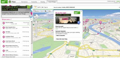
Nokia - Ovi Good Things

Nokia - Ovi Good Things

Nokia - Ovi Good Things
http://maps.ovi.com/goodthings/f84c5631-eec4-4ee6-8c04-872622dc1cb0/Secret-Location

(that's the location but you need a special token)

Labels: , , , , ,

03 September 2009

Ovi Maps News

Ovi Maps News
Nokia have released/updated some Ovi Apps Products

Of Mapping interest there are:

Developers that register for the programme will have access to the following:

  • Ovi Maps Player API – Bringing maps to mobile and web applications effortlessly. The API is powered by NAVTEQ and features more than 180 country maps, location-based search, and detailed place information. Other features include vector-based maps that give a range of views, including: map, terrain and 3D modes for dynamic map mash-ups. The Ovi Maps Player API for the web was introduced earlier this year.
  • Ovi Navigation Player API - Allowing developers to bring Nokia’s industry-leading walk and drive navigation features to their applications, including: pedestrian navigation, turn-by-turn car navigation, and route planning. Developers can deliver applications that get consumers exactly where they want to go.

Ovi Maps Player Example

"Introducing Maps Player - the brand-new, easy-to-use API for Ovi Maps. Maps Player makes it simple to integrate rich Ovi Maps functionality into your website, turning it into a personalised, contextual and compelling experience. "

here is one example

Ovi Maps Player POI

Unlike other Mapping API's available - [Nokia] Ovi Maps Player API gives developers access to their Point's of Interest (currently 3 million) Database.

POI Categories are:

"AMUSEMENT_PARK", "BARS_CAFES", "BAR_DISCO",
"BEACH", "CAMPING", "CAR_DEALER",
"CAR_REPAIR", "CASH_DISPENSER", "CASINO",
"CINEMA", "COMPANY", "CONCERT_HALL",
"CULTURAL_CENTRE", "EDUCATION", "EXHIBITION_CENTRE",
"GOLF_COURSE", "HOLIDAY_PARK", "HOTEL",
"LIBRARY", "MUSEUM", "OPERA",
"PARKING", "PARKING_AREA", "PARKING_GARAGE",

"PARK_RECREATION", "PETROL_STATION", "PHARMACY",
"PLACE_OF_WORSHIP", "POST_OFFICE", "RENT_A_CAR_FACILITY",
"RESTAURANT", "REST_AREA", "SHOP",
"SHOPPING_CENTRE", "SPORT_OUTDOOR", "STADIUM",
"THEATRE", "TOURIST_ATTRACTION", "TOURIST_INFORMATION_CENTRE",
"UNIVERSITY", "ZOO"

Live Example:

Note: you cannot copy & paste the source code unless you have signed up to Ovi Maps Player API (beta) and have recieved 2 api keys from Nokia for specific domains

** For 3D view an Ovi Map Plugin is required and you will require a restart of you web browser.

http://maptile.svc.nokia.com.edgesuite.net/players/map/noauth/examples/Map_Player_moveToObjs.html

More Information Link:

http://www.allaboutsymbian.com/news/item/10415_Ovi_Maps_opens_up_to_devlopers.php
video:

Ovi Navigation API
Ovi Maps Navigation Player API gives you access to the industry-leading Ovi Maps Walk and Drive navigation service, powered by NAVTEQ [Nokia Owned]. With just a few lines of JavaScript, you can add turn-by-turn pedestrian or car navigation to your Ovi apps. You can also add routing to your websites.
Ovi Navigation API
Ovi Navigation API - Drive, Walk & Cycle 'turn-by-turn' directions

Advanced vector maps allow routes matched to the needs of drivers and pedestrians – even when your users are offline.

Developers will be able to use simple, high-level interfaces to leverage turn-by-turn Walk and Drive navigation, with voice guidance in over 20 languages

Users are tired of seeing car routes recycled as "pedestrian". Give them a real Walk experience, with custom map display and enhanced DiscoverCities Navteq data.

Quick links:
http://www.forum.nokia.com/Ovi/
http://www.slashgear.com/nokia-ovi-sdk-plus-navigation-and-maps-apis-launched-0354940/

Source: @Mapperz

Labels: , , , , , , ,

15 June 2009

Nokia N97, Ovi Maps - The Mapperz Review

Nokia N97 Ovi Maps Review

"Ovi Maps is the new name for Nokia Maps."
Nokia have updated their mapping application.
Some good improvements and new content and new features and simpler cost structure.

Deleting Outdated Map Data
Old map data is recognised in the new software and will update the data, though depending on the amount of coverage you choose. Total for the entire world is towards 7GB. The UK is 156.5mb.
Pre-loading the maps will save you money in
'data transfer' costs over the mobile networks.

New Nokia Ovi Maps
Nokia Maps now Ovi Maps was updated last Thursday (11/06/09)

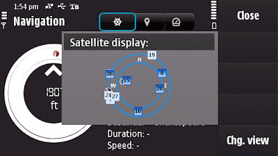
Satellite Status - BarSatellite Status - Radial
A quick note: Getting GPS Fixes faster. (less than a minute with 5 satellites
using standard GPS - no network based or A-GPS which uses the mobile
network to access GPS positional data)

The New N97 has more GPS details - in Applications>Location you can find
this in Position options Satellite Status will give you the signal strength of all
the GPS satellites available.
The view can be changed to Satellite display that gives the orbits on a radial
chart with sun and moon positions also. A nice feature, could this be implemented
in the Ovi Maps Application on the phone?

Back to the Maps:

What is New?
  • The map (vector) data has been completely updated
  • Current weather forecast information.
  • Speed Limit Warner
  • Saftey Spot Warner
  • Travel time or Time of Arrival option
  • Automatic 'Re-route' due to traffic option
  • Walking Directions has the option of straight-line distance to the destination.
  • Automatic 'Day/Night Time' Map mode.
  • Maps Improvement option.
  • *Compass mode (N97) Map rotates with you touch dragging (pan & zoom)
  • Search Nearby - vastly improved and more details available to users
  • Synchronisation with Ovi Maps Online. (confirmed this works very well)
  • Performance has been much improved (panning the map)
  • bugs fixed and is now a more stable application.
  • Better support and help - on phone or online option
Compass requires calibration before the function is available to use.


Traffic Information is now displayed on the Map even in 3D mode - Routes can be
automatic recalculated to avoid traffic incidents.

Smoothness, there has been a big improvement in the panning and zoom,
no jittering - when in driving navigating the map keeps up with the speed
of the vehicle. Navigation does repeat 3 times, one for advanced warning
- 350 yards. Then reminders at 50-30yds then 10 yards.

Walking mode does have the addition of straight line
'as the crow flies'
direction and distance.
(Golf players might use this to their advantage.)
Note the compass is 'green' meaning it is calibrated and active giving the
user the sense of bearing.
Walking Mode Straight line Navigation

Details on the map data:
v3.01 09wk24 b01 MV OpenGL LM MN
Map Version 0.1.22.103 OpenbitLM 6.21.3

Data souces:
NavInfo (Traffic info)
Satellite Imagemap 2002 - Planetary Visions
Imagery - Digital Global 2008
Aronbado por el Insitututo Geografico Milltar 5 Sept 2008.
STRM V4 2008 CIAT

update 25th January 2010 - New devices N97 (June 2009 onwards) Navigation is now Free
for life of the Phone. see
http://maps.nokia.com/explore-services/ovi-maps/downloads#/default/
Costs: (based on UK prices) - For Directions and Voice Navigation.
£52.99 for a year.(covers Europe).
£6.00 for 30 days.
£1.50 per day
*Pricing for other regions vary

1. Bug found: When using the 3D map option on the N97 - the touch screen only pans
upwards, the user cannot pan down the map.

Overall impressed with Nokia Ovi Maps 3 and where this application is going,
not only improving the software, the map data but introducing new and useful
features that engage and interacts with the user getting them to and from
locations conveniently.
Also the maps (vector data from Navteq now Nokia owned) are more up-to-date
than many online mapping
sources including TeleAtlas etc. (which Google uses).
At least areas that Mapperz has tested in so far.

This is the final beta stage of Ovi maps version 3. Expect the full release
in the next few weeks for
all current nokia phones that can support the application.

SportTracker Users will be happy to know that this is working for the N97 with
the touch screen controls.
Please visit Symbian World for more on this:
http://symbianworld.org/1187-sports-tracker-finally-
available-for-nokia-n97-and-5800/

Ovi Maps is a free application for S60 devices, though extra features
'Directions and Voice Navigation'
require licences that can be purchased
through the application.
More information
http://betalabs.nokia.com/betas/view/nokia-maps-30-maps-ovi

More details on the N97 Mapperz recommends:
http://www.allaboutsymbian.com/reviews/item/Nokia_N97
_Review-Part_1-First_impressions.php

http://www.allaboutsymbian.com/news/item/9902_Nokia_N97
_Review-Part_2-Touch-.php

A very special thanks to the team at http://www.womworld.com/nokia/
for a very successful 'Search for N' competition.


Labels: , , , , , , , , ,

31 May 2009

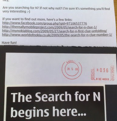
Nokia N97 Hunt - Clues 1,2,3,4 (UK Only)

Nokia N97 Hunt - Clues 1,2,3,4 (UK Only)

(Search for N)

Clue 1:
http://share.ovi.com/media/womworldnokia.public/womworldnokia.11602
(3,3,7)

Clue 2:

http://thereallymobileproject.com/2009/05/search-for-n-clue-2/
(3)


Clue 3: on this post (3 other parts needed)
(not a word but a format)

Clue 4: http://twitter.com/WOMWorldNokia
(5)


(no this is not photoshopped)

Clue 5: Unreleased yet.
(but predictable)


Enter your answers to the clues here
http://blogs.nokia.com/nseries/index.php/search-for-n
(mapperz has this confirmed by 4 green ticks


Please note: this is NOT the same clues for NokNok.tv running a similar competition (riddles only).

Source: (via email) +additional information:
"Actually, it isn't the WHOLE of the next clue, just a quarter of it you'll have to find the other three parts before you can crack it!
This is something of a collaborative clue, and you'll only be able to solve it by sharing what you have, and making sure you find the other parts. Good luck!

P.S. Clue number 4 will hit Twitter tomorrow afternoon, so keep an eye out."

Only helping out Nokia Hunters not the clever PR Spin from Nokia Marketing

Mapperz

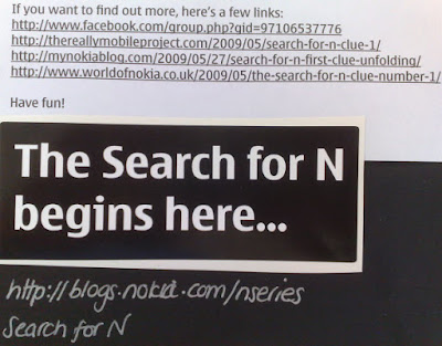
well done royal mail - only 4 days late!

Search for N has been and gone - post was seriously late for this...


nice handwriting though....

Labels: , , , , , ,

24 March 2009

Nokia SportsTracker v2.05 with Maps

Nokia Sports Tracker v2.05 with Maps

Finally Nokia makes the map option available in the Sports Tracker Application
Nokia Maps v2.05 - With Maps
Image source:
http://nokiae71.wordpress.com/2009/03/23/the-best-now-even-better-nokia-sports-tracker-205/

Phone - Map Options - Source
Maps are available - though the Phone option does not use Nokia Maps (v2 or v3) data to display but rather downloads tiles (similar to web based maps).

Not sure if that is a good thing, Would rather have preloaded tiles on an area - due to out of network issues with walking, hiking, cycling in rural areas.

But at least the maps have made it to this application- after a long and a number of submitted requests.

Only 'Map Tiles' available - no Satellite or Terrain option (unlike the Nokia Maps)

The fastest way to get it is connet to a wifi source and use the 'check for updates on the phone.
Or Download it from here
http://sportstracker.nokia.com/nts/mobile/downloadclient.do?p=50&hw=536926806
(link is a direct link to the file SportsTracker_50_v205.sisx)

Sports Tracker GPS fix quality
GPS Fix strength/quality is viewable (map has no data in this area) and will also replay your routes.

http://betalabs.nokia.com/blog/tag/sports-tracker/

Suggestion - Terrain maps would be useful.

Labels: , , , ,

02 December 2008

Nokia Maps 3.0 (beta) - New! +Ovi Maps

Update: WOM World have just sent Mapperz a Nokia Nokia 6210 Navigator for testing the New Maps out.

Will do a honest roundup of the new map application with the next week or so.
[Thanks to WOM World for that surprise and the link]

Nokia Maps 3.0 (beta)
- New!

Nokia Maps 3.0 - New Features
3D Buildings, New Terrain Mode, and Faster... Nokia Maps 3.0 (beta)

Nokia are having a large launch of many mapping apps and plugins:

updates will follow...

Important bit of info:

"Finally some words about compatibility. Right now the Maps 3.0 beta is available only for Nokia devices based on S60 3rd Edition Feature Pack 2, but we haven’t forgotten the FP1 users either. The version for you will follow soon. Also we’ve seen compatibility issues with N96, so we don’t recommend using Maps 3.0 beta with it just yet. In Maps 3.0 beta old Maps 2.0 licenses are supported, so if you have Walk or Drive licenses on your device, they will continue working also after the update."

* What’s new: Enhanced car navigation, Drive*, through lane assistance, speed limit warners, improved sign post design and new ‘Route overview’ mode during navigation,
* Enhanced pedestrian navigation, Walk**, through shortcuts (virtual connections) in urban areas, straight line guidance for off-road terrain and beeps and vibrations before next turn,
* Significantly improved map data quality and content,
* 3D landmarks for over 200 cities – can be displayed in 3D and 2D map modes,
* New Terrain*** map mode,
* Hi-res aerial images for Satellite*** and Hybrid*** map modes,
* Nokia Maps Updater for PC, to update your Maps application and existing map data,
* Synchronisation of Favourites and Collections with MapsBeta on Ovi and vice versa (use in online mode, enable Internet connection).

# Coming soon in Maps 3.0 commercial release: Safety spot warners in selected countries
# Extended country coverage for Traffic info service
# Weather information
# Premium POI content for travel, selected events and cinemas


More info from
http://www.allaboutsymbian.com/news/item/8588_New_Nokia_Maps_plus_personalis.php

# Coming soon in the next Beta release: Route planner for Drive, car navigation, and Walk, pedestrian navigation,
# Traffic information,
# Weather information.

Download available from here

http://www.nokia.com/betalabs/maps/

Nokia maps comes to the Web Browser (plugin required)

Ovi Nokia Maps in IE8 Browser
You can now view Nokia Maps in Full Screen on your PC - The Plugin is available for IE and FireFox. (Shown here in IE8)

Plugin download from
http://maps.ovi.com/services/integrated

Labels: , , , , , , , ,

23 September 2008

Nokia ViNe Alpha (Mapping)

Update 23/09/2008
There is now a Nokia Mapping Application available to view your 'geotagged' photos using
the new Nokia Photo v1.5 (Beta)

Nokia Photo Maps - Stacking Photos on Location
Multiple photos on the same geographical location are stacked.

For a full and in-depth review on the functionality visit

http://www.allaboutsymbian.com/news/item/8097_Nokia_Photos_15_now_available_.php

To download the Windows (Mac coming soon?)
http://www.nokia.com/betalabs/photos
(NokiaPhotos_1_5_200_en_gb.exe is a 53.8mb download)

Seems to me that Nokia are now competing with Google Picasa 3.
Though the Nokia application seems to be more seamless with loading geotagged photos from your phone and showing those photos on a map than Picasa is.
Maybe Picasa 4 will make use of the Google Map API and overlay photos onto that.... there is hoping.

Nokia ViNe Alp
ha (Mapping)
Nokia ViNe
Nokia ViNe application is currently in closed Alpha but the website is up and running.

"new geo-tracking-photo-and-video-and-music application"
Clinton Jeff - Darla Mack


Nokia ViNe Mapping Tracks
ViNe combines and uploads music, photos and gps tracks you record from your Nokia Device on one process.

Combine following applications:
Nokia Sports Tracker (Still Beta)
Nokia Lifeblog (Photos)
Nokia Music Player
GPS (GeoTagging)

Why the fuss? Why not use the applications that already exist?
It's one application that encapulates three applications and expands the mapping potential of geo-location tagged files (photo,music & video).
The Mapping is based in flash (website) - the users tracks link photo, music and videos that were captured when the ViNe Application is set to record.
There are concerns over the battery life - lucky for Nokia this is still in pre-release alpha and can be addressed before a public beta version.
Nokia's LifeviNe project has been renamed, it seems, to just Nokia ViNe.

There is nothing new but - for the non-savvy phone user it makes it easier for the user to record trip for sharing with friends afterwards.

For a more in depth review of the new application vist the Darla Mack Blog below where the whole process is shown.

Sources:
http://www.allaboutsymbian.com/news/item/8088_Nokia_ViNe-Practical_or_Pointl.php
http://www.darlamack.com/darlamack/2008/09/nokia-lifevine.html

At least Nokia are making use of Navteq data, now that Google Maps is completely TeleAtlas based.

Labels: , , , , , ,

19 September 2008

Google Street View on Nokia Phones (N82)

Google StreetView on Nokia Phones (N82)

As Google have released v2.3.1 of Google Maps Mobile
It is now possible to access 'StreetView' and 'Walking Directions' on Mobile Devices

Here is the new Streetview functionality on a Nokia N82

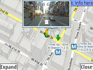
StreetView on Nokia N82
Street view (screen shot from a Nokia N82 here) is new to mobile devices but there is huge data transfers (2000k+) so make sure you have access to wifi or an unlimited data plan (3G/GPRS)
*Expand button makes streetview full screen.
The images are large (in terms for mobile devices) and a little grainy when panning around but does sharpen up when paused.

The .jar install file is available from
http://m.google.com/gmm/apps/v2.3.1/L1/gmaps-231-m2_L1.jar
Thanks to http://www.allaboutsymbian.com/

Labels: , , , ,

15 September 2008

Nokia Mapster's Game

Nokia Mapster's Game
Nokia Mapsters Game
A game that might be classified as addictive.

[Mapperz sent in a high score of 196,500]

http://www.themapsters.com/index.php

[Flash Required]

There are prizes: Nokia maps navigation licenses [drive & walk] and Mapster's toy figures for top 50 score per week.
Or just do it for fun.

Post your high scores here in the comments.

Labels: , , ,

23 May 2008

The Mapsters - Nokia Maps Launch

The Mapsters - Nokia Maps Launch


Video courtesy of http://thenokiablog.com/
So this is what happens when maps and drugs mix....

http://www.themapsters.com/ [click on the 23rd May]
only a teaser before that.


Source
http://thenokiablog.com/2008/05/22/preview-nokia-maps-20-mapsters-website/
preview-nokia-maps-20-mapsters-website/

Labels: , , , , ,

22 May 2008

Nokia Maps 2.0 Goes Mainstream

Nokia Maps 2.0 Goes Mainstream

Finally after many months of 'Beta' status the Nokia Maps 2.0 has made it available to the normal users.
Nokia Maps 2.0 Goes Mainstream
So whats changed?
Well from version 1.0 lots but from the 2.0 beta version not very much (a few bugs)

A quick summary:
Car Navigation
Pedestrian navigation
Multimedia city guides

Car Navigation has navigation carousel with three pre-defined navigation views (navigation, arrow and bird-eye) with multi-stops route planner.

(Purchase required based on region 3 day, 1 month, 1 year subscriptions - there is a option for 3 days free trial - this now tied to the SIM card not the IMEI of the Phone - meaning if you change your phone you can keep you licence.)
SIM to SIM licence copying can be done.

Satellite images
Hybrid mode


**Note these two modes use either Wifi or GPRS for displaying the layer they DO NOT come with the MapLoader pre-installed onto a memory card.

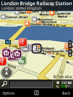
Nokia Maps 2.0 Goes Mainstream - London Bridge

Nokia Maps 2.0 uses digital vector data provided by Navteq and TeleAtlas
Either download directly to the nokia device or by using the Nokia Map Loader on a PC. Nokia Maps 2.0 and the current commercial version of the Nokia Maps Loader are freely available for selected devices.

Downloads
Nokia Maps 2.0
http://europe.nokia.com/A4984199
(select your device)

Nokia Map Loader v1.3.8 (for Vista/XP on the PC - use this to save money on data transfer fees)
If your feeling brave there is a new beta version of Nokia Maps 2.0

Created Feb. 11, 2008 but updated on May 08, 2008
nokia_maps_2.0_1803_3.1_u.sis
http://www.nokia.com/betalabs/applications


Other Nokia useful applications recently released.

Nokia Step Counter
Nokia Step Counter New! [Free]
Every step you take

Location Tagger (Updated) [Free]
http://www.nokia.com/betalabs/locationtagger

Mapperz

Update of Nokia Maps 2.0 source:
http://www.infosyncworld.com/news/n/9390.html

Labels: , , , ,

11 February 2008

Nokia Maps 2.0 Beta (pre-release)

Two blogs in one.... "Nokia aiming to banish paper maps" & Nokia Maps 2.0 Beta (pre-release)

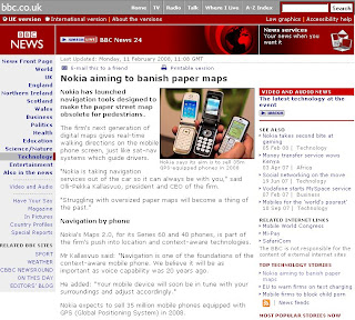
BBC News Nokia Maps
BBC News Technology

"Nokia expects to sell 35 million mobile phones equipped with GPS (Global Positioning System) in 2008"

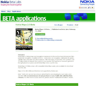
Nokia Maps 2.0 Beta (pre-release)

What is new?
  • Pedestrian mode
  • Enhanced driving navigation mode
  • Satellite maps
  • Hybrid (satellite and important map features overlayed)
  • Vastly improved search
  • New real time traffic information

Official Release here
Nokia Beta Labs - Nokia Maps 2.0 Beta
http://www.nokia.com/betalabs/maps


Screenshot of Nokia Maps 2.0
Nokia has launched Nokia Maps 2.0 - Allaboutsymbian
Image source: Allaboutsymbian

Beta means Beta! here are the known issues:

" We recommend you do not purchase or use Traffic info yet with this Beta release."

"New map data also still in beta and, for example, Taiwan, Hong Kong and Macau are not drawn correctly"

"N95 users, please make sure you have the latest firmware (v20.0.015)"

"The help texts have not yet been updated from previous Maps version"

"Localization is not completed in all languages so some menu items might still be in English"

"Please note that extra services like Drive and Walk navigation and City guides require" purchase."

Allaboutsymbian as ever releases some great screenshots and first impressions on the application.


Questions...
Navigation is now SIM locked not to the device.
If you have purchased a license (for example, for navigation) in Nokia Maps 2.0 Beta, you can transfer it freely from one device to another as long as you keep using the same SIM card.

In case you change your SIM card, you can regain your navigation license in the Nokia Maps application for the remaining time period of your navigation license.
(but you require your old SIM card to put in the licence onto the new one very the device)

Changed device and SIM card?
First, use your old SIM card (the one you used when purchasing the license in Nokia Maps) and insert it into your new device. You can now transfer your license by connecting to the license server. Go to
Options > Extras > Drive & Walk. Choose the region for which you purchased the navigation license
and go to Options > Update.

Well it better than using the IMEI code which means if the device is sold or given away you cannot move navigation license.

Look out for a review on this from here in a few weeks

Mapperz sources:

http://www.nokia.com/betalabs/maps

http://www.allaboutsymbian.com/news/item/6704_Nokia_Maps_20_hits_beta.php

http://news.bbc.co.uk/1/hi/technology/7230686.stm

and keep an eye on
http://www.womworld.com/nseries/
for more blog posts in the coming hours

Labels: , , , , , , , ,

01 February 2008

Nokia Internal vs External GPS

Nokia GPS Internal vs External
"The Nokia Bluetooth GPS Module LD-4W is for you if you’re looking for a navigation solution to send you effortlessly on your way. The lightweight, slim design makes this technology a great travelling companion" (AND DON'T HAVE AN INTERNAL GPS BUILT TO YOUR MOBILE PHONE)

Nokia GPS LD-4W Module
Nokia GPS Module - it's light, small and gets good fixes with good battery life.

(though users with built in Internal GPS (i.e.N95, N82 etc might be surprised on this independent review...)

GPS Module LD-4W generously supplied by WOM World, not only did they just supply a bluetooth GPS but also a Nokia N95.

Mapperz likes thank them once again for this opportunity.

Nokia says you can...With a Nokia Bluetooth GPS Module LD-4W you can: Turn your mobile device into a navigator (but only if you sign up to Nokia Maps with Navigation)Explore with GPS features on Nokia Maps, or compatible software (correct)tap in an address to Nokia Maps and let voice-guided directions take you there (see note 1)
Take it along with the belt clip or suction cup (yes it comes with this though you might not ever use it)
Operate up to 11 hours on a single, fast charge (fast charge is 1 hour approx -came with a car charge but not a mains charger, though you can use the N95 mains charger.)

If on a long trip 11 hours or more your likely to need a double car charger or if not driving out on the mountains then a Power Monkey is recommended.

Tech Spec:
The GPS Module Tech spec:

SiRF Star III LT, 20 parallel channels, Weighs 31 g (It is small and super light
Up to 11 hours, continuous tracking (so your phone will need a charge by then
Stand-by up to 4 days (seems pretty good for a small device
Typical ± 5-10 m (seem better than that most of the time with 8 or more satellites)1 second refresh rate-30°C up to +70°
Cold start (when the Nokia Bluetooth GPS Module has been switched off more than 2 hours): up to approx. 45 seconds on average - TrueHot start (when the Nokia Bluetooth GPS Module has been switched off for less than 2 hours): up to approx. 2 seconds on average - True
DatumWGS84 (world geodetic system) only - (this seems the main stream format these days)
Supports most Nokia bluetooth phones - though you will need a map application or tracking application to use it.

Here is Mapperz tested Map Application List...
Tested with:Google Maps Mobile (with 'My Location')
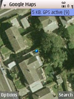


9 Satellite Fixes with Google Maps
Google Maps used the fully capacity of the GPS Module and got 9 satellites
(less than 4 metres in true terms)

MGMaps (Internal GPS worked but failed to detect the paired bluetoothed GPS device)
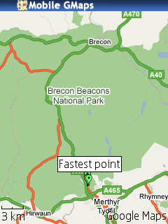
Brecons Track KML MGMap

but does overlay kml from sport tracker

Yahoo Go! (beta 3) worked but no coverage maps of aerial for the UK (yet).
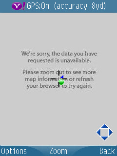
Yahoo_Go Beta 3.0

Maps24 (no gps tracking support but was 3D and has traffic alerts)
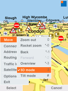
Map24 Options

All required a internet link either wifi or more likely GPRS when out and about.

combine these mapping applications and you will get a first class mapping application

**Though Nokia Maps was pre-installed and map data loaded onto the memory card - but will use mobile/cell network if required.
Nokia Maps - worked in the same way as the internal gps device as expected.Nokia Sports Tracker (v1.7) worked well as expected.
Nokia Navigation A40

Nokia Navigation, but beware of a few strange things - the route is correct but is the symbolisation?
Also told Mapperz to do a U-Turn on a dual carriageway!! though was traveling at speed.

The trial had almost ended from WOM World when Nokia Labs released Location Tagger (not used here) though see post.
Interesting the Nokia GPS device has 20 channels however their software seems only to support 5 channels (satellite fixes)

Google Maps Mobile used as many as 9 channels (max 12?) and seemed to get almost within a metre of 'my location' in several occasions.
*note to be fair the Assisted GPS and Network positioning was switched off as not all applications supported it.

Conclusion - if you have gps on your phone then you might not need to use this but if you want to take the strain off your mobile phone battery then you might consider this option, though remember that the bluetooth link will use battery life up too but not as much as internal gps chips.
Non-GPS phones (with bluetooth) that can install S60 mapping applications and want a nice little gps which does not need to be attached to the phone physically. This device is for you.

Price

Two options available:

The £59.99 version (just the module)

or the £169.99 version (includes Nokia Maps - but unsure if includes Navigation...)

Labels: , , , , , , ,

30 January 2008

Nokia Beta Labs - Location Tagger

Nokia Location Tagger
(georeferencing your phone camera photos)

Nokia Location Tagger

"What is it all about? Nokia Location Tagger is a small application running on “selected” S60 3rd devices that allows you to tag pictures captured from Camera application with geographical coordinates from GPS. The tagging process itself is sometimes called geotagging or geocoding (see also this article at Wikipedia). Technically, the location information is stored in the EXIF header of your pictures (.jpg file)."

Nokia Location Tagger S60


With Nokia Location Tagger, you can automatically tag your location data to your pictures. As you take a picture, your GPS coordinates are saved to the EXIF header of the JPEG file. You can use this data later, for example, to locate your pictures on a map.
In the near future, we hope to make location tagging a seamlessly integrated part of your Nokia experience. Until then, Nokia Location Tagger is a small standalone application that gives you a sneak preview. We are not planning to productize this application as such, but we’d love to hear your thoughts already now, so that we have time to take it into account in the mainstream development.
Tested with Nokia N95, N95 8GB, N82, and E90 using the integrated GPS. Should work but not fully tested with all S60 3rd edition devices using an external Bluetooth GPS receiver. Sharing your location-tagged pictures online requires Share Online 3.0.

- Launch Nokia Location Tagger application.- On the main screen, you will see the status of your GPS module. It will show the coordinate if GPS module is active. Otherwise, it will show "Searching".- To tag pictures with GPS coordinates, simply use the built-in Camera application. Press the Camera button of your device to take pictures as usual. When Nokia Location Tagger is running in the background, you will see small icon at the top left corner of Camera’s view finder. This indicates the status of GPS module: Green: GPS module is active. Amber: Nokia Location Tagger is connecting to GPS module or searching for GPS coordinate. Red: GPS module is inactive.

Q: What happens if I take pictures while the GPS module is not active yet?

A: Nokia Location Tagger tries to tag pictures to the last "known" coordinates in the last 10 minutes. Since GPS module normally takes some time to initialize, it’s better to launch Camera application a couple of seconds before taking pictures. Launching Camera application will activate Nokia Location Tagger; which will initialize GPS module. You can also bring Nokia Location Tagger window to the foreground to initialize GPS module.


Q: Will my battery be empty very fast when running Nokia Location Tagger in the background?A: Nokia Location Tagger has a time-out feature (by default, it is 5 minutes). If there is no picture until time-out time, the GPS module will be turned off. This will normally save power. you can change the time-out option in the settings (2, 5 (default), or 10 minutes)

Q: How can I view the GPS coordinates of my pictures?A: The GPS coordinates are stored in the EXIF header of JPEG files. Some online sites, such as Flickr and Panoramio are able to display GPS coordinate from the EXIF. For more info on these services, please see below. You can also use photo organized software that read EXIF, such as Picasa (with the combination of Google Earth).
Q: How can I set Flickr to automatically import location in my uploaded pictures, and place them on a map accordingly?A: Please go to this URL: http://www.flickr.com/account/geo/exif, sign in, tick the yes please box and click save. From now on, all new tagged pictures that you upload will automatically be placed on a map. Also underneath every picture, there will be a map link that - after you click on it - shows where the picture is taken. Here are some examples. A nice alternative to Flickr is Panoramio. After uploading your pictures, you can view them on Google Maps but also export them to Google Earth. Here are some examples.
issues- The pictures from secondary camera are not tagged. Nokia Location Tagger tags pictures from the main camera only.- In a very rare case, Nokia Location Tagger may not be able to tag picture with the error message "File is being used".- Pictures captured in burst mode may not be displayed in order in the Logs tab.- This version has been tested on N95, N82, E90 as well as N73, N81 with external GPS module (Nokia LD-4W). It should work on all other devices; but there is no guarantee at this point.

What can we do with the Geo-tagged pictures? You can upload them to the photo sharing sites, such as Flickr, Panoramio and Picasa Web, so that your friends know where the pictures were taken. If you want to keep them private on your PC, some photo organizer applications, such as Picasa (combined with Google Earth), are able to display location information.
Please read the instructions at Nokia Location Tagger web page.
Labels: , , , , , ,

22 November 2007

Nokia Sports Tracker Beta Map
Nokia Sports Tracker Beta Map

Nokia Sports Tracker Beta

http://sportstracker.nokia.com/nts/main/index.do

Sports Tracker version 1.63 is available from this site (login required)

  • Integrated with Google Maps: "satellite" or "map" view.
  • Store and display your activities online
  • View detailed data such as speed, distance etc
  • Upload geotagged photographs of your activities
  • Live Sharing of activities
  • Free (no subscription)
Download for Nokia Phones
http://sportstracker.nokia.com/nts/download.jsp
But still not integrated with Nokia Maps!
(now that would be very useful)

for more detailed information on the sports tracker
http://www.e-series.org/archives/450

still not sure why it only uploads gpx files and not kml files

What tools do I need to use the Nokia Sports Tracker Online service?

For viewing the stuff on Nokia Sports Tracker Online you need a web browser.

Mozilla Firefox is recommended.

http://sportstracker.nokia.com/nts/faq.jsp


Labels: , , , , , , ,

29 August 2007

Ovi Nokia Maps Released

Ovi Nokia Maps Released for All - (Out of Beta!)

Nokia Maps Released

"London, UK – Nokia today introduced Ovi, the company’s new Internet services brand name. With the
introduction of Ovi, Nokia is expanding from a focus on mobile devices to offering a range of Internet services. Ovi, meaning ‘door’ in Finnish, enables consumers to easily access their existing social network, communities and content, as well as acting as a gateway to Nokia services."

Ovi Nokia consists of:
  • Nokia Music Store
  • N-Gage
  • Nokia Maps
  • *(more to be added)

Also under the Ovi umbrella is Nokia Maps, a navigation service that offers maps, city guides and more directly to compatible mobile devices. Nokia aims to bring more Internet based services to Ovi in the coming months.

Give me the links!

http://europe.nokia.com/A4509271 - Nokia Maps/Device Selector

http://europe.nokia.com/A4509291 - Introduction and how it works

http://ovi.nokia.com/ovi/flash/assets/

pdf/1_MeetOvi_Umbrella.pdf - Press Release (PDF)

http://nds1.nokia.com/files/support/global/phones/
guides/Maps_1_UG_en.pdf
User Guide (PDF)

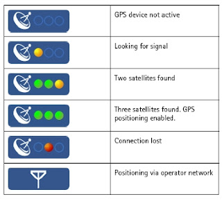
Nokia Maps GPS Fixes
GPS Fixes - the bottom icon costs you money with data transfer - Assisted GPS enabled (N95) only

Mapperz

Labels: , , , , , ,

16 June 2007

New Faster Maploader - Nokia

New Faster Maploader - Nokia

New Maploader v1.1

Faster MapLoader 1.1 downloading map data has improved vastly :)

New Maploader Voices

Now comes with voice commands in 24 Languages.
English (UK) has 0.2mb more the English(USA).

Nokia Maploader v1.1 New Data UK

Checked UK differences in Data from the last upload.

England has more data was 90.3mb now 95.8mb (6% increase in detailed coverage)
Northern Ireland has more data was 6.6mb now 6.7mb (1.5%)
Wales has much more data was 12.7mb now 16.7mb (24% increase)
Scotland 18.4mb now 19.4 (6% increase)

New Maploader Speed is much better
England at 95.8mb was downloaded in less that 8 minutes, the software then transfers to the memory card and verifies the map data has been completed successfully.
Voice for English [UK] took 45 seconds to download and a minute to transfer and verify.

Smart2Go update coming very soon.
More on this over at
http://www.allaboutsymbian.com/

Tips- 1. BACKUP YOUR PHONE - VERY IMPORTANT! - Use Nokia PC Suite Backup to your PC and the backup function on your phone - backup phone to memory card.

2. FLASH YOUR FIRMWARE, v11.0.026..... is the latest *#0000# will show your version on screen on your phone.

Go get Maploader v1.1
and enjoy free digital maps on your phone.

Mapperz

Free Maps, Nokia,N-series,N95, Maploader,

Labels: , , , , , , ,

23 February 2007

Nokia Maps - Smart2Go Goes Testing

Nokia Maps - Smart2Go Goes Testing

Martin Sauter is commencing testing Nokia's Smart2Go Service

Nokia MapLoader Splash Screen


Part 1. Navigation to close-by (100km) destinations. (available now)
Part 2. Nokia maps as a guide for finding a location in a city while walking (coming soon)
Part 3 Route planning and navigation for destinations 500+ kilometers away more demanding than the task in part 1 (coming soon)

"Most features of Nokia maps can be used for free. The most important ones are certainly the free"

In Summary his site runs through

License and Payment Model:

Pricing:
  • Western Europe maps Sat Nav (Routing) for a 30 day period are €10.
  • A three year license is €99.
Getting The Maps:
  • Download over Wifi direct to the Phone
  • Download over the GSM/3G Nework (can be expensive when maps can be 100mb)
  • using a PC with the Nokia MapLoader Software (Mac's not supported yet) - Mapperz Recommend - As this is the fastest way to obtain the digital maps bases
Nokia MapLoader Map Downloader
Selecting the Destination And CaCalculating A Route:

  • using the current GPS location to a known destination
  • address search bug (now fixed)
  • address search takes about 15 seconds
  • routing calculation took about one minute
Running Other Applications While Navigating
  • occasional navigation speech commands and podcast audio were mixed and played over the speaker simultaneously
  • When accepting a call, the mapping application was terminated
Stability
  • could still be improved
Available in more detail here

All credit to Martin Sauter for a good round-up of this service.

Labels: , , , , ,