->

09 June 2010

Google Android Navigation Expands

Google Android Navigation Expands

Google Maps Navigation version 4.2 is now available in Austria, Belgium, Canada, Denmark, France, Germany, Italy, the Netherlands, Portugal, Spain, and Switzerland
*
for Android devices 1.6+

Google Navigation Coverage Map


Google first added free turn-by-turn voice guidance to its smartphone operating system in October last year. The move has had some lasting effects on the navigation sector. For example, Nokia followed in Google's footsteps and announced free turn-by-turn voice guidance for Ovi Maps in January.

Sources:
http://www.pcworld.com/article/198376/googles_turnbyturn_navigation_comes_to_more_countries.html

http://googlemapsmania.blogspot.com/2010/06/google-maps-navigation-going-global.html
Official Post:
http://googlemobile.blogspot.com/2010/06/fun-on-autobahn-google-maps-navigation.html

Labels: , , , , ,

21 January 2010

Big News - Nokia Ovi Maps Free for Life

Big News - Nokia Ovi Maps Free for Life

updated 5.07pm 21/01/2010
Nokia Ovi Maps Free for Life
No more subscriptions, Ovi Maps with Navigation (Walking, Driving) is now Free.
*N97 soon after firmware update release.
update N97 users: "New Ovi Maps for N97 will be available on 28th January 2010." with Maps v3.3 included in the firmware update.

note:some N97 users are confirming that the new ovi maps application will install when there is more than 20mb free space on the c: drive (untested by mapperz).

A New version of Ovi Maps 3.3 comes with FREE driving (car) & walking (pedestrian) features turn-by-turn, with voice guided navigation. Ovi Maps has a large global coverage.
74 countries are covered.
Maps Data for all the regions will be available, for free, for loading over the air (data costs!) or pre-loading via a desktop computer (PC or Mac). Traffic information and city guides from the likes of Lonely Planet and Michelin, will also be made available at no additional cost.

Since Nokia owns Navteq (the map data company) they can do this without losing out. So Google, tomtom and many others look out.

Press Release:January 21, 2010
Nokia makes walk and drive navigation free on its smartphones, doubling size of mobile navigation market
http://www.nokia.com/press/press-releases/showpressrelease?newsid=1375569

Video


Official Nokia Maps Website
http://maps.nokia.com/explore-services/ovi-maps/ovi-maps-main

Supported Devices for the Nokia Ovi Maps v3.3
http://europe.nokia.com/support/product-support/maps-support/compatibility-and-download#/default/

More Details at:
http://www.womworld.com/nokia/13158/your-thoughts-on-this-mornings-ovi-maps-announcement/
http://www.allaboutsymbian.com/news/item/11010_Nokias_Ovi_Maps_navigation_goe.php

News Links
PC World
http://www.pcworld.com/article/187335/nokia_delivers_free_navigation_service_to_customers.html

Engadget
http://www.engadget.com/2010/01/21/nokia-ovi-maps-with-free-turn-by-turn-navigation-hands-on/

BBC News
http://news.bbc.co.uk/1/hi/technology/8472165.stm

The Guardian
http://www.guardian.co.uk/technology/2010/jan/21/nokia-satnav-software

The Times Online
http://technology.timesonline.co.uk/tol/news/tech_and_web/article6996954.ece

Labels: , , , , , , ,

08 September 2009

Ovi SDK - Map Beta Examples - First Look

Ovi SDK - Map Beta Examples - First Look

It is nearly a week since the public release of the Ovi [Nokia] SDK

Mapping Wise what can you do with it?

Ovi Map Example Apps
Well the first version had an issue - apps would not show, but this has been rectified and now the examples will show in the Nokia(N97) Emulator.

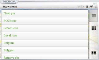
This example shows a few options.
Drop Pin
POI Icons
Server Icon (Wifi/3G connection required)
Local (Phone memory in the app)
Polyline (now we are getting somewhere)
Polygons - Reviewed

Map Content Example
Landscape mode enabled - shows all example with out needing to scroll.

Polygon Example

mapperz wasn't happy with the example polygon - it didn't seem that helpful

Ovi Maps Beta Example Polygon Bristol,UK
Custom Polygon generated in Ovi Map Player using the Ovi Apps SDK
(mapperz customised the orginal example with something slightly better)
So how was this achieved?

Well you can study the Development Guide or the API Library that comes zipped up
However the fastest way to learn is working examples

The code was found in mapfunctions.js
(in the Downloaded SDK >com.nokia.maps.examples.mapContent)
in here there is a section of code:

Example – Adding a Polygon to the Map
*/
function addPolygon()
{
var polygon = {
type: "polygon",
points:
[{latitude: 51.45128846597743, longitude: -2.5956809520721436}, {latitude: 51.45115474591054, longitude: -2.5934386253356934}, {latitude: 51.44976403399727, longitude: -2.5936853885650635}, {latitude: 51.449957933872724, longitude: -2.595916986465454}],
visible: true,
width: 5,
color: {red: 180, blue: 20, green: 0, alpha: 255},
fillColor: {red: 0, blue: 0, green: 0, alpha: 100}
};
// Set zoom level
player.map.setZoomScale(500);

// Move map center to a central location between the three points of the polygon:
player.map.moveTo({
latitude: 51.45052625634988,
longitude: -2.5947046279907227
});

// Create a layer:
//var layer = player.map.createLayer({name: "testLayer1"});

// Add the polygon:
var mapObjects1 = layer.addMapObjects(polygon);

}


all that code for one square polygon? well yes...

Now in real-world terms you need quite a lot of information before you start:
Coordinates for each vertices is required to have
{latitude: 51.45128846597743, longitude: -2.5956809520721436}
easier would be: {lat1:
51.451288,lng:-2.595680}
but it would be simpler to list them in a clockwise order.
or you end up copying and pasting lots of coordinates for quite simple shapes.

**note make sure you use {} 'curly brackets' and not () 'normal brackets' or you will get javascript errors.

There is currently no option for holes in polygons (donut polygons)
What would really help is the ability to overlay KML/GPX files from servers or accessed from the device.

Not sure why zoom extent coordinates are required - would be easier for the extent of the polygon(s) to be used.

Less code makes faster devices (http://www.bewebmaster.com/42.php)
color: {red: 180, blue: 20, green: 0, alpha: 255},
fillColor: {red: 0, blue: 0, green: 0, alpha: 100}

how about:
rgb:180,20,0,255
fill:0,0,0,100


Was hoping to evaulate the New Ovi Maps Navigiation API though in reading the documentation you get a message:

NOTE: The functionality described here is not yet available.

Would prefer they left it out until it was available - would presume that this requires an api key of sorts - but if wanted it tested and de-bugged in beta you would think it would be.


There is demand for this - many, many mobile devices are geo-aware and can use this but it seems clearer there is going to be a good few months of re-writting code to make this a truely customisatable portable mapping and navigational system.
Mapperz will review when activated.

The SDK has been written by techinical people and it does show. They say you are required some basic knowledge of html & javascript.
Mapperz would say you are required to be at an intermediate level for javascript, html,css and de-bugging.
Note: The Software Aptana 1.5 is required to do serious work in the Ovi Apps SDK.

Nokia have the resources they just need to apply it a little stronger.
Web Documentation would be also helpful - like many other mapping apis available.

So the answer to their blog
"OviSDK+you=Ovi Apps for Everyone"
http://blog.ovi.com/2009/09/03/ovi-sdk-you-ovi-apps-for-everyone/?utm_source=rss&utm_medium=rss&utm_campaign=ovi-sdk-you-ovi-apps-for-everyone

is no currently and unfortunately (hope this changes)

Action please
Nokia need people with basic programming - to read their documentation and highlight areas of explanation.

Ovi Maps Player API stongest competitor is going to be Google Map API (v3) There are some interesting features coming to it in the coming weeks, stay tuned.

When these teething issues have been ironed out then they will have a competitive product.
There is no indication whether the Navigation API will require a licence.
Currently Nokia Ovi Map users require a daily,weekly,monthly or yearly licence to use Navigational Features, if you make an app with it - does everyone require a seperate licence.
If they do it will be a stumbling block for a promising feature.

Labels: , , , , , , , ,

03 September 2009

Ovi Maps News

Ovi Maps News
Nokia have released/updated some Ovi Apps Products

Of Mapping interest there are:

Developers that register for the programme will have access to the following:

  • Ovi Maps Player API – Bringing maps to mobile and web applications effortlessly. The API is powered by NAVTEQ and features more than 180 country maps, location-based search, and detailed place information. Other features include vector-based maps that give a range of views, including: map, terrain and 3D modes for dynamic map mash-ups. The Ovi Maps Player API for the web was introduced earlier this year.
  • Ovi Navigation Player API - Allowing developers to bring Nokia’s industry-leading walk and drive navigation features to their applications, including: pedestrian navigation, turn-by-turn car navigation, and route planning. Developers can deliver applications that get consumers exactly where they want to go.

Ovi Maps Player Example

"Introducing Maps Player - the brand-new, easy-to-use API for Ovi Maps. Maps Player makes it simple to integrate rich Ovi Maps functionality into your website, turning it into a personalised, contextual and compelling experience. "

here is one example

Ovi Maps Player POI

Unlike other Mapping API's available - [Nokia] Ovi Maps Player API gives developers access to their Point's of Interest (currently 3 million) Database.

POI Categories are:

"AMUSEMENT_PARK", "BARS_CAFES", "BAR_DISCO",
"BEACH", "CAMPING", "CAR_DEALER",
"CAR_REPAIR", "CASH_DISPENSER", "CASINO",
"CINEMA", "COMPANY", "CONCERT_HALL",
"CULTURAL_CENTRE", "EDUCATION", "EXHIBITION_CENTRE",
"GOLF_COURSE", "HOLIDAY_PARK", "HOTEL",
"LIBRARY", "MUSEUM", "OPERA",
"PARKING", "PARKING_AREA", "PARKING_GARAGE",

"PARK_RECREATION", "PETROL_STATION", "PHARMACY",
"PLACE_OF_WORSHIP", "POST_OFFICE", "RENT_A_CAR_FACILITY",
"RESTAURANT", "REST_AREA", "SHOP",
"SHOPPING_CENTRE", "SPORT_OUTDOOR", "STADIUM",
"THEATRE", "TOURIST_ATTRACTION", "TOURIST_INFORMATION_CENTRE",
"UNIVERSITY", "ZOO"

Live Example:

Note: you cannot copy & paste the source code unless you have signed up to Ovi Maps Player API (beta) and have recieved 2 api keys from Nokia for specific domains

** For 3D view an Ovi Map Plugin is required and you will require a restart of you web browser.

http://maptile.svc.nokia.com.edgesuite.net/players/map/noauth/examples/Map_Player_moveToObjs.html

More Information Link:

http://www.allaboutsymbian.com/news/item/10415_Ovi_Maps_opens_up_to_devlopers.php
video:

Ovi Navigation API
Ovi Maps Navigation Player API gives you access to the industry-leading Ovi Maps Walk and Drive navigation service, powered by NAVTEQ [Nokia Owned]. With just a few lines of JavaScript, you can add turn-by-turn pedestrian or car navigation to your Ovi apps. You can also add routing to your websites.
Ovi Navigation API
Ovi Navigation API - Drive, Walk & Cycle 'turn-by-turn' directions

Advanced vector maps allow routes matched to the needs of drivers and pedestrians – even when your users are offline.

Developers will be able to use simple, high-level interfaces to leverage turn-by-turn Walk and Drive navigation, with voice guidance in over 20 languages

Users are tired of seeing car routes recycled as "pedestrian". Give them a real Walk experience, with custom map display and enhanced DiscoverCities Navteq data.

Quick links:
http://www.forum.nokia.com/Ovi/
http://www.slashgear.com/nokia-ovi-sdk-plus-navigation-and-maps-apis-launched-0354940/

Source: @Mapperz

Labels: , , , , , , ,

22 June 2009

iPhone MobileNavigator [NAVIGON]

iPhone MobileNavigator [NAVIGON]

Navigon iPhone GPS Navigator
Now Available via iTunes Apps

"Turn your iPhone into a first-rate navigation system with MobileNavigator. Try the feature for yourself and enjoy the excellent user control and superior design that allow simple and intuitive operating. The application includes the latest map material from the market leader NAVTEQ and can be used without an Internet connection, which is of enormous benefit abroad, for example, as no extra charges are incurred. With MobileNavigator you can turn your iPhone into an equally handy and convenient route guidance system."

Features and range of functions:

  • 2D and 3D map displays
  • Can be used in portrait and landscape format
  • Precise voice announcements
  • Intelligent address entry
  • Reality View Pro (realistic display of motorway interchanges and exits)
  • Lane Assistant Pro
  • Real signpost display
  • Speed Assistant with adjustable audio-visual warning
  • Day and night mode for map display
  • Direct access and navigation to contacts saved in the iPhone's address book
  • The latest NAVTEQ map material including more than two million (EU version) places of interest (POIs)
  • Navigation is automatically resumed after an incoming phone call
  • Quick access to user-defined POIs in the area and along the route
  • Take Me Home function with a single click
  • Automatic language selection to match the iPhone's user language
Cost:
Navigon’s MobileNavigator Europe app (iTunes link) is now listed on the App Store for a one-time price of $94.99 [£58] but a note in the description claims that the “special introduction price is valid only until June 30th.”

Similar Products for Windows/PDA's

also S60 3rd Edition Phones

Source:
http://blogs.zdnet.com/Apple/?p=4220

Labels: , , , , ,

01 February 2008

Nokia Internal vs External GPS

Nokia GPS Internal vs External
"The Nokia Bluetooth GPS Module LD-4W is for you if you’re looking for a navigation solution to send you effortlessly on your way. The lightweight, slim design makes this technology a great travelling companion" (AND DON'T HAVE AN INTERNAL GPS BUILT TO YOUR MOBILE PHONE)

Nokia GPS LD-4W Module
Nokia GPS Module - it's light, small and gets good fixes with good battery life.

(though users with built in Internal GPS (i.e.N95, N82 etc might be surprised on this independent review...)

GPS Module LD-4W generously supplied by WOM World, not only did they just supply a bluetooth GPS but also a Nokia N95.

Mapperz likes thank them once again for this opportunity.

Nokia says you can...With a Nokia Bluetooth GPS Module LD-4W you can: Turn your mobile device into a navigator (but only if you sign up to Nokia Maps with Navigation)Explore with GPS features on Nokia Maps, or compatible software (correct)tap in an address to Nokia Maps and let voice-guided directions take you there (see note 1)
Take it along with the belt clip or suction cup (yes it comes with this though you might not ever use it)
Operate up to 11 hours on a single, fast charge (fast charge is 1 hour approx -came with a car charge but not a mains charger, though you can use the N95 mains charger.)

If on a long trip 11 hours or more your likely to need a double car charger or if not driving out on the mountains then a Power Monkey is recommended.

Tech Spec:
The GPS Module Tech spec:

SiRF Star III LT, 20 parallel channels, Weighs 31 g (It is small and super light
Up to 11 hours, continuous tracking (so your phone will need a charge by then
Stand-by up to 4 days (seems pretty good for a small device
Typical ± 5-10 m (seem better than that most of the time with 8 or more satellites)1 second refresh rate-30°C up to +70°
Cold start (when the Nokia Bluetooth GPS Module has been switched off more than 2 hours): up to approx. 45 seconds on average - TrueHot start (when the Nokia Bluetooth GPS Module has been switched off for less than 2 hours): up to approx. 2 seconds on average - True
DatumWGS84 (world geodetic system) only - (this seems the main stream format these days)
Supports most Nokia bluetooth phones - though you will need a map application or tracking application to use it.

Here is Mapperz tested Map Application List...
Tested with:Google Maps Mobile (with 'My Location')
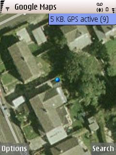


9 Satellite Fixes with Google Maps
Google Maps used the fully capacity of the GPS Module and got 9 satellites
(less than 4 metres in true terms)

MGMaps (Internal GPS worked but failed to detect the paired bluetoothed GPS device)
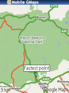
Brecons Track KML MGMap

but does overlay kml from sport tracker

Yahoo Go! (beta 3) worked but no coverage maps of aerial for the UK (yet).
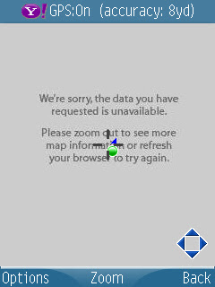
Yahoo_Go Beta 3.0

Maps24 (no gps tracking support but was 3D and has traffic alerts)
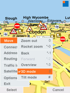
Map24 Options

All required a internet link either wifi or more likely GPRS when out and about.

combine these mapping applications and you will get a first class mapping application

**Though Nokia Maps was pre-installed and map data loaded onto the memory card - but will use mobile/cell network if required.
Nokia Maps - worked in the same way as the internal gps device as expected.Nokia Sports Tracker (v1.7) worked well as expected.
Nokia Navigation A40

Nokia Navigation, but beware of a few strange things - the route is correct but is the symbolisation?
Also told Mapperz to do a U-Turn on a dual carriageway!! though was traveling at speed.

The trial had almost ended from WOM World when Nokia Labs released Location Tagger (not used here) though see post.
Interesting the Nokia GPS device has 20 channels however their software seems only to support 5 channels (satellite fixes)

Google Maps Mobile used as many as 9 channels (max 12?) and seemed to get almost within a metre of 'my location' in several occasions.
*note to be fair the Assisted GPS and Network positioning was switched off as not all applications supported it.

Conclusion - if you have gps on your phone then you might not need to use this but if you want to take the strain off your mobile phone battery then you might consider this option, though remember that the bluetooth link will use battery life up too but not as much as internal gps chips.
Non-GPS phones (with bluetooth) that can install S60 mapping applications and want a nice little gps which does not need to be attached to the phone physically. This device is for you.

Price

Two options available:

The £59.99 version (just the module)

or the £169.99 version (includes Nokia Maps - but unsure if includes Navigation...)

Labels: , , , , , , ,

01 April 2007

Nokia N95 - part 1, The Navigator (Smart2go)

Nokia N95 - part 1, The Navigator (Smart2go)

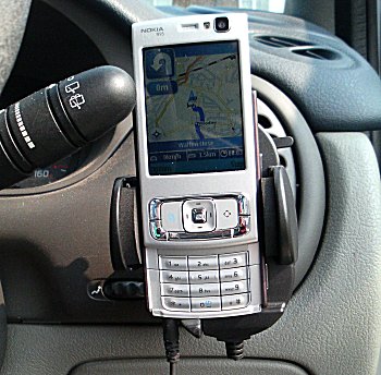
N95 in Action in Car
Image source: allaboutsymbian

A first clear and detailed review of the N95 (super duper smart phone) and the Smart2go mapping application.
Officially Released Tomorrow (2nd April 2007) in the UK.

in summary the review points out:
the pluses +
  • maps are basically completely free
  • option to have all maps stored on your expansion card or to grab them as needed over GPRS or 3G (cheaper to get them via wifi)
  • Navigation always intuitive
  • Route planning was as good as any other
  • 2D and 3D view Mapping (like a TomTom)
  • The zoom/scale is adjusted dynamically
minuses -
  • Navigation is not free (approx £30 (€50)) per year for turn by turn info
  • tediously slow, nokia maploader servers are slow due to high demand (leave overnight to download)
  • Battery life in GPS mode is approximately 1 hour from a full charge (best used with 12v car charger for navigation)
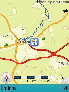
N95 in Action Reading Map
Image source: allaboutsymbian

Overall this combination of an all in one smart device and mapping is the start of bring all the 'now' technologies (gps,wifi,3g etc) together to make a very useful and handy for everyday life.

read in more detail at http://www.allaboutsymbian.com/reviews/item/Nokia
_N95-part_2_the_Navigator.php

Labels: , , , , , , ,