->

20 July 2011

3D Buildings - Google Maps Expands Coverage

3D Buildings - Google Maps Expands Coverage
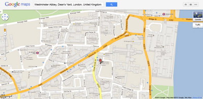
2.5D_Buildings Google Maps - London
Only 2.5D on the Google Maps sites (transparency induced)

But becomes true 3D on the Mobile device:

3D_Buildings Google Maps - London & Paris - Google Maps Mobile
3D London and Paris on the Google Maps Mobile - gives users a more realistic sense of location and bearing.

Now, 3D buildings are available in London, Paris, Barcelona, Stockholm, Singapore, Lisbon, Boulder, and 11 major cities in South Africa. These buildings will appear in both Google Maps and Google Maps for mobile.

Sources:
http://googlemapsmania.blogspot.com/2011/07/building-outlines-in-more-cities.html

More Info:
http://google-latlong.blogspot.com/2011/07/building-outlines-now-appearing-in.html

Labels: , , , ,

21 June 2010

UKFreeTV Creates Freeview Digital Coverage Map

UKFreeTV Creates Freeview Digital Coverage Map (Beta)

Over the last month Mapperz has seen this excellent (though still in beta) Google Map Mashup develop with comments and feedback from users of this free service being acknowledged by the creator.
[which is 100 times better than the official site that can only do postcodes searches but no visualisation]
The site is developed and maintained by @briantist (Brain Butterworth) and well done for taking the time to compile and map UK Digitial TV Coverages which does include Freeview HD coverage.

UKFreeTV  Creates Freeview Digital Coverage Map Example

Yellow is the area where the transmitter provides the best signal, green is where there is overlap and the selected transmitter is not the strongest signal.

Example: http://www.ukfree.tv/transmitters.php?P=RH130TR&s=map

The green/yellow fades to white where the signal is weakest.

Other Features:
The new Freeview prediction system - includes Freeview HD
  • Now with any date choice
  • Terrain mode (beta) - profile see below
UKTV digital TV map terrain profile
Terrian or Profiles of the Transmitters to your choosen location (postcode)

There are five different views
  • By direction: this will show the various directions your aerial might point and the services you can receive from the transmitters in that direction
  • Received signal strength: this shows the information ordered by signal strength, to help you find the strongest signals.
  • By frequency: this lists broadcast frequencies from C21 to C68, showing the services on each. This view can be used to find potential interference or to help with digital region overlap areas.
  • Service names: this lists the services that you can receive, each ordered by the strongest signal.
  • Transmitter names: and finally an alphabetical list of the transmitters with the services listed by broadcast frequency.

Note Terrain Mode(beta) the diagrams (can take several seconds to generate) below show the terrain between the selected location (postcode) and a number of transmitters. Green is used to denote ground, blue for water, with the transmitter on the right.

The values shown in meters are the height above sea level (for the receiver and transmitter aerials), the value in kilometres is the distance from the transmitter. Also shown as a value in degrees in the bearing, with each block being a kilometre step along the way.

Signal Strength
UKTV Digital TV by signal strength title=
Users can drill-down to individual channels if required.

Reception requires a line-of-sight between the transmitter and receiver aerial. Distant transmitters will, during periods of Inversion become visible and (unintentionally) they may adversely effect reception.

Sources:
http://www.ukfree.tv/fullstory.php?storyid=1107051660

http://www.ukfree.tv/starthere.php

Map Example (RH130TR Postcode)
http://www.ukfree.tv/transmitters.php?P=RH130TR&s=map

One of the best individual Google Map Mashups to date (21th June 2010).

Labels: , , , , , , ,

09 June 2010

Google Android Navigation Expands

Google Android Navigation Expands

Google Maps Navigation version 4.2 is now available in Austria, Belgium, Canada, Denmark, France, Germany, Italy, the Netherlands, Portugal, Spain, and Switzerland
*
for Android devices 1.6+

Google Navigation Coverage Map


Google first added free turn-by-turn voice guidance to its smartphone operating system in October last year. The move has had some lasting effects on the navigation sector. For example, Nokia followed in Google's footsteps and announced free turn-by-turn voice guidance for Ovi Maps in January.

Sources:
http://www.pcworld.com/article/198376/googles_turnbyturn_navigation_comes_to_more_countries.html

http://googlemapsmania.blogspot.com/2010/06/google-maps-navigation-going-global.html
Official Post:
http://googlemobile.blogspot.com/2010/06/fun-on-autobahn-google-maps-navigation.html

Labels: , , , , ,

11 March 2010

UK Streetview - FULL Coverage

UK Streetview - FULL Coverage

updated...

http://maps.google.co.uk/?ie=UTF8&hq=&hnear=United+Kingdom&ll=53.343993,-5.185547&spn=8.217413,23.269043&z=6
(and drag the yellow pegman)

Longest unbroken Trip in Streetview for the UK now possible

http://mapperz.110mb.com/GMAP/LongStreetView_UK.html
838 mi (about 15 hours 2 mins)

England, Wales, Scotland and Northern Ireland Full Coverage.

(Republic of Ireland streetview coverage is likely in due course.)

New Content:

Visit Wales in Streetview
http://tinyurl.com/visit-wales-view
NationalTrust in Streetview (better coverage)
http://tinyurl.com/NationalTrust-view

Note:some images are over 1 year old since google recorded them.

Big Brother is now complete for the United Kingdom.

mapperz

Labels: , , , , , ,

09 February 2010

New Street View Coverage for Norway & Finland

New Street View Coverage for Norway & Finland

update:
Canada has large coverage updates too
Canada Streetview Expands
New Canadian Coverage (substantial)
Yukon (Whitehorse)
Northewest Terroritories (YellowKnife)
Alberta (example Grande Prairie)
Bristish Columbia (example Prince George) (also includes Snow Mobile Streetview)
Saskatchewan (Example Prince Albert)
Manitoba (Lake Winniepeg)

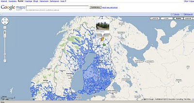
Google Maps Street view Finland
New Suomi (Finland) Street View Coverage

View the New Coverage
and drag the yellow pegman, drop on anywhere that is blue.


Google Maps Street view Norway

Norge (Norwegian) Street View Coverage

View the Norge Streetview


Also available on the Desktop via Google Earth see
http://www.gearthblog.com/blog/archives/2010/02/streetview_added_to_norway_and_finl.html

Source:
http://googlemapsmania.blogspot.com/2010/02/street-view-arrives-in-norway-finland.html

Labels: , , , , , , , ,

27 May 2009

UK Broadband Notspots

UK Broadband Notspots

Lots of noise about where UK Broadband exists and does not exist - which is more important?

UK Broadband 'notspots' map

The UK Broadband Notspots (slow broadband or no broadband)
http://www.broadband-notspot.org.uk/coverage-map.html

Or by County
http://www.broadband-notspot.org.uk/maps-by-county.html

Define: Broadband
(typically speeds above 2mb bandwidth)

"The broadband comparison site SamKnows.com composed a connection map which shows graded postcode areas with a connection speed according to their distance from the UK's 5,500 telephone exchanges. Any more than 4km from an exchange and the speed drops below 2Mbps - but that's the case for 50% of homes in Basingstoke and about 25% of homes in Hampshire. Around 1% of UK homes can't get any broadband connection.

SamKnows co-founder Alex Salter said decent broadband has economic implications for both consumers and businesses. "In some cases people aren't able to shop online, aren't able to view certain websites or use social media applications such as Facebook and Twitter and they can't watch the BBC's iPlayer.

"It prevents flexible working. If the problem is fixed it means a lot more people could work from home which offers a very real way to improve society."

source: Jemima Kiss - Broadband Britain: Can you get 2Mbps? The Guardian

Media Coverage:
http://www.guardian.co.uk/media/pda/2009/may/27/broadband-digital-media
http://news.bbc.co.uk/1/hi/technology/8068676.stm

Labels: , , , ,

02 July 2008

Satbeams Map

Satbeams Map

Satbeams Generates Transparent Polygons
Satbeams generates transparent polygons on the fly for each selected satellite 'beam'.

Satbeams Signal Strength Map
This example shows signal strength (useful for finding out receiver dish/antenna size)
http://www.satbeams.com/footprints?beam=5223


"The site allows to view the Satellite Coverage maps for most of the satellites all over the globe in Google Maps format. At the same time it is possible to place markers on the map stating which frequencies/channels one can receive at the specific location and view what others can receive from the selected satellite in different places of the world."
Alexander -Satellite Coverage Maps

Current stats (subject to expanding numbers)

Number of Satellites: 226
Coverage maps: 641

Number of receivers: 4933
Number of Antennas: 289
Number of LNBs: 416


Registered Users have more
  • Save markers on the map and report which satellites and beams one can receive there
  • See the markers saved by other members (perhaps there is someone already receiving selected Satellite/Beam in the neighbourhood)
  • Add Satellite equipment to the reception report including the antenna model, receiver and Lnbs (Low-noise Block Converter)
  • Report different news - frequencies, channels and even new equipment (i.e. receivers, dishes, Lnbs...)
As a result, the more people place markers with their reports the more accurate information is available to Sat-TV users all over the globe.

Mapperz notes there was a lot of work done on the website - it took
several months of several people to make the website.
More features to come in a 2-3 months from now. So stay tuned.
Congratulations to the team for creating a useful mapping tool.

related:
http://www.dishpointer.com/
http://mapperz.blogspot.com/2007/08/satellite-finder-map-updated.html

Labels: , , , , ,

21 December 2007

Live Search Maps - Coverage Updated

Live Search Maps Coverage Updated

(Virtual Earth has updated 36.3 TB of data)
UK Coverage listed here

Liverpool Buildings in 3D Virtual Earth
Liverpool gets 3D Buildings

Aerial Imagery
Supplied by GetMapping UK:

* England\Wales (12.5 cm)
* Scotland (25 cm)

BIRD'S EYE AERIAL IMAGERY
Castleford, UK
Chester, UK
Crewe, UK
Darlington, UK
Dearne Valley Urban Area, UK
Harrogate/Knaresborough, UK
Hartlepool, UK
Leeds, UK (1 & 2)
London, UK (several AOIs here)
Macclesfield/Pretsbury, UK
Middlesborough, UK
Milton Keynes, UK
Newcastle, UK
Reading/Workingham, UK
Scarborough, UK
Scunthorpe, UK
York, UK (1 & 2)
*AOI = Area of Interest

3D City
* Liverpool, UK (43.04 sq. mi.)

For more Worldwide updates go to the Official Virtual Earth Blog.
http://virtualearth4gov.spaces.live.com/Blog/cns!369B39F890CE30C1!607.entry

Labels: , , , ,

18 September 2007

Google Maps coverage expands - 54 more countries

Google Maps coverage expands... 54 more countries covered.

Update 18/09/2007
Pamela Fox (Google Maps API Team) introduces Google Spreadsheets New Features that use your data (xml, html, csv, tsv, as well as RSS and Atom based)


In combination with the Google Maps API you can now view the new tiles via her mashup.


note1 - the Google Geocoder is not perfect.
(click on Costa Rica and you will see)

*Note- Additionally, the limit on functions per spreadsheet is 50.

previous post
Click a hyperlink to view the new coverages - some are limited in content.


Afghanistan
Aruba
Bahamas
Bahrain
Bangladesh
Belize
Bermuda
Brunei Darussalam (limited coverage)
Bhutan (limited coverage)
Bolivia (limited coverage - cities only)
Cambodia
Chile
Colombia (limited coverage - 50% approx)
Costa Rica
Cuba
Ecuador
El Salvador
Fiji (very limited coverage)
Guatemala
Haiti
Honduras
Indonesia (limited coverage)
Iraq
Iran
Jordan
Kazakhstan (limited coverage)
Kyrgyzstan
Kuwait
Laos
Lebanon
Mexico
Myanmar (Burma)
Mongolia
Nepal
Nicaragua (limited coverage - 50% approx)
Oman
Pakistan
Panama (fragmented coverage)
Paraguay (very limited coverage)
Peru(very limited coverage)
Philippines
Papua New Guinea
Qatar
Saudi Arabia
Sri Lanka
Syria
Tajikistan
Turkmenistan
Timor-Leste
Uruguay
Uzbekistan
Venezuela (limited coverage - 50% approx)
Vietnam
Yemen (limited coverage)

*Coverage only approximated by Mapperz

Source:
http://google-latlong.blogspot.com/2007/09/
more-of-world-for-you-to-explore.html

Labels: , , , ,

02 July 2007

More Updates to Google Maps

More Updates to Google Maps - In Summary


India Points of Interest (POI) and addresses are now searchable.

More information in more detail on Google Maps Mania with a full list of Locations

New Coverage - for the United Arab Emirates

Click the image to see it live.

Labels: , , , , ,