->

05 April 2011

Map Channels v4 Released

Map Channels v4


Google Maps Mania Keir Clarke created this London Video Map in about two minutes from a Google My Map. Essentially all I needed to do was post in the URL of my Google My Map to create a finished map.

Despite the ease of use of Map Channels there are also a large number of options available. You can define the initial map view, use your own marker images, add traffi
c and Panoramio layers, set the map language and adjust a number of other map settings.

Once a map is created you get a URL for your map or you can embed the map in your own website or blog.

Also available is Map Channel Events
http://events.mapchannels.com/

http://www.mapchannels.com/

Source/Cross Post:
http://googlemapsmania.blogspot.com/2011/04/create-google-map-in-seconds.html
http://googlemapsmania.blogspot.com/2011/04/whats-going-on-with-google-maps.html

Labels: , , ,

07 July 2010

Google Maps v3 New Map Mashups - July 2010

Google Maps v3 New Map Mashups - July 2010

Here are some of the newest v3 Google Maps

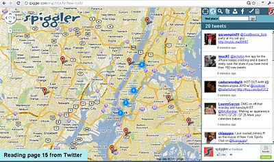
Spiggler.com Searches Twitter with your location.
Spiggler - Twitter Google v3 Map
Updates as you pan the v3 Google map nice integration with the twitter api.

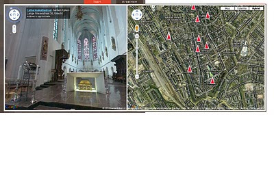
Streetview Inside
http://weblab.ab-c.nl/streetview v3 google map


Location Search Tool for Twitter
Find Geo-Twitter comments via this v3 Twitter Location search Google Map


The Grand Canyon - v3
Maptiler Custom v3 - The Grand Canyon
Using USGS DRG tiles as a custom tiled Google Maps v3.

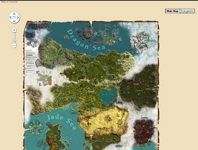
Game:Map of Ancaria
Map of Ancaria_v3 Google Maps
Very well illustrated Map of Ancaria [Sacred Game] - users can switch between this main map and dungeons custom map.

Missouri State Campus Map - Mobile
Missouri State University Campus v3 Mobile Map
Clean, Fast with campus overlay implemented in v3 for mobile users.

Don't forget that you can style your own map in v3 see the previous post.

Have you made your own v3 custom map like this? Add a comment and mapperz will post an update.

Labels: , , , , , ,

21 June 2010

UKFreeTV Creates Freeview Digital Coverage Map

UKFreeTV Creates Freeview Digital Coverage Map (Beta)

Over the last month Mapperz has seen this excellent (though still in beta) Google Map Mashup develop with comments and feedback from users of this free service being acknowledged by the creator.
[which is 100 times better than the official site that can only do postcodes searches but no visualisation]
The site is developed and maintained by @briantist (Brain Butterworth) and well done for taking the time to compile and map UK Digitial TV Coverages which does include Freeview HD coverage.

UKFreeTV  Creates Freeview Digital Coverage Map Example

Yellow is the area where the transmitter provides the best signal, green is where there is overlap and the selected transmitter is not the strongest signal.

Example: http://www.ukfree.tv/transmitters.php?P=RH130TR&s=map

The green/yellow fades to white where the signal is weakest.

Other Features:
The new Freeview prediction system - includes Freeview HD
  • Now with any date choice
  • Terrain mode (beta) - profile see below
UKTV digital TV map terrain profile
Terrian or Profiles of the Transmitters to your choosen location (postcode)

There are five different views
  • By direction: this will show the various directions your aerial might point and the services you can receive from the transmitters in that direction
  • Received signal strength: this shows the information ordered by signal strength, to help you find the strongest signals.
  • By frequency: this lists broadcast frequencies from C21 to C68, showing the services on each. This view can be used to find potential interference or to help with digital region overlap areas.
  • Service names: this lists the services that you can receive, each ordered by the strongest signal.
  • Transmitter names: and finally an alphabetical list of the transmitters with the services listed by broadcast frequency.

Note Terrain Mode(beta) the diagrams (can take several seconds to generate) below show the terrain between the selected location (postcode) and a number of transmitters. Green is used to denote ground, blue for water, with the transmitter on the right.

The values shown in meters are the height above sea level (for the receiver and transmitter aerials), the value in kilometres is the distance from the transmitter. Also shown as a value in degrees in the bearing, with each block being a kilometre step along the way.

Signal Strength
UKTV Digital TV by signal strength title=
Users can drill-down to individual channels if required.

Reception requires a line-of-sight between the transmitter and receiver aerial. Distant transmitters will, during periods of Inversion become visible and (unintentionally) they may adversely effect reception.

Sources:
http://www.ukfree.tv/fullstory.php?storyid=1107051660

http://www.ukfree.tv/starthere.php

Map Example (RH130TR Postcode)
http://www.ukfree.tv/transmitters.php?P=RH130TR&s=map

One of the best individual Google Map Mashups to date (21th June 2010).

Labels: , , , , , , ,

20 May 2009

Ordnance Survey [resurrects] OpenSpace Mashup

Updated 20/05/2009
An the Winner is.... Gavin Brock -
Well done to everyone who contacted the Ordnance Survey about this - now you can be proud of yourselves.


The tiles impressions limit has also been upped to 1,000,000 from 30,000.
[http://www.brock-family.org/gavin/google-earth/osmaps.html]

2009-05-19 (Tue)

We’re back!

"First I would like to thank you all for your support! I believe that your emails, posts and comments, regarding yesterdays blog post, made a difference. It’s great to hear from you – it’s what makes writing software for fun, erm.. fun!

I just received a detailed message from the Director of Products at Ordnance Survey, apologising for the communication regarding the disabling of the service. He explained, that this is not a “derived data issue“, but rather to do with the licenses:"

more here: http://gavcode.wordpress.com/2009/05/19/os-overlays-re-enabled/


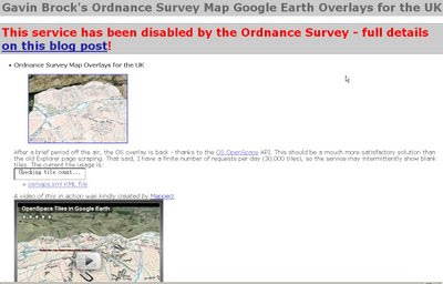
Ordnance Survey Kills OpenSpace
Mashup

update: Ed Parsons (former CTO at OS, now Google) mentions this mashup in his latest post
http://www.edparsons.com/2009/05/os-puts-the-no-back-in-innovation/

OS Kills OpenSpaceAPI G.Brock Mashup
For a long time this site [http://www.brock-family.org/gavin/google-earth/osmaps.html] was straight forward and overlayed Ordnance Survey Maps in Google Earth.

Users could view the Maps which were overlay-ed on the Google Earth Terrain.
The 3D view helped visualize users with the surrounding features as well as giving them familiar maps as reference. There is no financial gain here, nor any advertising, but Ordnance Survey states

"We really like your project, but unfortunately it will need to be discontinued as soon as you can. This is because it remains our current position that OS OpenSpace Developers may use third party content with our data provided they do no grant the third party any wider rights than those the Developer agrees to when accepting the Ordnance Survey’s OpenSpace Developer Agreement."

OS, Openlayers [the underlying OpenSpace API source code] itself is third party [right?]

and JSR_CLASS.JS
is part of Yahoo! SDK Copyright (c) 2005, Yahoo! Inc.
[see http://openspace.ordnancesurvey.co.uk/openspace/opensourcelicences.html#anc1]

So what is wrong here?
Ordnance Survey you are not losing out here. In-fact it is a free promotion to use your service.

Brock OS disabled KML Tiles
The web version of the above site worked really well but not anymore - thanks OS.

Read more from the source:
http://gavcode.wordpress.com/2009/05/18/os-overlays-disabled/


Labels: , , , , , ,

26 January 2009

Filmaps.com - Film Locations - Mapped

Filmaps - Film Locations - Mapped

update 27/09/2009
Google Maps Mania Expands the Film Exposure on Maps
http://googlemapsmania.blogspot.com/2009/01/film-locations-on-google-maps.html

Clean cut, easy to navigate, film suggester and maps what else is there...

Film Maps - Bourne Ultimatum
If you know a film well then you can add your own locations and using the 'I know a location' button

"We like films (movies and TV series) and we love travelling around the world, who doesn't?...Sometimes the charm of the places where the films have been filmed wakes up your adventure soul and you would like to discover even visit the exactly place where the scene took place. That's the filmaps aim, the possibility of locating that place!"

There is a lot of activities and tours related with film locations which are designed in order to visit some of them and
recreate the film action. Filmaps wants to help people in order to find that place.

A nice mashup with huge potential to link up with imdb, wiki or rotten tomatoes databases
example 'The Bourne Ultimatum'
http://www.imdb.com/title/tt0440963/
http://en.wikipedia.org/wiki/The_Bourne_Ultimatum_(film)
http://uk.rottentomatoes.com/m/bourne_ultimatum/

Then it's a question of keeping it up to date.

Labels: , , , , ,

27 August 2008

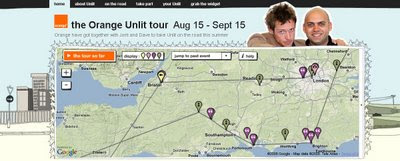
Orange Unlit Tour Map

Orange Unlit Tour Map

A Live Music Map Mashup.

"Unlit is a mixture of a gig and party, free and open to anyone, which takes place in people’s houses around the world."

Orange Unlit Tour Map
Very 'Flashy' Orange Unlit Map - Tour. Using flash and Google Maps to animate the tour so far, includes links to photos, videos, blog and twitter feeds.

"This summer, thanks to the support from Orange, we’re able to take the whole thing to a new level. From mid-August to mid-September we’re going on the road in a big caravan, doing two nights a week and posting the films just a couple of days after we’ve shot them.

We’re also using new technology, something Unlit has always been about… track us on Google maps, check out photos on Flickr, watch our daily video blog… it’s going to be amazing!"

View the Map (flash required) http://www.i-am-everyone.co.uk/orangeunlit/

The tour dates ranges from Aug 15 - Sept 15 2008.

If you want to take part...
http://www.i-am-everyone.co.uk/orangeunlit/takepart/

Labels: , , , , ,

05 October 2007

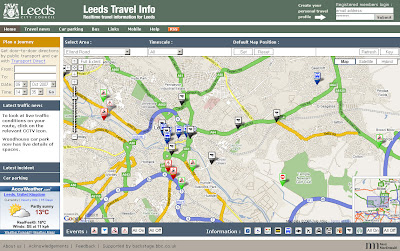
Real-Time Travel Information Map - Leeds

Real-Time Travel Information Map - Leeds

The Map shows the location of all traffic affecting Road Closures, Roadworks and Planned Events active now or in the near future.

Leeds Travel Information Map
An excellent 'mashup' using numerous data sources including BBC Backstage and Leeds City Council.

Tips on Use: If the map looks cluttered when you visit first use the content panel and switch off all then click individual icons for that layer to be displayed.
Also available is a set your last selected default map position and also remembers your last selection of travel information types and time.

Full Features of the Leeds Travel Information Map
  • Map: the map shows the locations of all traffic affected by road closures, roadworks and planned events that are active now or in the near future
  • Car Parking: A list of up to the minute information on car parking spaces
  • Travel News: This tab contains a searchable list of all traffic affecting road closures, roadworks and planned future events.
  • RSS Feeds: subscribing to the RSS feeds you can receive up to the minute travel information of your choice for the Leeds area
  • Mobile Services: live travel information to mobile phones with Google Maps for Mobile
More Information from the Help Guide
and for a Full Legend for the Map Icons go to the Key

Leeds Travel Information Map


More like this please! Mapperz

Labels: , , , , ,

13 June 2007

Google Maps API and AJAX LocalSearch Control

Google Map API and AJAX Search API get closer ...

the one liner that makes it happen
map.addControl(new google.maps.LocalSearch());

Update Please Note: Adsense is not Enabled yet but in the pipeline.


Note: Google will serve advertisements if you use this Local Search Control.

In addition to providing useful search results to users of your Google Maps API powered site, the Local Search Control for Google Maps is designed to help you make more money from your maps mashup. Search is a great opportunity to target relevant AdSense ads to users of your site. If you pass your AdSense ID into the constructor of your Local Search Control, then you will share in the revenue from clicks on the AdSense ad(s) generated by the Search Control. If you do not provide your AdSense ID, then ad(s) will still be served, but you will not receive revenue from those advertisements.

Embedded AJAX API Local Search Control in Google Map

http://mapperz.googlepages.com/new_local_search_ajax_apiv3.html
(corrected url for the css)

Official Post
http://www.google.com/uds/solutions/localsearch/compact.html

Google Map API response
http://googlemapsapi.blogspot.com/2007/06/localsearch-control-letting-users.html

more info and stay tuned on Adsense in Google Maps!:
http://www.google.com/uds/solutions/localsearch/index.html
http://www.google.com/uds/solutions/localsearch/adsense_gmlocalsearch.html

Labels: , , , , ,

21 February 2007

Google Maps Mania: UK Roundup Part 7

The 7th UK Roundup from the Excellent Google Maps Mania Blog

Google Maps Mania UK Roundup Part 7

Mapperz can't blog them all, though gets a mention for the 'England Rocks' Map

Mapperz suggests you subscribe to the Google Maps Mania RSS Feed then you won't miss a thing.

Labels: , , , ,

15 January 2007

Gchart - Currency, Local Time and Weather Map

Gchart Currency Map
Gchart - Currency, Local Time and Weather Map all available on from one source and one map.
Simple and a easy to use.

Also mapped is video and web blogs

Mapperz (now with rss email feed - visit blog to subscribe)

Labels: , , , , , ,

15 December 2006

Hotels Across the World Map

Mashed Hotels - UK Hotels
A interesting mash up that combines a very large database of hotels and other points of interest (POI) and displays them on a Google Map.

Other POI's
Capitals
Destinations
Airports
Ports
Landmarks

Also includes
Prices in local currency and accommodation.

via ProgrammableWeb

Labels: , , ,

01 December 2006

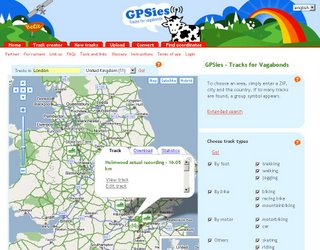
GPSies - Maps and Tracks

GPSies you can view and download tracks which have been recorded by a GPS device.
GPSies Map Mashup

Whether you are searching for running courses or Mountain Bike Tracks, with GPSies you can see what Tracks others have recorded. And you can download all the Tracks and put them onto your GPS device so you will not lose your way.

Formats supported are:

NMEA, Overlay, Kompass, PCX5 Track, GPX Tracks and Routes, Google Earth KML und KMZ, Garmin Course and Logbook

Includes an Address Geocoder (Google Maps API limits apply - no UK or Japan)

Is still Beta hence
Adresse nicht gefunden (Address Not Found). When searching UK addresses in English.
Suggest the AJAX Search route might be possible here.

Good design easy to use.

Just needs translating better from German to English.

Nice Cows with Aerials (don't suggest you do it to real ones).

Labels: , , , ,

27 November 2006

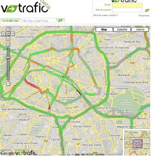
v-Trafic Beta - French Traffic Congestion Mapped

v-Trafic Beta - Traffic Congestion
Nice clear mapping overlay on a google map.
This shows in near real-time traffic congestion for the whole of France.

Labels: , , , , ,

17 November 2006

News has Location - Headline Map

Google Maps Mania posts are filled with the lastest google maps mashups.
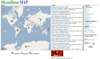
Headline Map is one that stands out...

Headline Map

Rich in multiple data sources cross referenced with location. This provides the user with World Headlines, Continental, Regional and Country News. This site is clean and responsive to the user. Users can submit feeds into this site. Mapperz gives this the thumbs up.
Well Done Headline Map.

Headline Map gives its credit to:
  • Google, for providing the amazing Google Map API
  • Topix.net, for providing granularity to this site due to their vast coverage
  • Flickr, for providing the pics of each location

Labels: , , , , ,

01 November 2006

MySpace Maps

Pimp Ma'Space Maps

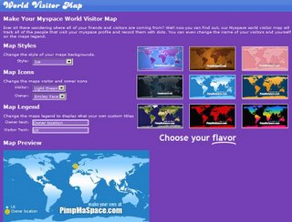
MySpace Maps

"Ever sit there wondering where all of your friends and visitors are coming from? Well now you can find out; our Myspace world visitor map will track all of the people that visit your myspace profile and record them with dots. You can even change the name of your visitors and yourself on the maps legend."

Quick and easy Maps for you MySpace - See where your visitors and friends come from.

other MySpace maps available
myspacemap.com
myspacemaps.info
map.mstracker.net

Labels: , ,

31 October 2006

UK Mashups Roundup Part 5

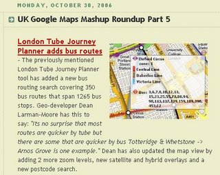
The ever resourceful Google Maps Mania is on it's 5th Roundup of UK Mashups using Google Maps API.

More and more sites and ever sophisticated integration of third party datasets.

Google Maps Mania UK Roundup 5

More from the site....

look forward to roundups 6,7 & 8...

Hint: Find that post!
To search mapperz blog and google maps mania blog use the custom search bar located in the right hand panel.
(more map/gis/cartographic sites will be added)

Labels: , , ,