->

21 March 2011

Closed Contour SPS Maps

Closed Contour SPS Maps

SPS (Sierra Peaks Section)

Closed Contour SPS Maps


Version 2 of the SPS Map by Closed Contours

New Specs:
  • Whiter glaciers/permanent snow with blue contour lines, talked about this in a previous post.
  • Change forest color depending on density (only in Yosemite and Sequoia/King’s Canyon NP so far). I also mentioned this in a previous post.
  • Non-SPS peak names. Discussed earlier as well.
  • Pass names.
  • Trail names, mostly in the NPs.
  • Removed many bogus ‘lakes’ which were actually mis-characterized permanent snow.
  • Added styling for scree, talus, and meadow/marshes.
  • Changed font for SPS peaks to slightly larger, darker, and italic to set them apart from non-SPS peaks.
  • Not a tile change, but added UTM coordinate display in lower right.

The SPS Maps have 248 peaks in the Sierra Nevada range of eastern California (plus Mount Rose in Nevada). The list is maintained by the Sierra Peaks Section, Angeles Chapter, Sierra Club. The map was designed to encompass all of the peaks on the list with a small buffer around them.


Cartography

Using a Transverse Mercator projection with a central meridian of 120° W, origin latitude of 0°, scale factor of 0.9996, WGS84 ellipsoid, and no false easting or northing. This projection was chosen as a compromise between UTM zones 10 and 11 which unfortunately split the Sierra Nevada vertically right through Lake Tahoe. Here’s the proj.4 string for the projection:

+proj=tmerc +lon_0=120w +k=0.9996 +ellps=WGS84
Data

Data sources:
DEMs are from the USGS NED program. (To generate hill-shade and contours.)
Road data are from TIGER.
Hydrology data are from the USGS NHD program.
Trails data are from the NPS and Forest Service.
Land cover data is from NPS and FRAP.
Buildings are from NPS and Mono County.

Map
http://www.closedcontour.com/

More information
http://blog.closedcontour.com/sps-map/

Full Credit to Dan the Contour Man
http://blog.closedcontour.com/2010/05/23/what-is-closed-contour/

Labels: , , , , ,

07 July 2010

Google Maps v3 New Map Mashups - July 2010

Google Maps v3 New Map Mashups - July 2010

Here are some of the newest v3 Google Maps

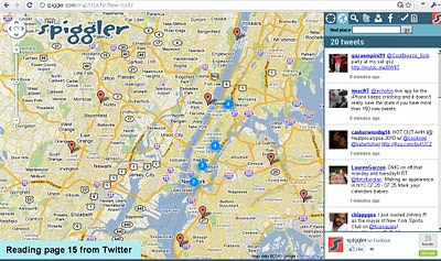
Spiggler.com Searches Twitter with your location.
Spiggler - Twitter Google v3 Map
Updates as you pan the v3 Google map nice integration with the twitter api.

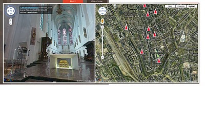
Streetview Inside
http://weblab.ab-c.nl/streetview v3 google map


Location Search Tool for Twitter
Find Geo-Twitter comments via this v3 Twitter Location search Google Map


The Grand Canyon - v3
Maptiler Custom v3 - The Grand Canyon
Using USGS DRG tiles as a custom tiled Google Maps v3.

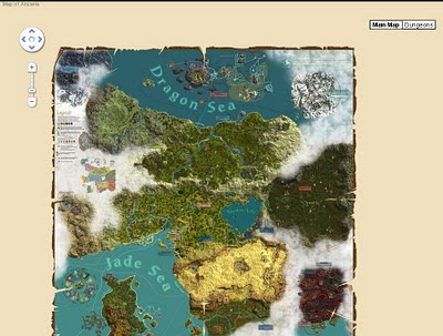
Game:Map of Ancaria
Map of Ancaria_v3 Google Maps
Very well illustrated Map of Ancaria [Sacred Game] - users can switch between this main map and dungeons custom map.

Missouri State Campus Map - Mobile
Missouri State University Campus v3 Mobile Map
Clean, Fast with campus overlay implemented in v3 for mobile users.

Don't forget that you can style your own map in v3 see the previous post.

Have you made your own v3 custom map like this? Add a comment and mapperz will post an update.

Labels: , , , , , ,

26 May 2009

Hypercities - Time Line Maps

Hypercities - Time Line Maps

A nice integration with a time-line and old maps.

Hypercities - Old Maps with Time-line
Using the time-line can narrow down dated maps for display in a particular city
More than one map can be overlaid and opacity can be controlled for each individual map.

Hypercities Maps in Rome
Rome has many old maps - worth checking out.

Note: There are option for 3D (GoogleEarth Browser plugin required) however the old map tiles do not seem to appear in the 3D version.

Timeline and Maps
http://linuxdev.ats.ucla.edu/

Source: Twitter (map search)

Labels: , , , , ,

06 March 2008

Master Class: Creating Custom Maps

Creating Custom Maps with John Coryat

How do you do 'Custom Tiles' in Google Maps?

An excellent presentation explains it all.

Software/scripts required
Perl 5.8 with DBI, GD and CGI modules
USNaviguide_Google_Relpix Perl module
USNaviguide_Google_Tiles Perl module
PostgreSQL 8.2 with PostGIS Extension (Mapperz recommends PostgreSQL)
Apache 2.0 webserver
ProjectedImage.js (Javascript)
US Census Cartographic Boundary County Shapefiles
Geonames.org US.zip data file

Or the PDF version

http://www.usnaviguide.com/ws-2008-02/presentation.pdf(5.5mb file)

Examples and Presentation Materials
http://www.usnaviguide.com/ws-2008-02/download.zip (111mb file)

Well done http://maps.huge.info/blog

Labels: , , , , ,