->

16 December 2010

OS OpenSpace & Google Maps v3 Meet

OS OpenSpace & Google Maps v3 Meet

Another great example from Bill Chadwick
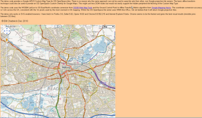
OS OpenSpace & Google Maps v3 Meet
Merging Map Tiles Ordnance Survey and Google Maps based on v3 Google Map API

"The demo code provides a Google APIV3 Custom Map Type for OS OpenSpace tiles. There is no reason why the same approach can not be used to warp tile sets from other, non Google projection tile servers. The basic affine transform technique could also be used to provide an OS OpenSpace Custom Overlay for Google Maps. This might use less DOM nodes but would not easily support the hidden peripheral tile fetching of the Custom Map Type.

The demo code uses the WGS84 Lat/Lon to OS East/North coordinate conversion from OSGB Web Map Tools and the Ground Control Point to Affine Transfrom Matrix algorithm from Google Mapping Hacks. The coordinate conversion accuracy is 1-2m across the UK, consistent with the 1m pixels used by the most zoomed in OS mapping. Whilst the OS OpenSpace tile server uses WMS like URLs, I do not believe that it will return Google projection tiles.

The demo only works in SVG enabled browsers. I have tried it in Firefox 3.6, Safari 5.02, Opera 10.63 and Chrome 8.0.552.215 and Internet Explorer 9 beta. Chrome seems to be the fastest and gives the best visual results (invisible joins between OS tiles)."

Full credit to Bill Chadwick

View the Map

http://wtp2.appspot.com/warpdemo.htm

Labels: , , , ,

20 September 2010

Hurricane IGOR - NOAA KMZ Overlays

Hurricane IGOR - NOAA KMZ Overlays

Hurricane IGOR Advisory Archive NOAA KML/KMZ - National Weather Service
Hurricane IGOR Advisory Archive NOAA - National Weather Service - KMZ Display using Google Maps v3.

Overlayed 4 KML/KMZ files from
http://www.nhc.noaa.gov/gis/archive_forecast_results.php?id=al112010&name=Hurricane%20IGOR

Mapped the overlays here
http://mapperz.110mb.com/GMAP/Hurricane_Igor.html

Labels: , , , , , ,

26 August 2010

Map Channels - Location Maps

Map Channels - Location Maps
*Using Google Maps API v3

Location Maps are simple controls to display a map of a single location. Street View can optionally be shown with the map.

Location Maps use the
Google Maps v3 API and are provided free for commercial or non-commercial use.

No adverts are included in Location Maps. An 'embed' control links from the map to this page.


Control size, maptype, map controls, markers and more with the new Location Maps which utilizes the fast v3 of Google Maps API.

Technical Notes:

You may copy the embeddable Location Map HTML Page to your own website (change the url used within the embeddable HTML code).

• Location Maps use the new Google Maps v3 API. This is more compact so loads faster.
• No API Key is needed for the Google Maps v3 API.
• The Street View is displayed without using Flash so no browser plugins are required.
• The 'fullscreen view' option included with the v2 API is not available. To see a larger street view click on the Google logo to see the street view at maps.google.com.

Full API reference can be found here http://www.mapchannels.com/LocationMaps.aspx#api


Labels: , , , , , ,

07 July 2010

Google Maps v3 New Map Mashups - July 2010

Google Maps v3 New Map Mashups - July 2010

Here are some of the newest v3 Google Maps

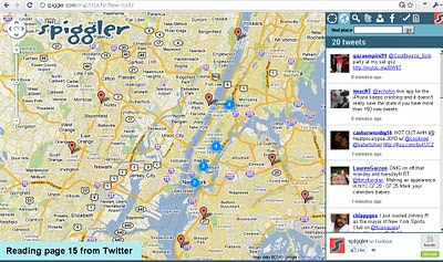
Spiggler.com Searches Twitter with your location.
Spiggler - Twitter Google v3 Map
Updates as you pan the v3 Google map nice integration with the twitter api.

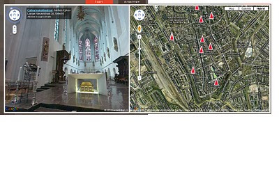
Streetview Inside
http://weblab.ab-c.nl/streetview v3 google map


Location Search Tool for Twitter
Find Geo-Twitter comments via this v3 Twitter Location search Google Map


The Grand Canyon - v3
Maptiler Custom v3 - The Grand Canyon
Using USGS DRG tiles as a custom tiled Google Maps v3.

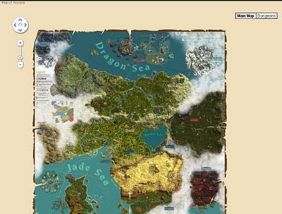
Game:Map of Ancaria
Map of Ancaria_v3 Google Maps
Very well illustrated Map of Ancaria [Sacred Game] - users can switch between this main map and dungeons custom map.

Missouri State Campus Map - Mobile
Missouri State University Campus v3 Mobile Map
Clean, Fast with campus overlay implemented in v3 for mobile users.

Don't forget that you can style your own map in v3 see the previous post.

Have you made your own v3 custom map like this? Add a comment and mapperz will post an update.

Labels: , , , , , ,

21 May 2010

Google Maps API Styled Map Wizard

Google Maps API Styled Map Wizard
*change Google Maps to suit your website colours and style.

Google Maps are instantly familiar by users interface the familiar look and feel of Google maps on any web site. All that can now change thanks to the Google Maps API v3 Style Wizard.

Google Maps API Styled Map Wizard bad carto
Make really bad colours if you want


Google Maps API Styled Map Wizard better carto
or something slightly more cartographically acceptable.

Use this http://gmaps-samples-v3.googlecode.com/svn/trunk/styledmaps/wizard/index.html
If you want your map to stand out from the crowd, your options are limited to customizing the markers and controls, and if your brand has a particular colour scheme that is reflected on your site, Google Maps may not sit well with it.

"You are now free to unleash your creativity on the base Google map itself, as we are delighted to launch Styled Maps in the Google Maps API v3."

Styled Maps offers you control over both the types of features shown on your maps, and the colour scheme used to represent them. The possibilities are endless....

See more Examples here:
http://maps-api-tt.appspot.com/apilite/styled/styled.html

Source:
http://googlemapsmania.blogspot.com/2010/05/add-style-to-your-google-maps.html
Official Post:
http://googlegeodevelopers.blogspot.com/2010/05/add-touch-of-style-to-your-maps.html

Labels: , , , ,

19 May 2010

Bye Bye Google Maps API v2 - V3 Graduates

Bye Bye Google Maps API v2 - V3 Graduates

was coming sooner or later...

As part of the Google Maps API v3 graduation to the principal maps API Street View has been added to the Maps API v3.

Street View in v3 is entirely implemented in HTML in order to accommodate all of the mobile devices on which v3 is supported. In v2 of the Google Maps API Street View relied on Flash.


Streetview now available in V3 of the Google Maps API (drag pegman to active the HTML version of Streetview)

In order to ensure that existing Maps API v2 applications can be migrated to Maps API v3, we have also been striving to add all of the most popular v2 features to v3. As part of that effort we are also happy to announce that Street View is now available in the Maps API v3.

When you use Street View in v3 you will notice a number of differences with v2. The most significant change is that Street View is entirely implemented in HTML in order to accommodate all of the mobile devices on which v3 is supported. We have also added Pegman support to the map, and a number of new features, including markers, infowindows, and custom imagery.

In conjunction with the graduation of the Maps API v3, we are also announcing the deprecation of the Maps API v2 and Mapplets (which is based on v2). These deprecation announcements confirm that no further feature development is planned for these two APIs. However, we will continue to maintain and support applications using these APIs for at least three years consistent with the deprecation policy detailed in the Maps API Terms of Service.


Sources:
http://googlemapsmania.blogspot.com/2010/05/google-maps-api-v3.html

Links:
http://googlegeodevelopers.blogspot.com/2010/05/they-grow-up-so-fast.html

Labels: , , , , ,

12 May 2010

Google Maps API v3 New Features

Google Maps API v3 New Features

3 New Features have arrived at the V3 Google Maps API


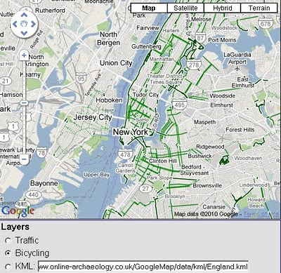
  1. KML Overlays
  2. Biking Directions (selected USA Cities currently)
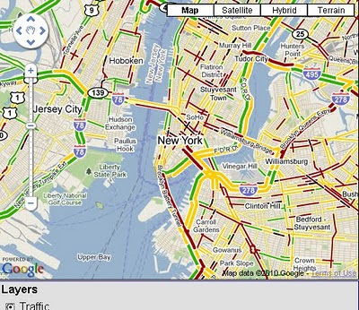
  3. Traffic Layer
KML Overlay Google Maps API v3
Google Maps API v3 now supports overlaying of KML files.

Bike Routes Google Maps API v3
Bike Routes are now enable for overlay for Googel Maps API v3 in selected cities across the United States.

Traffic overlay Google Maps API v3
Also Traffic Overlay is now available for use on v3 of Googel Maps API

You maybe interested in 'Boxer Router'
http://googlegeodevelopers.blogspot.com/2010/05/search-along-route-made-easy-with.html
credit to

and
Marker Manager 1.0 for v3
http://googlegeodevelopers.blogspot.com/2010/04/markermanager-10-manage-your-markers-in.html
credit to )

source with documentation
http://googlegeodevelopers.blogspot.com/2010/05/kml-traffic-and-bicycling-layers-come.html

Labels: , , , , , ,

09 March 2010

New Google Geocoding Web Service

New Google Geocoding Web Service

The service is now 'not limited' but you are required to show the results on a Google Map.
Examples given to help user understand the importance of this update.
Lots of updated content and improvement from feedbackNew Service v3 Geocoding
  • Unlimited Usage*
  • Status Codes (in Plain English!)
  • Java Support (Parsing XML with XPath)
"*Note: the geocoding service may only be used in conjunction with a Google map; geocoding results without displaying them on a map is prohibited."
[2,500 requests may be sent to the Geocoding Web Service per day from a single IP address]

but purley for example based on the official example given
Geocoding London (UK)
http://maps.google.co.uk/maps/api/geocode/xml?address=London&sensor=false
New Google Geocoding Web Service

Reverse Geocoding 51.5001524,-0.1262362 (London)
http://maps.google.com/maps/api/geocode/xml?latlng=51.5001524,-0.1262362&sensor=false

Countries Support
http://spreadsheets.google.com/pub?key=p9pdwsai2hDMsLkXsoM05KQ&gid=1
Note: en-GB ENGLISH (GREAT BRITAIN) enabled

New Status Codes - now in Plain English
  • "OK" indicates that no errors occurred; the address was successfully parsed and at least one geocode was returned. example
  • "ZERO_RESULTS" indicates that the geocode was successful but returned no results. This may occur if the geocode was passed a non-existent address or a latlng in a remote location. example
  • "OVER_QUERY_LIMIT" indicates that you are over your quota. (your geocoding too fast!)
  • "REQUEST_DENIED" indicates that your request was denied, generally because of lack of a sensor parameter. example
  • "INVALID_REQUEST" generally indicates that the query (address or latlng) is missing. example
Now for the new content:

geometry contains the following information:

* location contains the geocoded latitude,longitude value. For normal address lookups, this field is typically the most important.
*location_type stores additional data about the specified location. The following values are currently supported:
o "ROOFTOP" indicates that the returned result is a precise geocode for which we have location information accurate down to street address precision.
o "RANGE_INTERPOLATED" indicates that the returned result reflects an approximation (usually on a road) interpolated between two precise points (such as intersections). Interpolated results are generally returned when rooftop geocodes are unavailable for a street address.
o "GEOMETRIC_CENTER" indicates that the returned result is the geometric center of a result such as a polyline (for example, a street) or polygon (region).
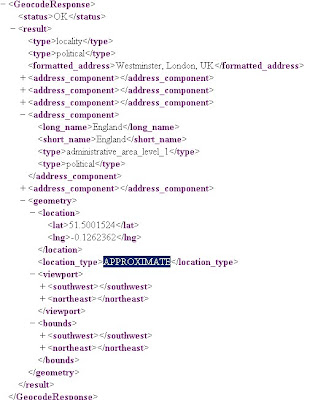
o "APPROXIMATE" indicates that the returned result is approximate.
* viewport contains the recommended viewport for displaying the returned result, specified as two latitude,longitude values defining the southwest and northeast corner of the viewport bounding box. Generally the viewport is used to frame a result when displaying it to a user.
* bounds (optionally returned) stores the bounding box which can fully contain the returned result.

Java Support
Parsing XML with XPath

Although it is not as lightweight as JSON, XML does provide more language support and more robust tools. Code for processing XML in Java, for example, is built into the javax.xml packages
please see http://code.google.com/apis/maps/documentation/geocoding/#XMLParsing for full details.

Full Documentation (updated)
http://code.google.com/apis/maps/documentation/geocoding/
Official Blog Post
http://googlegeodevelopers.blogspot.com/2010/03/introducing-new-google-geocoding-web.html
Mano Marks (Google Geo Developer Advocate)
http://randommarkers.blogspot.com/2010/03/client-side-geocoding-rocks.html

Full terms and conditions
http://code.google.com/apis/maps/terms.html#section_10_12
Maps API Terms
http://code.google.com/apis/maps/terms.html

Labels: , , , , , ,

29 January 2010

Mobile GeoRSS Maps *Beta* (Map Channels)

Mobile GeoRSS Maps *Beta* (by Map Channels)

"The easy way to add mapping for mobile websites"

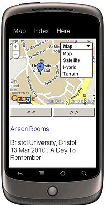
Mobile GeoRSS Maps combines the Google Maps v3 API and Google Feeds API to display a GeoRSS feed on a map that is optimized for mobile phone display.

Mobile GeoRSS Maps
Create your own Map with feeds for your mobile, mymaps or georss feeds can auto-update and provide you with latest information whilst on the move.

Use Mobile GeoRSS Maps to simply add your map to your mobile website, or to generate a map link for emailing.

Google My Maps are supported. Use Mobile GeoRSS Maps to generate a mobile version of a My Map in seconds.

Mobile GeoRSS maps works on any phone which supports the Maps v3 API, such as the iPhone and Android or Symbian platforms.

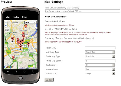
Mobile GeoRSS Maps Preview
Simple instructions to set you up for adding your own feeds to your mobile.

Technical Notes:

This map is a *beta* project, please contact us if you notice any bugs.

Only placemarks in a feed are displayed (lines and polygons are not displayed)

A maximum of 200 placemarks are displayed on the map

Custom Marker styles contained in a My Map are not displayed

base url for the following parameters
http://data.mapchannels.com/mobmap/100/map.htm

f = Feed URL or My Maps ID
r = Return URL
mt = Main Map Type (1=Road Map, 2=Satellite, 3=Hybrid, 4=Terrain)
pt =Profile Map Type (1=Road Map, 2=Satellite, 3=Hybrid, 4=Terrain)
z =Profile Map Zoom (between 1 and 20)
g =Geolocation (0=Off 1=On)
c =Marker Colour (0=Red 1=Blue 2=Green 3=White)

example:
http://data.mapchannels.com/mobmap/100/map.htm?g=1&mt=1&pt=1&z=16&c=0&s=1&f=http://www.entcal.com/rss/bristol_826.rss&r=
(will appear a full page map on a web browser)

Try it out here
http://www.mapchannels.com/MobileGeoRSSMaps.aspx

Nice, clean simple you set up and use, good work by the Map Channels keep up with developments at http://www.mapchannels.com/News.aspx

Labels: , , , , , , , ,

30 October 2009

Google Maps JavaScript API v3 - Now with Directions

Google Maps JavaScript API v3 - Now with Directions

**Remember Google Maps JavaScript API v3 is designed to be super lightweight for mobile devices

This makes mapping for mobile devices a lot more useful

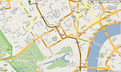
New Directions (Walking or Driving) in London - Google Maps API V3
New Directions (Walking or Driving) in London - Google Maps V3

@mapperz example above
http://mapperz.googlepages.com/google_mapv3_directions.html

With a Directions Panel
http://mapperz.googlepages.com/google_mapv3_directions_panel.html


Code:
New required parameters

var directionDisplay;
var directionsService = new google.maps.DirectionsService();

Set Start and End locations:

function calcRoute() {
var start = document.getElementById("start").value;
var end = document.getElementById("end").value;
var request = {
origin:start,
destination:end,

Travel Modes:

travelMode: google.maps.DirectionsTravelMode.WALKING
travelMode: google.maps.DirectionsTravelMode.DRIVING

Get the response from the Geocoder if both locations geocoded then display route between locations:

directionsService.route(request, function(response, status) {
if (status == google.maps.DirectionsStatus.OK) {
directionsDisplay.setDirections(response);


See the changelog
http://code.google.com/p/gmaps-api-issues/wiki/JavascriptMapsAPIv3Changelog

revelant links
Official documentation
http://code.google.com/apis/maps/documentation/v3/reference.html#DirectionsRenderer
http://code.google.com/apis/maps/documentation/v3/reference.html#DirectionsService

Offical Examples:
http://code.google.com/apis/maps/documentation/v3/examples/directions-simple.html
http://code.google.com/apis/maps/documentation/v3/examples/directions-panel.html

source:
http://groups.google.com/group/google-maps-js-api-v3/browse_thread/thread/ee7ce7cf8a872268?hl=en#

Labels: , , , , , ,

28 May 2009

Brand New Google Maps API v3

Brand New Google Maps API v3 (in Labs)

Just released... and its even faster....lots of code changes...
Google Maps API version 3 - Brand New

"Welcome to the release of version 3 of the Google Maps API. This JavaScript API will look similar to the existing version 2 of the Google Maps API. However, much has changed under the hood: Version 3 (called V3 within this document) has been designed to load fast, especially on mobile browsers such as Android-based devices and the iPhone™. The initial launch has a smaller feature set than that available in the V2 API. We will migrate additional features from V2 while working to keep the size of the JavaScript code small and maintain our optimized loading speeds. We welcome your feedback and comments on this version of the Google Maps API within the Google Maps API V3 discussion group."


Major Changes:
  • No API keys required! so can embed in RSS readers
  • Geocoding API has been overhauled!
  • Model–view–controller (MVC) based - so faster downloading javascript!

example of code changes:

function initialize() {
var myOptions = {
zoom
: 4,
center
: new google.maps.LatLng(-33, 151),
navigationControl
= false,
scaleControl
: true,
mapTypeId
: google.maps.MapTypeId.ROADMAP
}
var map = new google.maps.Map(document.getElementById("map_canvas"),
myOptions
);

More Information:
http://code.google.com/apis/maps/documentation/v3/
Official Blog Post:
http://googlegeodevelopers.blogspot.com/2009/05/announcing-google-maps-api-v3.html

Labels: , , , , , ,