->

05 April 2011

New Ordnance Survey Leisure


New Ordnance Survey Leisure

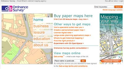
Ordnance Survey New Get-a-Map
View weather and 1:25,000 scale [Explorer Range] Maps

bug: when panning with toolbar pan panning does not stop [FireFox 4.]

Experience a whole new world of online maps with Ordnance Survey getamap. Plot your own routes, print, save and share customised maps. If you’re looking for something new on your door step or planning a trip away...

  • Create and share routes and maps
  • Search for routes from other members or our featured brands
  • Print Ordnance Survey mapping
  • Find places of interest and attractions
  • Check the weather and local news.
  • upload gpx or kml files for creating routes
  • save as gpx to hand held gps unit (only garmin gps products supported)
  • get local weather, news,
Subscribe for £30 per year (but with a special launch price of £18 until 30th June 2011)

Full Screen Map
Unlimited A4 Maps at no extra cost (but have an A3 Printer!)
Unlimited Authored Routes at no extra cost

FAQ and Help

Digital Maps
http://www.shop.ordnancesurveyleisure.co.uk/products/digital-maps/digital-maps-for-personal-computer (these are at cost/paid for products other free alternative sites are available.)
For IPhone/Touch

They even sell clothes....
(not cheap)

Labels: , , , ,

15 February 2011

National Address Gazetteer (GeoPlace)

National Address Gazetteer (GeoPlace)

Press Release from the Office of Fair Trading (OFT)

The proposed joint venture combines the spatial address databases of Ordnance Survey and the Local Government Improvement and Development Agency (LGID), to create the National Address Gazetteer, a database of accurate geo-referenced addresses in England and Wales. This data is relied upon by the public and private sector to accurately locate addresses when delivering services such as public transport, road maintenance, utility management and emergency call-outs.

The OFT found that the parties provide the only two accurate geo-referenced addressing databases, and do not face competition from less frequently updated and geographically accurate databases, such as those used by satnavs. Consequently it found that the joint venture would create a monopoly in this market.

However, the OFT concluded that it was not proportionate to refer the market to the Competition Commission because:

  • the Government is the parties' largest customer and will continue to enjoy substantial buyer power and influence over the joint venture
  • in practice there has been limited opportunity for the private sector customers of the two parties to trade one off against the other, and in any case the size of the affected private sector market is relatively small and
  • virtually all customers, both public- and private-sector, strongly supported the creation of the new database.
The plan is to be fully operational by April 2011, with the first data made available in summer or early autumn of 2011
Vector1Media

Full Press Release
http://www.oft.gov.uk/news-and-updates/press/2011/18-11

Ordnance Survey
http://www.ordnancesurvey.co.uk/oswebsite/media/news/2011/feb/geoplaceapproval.html

GeoPlace™ Q&As
http://www.lga.gov.uk/lga/core/page.do?pageId=15377046

Labels: , , , , ,

16 December 2010

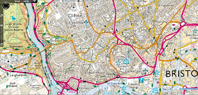
OS OpenSpace & Google Maps v3 Meet

OS OpenSpace & Google Maps v3 Meet

Another great example from Bill Chadwick

OS OpenSpace & Google Maps v3 Meet
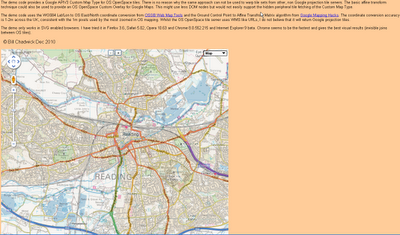
Merging Map Tiles Ordnance Survey and Google Maps based on v3 Google Map API

"The demo code provides a Google APIV3 Custom Map Type for OS OpenSpace tiles. There is no reason why the same approach can not be used to warp tile sets from other, non Google projection tile servers. The basic affine transform technique could also be used to provide an OS OpenSpace Custom Overlay for Google Maps. This might use less DOM nodes but would not easily support the hidden peripheral tile fetching of the Custom Map Type.

The demo code uses the WGS84 Lat/Lon to OS East/North coordinate conversion from OSGB Web Map Tools and the Ground Control Point to Affine Transfrom Matrix algorithm from Google Mapping Hacks. The coordinate conversion accuracy is 1-2m across the UK, consistent with the 1m pixels used by the most zoomed in OS mapping. Whilst the OS OpenSpace tile server uses WMS like URLs, I do not believe that it will return Google projection tiles.

The demo only works in SVG enabled browsers. I have tried it in Firefox 3.6, Safari 5.02, Opera 10.63 and Chrome 8.0.552.215 and Internet Explorer 9 beta. Chrome seems to be the fastest and gives the best visual results (invisible joins between OS tiles)."

Full credit to Bill Chadwick

View the Map

http://wtp2.appspot.com/warpdemo.htm

Labels: , , , ,

29 November 2010

Olympic Park Ordnance Survey Map

Olympic Park Ordnance Survey Map

Olympic Park Ordnance Survey Map
Olympic Park Ordnance Survey Map Progress

"Hopefully it will give you a taster of the development that has taken place on the site since 2001 and the contribution that Civil Engineers have made."

Full PDF available at
http://blog.ordnancesurvey.co.uk/2010/11/mapping-the-olympic-park/

Labels: , , ,

11 July 2010

Ordnance Survey Map in Bing Maps - Silverlight

Ordnance Survey Map in Bing Maps 1:25k and 1:50k Mapping Scales

Ordnance Survey 50k Landranger Bing Maps Silverlight

Ordnance Survey 1:50,000 (Landranger series) scale mapping in Bing Maps

Ordnance Survey 25k Landranger Bing Maps Silverlight
Ordnance Survey 1:25.000 (Explorer series) scale mapping in Bing Maps

http://uslot.com/NewBingTestPage.html

Source:
http://bingmapswatch.blogspot.com/2010/07/ordnance-survey-map-in-bing-maps.html

more details on the implementation from this blog
http://jimlynn.wordpress.com/2009/11/12/ordnance-survey-maps-in-bing-maps-silverlight-control/

Labels: , , , , ,

29 April 2010

Ordnance Survey Maps Vector Map District Available

Ordnance Survey Maps Vector Map District Available


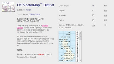
Finally a very useful dataset from ordnance survey for users wanting to create cartographic maps at mid-scale. Licence favourable for the use (with source attrbution) for the like of open street maps and others.

Techie spec.
Specification OS VectorMap District
CoverageGreat Britain ( England, Scotland and Wales )
Data sourceMajority of content derived from the mid-scales database. Buildings, cartographic text and functional sites derived from large-scale database.
Data structureESRI® Shape
ScaleNominal scale is 1:25 000.
Recommended scale range is 1:15 000 to 1:35 000.
Storage (unzipped)Tiles range between 6 - 20 Mb
Vector stylingShape format is supplied without styling, enabling users to customise the data to suit their needs.
Product content

Each vector feature has its own feature code, and falls within one of 15 layers:

A full list of feature codes and layers can be found here.

Number of tiles2860 tiles cover Great Britain
Tile size10km x 10km
Coordinate reference systemOSGB36. (@mapperz will have a WGS84 version by May2010)

Data Available to Download Here:
https://www.ordnancesurvey.co.uk/opendatadownload/products.html

Labels: , , , ,

07 April 2010

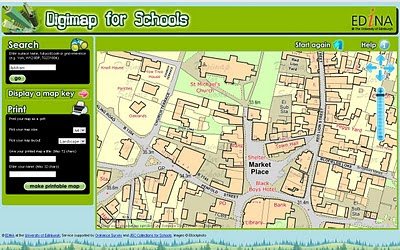
Digimap for Schools

New Digimap® data supply service for GB Schools
GB (Great Britain England, Scotland & Wales) but not Northern Ireland Schools

updated 8th April with correct details - many thanks to Emma Sutton (Geoservices Support Coordinator) EDINA
Ordnance Survey please update your PDF the right details.

Digimap for Schools
Schools will be able to print A4 or A3 Maps from the Online Service coming soon. Teachers will be able to teach children the importance of maps in a much easier 2011 fashion.

http://digimapforschools.edina.ac.uk

So this is why 1:25,000 Explorer Maps & 1: 50,000k Landranger Maps are not part of OpenData from Ordnance Survey.

Cost:
£60 for primary schools, and from £75–£125 for secondary schools.
  • Includes Ordnance Survey's OS MasterMap®, the most detailed mapping available for Great Britain, with over 450 million features from the built and natural landscape such as building outlines, pavement edges, walls and fences, house numbers, ground cover, benchmarks and much, much more.
  • Offers complete coverage of Great Britain mapped at 1:10 000 scale and showing street names.
  • Provides a seamless digital map covering all 403 sheets in the OS Explorer Map series (1:25 000 scale), all 204 sheets in the OS Landranger Map series (1:50 000 scale) and regional maps at 1:250 000 and 1:1 million scales.
  • Includes map keys and a search gazetteer with over 250 000 place names.
  • Maps can be located using postcode or place name searches, with a series of progressively more detailed map views available.
  • Maps can be titled by users before printing at either A4 or A3 size in portrait or landscape format.
  • Map content is updated annually.
  • Unlike paper maps, digital maps can be centred on your school or place of interest.

"The web interface gives a generous map area and has been designed to so that pupils can easily find maps themselves. Digimap for Schools supports maps skills teaching in geography, and has many wider cross-curriculum uses. It is the next step for pupils and teachers who generally use paper maps but are now looking for the flexibility of using digital mapping within a safe-surfing environment."

Digimap for Schools is designed to provide access to mapping, but is not a GIS.
Digimap for Schools is available via subscription for an annual charge of £60 for primary schools, and from £75–£125 for secondary schools.
Free trials available, sign up and more information at http://www.jcs.nen.gov.uk/catalogue/digimap.html

Map skills are also included as a key skill in the new Primary Curriculum, due for implementation in England from September 2011 under ‘Historical, geographical and social understanding’. Use of maps is considered to be ‘essential knowledge’ for developing understanding of how and why places and environments develop, how they can be sustained and how they may change in the future.

source: [big PDF with some image errors]
http://www.ordnancesurvey.co.uk/oswebsite/education/mappingnews/previouseditions/ed37.pdf [outdated]
info
http://www.jcs.nen.gov.uk/catalogue/digimap.html
more info
http://digimapforschools.edina.ac.uk/cosmo/faqs

Labels: , , , , , , ,

25 March 2010

@Nomads_land got Ordnance Survey Maps!

@Nomads_land got Ordnance Survey Maps!

What's the story here?

Ordnance Survey have helped the request for Ordnance Survey maps for a long walk (7,000 miles) around the United Kingdom for 3 UK Charities by Nathaniel Severs
Ordnance Survey
http://www.ordnancesurvey.co.uk/oswebsite/

The Three Charities:
  1. Southampton General Hospitals Paediatric Physiotherapy department
  2. The Stroke Association
  3. The Mammal Society
The request:
requested: 10:33 AM Mar 16th via Twitter on the web
S: Right Twitter,Nat is after some maps for the Scottish leg of the walk. SO, has anyone got OS Maps of scotland they could donate?Please RT

@mapperz picked up this request after following the daily tweets from @Nomads_land on his walk around the UK coast.

Basically mapperz has a number of good contacts, those contact have even better contacts.
Enter @StevenFeldman to the request and things really start moving and thanks to him Ordnance Survey have given the maps away for the Scottish leg of the 7,000 mile journey. That's over 40 1:25,000 Explorer Maps and a geo success of social networking that can be achieved.

More info on the guy doing the work:
"My names is Nathaniel Severs, I am 24 years old and in 2010, I am walking the entire coastline of mainland Britain (7,000 miles) for three great charities."Nomad's Land Big Walk Blog
Keep up to date on the Big Walk on http://natsevs.wordpress.com/

"I set out from Portsmouth on 10 January accompanied only by a large rucksack carrying my tent and kit. I camp most nights but am open to offers for accomodation! The entire journey will be completed using leg power and if there is a bridge, I will be crossing it (so Anglesey and the Isle of Skye will both be on the agenda). I will stay true to the coastline at all times, so if there is a ferry across a river (the River Dart, for example) that is not classed as coastline, then I will allow myself to take a ferry if one is available. But a ferry cannot be used at any other time. I aim to be home by Christmas!"

The journey so far
Nats Big Walk Route
Natathan is currently along Pembrokeshire Coast Path [Fishguard] (a very nice walk rain or sun)
Follow his progress here http://natsevs.wordpress.com/progress/

Many thanks to:

@Nomads_land for taking up the challenge to walk around the entire UK coast
http://natsevs.wordpress.com/

Steven Feldman (@StevenFeldman)
http://giscussions.blogspot.com/

Ordnance Survey for being so quick to respond and making the solution to the request.
hopefully a post on http://magazine.ordnancesurvey.co.uk/magazine/tscontent/editorial/exploremagazine/ about this soon?

Social networking Site Twitter - http://twitter.com/ connecting us all up.

and myself Mapperz @mapperz for helping a good cause.

Labels: , , , , , , ,

04 March 2010

SaferMK Community Safety Mapping by Zubed

SaferMK Community Safety Mapping by Zubed

A nice web GIS mapping solution....

SaferMK Community Safety Mapping by Zubed
Overlay of Crime data using Openlayers and using Ordnance Survey Mapping from the GetMapping Map Service

Clear thematic data is overlayed and fully interactive to query online but importantly easy to use by non-gis users (key fact!)

SaferMK Community Safety OS 25k Mapping by Zubed
1:25,000 Ordnance Survey (Explorer range) is used - making buildings and rights of way information viewable - you don't see this level of detail online often.

**Hopefully after the Ordnance Survey Consultation (Deadline 17th March 2010) this data and others is made available freely to use - Due April 2010.

The main features of the SaferMK Community Safety Mapping site are:
  • It provides details of All Crime and anti-social behaviour (ASB) incidents and trends over the previous 12 months.
  • It is a web-based mapping system allowing Neighbourhood and Area (estate, village or town) level analysis of crime and anti-social behaviour, using data obtained from Thames Valley Police, the Milton Keynes Council and Buckinghamshire Fire & Rescue Service.
  • It displays anti-social behaviour data that isn't published by any other source.
  • It displays information (data and graphs that show trend) in data balloons for each Neighbourhood or Area and gives comparison data against the whole of the borough.
  • It provides the ability for residents and users to download standardised data; and to produce a standardised anti-social behaviour report for a specific Neighbourhood, which includes graphs and tables.
Guidance:
http://www.milton-keynes.gov.uk/safermk/DisplayArticle.asp?ID=67095

View the Interactive Map - http://safermk.zubed.com/

Credit to Zubed for the creation and implementation of this easy to use web mapping solution.

Labels: , , , , , , ,

17 November 2009

Ordnance Survey Maps to go FREE Online

Ordnance Survey Maps [and Data] to go FREE Online by April 2010.

updated: 18th November 2009.

News coverage on this story

Ed Parsons (former CTO at OS now
Geospatial Technologist at Google)
http://www.edparsons.com/2009/11/now-why-was-that-so-difficult/

BBC News
http://news.bbc.co.uk/1/hi/technology/8366190.stm

Number10
http://www.number10.gov.uk/Page21343
The Times
http://www.timesonline.co.uk/tol/comment/columnists/guest_contributors/article6920761.ece
TechRadar
http://www.techradar.com/news/internet/ordnance-survey-maps-now-free-online-652001
eGov
http://www.egovmonitor.com/node/30951
PublicNet
http://www.publicnet.co.uk/news/2009/11/18/plan-to-make-os-data-available-to-improve-public-services/


Groundbreaking News this is amazing turn-around for UK Government Geo-Spatial Datasets.

Freed our Data

Thanks to Sir Tim Berners-Lee
(& inventing the World Wide Web)

"The government is to explore ways of making all Ordnance Survey maps freely available online from April"


Today's announcement will be followed by a speech, due next week by the chief secretary to the Treasury, Liam Byrne, explaining how the freeing up of data, alongside the scaling back of other functions of central government, could lead to a "smarter state".
1:10,000 Raster Maps might be available for all in April 2010

1:10,000 Raster Maps might be available for all in April 2010....
image source for illustration only.
http://www.ordnancesurvey.co.uk/images/userImages/misc/products/10kraster/map-image-10k-lrg.gif

This is likely to include Flood Mapping Data, 1:10,000 data [Vector & Raster Datasets], Highways Agency Traffic Data and much more.
reports are conflicting whether 1:25,000 data will be freed (to be confirmed)
"sets of public data currently not freely available include wills dating back to 1858, house values recorded in the Land Registry, maps, and flood-risk data for individual homes"

***More important is vector data as users can create thier own maps/styles with it.
Will be interesting to know the re-licencing of these products and deriving from such sources conflicts with crown copyright.

The online maps would be free to all, including commercial users who, previously, had to acquire expensive and restrictive licences at £5,000 per usage, a fee many entrepreneurs felt was too high.

Noted on the Guardian:
Today the union representing staff at the OS stated that Brown's pledge was in "complete contradiction with the OS's own plans to explore commercial opportunities and find new ways of raising revenue".
Read more
http://www.guardian.co.uk/technology/2009/nov/17/ordnance-survey-maps-online
(and thanks for running the Free Our Data Campaign over the years)

Labels: , , , , , ,

12 October 2009

OS 3D Laser Map - Most Accurate Mapping Ever

The national agency used state-of-the-art laser technology and aerial imagery to create what it claims is one of the most accurate maps every produced.

"Ordnance Survey says that the results are substantially more accurate than the 3D maps available through online applications such as Google Earth and Microsoft Virtual Earth, and will revolutionise the way it charts the British Isles."

Video of Bournemouth's Seafront attractions


The Good News:

“Given the level of detail that we've [ordnance survey] achieved, I think Bournemouth can confidently lay claim to being the best mapped place on the planet.”
Glen Hart, head of research at Ordnance Survey

The Bad News:

The 3D mapping service will not be rolled to the rest of Britain for at least five years, while Ordnance Survey perfects the new method. The black dots in the video represent points where no laser data was obtained.

Full article and source:
http://www.telegraph.co.uk/news/uknews/6308577/Ordnance-Survey-3D-map-of-Bournemouth-is-most-detailed-ever.html

Labels: , , , , ,

06 October 2009

Discover,Evaluate & Develop - New Ordnance Survey Licences

Discover,Evaluate & Develop - New Ordnance Survey Licences

Ordnance Survey have found the word 'Innovate' and have changed the way they 'give away' (at cost*) data for
Discovering,Evaluating and Developing Ordnance Survey data.

The New Licencing Models:-

Discover:
if you are a private individual, new customer, social entrepreneur, or represent a social group or start up company. You can use the data for your internal evaluation and testing purposes only. You cannot develop or demonstrate the data. It is free of charge and can be used as long as you adhere to the terms. Terms PDF

Evaluate:
You may be interested in this licence if you are a new or existing customer who would like to take a larger area of OS data to evaluate, test or demonstrate internally. You can take this data initially for a maximum of three months. Standard supply is up to 10% of Great Britain. This licence is free of charge.
*Though if your order 10.1% of Britian you will be charged £500 payable within 30 days.
Terms PDF

OS Vector Data Formats Available
Many of the Ordnance Survey Datasets are available to download in various GIS formats so no data conversion is required. Simply load into your GIS sofatware.

Developer:
You may be interested in this licence if you would like to develop, test and demonstrate our data to your potential customers.

Our standard supply of Developer Data is for the Plymouth area. Products, formats and exact areas covered are on the Developer Data overview page.

You can use the data for 12 months (except for any third party products listed in the licence where the term can be reduced to 3 or 6 months) and the licence to do this is free of charge.
Terms PDF

FAQ's

How long can I use the data for?

Discover Data– until we terminate the licence.
Evaluation Data – You can take this data for three (3) months except where you request and we agree to supply more than four (4) individual kilometre tiles of OS MasterMap Imagery Layer, which will be for a period of one (1) month.
Development Data – 12 months from the date of despatch, after this time the licence will automatically renew on the same terms. Term for the 3rd party products is also 3 months from the date of despatch.

How much data can I have?

Discover Data– You can download what is on the website.
Evaluation Data – up to 10% of national cover as standard.
Developer Data – Plymouth area as standard.

Which products are available?

** Rasters require world files for GIS software to geo-reference each image available here
***not sure why this data is made available is 'frozen' (dis-continued)

Can I have, for example, three different areas of 10% cover?

Under the Evaluation licence you can have one geographical area of 10% for different products.

What do I do if I want to order the same area for a different product a few weeks after I placed my first order?

You need to complete another request form for the second batch of data.

What happens with the evaluation licence at the end of three months?

You should cease use, destroy and delete the data or contact us if you still need to use the data.

Source:
http://www.ordnancesurvey.co.uk/oswebsite/products/innovations/

Though at the end of the day does it innovate you?

Labels: , , , , , , ,

12 May 2009

Ordnance Survey Openspace API - UPDATED

Ordnance Survey Openspace API - UPDATED

Now include access to Ordnance Survey BoundaryLine [vector] Data

"Use the OS OpenSpace API to add Ordnance Survey maps to your website or blog."

Finally after many, many requests Ordnance Survey have updated their OpenSpace API which now allows adverts on your site!
See the OpenSpace API FAQ for more details on this

New Features:


Look-up services
  • OS OpenSpace boundary look-up
  • Postcode look-up
  • Place name look-up

A single API key may access data up to the following daily usage limits:

  • 40 000 tiles of mapping data in a 24-hour period.
  • 1 000 Place name look-ups (Gazetteer service) in a 24-hour period
  • 1 000 Postcode look-ups in a 24-hour period
  • 1 000 OS OpenSpace boundary look-ups in a 24 hour period
A New Gallery:

OS OpenSpace API Updated

The gallery includes projects like
Manchester cycling club (overlaying .gps routes on 1:50k mapping)

Satellite Dish Alignment (click UK Map to find the OS Mapping)

Whereisthepath (now 40,000 tile impressions per day due popularity - now using Google Appspot) *a Mapperz favourite all round mapping mashup.

Geograph Photos on an OpenSpace Map (Shows all the Geography photos - please do not use it to geo-locate photographs)

Public Footpaths [OpenSpace] on iPhone (designed specifically to be displayed on the Apple iPhone.)

Bike Hike (May 2009 update: Finding routes has been revised. Also revised so course points are now downloaded in GPX tracks and routes as waypoints)
Sky Cam (Latest skycam images using the Ordnance Survey OpenSpace Mapping)
Bikes & Boots (currently unavailable - Updated 12 May 2009)

Hill-baggin (Hill walkers and summit-baggers, attempting to provide accurate Ordnance Survey grid references for the 3000ft mountain tops, and prominent lower hills, of Scotland.)

Kent Trails
(Lots of trails [155 miles worth] in the County of Kent)

For more details and terms and conditions please see
http://openspace.ordnancesurvey.co.uk/openspace/developeragreement.html

Official OpenSpace API Demos - now including BoundaryLine data [wards, administration boundaries etc]
http://openspace.ordnancesurvey.co.uk/openspace/support.html

Thanks to Bill Chadwick [Whereisthepath author for the additional information]

Labels: , , , ,

25 January 2009

Multimap - Ordnance Survey 1:25,000 Mapping Available

Multimap - Ordnance Survey 1:25,000 Mapping Available

update 26/01/2009 11.36am: from the forum link below- there has just been a reply from Multimap:

"We've worked with OS to get the data which features in the OS OpenSpace API (such as the 1:50k Landranger maps), also published in the Open API. Unfortunately, the 1:25k Explorer maps are not currently available through OpenSpace, so we can't currently make them available in a product such as the Open API. We can however make them available through our commercial API product (Multimap API)."
Julian Skeels, Senior Program, Manager Multimap

Come on Ordnance Survey free up your data! before your sold by the treasury...

“A STRING of state-owned household names including the Met Office, mapmaker Ordnance Survey and the Forestry Commission, are being prepared for sale by the government in the next two years to raise cash for the stretched public purse. ”
source:
James Ashton - The Times (November 23, 2008)


Finally 1:25,000 [Explorer] Mapping is available online for viewing and printing thanks to Multimap (Microsoft cash injection?).

This is the best overall mapping product Ordnance Survey produce for leisure tourism activities in Great Britain (England, Wales and Scotland).

View map of Malvern, Malvern Wells, Worcestershire, England, WR14 4 on Multimap.com
Get directions to or from Malvern, Malvern Wells, Worcestershire, England, WR14 4

[RSS Readers cannot show the embedded map so please visit http://mapperz.blogspot.com/ to see the Ordnance Survey 1:25,000 Mapping embedded in the blog - thanks]

Now users can see official public footpaths, more detailed contours, field boundaries etc.

This beats the only other current accessible service from Ordnance Survey 'Get a Map' service hands down.

Available Multimap Open API? No (currently - see comments & update)
Is this available in the MultiMap API? Yes
Possibly, with an experienced developer would be able create a workaround to switch the tiles when the map zoom scale is higher than 16. (this has been done! borderline with ToS)
Though it would be adviseable to wait and see if Multimap updated thier documentation on the Open API
*note the updated red notations (need to be dated) these have been like this for a while now.

Legend
A full legend of all the map symbols and representations
http://leisure.ordnancesurvey.co.uk/leisure/tscontent/products/os/explorer/symbols/25k_English_Legend_March08.pdf

Tile Source Structure.
http://mc2.tiles-cdn.multimap.com/ptiles/map/mi932/16/031313/100323/232.png
(does allow access to the raster png files but not recommended to do direct access to them as likely to be breaking multimap terms and conditions and ordnance survey copyright).

Source and a good question
http://forums.multimap.com/viewtopic.php?f=1&t=165

Official Blog Post
http://blog.multimap.com/2009/01/21/os-explorer-maps-on-multimapcom/

Labels: , , , , , ,

13 November 2008

Ordnance Survey - Doom Masters

Ordnance Survey - Doom Masters

Double Update:
Ed Parsons (a former CTO of the Ordnance Survey) writes:
http://www.edparsons.com/2008/11/who-reads-the-terms-of-service-anyway/

"As the Guardian article points out the OS was unhappy with local authorities signing up to the Google Maps API terms of service as it required a “broad” re-licensing of the data to Google and the users of Google maps based sites."

Google Maps Terms have been adjusted:
"Thank you for your interest in the Google Maps/Google Earth APIs. The Google Maps/Google Earth APIs are a collection of services that allow you to include maps, geocoding, and other Content from Google in your webpages or applications."
http://code.google.com/apis/maps/terms.html
(Last updated: November 12, 2008)


Update:
Google Maps API Users have raised the issue
http://code.google.com/p/gmaps-api-issues/issues/detail?id=852
(please star the issue so the 'Terms of Use' will be updated asap.)

The Ordnance Survey are striking back after the announcements of 'Show Us a Better Way' about derived data - breaking copyright.

Breaking Copyright
OS Maps Online - But you cannot create points, line or polygons from it as your breaking copyright.

Using Old OS Maps to capture data freely
However you can use these Old OS Maps to capture data freely.

http://www.showusabetterway.co.uk/call/2008/11/and-the-winners-are.html
Most have some element of Geographical Data (Postcodes) or Mapping.

From the Free Our Data Blog (The Guardian)
"The OS, we’ve learnt, has circulated local government with a helpful Q+A about how they shouldn’t embed info on Google Maps (or of course other mapping companies such as Microsoft or Yahoo or..) if it has been “derived” from OS data."

How to kill innovation in one huge swipe! Well done OS. Remember the UK Taxpayer has funded you for years (now its 47%).

more on the debate:

Question: I want to pull Google Maps onto my system and host my Ordnance Survey derived business information on top, so that no data will pass to Google. Can I use this solution instead?

A No. Although you will not be passing any data directly to Google, by displaying such data on top of Google Maps in this way and making such mapping available to the public, it appears that you will be granting Google a licence to use such data. This is the case despite the fact that you will be hosting the data on your system. Google’s terms and conditions appear to provide that any display of data on or through the Google services grants Google a perpetual, irrevocable, worldwide, royalty-free licence to reproduce, adapt, modify, translate, publish, publicly perform, publicly display and distribute such data.

The terms of your licence do not permit you to license Ordnance Survey data to a third party in these circumstances.


Full Article by Charles Arthur

http://www.guardian.co.uk/technology/blog/2008/nov/12/ordnance-survey-google-maps-copyright


View and get bored read the PDF the Ordnance Survey published

http://www.freeourdata.org.uk/docs/use-of-google-maps-for-display-and-promotion.pdf

so '*S%^&@' you are.... thanks OS.

Labels: , , , ,

27 October 2008

MultiMap adds OSNI Maps

MultiMap Adds OSNI Maps


View map of Ballymena, Antrim, Northern Ireland, UK on Multimap.com
Get directions to or from Ballymena, Antrim, Northern Ireland, UK

Ordnance Survey Northern Ireland(OSNI)
Similar to the Ordnance Survey 50k Rasters

Also added are:

Multimap have recently released new street level maps for countries in the Middle East. The countries are:

Bahrain
Kuwait
Oman (limited coverage)
Qatar
Saudi Arabia
UAE

Source:

http://blog.timwarr.net/

Labels: , , , ,

09 September 2008

Where is the GPX Path?

Where is the GPX Path?

(well the answer is on the map now thanks to Bill Chadwick's update of GPX import.)

South West Coastal Path - Lizard Point (Cornwall)
Importing of GPX data is very fast and when in 3D (Earth) Mode it shows you the terrain your likely to encounter. (weather not included!)

"GPX to GeoJson Converter is purely a convenience for those who want to read a random GPX url on a page from a host that lacks server side scripting"

Example - The South Coastal Path
http://tinyurl.com/5zd4af

NOTE* The most annoying issue for this site is not the author's fault at all. It's the Ordnance Survey with ridiculously low openspace tile quota (currently 30,000 per 24hrs).
This is a very popular site and 30,000 tile impressions needs to be 75,000 at least.
Why does the Ordnance Survey insist of bottlenecking useful web mapping applications?
And why allow users to have 1:50,00 colour rasters (Landranger Maps) and StreetView 1:10,000 and not the very useful 1:25,000 (Explorer Maps)?

Data for the South West Coastal Path is available from (GPX format for GPS)
http://www.southwestcoastpath.com/main/useful_info/GPS-downloads.cfm

For more information on the technical aspects please visit
http://groups.google.com/group/Google-Maps-API/browse_thread/thread/69f83113b27388a3

Labels: , , , , ,

05 May 2008

The Ordnance Survey & Becta Schools 'Map Pilot'

The Ordnance Survey & Becta Schools 'Map Pilot'

"The Ordnance Survey (OS) and Becta have been running a `map pilot' aimed at exploring ways of making digital maps accessible to schools."

source an thanks to: Wendy North Primary Project Leader http://primarygeogblog.blogspot.com/


`The MapPilot enables a range of Ordnance Survey digital mapping to be accessed free by pilot schools and educational mapping suppliers for a trial period. MapPilot is run by Becta, in conjunction with The Advisory Unit: Computers in Education and eMapSite with funding from DfES and support from Ordnance Survey.'
*via a simple GIS such as Local Studies

The other mapping source they have used is the excellent Geograph

This a very good way to introduce school childern to Maps and Technology. They are the potentional future Carographers and GIS engineers of tomorrow.

The project highlights 'software issues' so any budding software engineers out there that could develop 'A deskstop or web-based GIS' for school childern would be on a winner.
Openlayers & QGIS Hybrid has potential with development.

Mapperz

Labels: , , , , , ,

27 April 2008

BBC Jam Cams using Ordnance Survey Maps

BBC Website using Ordnance Survey Maps

"View our Jam Cams by using our new interactive map"


BBC Ordnance Survey Maps Jam Cams

The map is dynamic (generated in flash) and shows clusters, the larger the circle the more cameras are available to view.


Quick Video showing the Ordnance Survey 1.1million (Miniscale) 1:250,000 & 1:50,000 Colour Rasters in thier flash application.


Now you would think nothing of this, until you realise the cost for this.
A Corporate Licence. It must be very expensive to do this.


[Now in the UK every household that has a TV tuner requires a TV Licence, now that can be seen as a 'tax'. This tax then is used to fund the BBC and all it's programme making and anything to do with the BBC. Including the very successful iPlayer.]


It's nice to see this data finally and freely accessible on a very large UK website other than the Ordnance Survey's own site.

Though if you are looking for Free Access to Ordnance Survey data and the use of these products mentioned you can provided you have no adverts on your site or making money via the access of the data. OpenSpace API is the route for you.

Labels: , , , ,

19 December 2007

Ordnance Survey - OpenSpace API ( now with Demo)

19/12/2007
update: Found a Demo Page with using OpenSpace API

OpenSpace Map Image for Illustration
Image is for illustration only.

On closer inspection there is a lot of content which has been removed at the larger scales.
Live Demo
http://www.maptasm.com/


Ordnance Survey - OpenSpace API
(Alpha)

Ordnance Survey OpenSpace Logo

"Got a great idea? Make it work with the best mapping in the world."
(well Great Britain anyways)

"OS OpenSpace is a free Ordnance Survey service that allows you to embed Ordnance Survey maps covering England, Scotland and Wales in your web applications using our Javascript® application programming interface (API)."

Some Functionality :

The OS OpenSpace API and all the data provided is in British National Grid (ESPG 27700).
The API also provides the ability to covert between National Grid and latitude and longitude (ESPG 4326) and vice versa.


OS OpenSpace allows your API key to access up to 30 000 tiles of data and up to 1 000 place name look-ups per day for free

Can you add Ads to the API?
No, please see the OS OpenSpace Developer Agreement (there can be no form of financial gain).
FaceBook, MySpace apps?
No, The application you build cannot result in any financial gain to you (the developer of the application), the user or any other party; please see the OS OpenSpace Developer Agreement .


Note: Any Content you create using the Open Space API - Will not be yours, as it is 'dervived' from Ordance Survey Products.

the ownership and licensing of the copyright and other intellectual property rights in:

* any data supplied to you by us; and
* any data created by you.

Primarily, you cannot use any data you create for any commercial purpose.

No 1:25,000 (Explorer range) or 1:10,000 Rasters


More Information:
The Guardian
http://www.guardian.co.uk/technology/2007/dec/13/freeourdata.software

Ed Parson's (Ex CTO Ordnance Survey) briefly mentions it too
http://www.edparsons.com/


OS OpenSpace is currently running as a closed alpha test service.

OS OpenSpace Developer Agreement is 16 Pages long.

http://openspace.ordnancesurvey.co.uk/openspace/index.html


It's a good step forward, but very restrictive in use.
Hopefully can be developed for Educational and Charity Institutions

At least Microsoft haven't bought them yet.

Stefan Geens writes an excellent roundup of the implications of this API. Removing ads from his site could only run the OpenSpace API on the Ogle Earth site for 12 hours a day due to the amount of traffic it generates.
http://www.ogleearth.com/2007/12/ordnance_survey.html
(But I think he will stick to his current formula with ads.)

Labels: , , , , ,