->

30 June 2006

Quikmaps back up and running
Quikmaps Treasure Map

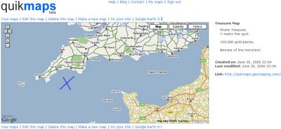
Using sophisticated mapping techniques and using the excellent quikmaps website.
The creation of a 'Treasure Map' was easily achieved.

X does mark the spot... just this once.

Globe Feed World Map (in Alpha)

A World Map that presents a whole new way of getting connected with the world.


GlobeFeed maps is built on Google Map APIs and contains world photos, wikipedia entries for locations, integrated Geoplace names, chat, nearby postcodes, bookmarking and sharing locations on a World Map. There is lot more on this map and its free to use.

How much does it cost to display an Ordnance Survey (OS) map on a website? contd.

How much is that map on your website? well for a charity this would be...
"For a single scale mapping of the country - say, at 1:50,000 scale - including Code Point for finding postcodes (so you can get a map of a postcode's location), the annual licence for a website serving 20,000 map images per day, every day, would be £18,200 per year."

Using multiple scales will, of course, ramp up costs very quickly - as will being popular. But even licensing seven scales will only take your annual costs to around £100,000* ($181,980)- not into the millions.

sources:The Guardian

CTO at Ordnance Survey Ed Parsons

If Ordnance Survey reduced costs and therefore gained customers numbers, surely they would recover the costs of surveying and updating their digital datasets?

previous post on this article

Map24 - World Cup Map

Map24 World Cup 2006 Map
Interactive World Cup 2006 map from Map24
Includes team news and Stadium information.

ACME GeoRSS Map using Reuters News

ACME News Map ReutersAn ACME GeoRSS Map


Using Reuters news as it's source.

World News Map

World News MapWorld Map News from maplandia

responsive map with auto centring on the news story.

BBC News UK Map - Powered by BBC BackStage

BBC News Map UK - Powered by BBC Backstage
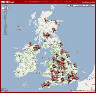
News Maps for the United Kingdom. Powered by BBC Backstage, reports the last 12 hours of news.

Clean and easy to use.
credit to Ben O'Neill

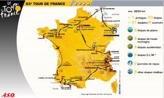
Tour de France Map in Flash

Tour de France MapA Static and Flash Version of the Tour de France
Live route information is also available.


credits 2006 © A.S.O. / Amaury Sport Organisation

29 June 2006

Traffic Map - Live


Live Traffic Map from the Highways Agency

Travel Time Tube Map

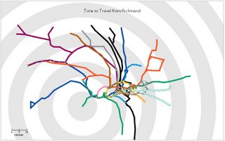
Travel Time Tube Map
A WOW Map!

"Click on a station to see the London Underground map reorganise around the times of travel from that station. Shortest paths are used to place the other stations - radius is proportional to time to travel, and angle should be correct for as-the-crow-flies direction on a map. The concentric circles are at 10 minute intervals.
Press 'g' to get back to the geographical tube map."

Very Clear and Fast, Top Marks go to Tom Carden

Java Applet required

WildFinder - WWF ArcIMS Map

World Wildlife Fund

Find Endangered species and find their locations using the WildFinder


WildFinder from World Wildlife Fund
WildFinder uses ESRI ArcIMS

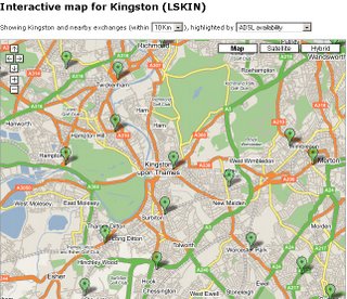
BT ADSL MAX Map

ADSL Map Kingston upon Thames
BT ADSL Max Map

Underlying all Internet maps and mapping websites is the BT Broadband network.
Sam Knows is an excellent resource and visualises Broadband providers with Static and Google Maps for the user.


28 June 2006

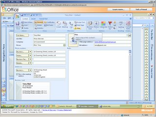
Microsoft Office 2007 Online - Contacts have Maps

Map in Office 2007 ContactsTesting Microsoft Office 2007 Online with Contacts in Outlook 2007 there is 'View a Map of this Contact' function.
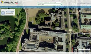

Not fully functional yet but attempted to go to Windows Live Local


Hopefully when its released a Map like this will work.

Windows Live in London UK


Will OpenOffice take note?

Google Maps on Mobile (UK)

Google Maps on Your Mobile DeviceGoogle Maps on Mobiles Phones (GPRS/WAP phones) have been around for a while though its seems that improvements to the speed and more mobile devices has been supported.


The link for your mobile device is www.google.co.uk/gmm

27 June 2006

Maps on your Ipod Photo

Ipod Maps

Maps of Underground routes and stations on your Ipod to view when out and about.


Vancouver Tube MapLondon Tube MapTokyo Tube Map

True European Maps

 France in Local Language (French)A True European map and presents each country's name and place names in the local language.
Languages used on the map are the 20 official languages of the European Union or the main national language(s) for those countries outside the European Union.

The maps show the administrative divisions of each country as determined by the national authorities.

Clickable but not Dragable

AM Maps

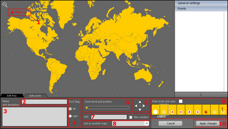
AM Flash Map EditorCreate clean simple maps with ammaps... uses flash but can export to .html


To create your own click the image and name your map then select from the list and click edit.

Nice Interface.. and quick.

26 June 2006

Quikmaps in a Doodle

QuikMaps Logo


Make a map in minutes if not seconds...

Clean, easy to use google map creator for anyone to use.

Update: 28/06/2006 - Due to being very popular QuikMaps has had to move, all links have been updated from this blog.

25 June 2006

Quantum Leap for GIS.

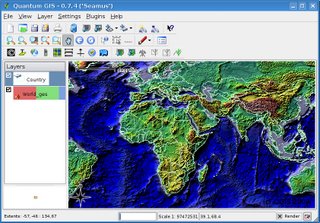
Quantum GIS
Quantum GIS (QGIS) is a user friendly Open Source Geographic Information System (GIS) that runs on Linux, Unix, Mac OSX, and Windows.

So you want to make a Google Map?

Mike Williams Google Map Tutorial is one of the best starting points for creating Google Maps of your own. Clear, Clean and Easy Documentaion in Plain English.
Example Number One

Keep the good work up Mike.

ALOV Free Java Mapping Application

ALOV Map Application
ALOV Map is free a portable Java Application for publishing vector and raster maps to the Internet.

ArcGIS Explorer vs Google Earth

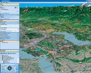
ArcGIS Explorer Beta ScreensotCan ESRI really compete againist Google?
ArcGIS Explorer is soon to be released and it seems that will be able to do more than Google Earth in features but can it spread further than just the GIS community?


Both look great products (Viewers are both Free) but can paided services really beat Free data too?


Google provide both the viewer and the data via a desktop application.
Esri provide the viewer free but what about the data?
Can it display Arc/Info Coverages, Shapefiles and Geodatabase datasets?

We will see - watch this space for answers....

24 June 2006

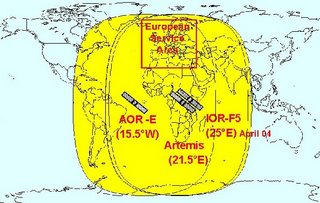
European GPS more Accurate?

European GPS Coverage Map

GALILEO offers a number of advantages over GPS.
Advantages are:
  • Indoor use
  • Notification of errors
  • Higher Accuracy
  • Current GPS devices should work with the new system

mapz: a gis librarian

American version of what this blog is doing, useful links and interesting articles.
blog on.

23 June 2006

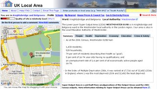
UK Local Area Map (Postcode Map)

UK Local Area Map
Very informative Map that finds information on your local area.

Information includes:

  • Neighbourhood Profile (People, Health, Deprivation, Economy, Education, Crime)
  • Average House Prices for the last 6 months
  • Council Tax for all bands
  • Gas & Electricity Utility Prices
  • Nearest Public Transport & Find nearest business
  • School Results (Primary Key Stage 4, GCSE, A/AS Levels)

Mobile Gmaps

Gmaps Mobile Map on Phone
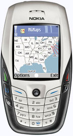
Mobile GMaps is a free application that displays Google Maps, Yahoo! Maps, Windows Live Local (MSN Virtual Earth) and Ask.com Maps and satellite imagery on Java J2ME-enabled mobile phones, PDAs and other devices.

Motion Based - Map Player (GPS Tracking)

Motion Based GPS Tracking Map
Works in IE6+ but not FireFox because of limitations with the Adobe SVG viewer.

Blue Ghost BBC Map (UK Weather and Traffic Info)

BlueGhost BBC Map
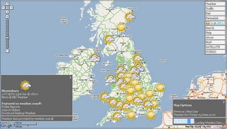
Clean, Fast and Clear UK Map from Blue Ghost BBC Backstage. This site pulls live feeds of Weather and Traffic information and displays it fast on the Google Map.

Credit goes to Michael Pritchard for developing the BlueGhost Google Map with BBC live feeds

22 June 2006

Time to account for Ordnance Survey costs

Ordnance Survey killer costs....

"How much would it cost to put some maps on a webserver that anybody could access? MySociety asked Ordnance Survey's licensing department. It calculated that displaying 16 "map tiles" with the relevant data would cost between £837.81 (for a 1:25,000 scale) or £1,032.71 (for a 1:250,000 scale)"

Solution: Ordnance Survey to drop the cost of it's maps (all maps digital, paper etc) this would allow more customers to be able to afford them (more customers, more profit)- raising profits once more.

Rip off Britain continues...
source: The Guardian Unlimited

21 June 2006

Google Maps now supports KML and KMZ feeds

KML Feeds in Google Maps
You can now view KML in Google Maps by entering the URL for your KML or KMZ file.

20 June 2006

BBC SPORT | 3-D| Map in Flash

BBC World Cup 3D Map

Urban Population of the World | Flash

 World Urban Population MapBBC presents: A Time Line Map Showing Urban Population Growth from 1955 to a projected 2015.

OpenJUMP – The free, Java based and open source Geographic Information System for the World

Screenshot of OpenJump GISOpenJUMP – The free, Java based and open source Geographic Information System for the World

19 June 2006

Google bring Geocoding to Google Maps API

Geocoding has been the Number 1 requested feature on the Google Maps API, Google prove that they do listen and read users emails and blogs.

Google Geocoding is available for USA, Canada, Italy, France, Germany only so far.

Mike Williams Website shows you step by step how to use it with excellent documentation in a short space of time since it was released.

Ordnance Survey Interactive Map Locator (Explorer Maps)

Click on the area of the UK you are interested in to see the map details.

Google Maps for Enterprise (for IntraNet)

Google Maps for Enterprise utilises the Google Maps API, the solution for free, public facing web sites, and adds enterprise quality support plus the ability to integrate maps into intranet applications
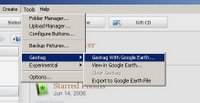
Picasa and Google Earth (GeoTag Images)

Geotagging via picasa
The test version of Picasa can Geo Tag images with location information that can be used with google earth.
Credits to Ogle Earth

Mapbender

Mapbender is a Open Source Map Application.
Using WMS from Demis World Map WMS as a source data. User data is stored in a PostGIS extension is used to render maps by using MapServer WMS. The GeoServer WFS-T provides for the GML which Mapbender uses for the interactive tool tips and digitizing modules.

17 June 2006

WeatherBonk | Google Map

Weather Bonk is a mashup that lets you view real time weather information on a map.
View temperatures, windspeed, and even live webcams to see what the weather is like in your favourite places.

16 June 2006

Google Earth | KML Tutorial

Interested in learning more about kml for Google Earth but don't want to wade through a long, detailed document? Just want to jump right in and figure it out for yourself? Then this is for you.

A kml tutorial for Google Earth that allows you to jump right in and get started, showing real examples that can be viewed in Google Earth.

14 June 2006

Google Earth | Release 4 Beta

Changes include:
  • a new, simpler user interface
  • larger image as a result of navigation tools being moved
  • support for "textured" 3D buildings that you can create yourself using Google SketchUp
  • smart loading techniques built into KML
  • versions of Google Earth in French, Italian, German, and Spanish.
  • improvements to our GPS support (in Google Earth Plus only)
  • improved terrain, so peaks and valleys are more realistic
It is available for download here

12 June 2006

Maps from the National Library of Scotland

The map collection at The National Library of Scotland is one of the 10 largest in the world. They offer online maps of Edinburgh, Glasgow, and Wick, allowing a unique look at those cities from 150 years ago. The map of Wick is from 1872 and displays features within some buildings, while the map of Edinburgh was originally published in 1891.
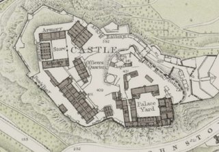
Map of Edinburgh

11 June 2006

RoboGeo | Geocode Photos for Maps

Google Map with photo geocoded by RoboGeo
RoboGeo allows you to geocode your photos with location information
from a GPS tracklog, an imported GPX file, from GPS waypoints,
or manually entered coordinates.

You can then document the photo on a webpage
that uses Google Maps, in Google Earth, or on Flickr.

09 June 2006

Hurricane Season, New Google Maps

Hurricane Map,in the Caribbean
Hurricane Season in the Caribbean starts so does New Google Maps from IBISEYE providing interesting reading on current alerts including tornados, hurricane and tropical storms. This site also provides historical data back to 1851.

The Gough Map of Great Britain

The Gough Map of Great Britain
The Gough Map of Great Britain is the oldest surviving road map of Great Britain

Update for Google Earth

Updated Aerial Photos (orthophotos) areas include:
Russia, China, Africa, Taiwan, USA, Canada, Bermuda, the Caribbean Islands,Islands in the Pacific, Puerto Rico, South America, New Zealand and Australia

08 June 2006

University Map UK

Destination| Maps|UK|Europe|Wordwide|

Travel Maps and Guides Worldwide
My Destinations Logo
A new website that allows searching for books,guides and maps for anywhere in the world, a good index and choice. Passport at the ready.

If you have travelled and always wanted to review it online.
Submit your own travel experiences, and get a Lonely Planet guide free of charge (if published online).

Google Map| Favourites| Sample| Geocoding

Geocoding in Google Maps Sample

From this looks like Google could be looking to add geocoding into their mapping api

Google Maps and Google Calendar Meet up

Google Map meet with Google Calendar

Don Crowleyshows how you can implement google maps with your calendar or shared calendar, reversing the way you can add locations in the calendar, very useful if planning a trip with others.

Simple Google Map| Created| DonkeyMagic

Simple Google Map Click to View
Click here for Google Map

Google Map Maker | Making Maps Simple for Everyone|

Make a google map in seconds....no programming knowledge needed :o)

1. Navigate using the map controls to the place you want to add your marker.
2. Activate the controls.
3. Click on the map to place to add a marker.
4. Give your marker a name and add some content for it's popup.
5. Click the 'Add marker' button and your marker will appear on the map.
6. Repeat steps 1 - 5 to add as many markers as you need
7. Click the Generate code button.Copy the code to a page on your website and change the API key and the link to your marker graphics.
8. Get your own API key from Google

Making Maps Simple for Everyone.

All Credit goes Richard Stephenson DonkeyMagic good work Richard.

07 June 2006

Project Thin Ice| Greenpeace| Live Tracking|

1,100 miles to trek and 4 months to get to the North Pole and back. Their location is plotted Live with a red point, past locations with blue points.
To open in Google Earth click the logo
Google Earth Feed

Microsoft® MapPoint® 2006

Screenshot of GPS with Map in Microsoft MapPoint 2006
Microsoft® MapPoint® 2006
New Features include:
  • Use updated geographic and demographic data sets in MapPoint to display trends and illustrate key points on maps.
  • The new GPS task pane uses information from your connected, compatible GPS device to display your current location, speed and traveling direction.
  • New Driving Guidance finds your location from a connected GPS device and combines it with a route you have created to give you voice-prompted driving directions.
  • New Location Finder uses your computer’s wireless network capability and a database of known WiFi access points to display your location on maps, even if you do not have a GPS device.
  • New Map style for low-light conditions makes it easier to view maps on your laptop computer.
European Version is due for release Summer 2006. Prices ($ and €)

Virtual Tourist | New Maps|UK, Europe and World|

Virtual Tourist have upgraded there maps, now using google maps.
A Clean and Clear Example: UK

Free GIS Viewers|GeoCommunity |Software

26 Free GIS Viewers, Select one that meets your requirments.
Some easier to use than others.

Orange Tea | World Cup Stadiums| 3D| Google Earth|

With only days to Go until the World Cup kicks off....
Orange Tea presents to you the twelve stadiums in 3D where the matches will be played for the FIFA Worldcup 2006 in Germany
Download the KML file for use in Google Earth

Google Earth Image of a 3D Football Stadium in Germany

Geography Network

The Geography Network is a global network of geographic information users and providers. It provides the infrastructure needed to support the sharing of geographic information
  • Web Services
  • Applications
  • Data
  • Maps
  • Publishing

06 June 2006

|Worldmapper| Cartograms|

The maps presented on this website are cartograms, otherwise known as density-equalising maps.

Example:
In the population example, densely-populated country such as the UK will appear much larger than it does on a standard map, and sparsely populated countries will appear smaller.

Google| Talk Maps| Chat to Others

Google Talk Maps

If you have a Google Talk account you can now point on Google Maps where you are. The Google Talk Map shows if you are available/busy and shows a custom message which can contain a link to your website, blog, or your hometown site, webcam etc.

How to use Google Talk Maps
  • Add map.bot@gmail.com to your friends.
  • Ask the bot anything and it will respond with a link that gives you access to a page where you can set your position.