RoboGeo | Geocode Photos for Maps

from a GPS tracklog, an imported GPX file, from GPS waypoints,
or manually entered coordinates.
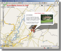
You can then document the photo on a webpage
that uses Google Maps, in Google Earth, or on Flickr.
Mapperz - The Map & GIS News finding blog. With so many Mapping sites online. This blog tries to provide you with the best maps and services that are currently available online. @mapperz

0 Comments:
Post a Comment
<< Home