->

01 February 2010

FREE the PostZon (UK Postcode Data)

From the Free Our Data Blog:

A new No.10 petition: FREE the PostZon and help innovate the UK Geo-spatial industry

(We are in 21st Century now aren't we?)

Mark Goodge added this as a comment to the data.gov.uk post, but it seems worth making more visible. So here it is:

This is not asking for Full Postcode (PAF) data but This is about Ordnance Survey's data, not Royal Mail's -- so it won't affect PAF, but it will affect postcode coordinate data.

"Postzon™ data allows you to link geographic and administrative data from government bodies, such as local authorities and the NHS, for all known Postcodes in the UK. Use it to help plan routes, calculate distances between Postcodes, allocate sales force areas, distribute resources or locate facilities."

http://www.royalmail.com/portal/rm/jump2?mediaId=400088&catId=400084

Without this, UK mapping innovation will be quashed.

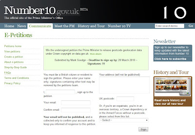
Number10 Geolocation Postcode Petition

http://petitions.number10.gov.uk/geopostcode/ requires your input 28 March 2010 deadline (note: OS Consultation period deadline is 17th March 2010).

“While the launch of data.gov.uk is a big step in the right direction, the government’s response to the petition inspired by the forced closure of ernestmarples.com has been pathetic. As a consequence, I’ve created a new petition which seeks to focus more tightly on the Postzon data (the data use by ernestmarples in their API)." This can be found at http://petitions.number10.gov.uk/geopostcode/

http://ernestmarples.com/blog/

http://www.freeourdata.org.uk/blog/2010/01/a-new-no-10-petition-free-postzon/

Help free the data that was paid for by the public (UK tax payer)...

Labels: , , , , ,

23 December 2009

'Ordnance Survey Free' 23rd December 2009

'Ordnance Survey Free' 23rd December 2009

The document that everyone has been waiting for ;

"Policy options for geographic information from Ordnance Survey Consultation"
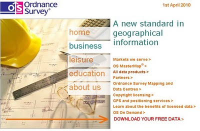
Ordnance Survey Website April 2010
Will the Ordnance Survey Website have a direct link to your free data in April 2010?

Ordnance Survey Free products from 1 April 2010 is shown below. It includes digital reference
products and digital display products:

Raster Free Products:
Vector
  • Code-Point - that's full grid refrenced postcode data
  • Boundary-Line - a specialist 1:10 000 scale boundaries dataset
  • Meridian 2 - transport network and topographic themes
  • Strategi - 1:250 000 scale topographic database

The products that are released as part of Ordnance Survey Free will continue to be
maintained by Ordnance Survey to a high and consistent standard. The product set
may evolve over time.

Ordnance Survey Free is intended to allow communities to combine (or “mash-up”)
government data about their community and environment from a number of sources
and illustrate their findings in a geographic context:

The raster products will enable developers to produce an application that overlays
their information on a map and to zoom-in from a national view with MiniScale
down to the street level with OS Street Viev, the gazetteer, boundary and postcode information will enable widespread use.

These commonly used geographies and it will act as a link between other
government data sets which reference the same geography
the 1:50 000 Scale Gazetteer provides a definitive source of town and place.

names to search and locate a place of interest on the map

Code-Point provides the location of every postcode to enable accurate search and display of specific locations and it will link to other data with a postcode reference

• Boundary-Line provides the outline and a unique reference to all the
administrative and electoral units of Great Britain.

• Meridian2 and Strategi are small scale vector products which provide the
geometry of features to allow customisation and combination with other data.
Meridian 2 includes a full named and attributed road network.

Issues - none is there?

Issues highlighted by Ordnance Survey:
The most immediate impact on Ordnance Survey as a result of the release of
Ordnance Survey Free products will be the reduction in revenues.
Three different types of existing and future revenue loss have been identified, and their potential impact on Ordnance Survey quantified.
These include: direct revenue impacts as a result of the loss of revenue from the products to be released for free; product substitution affecting Ordnance Survey’s remaining products, which will arise as customers switch to Ordnance Survey Free products; and increased competition impacts as competitors are able to derive their own products from the Ordnance
Survey Free products.

The estimated that the revenue loss to Ordnance Survey from a combination of
these three effects would be £19-24m p.a. Further growth was anticipated in these
products, which could now be foregone.

The provision of Ordnance Survey Free datasets and associated services has been
assessed on the basis of avoidable cash costs at £6-8m p.a. over the next five years,
including both the operating costs and on-going investments required for these
products. In addition there would be one-off development costs for data provision of
up to £1.1m.

source:
http://www.communities.gov.uk/documents/corporate/pdf/1415413.pdf [PDF]
[Section 7]

Labels: , , , , ,

17 November 2009

Ordnance Survey Maps to go FREE Online

Ordnance Survey Maps [and Data] to go FREE Online by April 2010.

updated: 18th November 2009.

News coverage on this story

Ed Parsons (former CTO at OS now
Geospatial Technologist at Google)
http://www.edparsons.com/2009/11/now-why-was-that-so-difficult/

BBC News
http://news.bbc.co.uk/1/hi/technology/8366190.stm

Number10
http://www.number10.gov.uk/Page21343
The Times
http://www.timesonline.co.uk/tol/comment/columnists/guest_contributors/article6920761.ece
TechRadar
http://www.techradar.com/news/internet/ordnance-survey-maps-now-free-online-652001
eGov
http://www.egovmonitor.com/node/30951
PublicNet
http://www.publicnet.co.uk/news/2009/11/18/plan-to-make-os-data-available-to-improve-public-services/


Groundbreaking News this is amazing turn-around for UK Government Geo-Spatial Datasets.

Freed our Data

Thanks to Sir Tim Berners-Lee
(& inventing the World Wide Web)

"The government is to explore ways of making all Ordnance Survey maps freely available online from April"


Today's announcement will be followed by a speech, due next week by the chief secretary to the Treasury, Liam Byrne, explaining how the freeing up of data, alongside the scaling back of other functions of central government, could lead to a "smarter state".
1:10,000 Raster Maps might be available for all in April 2010

1:10,000 Raster Maps might be available for all in April 2010....
image source for illustration only.
http://www.ordnancesurvey.co.uk/images/userImages/misc/products/10kraster/map-image-10k-lrg.gif

This is likely to include Flood Mapping Data, 1:10,000 data [Vector & Raster Datasets], Highways Agency Traffic Data and much more.
reports are conflicting whether 1:25,000 data will be freed (to be confirmed)
"sets of public data currently not freely available include wills dating back to 1858, house values recorded in the Land Registry, maps, and flood-risk data for individual homes"

***More important is vector data as users can create thier own maps/styles with it.
Will be interesting to know the re-licencing of these products and deriving from such sources conflicts with crown copyright.

The online maps would be free to all, including commercial users who, previously, had to acquire expensive and restrictive licences at £5,000 per usage, a fee many entrepreneurs felt was too high.

Noted on the Guardian:
Today the union representing staff at the OS stated that Brown's pledge was in "complete contradiction with the OS's own plans to explore commercial opportunities and find new ways of raising revenue".
Read more
http://www.guardian.co.uk/technology/2009/nov/17/ordnance-survey-maps-online
(and thanks for running the Free Our Data Campaign over the years)

Labels: , , , , , ,

05 July 2007

Free Our Flood Mapping!

A recent article on this Mapperz Blog showed OnOneMap Maps (using Google Maps API) was better than the Environment Agency own Online Mapping.
http://mapperz.blogspot.com/2007/06/environment-agency
-adds-pollution-maps.html

But due to the nature of 'public' data the Environment Agency has told OnOneMap to remove this service as the data is their copyright - excuse me but this is UK tax payers money

"We have had to withdraw our popular and innovative flood map layer, ironically and sadly during one of the worst periods of flooding the UK has ever experienced. The Environment Agency claims they have copyright over the information, and despite the fact that tax-payers’ money has paid for it to be collected in the first place, apparently the tax-payer cannot benefit from innovations like our housing and flood map combination.

For more information on the lack of access the British public have to their data, visit The Guardian’s Free Our Data campaign."

Mapperz hoped the Guardian is reading about this!

Yes they have

http://technology.guardian.co.uk/weekly/story/0,,2118152,00.html

Free Our Data Please. So we can make use of it and provide useful services to the public - like property mapping. Knowing if your house is 'likely' to flood before buying it.

Labels: , , , , ,

04 January 2007

Crown Copyright crushing UK Mapping Innovations

This is a post to make people aware that government agencies are stifling UK innovations.


"Public money paid for it - but the public can’t view because of crown copyright"

Says the Guardians Free Our Data Campaign

"Imagine flying at rooftop height up the Thames. You dive under Tower Bridge, then twist between the Gherkin and Tower 42 skyscrapers. As the London Eye looms, you bank right and dive into a translucent globe which transports you into the middle of St Paul's cathedral."


But you can't put it online!

"Although Virtual London was funded by another state body, the computer model cannot be posted on the web without infringing Ordnance Survey's copyright."

"Public money funds it, yet "public" copyright keeps it shut away."

But how can Geographically data be locked down to some ceramic hard drive and not accessible to the people who paid for it?

Nicely timed just ahead of Christmas, the Department for Constitutional Affairs has put its Statute Law Database online. You can search for any extant law, and various others - including how upcoming legislation will affect existing laws.
This was protected under crown copyright so why can this be released to the public free of charge and available online?

Come on Ordnance Survey sort your out of date crown copyright.
Reduce your prices to commercial vender's and you will gain more consumers and increase your incomes 10 fold.

Sources:
http://freeourdata.org.uk/blog/
http://technology.guardian.co.uk/weekly/story/0,,1981821,00.html
http://www.ordnancesurvey.co.uk/oswebsite/aboutus/
yourinforights/copyright/index.html

Even little company Google are having issues with Ordnance Survey -

"The sticking point is understood to be Google's attempt to negotiate a fixed fee for the data, rather than accepting Ordnance Survey's practice of charging by the number of transactions. Ordnance Survey would not comment on the specific case, but said that a fixed fee would "wreck the level playing field for other partners" - and it should be noted that it is obliged to treat all customers (including itself) on the same terms. OS said it is happy for its data to be used in a "Google-type" environment. "Sites such as Multimap and Streetmap use our data and their services are freely available to the public over the web.""

Labels: , , , , ,