->

19 May 2009

Wolfram Alpha Maps

Wolfram Alpha Maps

Wolfram Alpha Maps
The new 'computational knowledge engine' creates maps for distances between 2 locations in the world on the fly.

Example
http://www29.wolframalpha.com/input/?i=London+to+Sydney


For more tips on find out facts and geographical (geography) start here
http://www29.wolframalpha.com/examples/PlacesAndGeography.html

Labels: , , , ,

19 November 2008

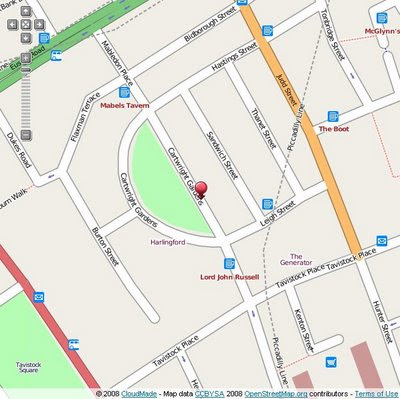
CloudMade Web Lite API (pre Alpha)

CloudMade API (pre Alpha)

"Our [CloudMade] aims are to continue the democratization of geo data and to expand access to open geo data through a range of simple yet powerful tools and APIs."

CloudMade Web Lite API
Early Days but looking promising in the 'lite' way to get web mapping on your site without the large restrictions other mapping api's have.

Now there is two Mapping API's that are in early stages of development.

Web Lite - API
http://www.cloudmade.com/products/web-maps-lite

Features:
  • Take advantage of the most up-to-date source of map data on the web
  • Benefit from the rich OpenStreetMap dataset, with features such as footpaths and cycle paths that are not found on other online maps
  • Be free from restrictive licensing - use our maps for routing, real time tracking and as a basemap to derive new layers
Mobile Maps API*
http://www.cloudmade.com/products/mobile-tiles
Features:
  • Create applications for mobile devices that use CloudMade's mobile optimized maps
  • Benefit from the rich OpenStreetMap dataset, with features such as footpaths and cycle paths that are not found on other online maps
  • Take advantage of the most up-to-date source of map data on the web
*untested by Mapperz currently

Examples:

Try the drag marker with panning and zooming functionally added.
http://mapperz.googlepages.com/cloudmade_web_lite_api.html


speed test onload: 0.85 milliseconds (YSlow!)

To test it - Mapperz used the OSM data in Virtual Earth as a comparison
http://mapperz.googlepages.com/osm_in_VE.html
speed test onload: 1.25 milliseconds (YSlow!)

Yes currently the bigger API's have more functionality but their Terms restrict in what you can and cannot do with your mapping, so the future for a lightweight Mapping API is looking good.

Web Maps Lite API is currently in 'closed pre-Alpha'
Let's look forward to a Public Beta.

Though you can view the Official Step-by-Step Examples
http://www.cloudmade.com/products/web-maps-lite/examples/1

Another good move by Cloudmade is the OSM data

"This is where you can find extracts of maps from different places around the world. From here you can download:"

  • OSM XML extracts by country
  • Garmin Map Files (OSM.err edition)
  • Osmosis country bounding polygon
  • Shapefile extracts by country
  • Navit maps by country
  • GPX POI by country
  • TomTom POI by country
  • OSM XML feature extracts by country
http://downloads.cloudmade.com/

Labels: , , , , , , ,

23 September 2008

Nokia ViNe Alpha (Mapping)

Update 23/09/2008
There is now a Nokia Mapping Application available to view your 'geotagged' photos using
the new Nokia Photo v1.5 (Beta)

Nokia Photo Maps - Stacking Photos on Location
Multiple photos on the same geographical location are stacked.

For a full and in-depth review on the functionality visit

http://www.allaboutsymbian.com/news/item/8097_Nokia_Photos_15_now_available_.php

To download the Windows (Mac coming soon?)
http://www.nokia.com/betalabs/photos
(NokiaPhotos_1_5_200_en_gb.exe is a 53.8mb download)

Seems to me that Nokia are now competing with Google Picasa 3.
Though the Nokia application seems to be more seamless with loading geotagged photos from your phone and showing those photos on a map than Picasa is.
Maybe Picasa 4 will make use of the Google Map API and overlay photos onto that.... there is hoping.

Nokia ViNe Alp
ha (Mapping)
Nokia ViNe
Nokia ViNe application is currently in closed Alpha but the website is up and running.

"new geo-tracking-photo-and-video-and-music application"
Clinton Jeff - Darla Mack


Nokia ViNe Mapping Tracks
ViNe combines and uploads music, photos and gps tracks you record from your Nokia Device on one process.

Combine following applications:
Nokia Sports Tracker (Still Beta)
Nokia Lifeblog (Photos)
Nokia Music Player
GPS (GeoTagging)

Why the fuss? Why not use the applications that already exist?
It's one application that encapulates three applications and expands the mapping potential of geo-location tagged files (photo,music & video).
The Mapping is based in flash (website) - the users tracks link photo, music and videos that were captured when the ViNe Application is set to record.
There are concerns over the battery life - lucky for Nokia this is still in pre-release alpha and can be addressed before a public beta version.
Nokia's LifeviNe project has been renamed, it seems, to just Nokia ViNe.

There is nothing new but - for the non-savvy phone user it makes it easier for the user to record trip for sharing with friends afterwards.

For a more in depth review of the new application vist the Darla Mack Blog below where the whole process is shown.

Sources:
http://www.allaboutsymbian.com/news/item/8088_Nokia_ViNe-Practical_or_Pointl.php
http://www.darlamack.com/darlamack/2008/09/nokia-lifevine.html

At least Nokia are making use of Navteq data, now that Google Maps is completely TeleAtlas based.

Labels: , , , , , ,

19 December 2007

Ordnance Survey - OpenSpace API ( now with Demo)

19/12/2007
update: Found a Demo Page with using OpenSpace API

OpenSpace Map Image for Illustration
Image is for illustration only.

On closer inspection there is a lot of content which has been removed at the larger scales.
Live Demo
http://www.maptasm.com/


Ordnance Survey - OpenSpace API
(Alpha)

Ordnance Survey OpenSpace Logo

"Got a great idea? Make it work with the best mapping in the world."
(well Great Britain anyways)

"OS OpenSpace is a free Ordnance Survey service that allows you to embed Ordnance Survey maps covering England, Scotland and Wales in your web applications using our Javascript® application programming interface (API)."

Some Functionality :

The OS OpenSpace API and all the data provided is in British National Grid (ESPG 27700).
The API also provides the ability to covert between National Grid and latitude and longitude (ESPG 4326) and vice versa.


OS OpenSpace allows your API key to access up to 30 000 tiles of data and up to 1 000 place name look-ups per day for free

Can you add Ads to the API?
No, please see the OS OpenSpace Developer Agreement (there can be no form of financial gain).
FaceBook, MySpace apps?
No, The application you build cannot result in any financial gain to you (the developer of the application), the user or any other party; please see the OS OpenSpace Developer Agreement .


Note: Any Content you create using the Open Space API - Will not be yours, as it is 'dervived' from Ordance Survey Products.

the ownership and licensing of the copyright and other intellectual property rights in:

* any data supplied to you by us; and
* any data created by you.

Primarily, you cannot use any data you create for any commercial purpose.

No 1:25,000 (Explorer range) or 1:10,000 Rasters


More Information:
The Guardian
http://www.guardian.co.uk/technology/2007/dec/13/freeourdata.software

Ed Parson's (Ex CTO Ordnance Survey) briefly mentions it too
http://www.edparsons.com/


OS OpenSpace is currently running as a closed alpha test service.

OS OpenSpace Developer Agreement is 16 Pages long.

http://openspace.ordnancesurvey.co.uk/openspace/index.html


It's a good step forward, but very restrictive in use.
Hopefully can be developed for Educational and Charity Institutions

At least Microsoft haven't bought them yet.

Stefan Geens writes an excellent roundup of the implications of this API. Removing ads from his site could only run the OpenSpace API on the Ogle Earth site for 12 hours a day due to the amount of traffic it generates.
http://www.ogleearth.com/2007/12/ordnance_survey.html
(But I think he will stick to his current formula with ads.)

Labels: , , , , ,

23 November 2006

Google Map Editor - in Alpha (A GIS)

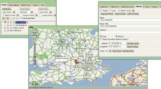
Stefan Blanke has been working on a very sophisticated Google Map Editor

Map Editor in Alpha
The screenshot does not do the 'Editor' justice as there are many editing functions hidden in the tabs.

The Map Editor use a very up-to-date version of the Google Map API (version 2.68 to the coders)
The includes creating Polygon though not implement (maybe version 2.69 needed)
Very Good work though.

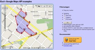
To see editing polygons using that 2.69 version pop over to ESA.
Very good Example of Editing Live on Google Maps.
ESA Edit Polygon Live on a Google Map

So how long before Google Maps becomes 'GOOGLE GIS API'?
At this rate "Early 2007"

Another High End Database (Oracle XE) potential is Oracle XE and Google Maps (though we haven't actually seen the map and data working yet - pre Alpha?)

Labels: , , , , , ,

21 November 2006

Mapperz requests Testers for UK Geocoding

Since the hot topic. UK Addresses -Geocoded via Google Maps API
and then our hopes dashed. Mapperz has done some research and development into Geocoding UK Addresses for Free.

(A bold claim, as due to 'contractual reasons' it cannot be done in the UK, as the USA & Canada can with the Google Maps API)

Official source
Unofficial source

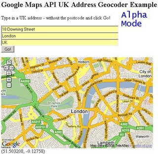
Well it is here:
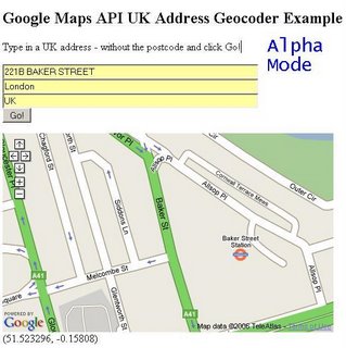
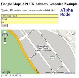
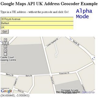
UK Address Geocoder Alpha - 10 Downing Street - Zoomed OutUK Address Geocoder Alpha - 221B Baker Street - Zoomed InUK Address Geocoder Alpha - 12 College Road - Zoomed InAddress Geocoder Alpha - 30 Royal Avenue,Belfast - Zoomed In


What we are after are people willing to test the accuarcy of this service. It is not 100% accurate (more 93%) but for free it is worth it.
email mapperz@gmail.com [Subject: UK Geocoder Tester Request]
Invites will be sent out: Starting with 10 (5 reserved), 15 then 25 users.
Needed are developers, coders, de-buggers, and normal web users.

Please say why you would like to test it.

This is using resources already available on the web. Just previewing and getting permisson to request information across domains and check this does not break any terms.

Anyone interested in the code please contact mapperz@gmail.com [Subject: Code Request Please]

Labels: , , , ,