->

16 December 2010

OS OpenSpace & Google Maps v3 Meet

OS OpenSpace & Google Maps v3 Meet

Another great example from Bill Chadwick
OS OpenSpace & Google Maps v3 Meet
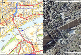
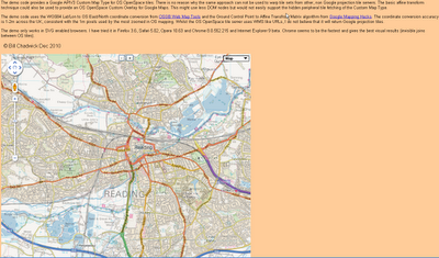
Merging Map Tiles Ordnance Survey and Google Maps based on v3 Google Map API

"The demo code provides a Google APIV3 Custom Map Type for OS OpenSpace tiles. There is no reason why the same approach can not be used to warp tile sets from other, non Google projection tile servers. The basic affine transform technique could also be used to provide an OS OpenSpace Custom Overlay for Google Maps. This might use less DOM nodes but would not easily support the hidden peripheral tile fetching of the Custom Map Type.

The demo code uses the WGS84 Lat/Lon to OS East/North coordinate conversion from OSGB Web Map Tools and the Ground Control Point to Affine Transfrom Matrix algorithm from Google Mapping Hacks. The coordinate conversion accuracy is 1-2m across the UK, consistent with the 1m pixels used by the most zoomed in OS mapping. Whilst the OS OpenSpace tile server uses WMS like URLs, I do not believe that it will return Google projection tiles.

The demo only works in SVG enabled browsers. I have tried it in Firefox 3.6, Safari 5.02, Opera 10.63 and Chrome 8.0.552.215 and Internet Explorer 9 beta. Chrome seems to be the fastest and gives the best visual results (invisible joins between OS tiles)."

Full credit to Bill Chadwick

View the Map

http://wtp2.appspot.com/warpdemo.htm

Labels: , , , ,

27 July 2009

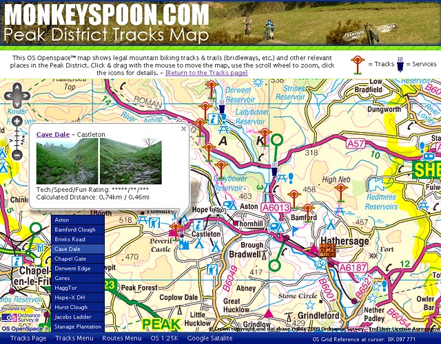
Peak District Map (MonkeySpoon.com)

Peak District Map (MonkeySpoon.com)

"Monkeyspoon.com guide to mountain biking tracks & trails in Peaks District"

Version 2 (using Ordnance Survey OpenSpace API) is now available and looking very good.


Peak District Map (MonkeySpoon.com)

New Features include:
  • Larger map view – The map will stretch as big as your screen goes. (Press F11 to have your browser view it full screen.)
  • Routes– Not many so far, but new ones aren’t to hard to add.
  • ‘Services’ locations – Places that useful to MTBer visiting the area.
  • Track Menu – Click to go straight to a Track.
  • Other view links – As well a link to 1:25K OS map there is now a Google Map Satellite link.
  • **Location URL shortcuts – You can link directly to a Track, Route or Grid Reference.

**How to use URL Shortcuts
"The easiest is a for a grid reference, just add “?g-” then the grid reference on the end of the URL. e.g. To go to Win Hill add “?g-SK187851” (without the quotes).
For tracks add “?t-” and the track name in lower case with dashes instead of spaces."

Direct link to the New Map
http://monkeyspoon.com/Tracks/MonkeyspoonOSopenspaceMap.htm
Original Map
http://monkeyspoon.com/tracks#osmap
Tracks Page
http://monkeyspoon.com/tracks

Labels: , , , , ,

20 May 2009

Ordnance Survey [resurrects] OpenSpace Mashup

Updated 20/05/2009
An the Winner is.... Gavin Brock -
Well done to everyone who contacted the Ordnance Survey about this - now you can be proud of yourselves.


The tiles impressions limit has also been upped to 1,000,000 from 30,000.
[http://www.brock-family.org/gavin/google-earth/osmaps.html]

2009-05-19 (Tue)

We’re back!

"First I would like to thank you all for your support! I believe that your emails, posts and comments, regarding yesterdays blog post, made a difference. It’s great to hear from you – it’s what makes writing software for fun, erm.. fun!

I just received a detailed message from the Director of Products at Ordnance Survey, apologising for the communication regarding the disabling of the service. He explained, that this is not a “derived data issue“, but rather to do with the licenses:"

more here: http://gavcode.wordpress.com/2009/05/19/os-overlays-re-enabled/


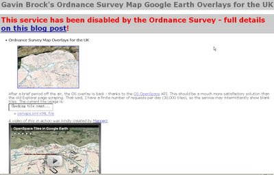
Ordnance Survey Kills OpenSpace
Mashup

update: Ed Parsons (former CTO at OS, now Google) mentions this mashup in his latest post
http://www.edparsons.com/2009/05/os-puts-the-no-back-in-innovation/

OS Kills OpenSpaceAPI G.Brock Mashup
For a long time this site [http://www.brock-family.org/gavin/google-earth/osmaps.html] was straight forward and overlayed Ordnance Survey Maps in Google Earth.

Users could view the Maps which were overlay-ed on the Google Earth Terrain.
The 3D view helped visualize users with the surrounding features as well as giving them familiar maps as reference. There is no financial gain here, nor any advertising, but Ordnance Survey states

"We really like your project, but unfortunately it will need to be discontinued as soon as you can. This is because it remains our current position that OS OpenSpace Developers may use third party content with our data provided they do no grant the third party any wider rights than those the Developer agrees to when accepting the Ordnance Survey’s OpenSpace Developer Agreement."

OS, Openlayers [the underlying OpenSpace API source code] itself is third party [right?]

and JSR_CLASS.JS
is part of Yahoo! SDK Copyright (c) 2005, Yahoo! Inc.
[see http://openspace.ordnancesurvey.co.uk/openspace/opensourcelicences.html#anc1]

So what is wrong here?
Ordnance Survey you are not losing out here. In-fact it is a free promotion to use your service.

Brock OS disabled KML Tiles
The web version of the above site worked really well but not anymore - thanks OS.

Read more from the source:
http://gavcode.wordpress.com/2009/05/18/os-overlays-disabled/


Labels: , , , , , ,

12 May 2009

Ordnance Survey Openspace API - UPDATED

Ordnance Survey Openspace API - UPDATED

Now include access to Ordnance Survey BoundaryLine [vector] Data

"Use the OS OpenSpace API to add Ordnance Survey maps to your website or blog."

Finally after many, many requests Ordnance Survey have updated their OpenSpace API which now allows adverts on your site!
See the OpenSpace API FAQ for more details on this

New Features:


Look-up services
  • OS OpenSpace boundary look-up
  • Postcode look-up
  • Place name look-up

A single API key may access data up to the following daily usage limits:

  • 40 000 tiles of mapping data in a 24-hour period.
  • 1 000 Place name look-ups (Gazetteer service) in a 24-hour period
  • 1 000 Postcode look-ups in a 24-hour period
  • 1 000 OS OpenSpace boundary look-ups in a 24 hour period
A New Gallery:

OS OpenSpace API Updated

The gallery includes projects like
Manchester cycling club (overlaying .gps routes on 1:50k mapping)

Satellite Dish Alignment (click UK Map to find the OS Mapping)

Whereisthepath (now 40,000 tile impressions per day due popularity - now using Google Appspot) *a Mapperz favourite all round mapping mashup.

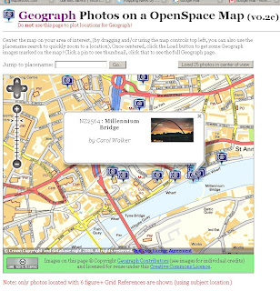
Geograph Photos on an OpenSpace Map (Shows all the Geography photos - please do not use it to geo-locate photographs)

Public Footpaths [OpenSpace] on iPhone (designed specifically to be displayed on the Apple iPhone.)

Bike Hike (May 2009 update: Finding routes has been revised. Also revised so course points are now downloaded in GPX tracks and routes as waypoints)
Sky Cam (Latest skycam images using the Ordnance Survey OpenSpace Mapping)
Bikes & Boots (currently unavailable - Updated 12 May 2009)

Hill-baggin (Hill walkers and summit-baggers, attempting to provide accurate Ordnance Survey grid references for the 3000ft mountain tops, and prominent lower hills, of Scotland.)

Kent Trails
(Lots of trails [155 miles worth] in the County of Kent)

For more details and terms and conditions please see
http://openspace.ordnancesurvey.co.uk/openspace/developeragreement.html

Official OpenSpace API Demos - now including BoundaryLine data [wards, administration boundaries etc]
http://openspace.ordnancesurvey.co.uk/openspace/support.html

Thanks to Bill Chadwick [Whereisthepath author for the additional information]

Labels: , , , ,

05 March 2008

OpenSpace Tiles in Google Earth

update: 38 second clip on You Tube by request - video capture by SnagIT

OpenSpace Tiles in Google Earth

"Gavin Brock has produced an Ordnance Survey Overlay for Google Earth which enables you to view public footpaths in Google Earth. Unfortunately the kml of the overlay doesn’t appear to work when loaded into Google Maps." Google Maps Mania

Not sure on the legal aspects (OS Copyright) on this but it is impressive to see 1:50,000 Landranger Series in 3D. Some footpaths are available but 1:25,000 (Explorer Series) is the official scale for public footpaths and rights of way, currently 1:25,000 is not available in the Openspace API.

Labels: , , ,

15 February 2008

OpenSpace API - More Examples Please

OpenSpace API - More Examples Please

15/02/2008

Keep them coming... (and keep asking the OS for 1:25,000 Explorer Mapping!)


http://www.geothings.net/openspace/index.html

blog post
openspace-licences-limits-and-first-steps-plus-demo

OpenSpace API - More Examples Please

A few weeks on from the Ordnance Survey releasing the OpenSpace API there are a few that are taking up the small challenge and using the API to full effect.

OpenSpace API & Google Maps API Combo Map
Very Clever

http://wheresthepath.googlepages.com/wheresthepath.htm

Note: Spilt screen half OS OpenSpace API and half Google Maps API Aerial imagery and is linked by location (pan and zooom can be enabled)
Blue transparent box shows the extent - switches between the maps.

Another Great Example

Geograph Photo Locator Map
Geograph Photos on a OpenSpace Map (v0.2c)
http://openspace.nearby.org.uk/geograph.php
(Please do not use the page to plot locations for Geograph!)

Suggestions to make a better Mapping API - OS 1:25k would complete the set as there is a big jump between 1:50k mapping and 1:10k Streetview mapping.

Note: 1:25k is available on the Get a map service. Then you would be able to plan walking and hiking trips using the OpenSpace API. (1:25k has all public footpaths)
Not asking for 1:10k Rasters or MasterMap but there needs a scale.
There needs to be more Official Examples and better documentation with clear examples.

http://openspace.ordnancesurvey.co.uk/openspace/support.html
maybe and Advanced Section showing users the full potential of what can be done.

Working pages rather than static images with code would also be a helpful guide to newcomers to mapping API's.

Know of another OpenSpace API Map or have another suggestion? Then add yours via the comments.

Note:
"Newcastle-upon-Tyne" needs to be "Newcastle upon Tyne" or you will get an error.

Note:
"There will be a outage today 14th Feburary OpenSpace has a planned downtime from 5-6PM GMT today."

Labels: , , , ,

19 December 2007

Ordnance Survey - OpenSpace API ( now with Demo)

19/12/2007
update: Found a Demo Page with using OpenSpace API

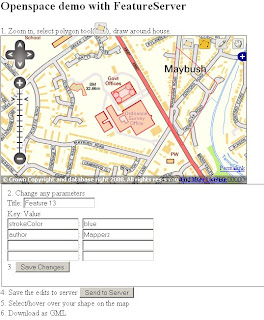
OpenSpace Map Image for Illustration
Image is for illustration only.

On closer inspection there is a lot of content which has been removed at the larger scales.
Live Demo
http://www.maptasm.com/


Ordnance Survey - OpenSpace API
(Alpha)

Ordnance Survey OpenSpace Logo

"Got a great idea? Make it work with the best mapping in the world."
(well Great Britain anyways)

"OS OpenSpace is a free Ordnance Survey service that allows you to embed Ordnance Survey maps covering England, Scotland and Wales in your web applications using our Javascript® application programming interface (API)."

Some Functionality :

The OS OpenSpace API and all the data provided is in British National Grid (ESPG 27700).
The API also provides the ability to covert between National Grid and latitude and longitude (ESPG 4326) and vice versa.


OS OpenSpace allows your API key to access up to 30 000 tiles of data and up to 1 000 place name look-ups per day for free

Can you add Ads to the API?
No, please see the OS OpenSpace Developer Agreement (there can be no form of financial gain).
FaceBook, MySpace apps?
No, The application you build cannot result in any financial gain to you (the developer of the application), the user or any other party; please see the OS OpenSpace Developer Agreement .


Note: Any Content you create using the Open Space API - Will not be yours, as it is 'dervived' from Ordance Survey Products.

the ownership and licensing of the copyright and other intellectual property rights in:

* any data supplied to you by us; and
* any data created by you.

Primarily, you cannot use any data you create for any commercial purpose.

No 1:25,000 (Explorer range) or 1:10,000 Rasters


More Information:
The Guardian
http://www.guardian.co.uk/technology/2007/dec/13/freeourdata.software

Ed Parson's (Ex CTO Ordnance Survey) briefly mentions it too
http://www.edparsons.com/


OS OpenSpace is currently running as a closed alpha test service.

OS OpenSpace Developer Agreement is 16 Pages long.

http://openspace.ordnancesurvey.co.uk/openspace/index.html


It's a good step forward, but very restrictive in use.
Hopefully can be developed for Educational and Charity Institutions

At least Microsoft haven't bought them yet.

Stefan Geens writes an excellent roundup of the implications of this API. Removing ads from his site could only run the OpenSpace API on the Ogle Earth site for 12 hours a day due to the amount of traffic it generates.
http://www.ogleearth.com/2007/12/ordnance_survey.html
(But I think he will stick to his current formula with ads.)

Labels: , , , , ,