->

09 February 2011

Natural Earth Free Map - Updated Data

Natural Earth is a free, public domain map dataset available at 1:10, 1:50, and 1:110- million scales and includes new vector and updated raster themes. The goal is to give cartographers and GIS users an off-the-shelf solution for creating small scale world, regional, and country maps.

To celebrate the 1 year-anniversary of the Natural Earth project by introducing a new "quick start kit" (150 mb ZIP) that includes a sampling of Natural Earth vector and raster data and an ArcMap document that compiles the themes into an easy to browse, styled map. The map comes in two flavors and scales: the world (zoom to all) and at a regional scale (zoom in to U.S. states and countries world wide) with cultural and physical data frames to switch between.

You can download individual themes (or the whole set) from naturalearthdata.com, where you'll find raster imagery of Natural Earth I and II in perfect registration with the vector linework. Both political and physical features are included in Natural Earth data.

Natural Earth solves a problem that many map makers face: finding vector data to make publication-quality small scale maps. At a time when the web is awash in interactive maps and free, downloadable vector data, such as the Digital Chart of the World and VMAP, map makers are forced to spend time sifting through a confusing tangle of poorly attributed data. Many map makers working under tight project deadlines must use manually digitalized bases instead.

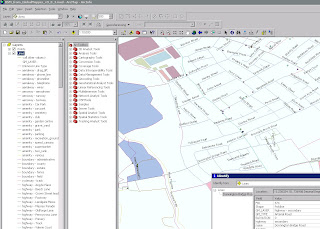
natural earth screenshot

Small scale map datasets of the world do exist, but they have their problems. For example, most are crudely generalized—Chile's fjords are a noisy mess, the Svalbard archipelago is a coalesced blob, and Hawaii has disappeared into the Pacific two million years ahead of schedule. They contain few data layers, usually only a coast and country polygons, which may not be in register.

The lack of good small scale map data is not surprising. Large mapping organizations that release public domain data, such as the U.S. Geological Survey, are not mandated to create small scale map data for a smaller user community that includes map making shops, publishers, Web mappers, academics, and students—in other words, typical cartographers.

Nathaniel Vaughn Kelso, The Washington Post

Tom Patterson, U.S. National Park Service

Originally Posted by ESRI Mapping Center http://blogs.esri.com/Support/blogs/mappingcenter/archive/2011/02/08/natural-earth-the-free-world-base-map.aspx

Labels: , , ,

24 November 2009

Open Flood Mapping - OSM Maps Update First

Open Flood Mapping - OSM Maps Update First

Yes the OpenStreetMap'ers have been on the ball and with on the ground surveys and have updated the Bridges (collapsed or to be demolished).
Now this sounds a cruel but in reality shows the raw power of 'crowdsourced' mapping.


Open Flood Mapping - OSM Maps Update First
OpenStreetMap Updates [source] have come online within days of the bridge collapse.
Yes there was a fatality more here
http://en.wikipedia.org/wiki/2009_Cumbria_and_southwest_Scotland_floods

Now all we require is Flood Mapping Areas from Environment Agency (EA) overlay [available in April 2010?] on the map to show potential flooding on Ordnance Survey (OS) Maps.
Then the analysis of Met Office data [available in raw format in April 2010?]
Then the OFS [Open Flood Map] can provide real-time flood alerts and help communities likely to be affected.

Required from Government sources
1 in 1000 year flood polygons (EA)
1 in 100 year flood polygons (EA)
1 in 50 year flood polygons (EA)
1 in 10 year flood polygons (EA)
1:10,000 vector/raster mapping (OS)
Raw live-feeds MetOffice (geo-xml/json please)

[available April from 2010?]

Now that's a potentially risk-saving mashup of data.

Background on Bridges and Travel Distruption
Cumbria Bridges
Fully closed and Collasped bridges.
Collapsed Bridges: 1. Northside Bridge, Workington 2. Navvies Footbridge, Workington 3. Camerton Footbridge, Camerton 4. Memorial Gardens footbridge, Cockermouth 5. Low Lorton Bridge 6. Little Braithwaite Bridge 7. Camerton Church Bridge, Camerton
Closed bridges: 8. Calva Bridge, Workington 9. Goat Bridge, Cockermouth 10.Holmrook Bridge, Holmrook 11. Ouse Bridge, north of Dubwath 12. Isel Bridge, near Cockermouth 13. Cocker Bridge, Cockermouth 14. Southwaite Bridge 15. Broughton Bridge 16. Bridge End, Egremont 17. Spark Bridge 18. Backbarrow Bridge (off A590) 19. Bouthrey Bridge, Water Yeat 20. Station Road Bridge, Keswick 21. Scarness Bridge, Keswick 22. Scale Hill Bridge, Scale Hill 23. Greta Bridge, Keswick 24. Wath Bridge, Cleator Moor
Source: Cumbria County Council, 24 November via BBC News

latest travel news
http://www.bbc.co.uk/cumbria/travel/roads.shtml

Flood Recovery Appeal
http://www.cumbriafoundation.org/

Note - Ireland has also had huge problems with flooding over the past week.
http://www.breakingnews.ie/ireland/emergency-flood-fund-to-little-says-opposition-435667.html
And more rain forecast doesn't look good.

Labels: , , , , , , , ,

07 September 2009

ViaMichelin Maps - Speed Camera Data

ViaMichelin Maps - Speed Camera Data

ViaMichelin has had traffic information available across most of Europe for several months now.
Their Blog seems a little dated. So here is a little update.

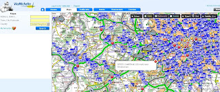
Via Michelin Oxford UK Traffic Info

Speed camera data is now available as an additional overlay - this data can be useful when overlaying the traffic data. The data for speed cameras is fairly up-to-date (apart from Swindon)
note: mobile 'safety' cameras are not mapped.

Via Michelin  Speed Camera Info

Other Geo-related (loosly) news:

ViaMichelin GPS Products


includes
Points of Interest:
Hotel and restaurant recommendations from the Michelin Guide, tourist locations from the Michelin Green Guide and thousands of useful and practical addresses throughout Europe

Safety Camera Locations: UK version or European version featuring Austria, Belgium, Czech Republic, France, Italy, Liechtestein, Netherlands, Poland, Portugal, Spain & United Kingdom.

MP3 Player for AudioTours (see below)

http://www.viamichelin.co.uk/viamichelin/gbr/GPS/htm/nav/gps.htm

ViaMichelin Local (geo-advertising)
Geolocated advertising for the tourism and leisure sector is now available.
http://local.viamichelin.com/?langue_choisie=en

ViaMichelin Geo-Tourism
This includes 'Green-Guides' and AudioTours
http://www.viamichelin.co.uk/viamichelin/gbr/dyn/controller/Tourisme
http://www.zevisit.com/NEWSVIAMICHELINUS/US/newsletter.html

Labels: , , , , , , , ,

03 September 2009

Ovi Maps News

Ovi Maps News
Nokia have released/updated some Ovi Apps Products

Of Mapping interest there are:

Developers that register for the programme will have access to the following:

  • Ovi Maps Player API – Bringing maps to mobile and web applications effortlessly. The API is powered by NAVTEQ and features more than 180 country maps, location-based search, and detailed place information. Other features include vector-based maps that give a range of views, including: map, terrain and 3D modes for dynamic map mash-ups. The Ovi Maps Player API for the web was introduced earlier this year.
  • Ovi Navigation Player API - Allowing developers to bring Nokia’s industry-leading walk and drive navigation features to their applications, including: pedestrian navigation, turn-by-turn car navigation, and route planning. Developers can deliver applications that get consumers exactly where they want to go.

Ovi Maps Player Example

"Introducing Maps Player - the brand-new, easy-to-use API for Ovi Maps. Maps Player makes it simple to integrate rich Ovi Maps functionality into your website, turning it into a personalised, contextual and compelling experience. "

here is one example

Ovi Maps Player POI

Unlike other Mapping API's available - [Nokia] Ovi Maps Player API gives developers access to their Point's of Interest (currently 3 million) Database.

POI Categories are:

"AMUSEMENT_PARK", "BARS_CAFES", "BAR_DISCO",
"BEACH", "CAMPING", "CAR_DEALER",
"CAR_REPAIR", "CASH_DISPENSER", "CASINO",
"CINEMA", "COMPANY", "CONCERT_HALL",
"CULTURAL_CENTRE", "EDUCATION", "EXHIBITION_CENTRE",
"GOLF_COURSE", "HOLIDAY_PARK", "HOTEL",
"LIBRARY", "MUSEUM", "OPERA",
"PARKING", "PARKING_AREA", "PARKING_GARAGE",

"PARK_RECREATION", "PETROL_STATION", "PHARMACY",
"PLACE_OF_WORSHIP", "POST_OFFICE", "RENT_A_CAR_FACILITY",
"RESTAURANT", "REST_AREA", "SHOP",
"SHOPPING_CENTRE", "SPORT_OUTDOOR", "STADIUM",
"THEATRE", "TOURIST_ATTRACTION", "TOURIST_INFORMATION_CENTRE",
"UNIVERSITY", "ZOO"

Live Example:

Note: you cannot copy & paste the source code unless you have signed up to Ovi Maps Player API (beta) and have recieved 2 api keys from Nokia for specific domains

** For 3D view an Ovi Map Plugin is required and you will require a restart of you web browser.

http://maptile.svc.nokia.com.edgesuite.net/players/map/noauth/examples/Map_Player_moveToObjs.html

More Information Link:

http://www.allaboutsymbian.com/news/item/10415_Ovi_Maps_opens_up_to_devlopers.php
video:

Ovi Navigation API
Ovi Maps Navigation Player API gives you access to the industry-leading Ovi Maps Walk and Drive navigation service, powered by NAVTEQ [Nokia Owned]. With just a few lines of JavaScript, you can add turn-by-turn pedestrian or car navigation to your Ovi apps. You can also add routing to your websites.
Ovi Navigation API
Ovi Navigation API - Drive, Walk & Cycle 'turn-by-turn' directions

Advanced vector maps allow routes matched to the needs of drivers and pedestrians – even when your users are offline.

Developers will be able to use simple, high-level interfaces to leverage turn-by-turn Walk and Drive navigation, with voice guidance in over 20 languages

Users are tired of seeing car routes recycled as "pedestrian". Give them a real Walk experience, with custom map display and enhanced DiscoverCities Navteq data.

Quick links:
http://www.forum.nokia.com/Ovi/
http://www.slashgear.com/nokia-ovi-sdk-plus-navigation-and-maps-apis-launched-0354940/

Source: @Mapperz

Labels: , , , , , , ,

20 August 2009

192.com Aerial Imagery Updated

192.com Aerial Imagery Updated

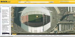
192.com have updated the to most up-to-date online aerial photography for London.
High Resolution aerial photography from Getmapping.com
The new imagery has been captured using the latest digital camera technology with each image pixel equivalent to 12.5cm from the ground. The result are high quailty true-colour photographs - right down to road markings and visable street furniture.

This data is more up to date than google 'satellite' mode and microsoft bing aerial (multimap) mapping sources.

192.com Aerial Mapping Updated

New orthorectified aerial images on 192.com include Wembley Stadium including the Wembley Arch and Wimbledon’s new multi-million centre court roof. Also visible on the new photography is the beginning of the preparations for The Ashes Test Matches at Lords and the Oval Cricket grounds.

"This new photography shows a step forward for aerial imagery used on the net and we believe it will help our users to get richer search results and a more enjoyable experience. The images are truly amazing and even let people check out the most recent aerial shots of their home."
Dominic Blackburn - Product Director

Check the new updated aerial photographs
http://www.192.com/places/


A couple links to some well know landmarks:

Buckingham Palace
http://www.192.com/places/search/?Type=All&place=BUCKINGHAM%20PALACE&gre=529168&grn=179747
(includes Super Zoom Mode)

Wembley Stadium
http://www.192.com/places/search/?location=wembley%20stadium&distance=1838&page=1&searchType=All&place=WEMBLEY%20STADIUM&gre=519384&grn=185519

source:http://www.journalism.co.uk/66/articles/535540.php
& email - thanks to Neil Watts - neil.watts@192.com

Labels: , , , , , ,

12 June 2009

Yahoo Maps Updated [Europe]

Yahoo Maps Updated [Europe]

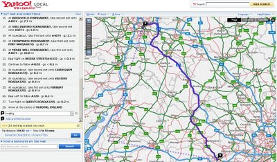
Yahoo Maps New Drag Directions
Now it is possible to drag the routes...
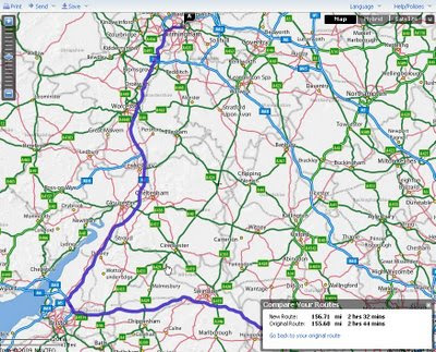
Yahoo Maps New Drag Directions - Compare Old and New Route
Yahoo draggable routes, with option to revert back to original, also compares the route distance.

Other new features & updates
In response to users feedback Yahoo made some major improvements to Yahoo Maps

  • Faster loading time -No more waiting for the application to load - Dial-up mode removed
  • Language preference – Choose from one of the 5 European languages: English, French, Italian, Spanish and German*.
  • Interactive print page – Customize the print page to include only the information you need.
  • Personalised routing – Don’t like the route yahoo provide drag and drop the routes interactively.
  • Saved locations – For convenience, previously entered locations are automatically stored and available within Maps and elsewhere on Yahoo, such as Local and Weather.
  • Quickly look up places through auto-completion.
  • Waypoint support – Get driving directions for trips with multiple stops.
  • Save driving directions – Two places to save, Yahoo! Bookmarks and delicious
  • Zoom bar – now with the ‘+’ on top.
*Yahoo will be rolling out the same set of Maps improvements in Germany in the coming weeks.

Try it
http://tinyurl.com/NewYahoo-Maps-Routes
(above example)

Yahoo Maps Europe main sites:
http://uk.maps.yahoo.com/ (UK)
http://fr.maps.yahoo.com/ (France)
http://de.maps.yahoo.com/ (Germany)
http://espanol.maps.yahoo.com/ (Spain)

Labels: , , , , ,

12 May 2009

Ordnance Survey Openspace API - UPDATED

Ordnance Survey Openspace API - UPDATED

Now include access to Ordnance Survey BoundaryLine [vector] Data

"Use the OS OpenSpace API to add Ordnance Survey maps to your website or blog."

Finally after many, many requests Ordnance Survey have updated their OpenSpace API which now allows adverts on your site!
See the OpenSpace API FAQ for more details on this

New Features:


Look-up services
  • OS OpenSpace boundary look-up
  • Postcode look-up
  • Place name look-up

A single API key may access data up to the following daily usage limits:

  • 40 000 tiles of mapping data in a 24-hour period.
  • 1 000 Place name look-ups (Gazetteer service) in a 24-hour period
  • 1 000 Postcode look-ups in a 24-hour period
  • 1 000 OS OpenSpace boundary look-ups in a 24 hour period
A New Gallery:

OS OpenSpace API Updated

The gallery includes projects like
Manchester cycling club (overlaying .gps routes on 1:50k mapping)

Satellite Dish Alignment (click UK Map to find the OS Mapping)

Whereisthepath (now 40,000 tile impressions per day due popularity - now using Google Appspot) *a Mapperz favourite all round mapping mashup.

Geograph Photos on an OpenSpace Map (Shows all the Geography photos - please do not use it to geo-locate photographs)

Public Footpaths [OpenSpace] on iPhone (designed specifically to be displayed on the Apple iPhone.)

Bike Hike (May 2009 update: Finding routes has been revised. Also revised so course points are now downloaded in GPX tracks and routes as waypoints)
Sky Cam (Latest skycam images using the Ordnance Survey OpenSpace Mapping)
Bikes & Boots (currently unavailable - Updated 12 May 2009)

Hill-baggin (Hill walkers and summit-baggers, attempting to provide accurate Ordnance Survey grid references for the 3000ft mountain tops, and prominent lower hills, of Scotland.)

Kent Trails
(Lots of trails [155 miles worth] in the County of Kent)

For more details and terms and conditions please see
http://openspace.ordnancesurvey.co.uk/openspace/developeragreement.html

Official OpenSpace API Demos - now including BoundaryLine data [wards, administration boundaries etc]
http://openspace.ordnancesurvey.co.uk/openspace/support.html

Thanks to Bill Chadwick [Whereisthepath author for the additional information]

Labels: , , , ,

10 February 2009

Nokia Maps v3.0 updated (including ovi maps)

Nokia Maps v3.0 updated (including ovi maps)

Nokia Maps v3.0 Updated
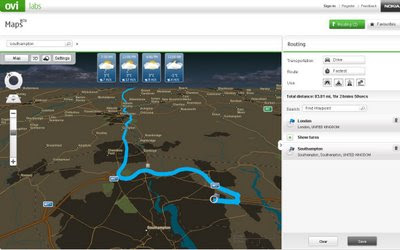
Nokia Ovi Maps (web browser) now can save routes and sync with your nokia maps v3 - mobile/cell device (sign in required to save routes) - Map in nighttime mode with weather and route.
  • You can rotate the map and view 3D landmarks from all directions.
  • In 3D view mode, you can tilt the view by pressing 2 and 8 button
  • 2D/3D mode works with all map modes, now with Satellite and Terrain
  • My Places has option "Point me to" for any saved place/landmark saves the viewing angle as well.
  • Synchronisation of Favourites and Collections with Ovi Maps and vice versa (use in online mode, enable Internet connection), you can now plan routings on Ovi Maps and synchronise to your device
Compatibility and system requirements
Maps Updater and Map Loader 3.0 require Microsoft Windows XP or Vista.
Maps Updater requires Nokia PC Suite to be installed on your computer.

Maps 3.0 Beta works with Nokia devices based on:
S60 3rd Edition Feature Pack 1 (E71, E66, 6110 Navigator, N95, N95 8GB, N82)
S60 3rd Edition Feature Pack 2 (N96, N85, N79, 6650, 6210 Navigator, 6220 Classic, N78)

Ovi MapsBeta works on IE6 (Windows XP), IE7, Firefox 2 and Firefox 3 (Windows XP or Vista).

Note: you cannot use the Nokia Maps 2 and Nokia Maps 3 on the same device. If you have a license for sat-nav (directions/traffic updates etc) you might lose your full licence.
Backup your device before trying beta software.

"Your travel guide licences are not valid in the beta version of Maps 3.0. However, the guide licences will be valid again in the final version of Maps 3.0."

Future implementations (commercial release)
  • Safety spot warner's in selected countries
  • Extended country coverage for Traffic info service
  • Weather information
  • Premium POI content for travel, selected events and cinema
http://betalabs.nokia.com/betas/view/nokia-maps-30-ovi-maps

source and many more screenshots:
http://www.allaboutsymbian.com/news/item/8921_Nokia_Maps_30_beta_updated.php

Labels: , , , , ,

08 January 2009

Google API Geocoder Updates [ExtendedData]

Google API Geocoder Updates [ExtendedData]

Update 13/01/2009

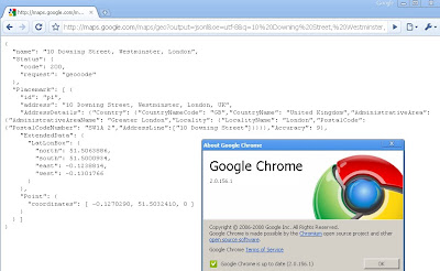
Google chrome users will be happy to know if you update to version (2.0.156.1)
your get the bounding box response from the Google Geocoder.


How to get Google Chrome 2 (Beta)?
http://dev.chromium.org/getting-involved/dev-channel

---------------------------------------------------------

Google Developers have been promising this for a few months now but finally it has made it to the real world. The Bounding Box has made it to the geocoder.

What is new?
Google Maps API Group has a suggestion/requests/issue tracker and one was for the bounding box (SW Corner and NE Corner) to be return when a geocode is sent to the google geocoding servers

Now you get the bounding box not just the centre coordinates

http://maps.google.com/maps/geo?output=jsonl&oe=utf-8&q=10%20Downing%20Street,%20Westminster,%20London&gl=uk&key=ABQIAAAA5heAddVpewIi0Vy-FvLfBBQ6SKP0Jc9Qt0dvx

now returns:
{
"name": "10 Downing Street, Westminster, London",
"Status": {
"code": 200,
"request": "geocode"
},
"Placemark": [ {
"id": "p1",
"address": "10 Downing Street, Westminster, London, UK",
"AddressDetails": {"Country": {"CountryNameCode": "GB","CountryName":
"United Kingdom","AdministrativeArea": {"AdministrativeAreaName":
"Greater London","Locality": {"LocalityName": "London","PostalCode":
{"PostalCodeNumber": "SW1A 2","AddressLine":["10 Downing Street"]}}}}
,"Accuracy": 9},

"ExtendedData": {
"LatLonBox": {
"north": 51.5063886,
"south": 51.5000934,
"east": -0.1238814,
"west": -0.1301766
}
},
"Point": {
"coordinates": [ -0.1270290, 51.5032410, 0 ]
}
} ]
}

Why the fuss?
Well now this extra [Extended information] can be used to set zoom levels for your map.

"Now, in the KML/JSON outputs, you'll also get information about the
recommended bounding box associated with a geocode. You can then use
that along with map.getBoundsZoomLevel(GLatLngBounds) to set an
appropriate center and zoom after a geocode. "

Available
"in the HTTP Geocoder output and JS/Flash Geocoder functions."
Not Available currently in the static api.

Source:
http://groups.google.com/group/Google-Maps-API/browse_thread/thread/b95422a18f8701ed?hl=en#

Well Done Google Map API Team


Potential Future Requests
Altitude (feet or metres)
Time Zone (+1GMT -7 GMT etc)
Standardize the output between formats
Translate place names (Local >English or English to Local)
Accuracy of Rooftop geocoding response
Sea/Ocean Geocoder (Atlantic, Black Sea etc)


Labels: , , , ,

10 November 2008

ArcGIS 9.3 Service Pack 1 Released

Update [26/11/2008]:
Due to a couple of issues that have been resolved ESRI have updated
Service Pack 1 for 9.3
http://support.esri.com/index.cfm?fa=downloads.patchesServicePacks.viewPatch&PID=66&MetaID=1457
If you have already downloaded the service pack check the time stamps
(right click properties on the installer)

New Timestamp (SP1)
21 November 2008 20:13:08

Old Timestamp (SP1)
23 October 2008 06:27:52


If already installed service pack 1 then you can download the patches and install them to update the software rather than the long winded re-installing SP1
Topology Validation Patch
http://support.esri.com/index.cfm?fa=downloads.patchesServicePacks.viewPatch&PID=66&MetaID=1468


To Check the actual file causing the issue check
  • Under the \ArcGIS\Bin folder, right click the GdbTopo.dll file
  • Select Properties
  • On the Version tab, the File version for GdbTopo.dll should read: 9.3.1.1851
(note the issue with subscribers to Virtual Earth in ArcMap has yet to be resolved, so a workaround is mentioned in the comments)

ArcGIS 9.3 Service Pack 1 Released

ESRI have released the first service pack for ArcGIS products.
The list of improvements is huge due to the 'error reporting' function built into 9.3 software.

Here is the full list of fixes
http://gisupdates.esri.com/93sp1/ArcGIS/ArcGIS-93sp1-issues.htm

Mapperz top pick of fixes

NIM009383 - With ArcGIS 9.2 SP2 and higher, certain JPEG images cannot be loaded.

NIM006247 - Saving shape file edits more than eight times in ArcMap leads to slower and slower performance.

NIM033727 - Converting symbology to representation with the 'Features in current extent' option chosen does not complete properly.

NIM035106 - Application failure when using the SHAPE" field in the Select By Attributes command."

NIM036029 - Millimeter values are interpreted as points for size and width property overrides.

NIM036446 - Representation rules with identical internal identifiers can lead to data corruption.

NIM036971 - Exporting attributes to PDF results in incorrect values for fields using a number format.
NIM037410 - Exporting attributes to PDF is not preserving alias names for fields.
NIM037888 - Exporting attributes to PDF drops the value of a field called NAME when layer is using unique value renderer.

NIM037099 - When a line feature class is labeled using Maplex with the centered straight placement option and a label expression whose font tags differ from the symbol size, the labels are drawn offset from the line.

NIM037125 - Using buffer (in the editor or the Geoprocessing tool) fails on some very large input features.

NIM037580 - Crash due to lack of memory while building a spatial index for a complex polygon

NIM037814 - The Label Placement Optimizer algorithm does not work correctly when run inside a Composte algorithm

NIM037818 - Append does not work with feature set as target.

ArcGIS Desktop (ArcInfo, ArcEditor, ArcView)
ArcGISDesktop93sp1.msp 94 MB

ArcGIS Desktop Help updates
ArcGISDesktopHelp93sp1.msp 243 MB

Download the latest Service Pack from:
http://support.esri.com/index.cfm?fa=downloads.patchesServicePacks.viewPatch&PID=17&MetaID=1457

Labels: , , , , , ,

18 September 2008

Live Maps - New Map Tiles

Live Maps - New Map Tiles

New Tiles
New Map Tiles
(odd with duplicate motorway junction numbers?)

Old Map Tiles
Old Map Tiles
To get the old tiles - press the 3D option - Virtual Earth plug in required.


From the Virtual Earth Blog

"now live and contains the following 46TB of imagery and vector updates."

* Vector overlays for Navteq and MDS data sources for orthos and Bird's Eye
* All mobile tiles
* New British Isles Map style

for those interested the new map tiles are load balanced from
r0.ortho.tiles.virtualearth.net
r1.ortho.tiles.virtualearth.net
r2.ortho.tiles.virtualearth.net


View some new tiles
http://tinyurl.com/4u2jrv

Labels: , , , ,

29 August 2008

ArcGIS 9.3 - Service Pack 1 - Announcement

ArcGIS 9.3 - Service Pack 1 - Announcement (updated)

(Due November 2008 - subject to changes and additions)

UK Users are still awaiting arrival of ArcGIS 9.3 from ESRI (UK)
(it arrived 25th September...)


Top Picks

NIM006247 - Saving shape file edits more the eight times in ArcMap leads to slower and slower performance. (an average user would save over 100 times a day).


NIM035569 - Network Dataset Build fails with File read/write error occurred" if more than 3 GB available RAM on the machine."(Windows can support 4GB)
NIM036572 - The Vehicle Routing Problem solver does not respect the network dataset hierarchy settings that the user has chosen for analysis.
NIM036573 - Out-of-memory error in Network Analyst crashes ArcMap.

NIM035799 - Using the repair geometry tool shifts feature-linked annotation to its default position when repairing the feature class it is linked to.
User would like to have the annotation remain in the position he [or she] set it.

NIM036029 - Millimeter values are interpreted as points for size and width property overrides.

NIM036030 - Representation masking creates unexpected results with advanced symbol level drawing.

NIM036694 - Using the Calculate Geometry tool in the attribute table produces incorrect results for calculating Hectares.


NIM037404 - The Microsoft Virtual Earth layer, available from ArcGIS Online, displays poorly when the data frame extent goes beyond -180 / 180.

NIM037690 - Remove duplicates deleting too many labels

More details from the PDF
http://downloads2.esri.com/support/downloads/ao_/ArcGIS_93SP1_Ann091608.pdf

To keep your ArcGIS up-to-date view
http://support.esri.com/index.cfm?fa=downloads.patchesServicePacks.listPatches&PID=43&FilterPV=457&FilterType=8%2C5
There are 3 patches for ArcGIS 9.3

Microsoft® Virtual Earth Patch (if have subscribed)
File Geodatabase SQL WHERE clause Patch
Adobe Reader® version 9 support

Labels: , , , , ,

11 August 2008

Where is the Path? - 3D

Where is the Path? - 3D

A recent update which includes the option of 'Earth' (Google Earth inside the web browser)


Allows the user to create a route of their choice and view it in 3D - attribution of the points is available.
Export to GPX for input into a GPS device.
*Earth plugin must be installed to view the content.
In the drop down list select OS+Earth

There is a limit on the number of Ordnance Survey tiles per a 24 hour period (30,000 tiles) - keep an eye on the percentage bar in the bottom left corner.
OS please raise this limit to 50k or higher.

http://wheresthepath.googlepages.com/wheresthepath.htm

Full credit goes to Bill Chadwick for producing this nifty side-by-side mapping application.

Labels: , , , , , ,

30 April 2008

OpenStreetMap Data in GlobalMapper - Fast!

OpenStreetMap in Global Mapper 9.0.3 - Fast!
OpenStreetMap (OSM)data to Shapefile using GlobalMapper v9.0.3
OpenStreetMap Data (.osm) can now be loaded directly into GlobalMapper.


Global Mapper has had an update (now GlobalMapper v9.0.3)


You would think that this is a minor thing, but there have been some very interesting additions

OpenStreetMap (OSM) data in ArcGIS from GlobalMapper v9.0.3
This is the Export from Global Mapper with the OSM Data - Full attribution has been preserved.
**This can be automated and projection assigned.

This method makes it very fast to get data from OpenStreetMap into ArcMap where edit and additonal attribution can be done.

What New? (Mapperz top picks)

  • WHAT'S NEW IN Global Mapper v9.03
    Added support for loading Tiger 2007 Shapefiles with full attribution and automatic styling and type assignment from http://www.census.gov/geo/www/tiger/tgrshp2007/tgrshp2007.html
  • Added support for loading Vulcan3D triangulation files.Added support for exported loaded gridded elevation data to Vulcan 3D triangulation (.00t) files.
  • Added support for loading OpenStreetMap (OSM) format vector maps.
  • Added support for loading NITF data sets using JPEG2000 compression.
  • Added support for exporting loaded point features to TomTom OV2 format files for creating new point databases for loading onto TomTom GPS devices.
  • Added option to KML/KMZ vector export to make labels for line and area features display on the map in Google Earth.Added option when generating elevation grids from vector data to ignore zero elevation values.
  • Added new option to the File menu of the rectification dialog to allow easily saving a world file that represents (if possible) the transformation defined by the currently provided control points.
  • Added yards and chains as available units of measure when using the Measure Tool.
  • Improved accuracy of OSGB36 datum conversions by using the OSTN02 tables.
  • Made Bonne projection work properly when the origin latitude is in the Southern Hemisphere.
  • Added support for decoding Albers Conic projections from Ozi .map files.
  • Added support for correcting the projection of multiple raster files at once (only if all of the raster files being corrected have the same projection to start with).
  • Fixed problem with displaying the equator grid line when using the Van der Grinten projection.
  • Fixed problems encoding and decoding Lambert Cylindrical Equal Area projection to/from GeoTIFF files.
  • Added option to the Shader Options tab of the Configuration dialog to reverse the color order of the selected shader (previously only the HSV shader was reversible).Added support for reading the track style information written to GPX files by the ExpertGPS software application.

http://www.globalmapper.com/

OpenStreetMap (Planet OSM)

http://wiki.openstreetmap.org/index.php/Planet.osm

Data (Index of)

http://planet.openstreetmap.org/

**Check dates

Labels: , , , , ,

21 December 2007

Live Search Maps - Coverage Updated

Live Search Maps Coverage Updated

(Virtual Earth has updated 36.3 TB of data)
UK Coverage listed here

Liverpool Buildings in 3D Virtual Earth
Liverpool gets 3D Buildings

Aerial Imagery
Supplied by GetMapping UK:

* England\Wales (12.5 cm)
* Scotland (25 cm)

BIRD'S EYE AERIAL IMAGERY
Castleford, UK
Chester, UK
Crewe, UK
Darlington, UK
Dearne Valley Urban Area, UK
Harrogate/Knaresborough, UK
Hartlepool, UK
Leeds, UK (1 & 2)
London, UK (several AOIs here)
Macclesfield/Pretsbury, UK
Middlesborough, UK
Milton Keynes, UK
Newcastle, UK
Reading/Workingham, UK
Scarborough, UK
Scunthorpe, UK
York, UK (1 & 2)
*AOI = Area of Interest

3D City
* Liverpool, UK (43.04 sq. mi.)

For more Worldwide updates go to the Official Virtual Earth Blog.
http://virtualearth4gov.spaces.live.com/Blog/cns!369B39F890CE30C1!607.entry

Labels: , , , ,

14 October 2007

Massive Live Local Maps and Imagery Updated

"Birds Eye views of dozens of cities around the world were added to the Virtual Earth platform last night. You can enjoy them at Live Search Maps or integrate them into your own applications with our Map Control. 10TB of new imagery went out in this release along with 28TB of refreshed street map tiles. The October imagery release is one of the largest for Birds Eye in a while, featuring coverage in Madrid, Stockholm, Copenhagen, plus 15 regions in the UK and US respectively (see below for full list) "


1 Terabyte = 1024 Gigabytes


(ensure 3D Virtual Earth Plugin is installed with IE7 before clicking the links)


Source:


http://virtualearth.spaces.live.com/Blog/cns!
2BBC66E99FDCDB98!9246.entry?action=post&wa=wsignin1.0

Labels: , , , ,

10 October 2007

Google Maps Street View - New Feature

Google Maps Street View - New Feature- now look up

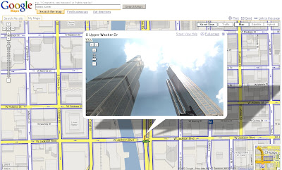
Now you can check out 360-degree views of Chicago(IL), Pittsburgh (PA), Philadelphia (PA), Phoenix (AZ), Portland(OR) and Tucson(AZ). As an added bonus, the images in Phoenix, Tucson and parts of Chicago are all in high resolution.
Plus you can pan within the Streetview mode and look up at tall buildings.

Sears Tower - StreetView - Now Look Up

Two Official Posts on this (one with a karaoke video)
http://google-latlong.blogspot.com/2007/10/
more-street-view-cities-to-explore_09.html(updated)

http://google-latlong.blogspot.com/2007/10/
more-street-view-cities-to-explore.html

Labels: , , ,

20 August 2007

Hurricane Dean - Mapped and Tracked

Final Update:
The storm has reached Category Five, the highest strength, with winds of up to 160mph (255km/h).

Dean Hurricane at Category 5
Radial Zones show destructive path of Hurricane Dean at Category 5

For a Visual Understanding - view the Hurricane Animated guide from the BBC (in Flash)


Update 3:
Dean is now forecast to slam into Belize and the east coast of Mexico's Yucatan Peninsula, including the popular tourist destination of Cancun.
http://news.sky.com/skynews/article/0,,30200-1280456,00.html?f=rss

Update 2:
meteorological reports the storm could intensify into a Category Five hurricane in the next few hours.
http://news.bbc.co.uk/1/hi/world/americas/6954296.stm

"
Dean is now expected to pass close by the low-lying Cayman Islands, before hitting Mexico in the coming hours"


Update:
For more information
http://www.nhc.noaa.gov/#DEAN

Currently Category 4
"Winds 131-155 mph (114-135 kt or 210-249 km/hr). Storm surge generally 13-18 ft above normal. More extensive curtain wall failures with some complete roof structure failures on small residences. Shrubs, trees, and all signs are blown down."
There is potential for this hurricane to be upgraded to category 5...eek!
" Dean is now over very warm water and in an ideal situation to strengthen further."
Rob McElwee, BBC Weather


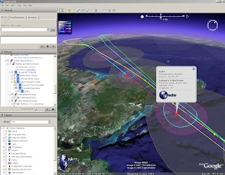
Hurricane Dean - Mapped and Tracked

Hurricane Dean Tracked

View live updated content for Hurricane Dean with predicted courses based on category (currently 4).

The KMZ for Google earth comes with more information.
  • Oil and Gas Fields
  • Buoys (Windspeed, pressure etc)
  • Sea Temperatures (very important with hurricanes)
  • Clouds (Shows the scale of the hurricane)
  • Predicted Routes/Modeled Forecasts

more information from GraphOilogy Blog

Link to the KMZ (the latest release of Google Earth is required which is 4.1.1087.5048)

Labels: , , , , , ,

15 August 2007

ArcGIS Explorer - Build 410 Released

ArcGIS Explorer Build 410

Improvements - it's smoother

Result Properties
source: ESRI

* When a result is generated it has a default zoom extent, or view. The default view is from an overhead perspective. You can capture a new view by moving and/or tilting to a new perspective, then using the result property sheet to capture the new view. The view property is persisted with the result.

Navigation with ArcGIS Explorer has been enhanced in the following ways.

Observer Elevator Movement: By default, zooming in and out on the map using the mouse or keyboard will zoom relative to the target location. Holding down the Ctrl-key and using the + and – keys will change the observer elevation. This is similar to traveling up and down in an elevator. This type of movement is useful for viewing vertical features in your map at differing elevations.

Zooming to Cursor Position: Zooming to a location on the map has been enhanced by zooming to the mouse pointer position. You can still zoom to the center of the map by holding down the Ctrl-key while scrolling the mouse wheel. Zooming out always occurs from the center of the map.

Look Replaces Pan at Tilt Angles Larger Than 45 Degrees: In previous versions of ArcGIS Explorer, double clicking on the map when viewing the map tilted beyond 45 degrees would center the clicked location. This often changed the distance from the observer location to the target. Now when the map is tilted beyond 45 degrees, a double-click will use the Look functionality, changing the observer's view without changing the observer position.


* Subsurface Navigation
To get a subsurface view of the earth, tilt your map then hold down the Ctrl key and use the + or - keys to move straight down below the earth or to move straight up.


* Easier Navigator Access
Access to the Navigator is easier; the target area which maximizes the control has been made larger.


* Faster Opening of Server Folders
The performance of opening servers publishing services in multiple sub-folders has been improved.


* Improved Stars
Stars now appear as different sizes and are centered at the observer position to illustrate their correct location, providing a more realistic appearance for the sky and globe.


* Close Shortcut
The keyboard shortcut which closes the application is now Alt-F4 to adhere to standard shortcut conventions.

* Point measurements and point notes now store the view properties captured at the time of their creation. For example, when you add a point note the current view will be captured and stored with the note. You can double-click the note to zoom to the specified view. The view properties can be edited through the result property sheet


* New Find Address task replaces the previous Find Address task found in earlier builds. The new task provides the capabilities to enter address or place in a single input from which it will be parsed and matched.

The Find Route and Get Driving Directions tasks provide a convenient drop down menu allowing you to choose which language to display your directions and routes. The following languages are supported: Danish, Dutch, English, French, German, Italian, Norwegian, Portuguese, Spanish, and Swedish

Free Download
http://services.arcgisonline.com/410/explorer/software/downloadpage.html
(No login required)

Labels: , , , ,

30 July 2007

192.com Mapping Updated

192.com Mapping and API Updated

  • 12.5cm resolution aerial photography UK-wide
  • Ordnance Survey maps with 100% of streets labelled
  • Maps based on Flash technology

192.com has just launched a number of new enhancements to its interactive mapping tool including the highest resolution aerial photography, exclusive UK styled maps and a new journey planner

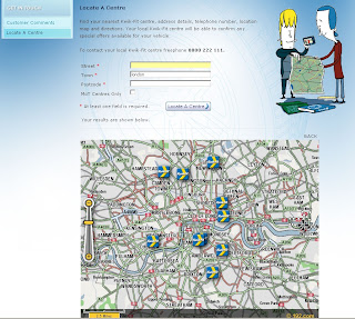
Kwik fit 192.com flash map

Kwik Fit uses 192.com Mapping for their website and works well.

These features make 192.com Maps a dynamic user experience designed specifically for the UK market.


"192.com is today announcing the first in a series of major improvements to its maps service, first launched last autumn and experiencing a surge in traffic in recent months. 192.com has republished all of its street maps after exclusively redrawing every UK map to incorporate the latest Ordnance Survey data and ensure street labelling was in an easy to read format. 192.com is unique on the internet for labelling 100% of UK streets (typically rival sites name 70-80%) and so uses hand drawn labelling particularly for crowded, historic cities with many street names in close proximity. The colouring of the maps has also been optimised to suit motorists and non-motorists alike and to accommodate the changing requirements of computer and mobile screens. The aerial photography, already acclaimed as the best available for the UK, has improved further and offers unrivaled clarity and resolution nationwide, not just in cities. But it’s the transition between maps and photography that really sets 192.com’s new maps apart, with the smoothest, cleanest transfer from map to map, and map to detailed aerial photography."
Having looked into these at more detail there seems to be a lot going on under the hood.
If your an experience programmer you will able to create flash based maps in a few minutes
Though a quick start tutorial with live example would aid the non-experienced programmer.

Clearly the mapping is excellent and well put togeather and seems to be the only online mapping fully based on Ordnance Survey Mapping. This must of cost a small fortune to buy or licence.

Here is a list of the scales available

  • 0 = 0.125 metres/pixel Aerial Photo
  • 1 = 0.25 metres/pixel Aerial Photo
  • 2 = 0.5 metres/pixel Aerial Photo
  • 3 = 0.125 metres/pixel Aerial Photo
  • 4 = Street level OS map
  • 5 = OS map
  • 6 = OS map
  • 7 = OS map
  • 8 = OS map
  • 9 = OS map (most zoomed out – whole of UK)
Hopefully the Roads data was based on OS Integrated Transport Network (ITN )
as the OSCAR Dataset is now withdrawn

Labels: , , , , ,