->

26 April 2011

BBC Nuclear Power Mapped

BBC Nuclear Power Mapped

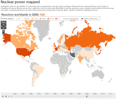
BBC Nuclear power mapped
See the development and introduction of Nuclear Power from 1955 onwards with the time slider at the bottom.

BBC Nuclear Power Map.
http://www.bbc.co.uk/news/world-13159407

Notes on the data and map:

Data in the map above is sourced to the IAEA. The map uses current political boundaries.

Data showing the percentage of electricity that nuclear power contributes to each countries' total electricity production is only available from 1985-2010.

*Under construction only represents countries currently building nuclear power plants that previously had none

**requires Flash Player

Labels: , , , , ,

26 December 2009

The London Of Sherlock Holmes...Mapped

The London Of Sherlock Holmes...Mapped
Sherlock Holmes Film (2009)
The New movie and the New Map of Locations

Sherlock Holmes Map London Locations
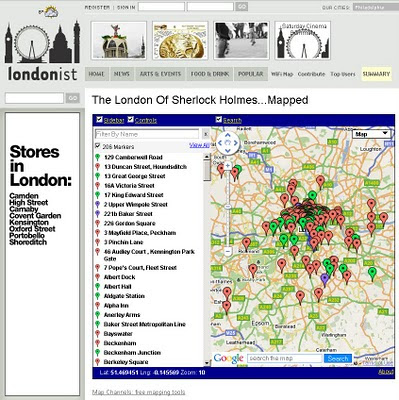
Find the locations of Sherlock Holmes and even some answers to clues on this Map of Sherlock Holmes in London.


The whole world is about to go Sherlock Holmes bonkers, due to the Warner Brothers movie starring Robert Downey Junior and Jude Law and Directed by Guy Ritchie of Lock Stock and 2 Smoking Barrels and Snatch fame.

"With each new telling, the character receives a certain amount of reinvention. One thing is constant, though. London. You can't have Holmes without the city he was so intimately associated with. But which parts of town did he know best? Our well of nerdiness will never run dry, so we re-read all the original Holmes tales and plotted every London location on the map above.

Some interesting patterns emerge. Naturally, there's plenty of action around the Baker Street area, but Holmes never once set foot in nearby Soho. Zooming out, there's a surprising cluster of incidents around Crystal Palace. The reason is elementary when you know that Sir Arthur Conan-Doyle lived for a time in South Norwood. We haven't plotted the numerous out-of-town locations mentioned in the books, but you can get a sense of Holmes' peregrinations by noting which rail stations he used most. Southern stations Charing Cross and Waterloo are visited a combined total of 16 times, while King's Cross and Euston are only blessed with the detective's patronage on four occasions."

Key: Green = precise location; red = imprecise location; purple = real-world Holmes-related sites; blue line = route taken by Holmes. Page numbers refer to those in the Folio Society's 1994 collection

source: The Londonist

Created by the Excellent Tools at Map Channels

View the Map
http://londonist.com/2009/11/the_london_of_sherlock_holmesmapped.php

Official Film (2009)
Official Website for the New Movie
http://sherlock-holmes-movie.warnerbros.com/


Labels: , , , , ,

11 December 2009

Planning a big event? - Marquee Venues Mapped

Planning a big event? - Marquee Venues Mapped

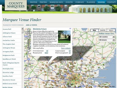
There are maps for almost anything, here is a site that can give you access to marquee sites and locations in South East England.
These are for small to very large events (weddings, rock festivals, sport events and corporate events.

Marquee Venues Mapped
Numerous locations that can accommodate large marquee events

http://www.countymarquees.com/venues.htm

This site does well due the integration of locating, planning events and gives clear and full specifications of all types of marquee's available.

In additional users can update this map with locations that accommodate these large shelters.

Geographical Areas covered:
  • London
  • Sussex
  • Surrey
  • Oxfordshire
  • Kent
  • Hampshire
  • Essex
  • Hertfordshire
  • Berkshire
  • Bedfordshire
  • Buckinghamshire
Equipment

Map

Neat 'undercover' Marquee Planner

Labels: , , , , , ,

27 November 2009

Golfshot.com - World Golf Courses Mapped and App'ed

Golfshot.com - World Golf Courses

Golfshot Touchpoint

Golfshot is now available for the iPhone and available from the App Store.

  • Golfshot makes it easy
  • Over 22,000 courses ready to play
  • No software to install on your computers
  • Show up and golf

Golf is a game. It should be fun.

We designed Golfshot to be easy to use, understand and share.
No computer downloads...simply add Golfshot to your iPhone and go play golf.
Scorecards, Statistics and now GPS Aerial View and GPS List View, are all included with
Golfshot: Golf GPS.

Example Golf Course
Golfshot Map Preview
http://golfshot.com/Courses/Detail/12681/Shanklin-Sandown-Golf-Club

but many more from (23,000+)
http://golfshot.com/Courses

and On the iPhone
Golfshot

Distances calculated and touch screen controls for the golfer.

We have over 23,000 courses mapped – mostly in the US, but we’re adding them worldwide. You can search and view courses at golfshot.com/courses. You can also request new courses for free from the same page.


Golfshot: Golf GPS is now featured in the Apple App Store at introductory pricing and no subscription.
More details:
http://golfshot.com/Home/Easy

Full Users Guide
http://resources.golfshot.com/userguide.pdf

*Google [Aerial images and API] requires an internet connection to view images for the course.
Tip - You are able to download images with WiFi and they will be available on the course if you keep the app open.

Labels: , , , , , ,

09 October 2009

OpenStreetMap Formula 1 Circuits

OpenStreetMap Formula 1 Circuits

F1 OpenStreetMap Circuits
OpenStreetMap Formula 1 Circuit - Circuit de Monaco (Monaco)

OpenStreetMapper '

Labels: , , , , , , , ,

19 June 2009

192.com Mapping Updates

192.com Mapping Updates

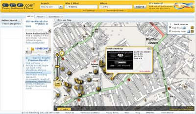
"New on 192.com is ability to see the list of people or businesses that matched your search criteria highlighted on the map. This makes it even easier to identify the person or business you are looking for. For example, you may know that a person definitely lives in the midlands. Or you may be looking for a business that is located on the high street or close to the tube.

You can also use the Locations grouping on the Refine Search panel to filter by any area in the UK, from country level right down to postcode."

What's New on 192.com

Image 192.com: Search results for People or Businesses are now mapped.

Other new searches:

You can now search all of 192.com from any page of the site. You can choose to Search All or select a particular section that you are interested in including:

  • People
  • Businesses
  • Places
  • Property prices
  • Electoral roll
  • Directors
  • Family records
  • Company credit reports
  • Visual timelines
  • Websites Mapped
Websites are now geocoded to a real business locations.

What's New on 192.com on the Map
Websites are now geocoded to real world locations

Websites now mapped on 192.com
Filtering by Website on a map - unique to 192.com

http://www.192.com/content/help/whatsnew/#maps


Try it out:
http://www.192.com/all/search/

Source:
http://blog.192.com/?p=21

Labels: , , , , , , ,

30 October 2008

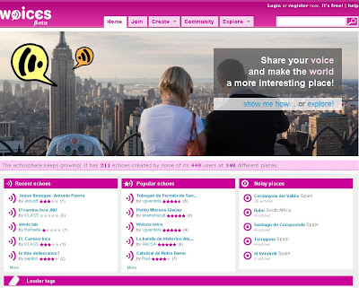
Woices.com - Echoes Mapped (Beta)

Woices.com - Echoes Mapped (Beta)

Woices.com - Echoes Mapped (Beta)

Brand New Google Map Mash-up with a twist. Mapping Echoes across the World.

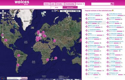
Woices.com - Echoes Mapped - The Map

What is woices?

"Woices.com is a FREE internet service that allows people to create, share and consume echoes, audio records that are linked to a very specific geographical location or real-world object. Woices ultimate goal is to extend reality by creating a new layer of audio information, what we call the echoesphere, that will make the world a more interesting place."

What is an echo?

"Echoes are words, left by one person at some precise place, that can be later listened to by anyone, as if their author was still there. Echoes can be about anything you want, from history, art or curiosities to personal memories or advices. An echo can even a poem."

There are three ways of locating echoes:
  • Using the Map. Select 'Map' in the 'Explore' tab. A full screen map will appear. Next to the map there will always be a list with the most popular echoes for the region viewed. Zoom in as much as you need to locate the echoes. Remeber that using the search box that comes inside the map is always a shortcut.
  • Browsing the Directory. Select 'Directory' from the 'Explore' tab. The directory allows you to quickly select a location by going through its continent, country, area and finally location.
  • Use the search box. On the top right corner of the page you will find a search box that can help you to quickly locate any echo.

The Basics
The Help
The Map

Labels: , , , , ,

11 June 2008

Students Map Kenya (for Google Maps)

Students Map Kenya (for Google Maps)

"The map was developed by a team of seven students from three Kenyan universities together with a team from India. Replacing a previously limited online map of four highways, the move has now placed Kenya on the level of other countries served by Google Maps."

Students Map Kenya now on Google Maps
Kenya's Data mapped by students is now available in Google Maps

Compare both the 'Map' and Terrain Modes - the difference is amazing.

Before {using Terrain}

After {using Map}


Source:
http://www.networkworld.com/news/2008/060908-google-launches-kenya-online.html

Labels: , , ,

21 April 2008

Mapped Webpages (Google Maps)

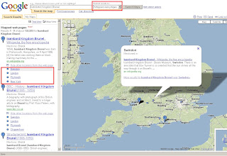
Mapped Webpages - Google Maps (the blue dots)
Google Mapped Locations

Google 'locate' information and display is on Map Searches now.

Try it
http://maps.google.com/maps?f=q&hl=en&geocode=&q=Isambard+Kingdom+Brunel&mrt=websearch&sll=58.263287,-36.210937&sspn=132.606541,329.0625&ie=UTF8&ll=52.153714,-1.966553&spn=4.773254,10.283203&t=p&z=7&iwloc=A-1-5-viewsSub

The clever bit this is it only display items within the map area with the option to expand in sidebar.

source: Google Maps Mania

Labels: , , , ,

07 October 2007

Woodland Trust - Ancient Trees Map

Woodland Trust - Ancient Trees Map - for the UK

"Ancient trees are living relics of incredible age that inspire in us feelings of awe and mystery. We reveal what makes a tree truly ancient, unlock a few of the fascinating secrets and stories associated with them and help you discover why they can sustain such a wide variety of wildlife."Ancient Tree Hunt

Ancient Tree Hunt
This custom built map is a good example on how to have your own custom map and still achieve
highly interactive content. Based in Flash the map is easy to use and has a 'drill down' on data, getting more detailed as you zoom in. More layers become available in the side bar when your in particular areas and zoom levels.

Currently there are 3410 verified ancient trees available

Other layers of data are available:
  • Protected Areas
  • Sites of Special Scientific Interest
  • Areas of Outstanding Natural Beauty
  • National Nature Reserves
  • Local Nature Reserve
Other valuable information is also given whether is private or has access to pubic.
  • Car Parks
  • Footpaths
  • Information Points
  • Entrances
  • Cycle Routes
To use the interactive map (in flash) go to
http://www.ancient-tree-hunt.org.uk/Discoveries/interactivemap?
and zoom into your area of interest.

Nice touches through out - print for personal use and the find works as it should.
Even the little flash intro (not too long) of leafs falling is a visual guide that something is happening.

*Note the 'Zoom Bar' is back to front - compared to conventional mapping applications out there.
Mapping has been created by DrawLive Ltd

Mapperz

Labels: , , , , , ,

02 October 2007

'At-Risk' Post Office Outlets Mapped

last update:
Yorkshire area
http://mapperz.googlepages.com/yorkshire_post_offices
_at_risk_name.html


Outreach Post Offices Planned (replacing these Post Offices)
http://mapperz.googlepages.com/outreach_post_offices_named.html

data from...
http://news.bbc.co.uk/1/shared/bsp/hi/pdfs/02_10_07_po_total.pdf
so if that is wrong so will the location on the map

update:

Midlands is Mapped now.
http://mapperz.googlepages.com/Midlands_post_offices
_at_risk_named.html
*Starkholmes, 133 Starkholmes, Road Matlock E4 5JA was not mapped due to an incorrect postcode.

Kent 'at-risk' Post Office Outlets Mapped


"The Post Office has announced the first 180 branches earmarked for closure under its plan to shut 2,500 by the end of next year."

based on the pdf on the BBC website - Mapperz mapped them. In 15 minutes
http://news.bbc.co.uk/1/hi/uk/7023244.stm


How was this done so quick?

  • Copy and pasted addresses and postcodes from the PDF into notepad, save as .txt
  • Rename as .csv
  • Open this in OpenOffice (or Word) as comma delimited.
  • Adjusted the Postcodes into one column
  • Appended the lat/lng to the Post Office 'at risk' in OpenOffice
  • Saved as .xls
  • Published this as 'public' (will not work if your don't)
*to create the link between the spreadsheet and google map via the Public Spreadsheet Key.
**the wizard does do a lot of things, icons sizes, colours, viewport, map extent based on data.
The Mapperz modified a little html to make the map centre on Europe before zooming to the Kent era.

View the 'At Risk' Post Offices in Kent Map

Mismatched postcodes with the geocoder
Kent had one Postcode that was incorrect replacing the 'I' for a '1' worked.
TN13 IHZ should be TN13 1HZ

Labels: , , , , , ,

20 August 2007

Hurricane Dean - Mapped and Tracked

Final Update:
The storm has reached Category Five, the highest strength, with winds of up to 160mph (255km/h).

Dean Hurricane at Category 5
Radial Zones show destructive path of Hurricane Dean at Category 5

For a Visual Understanding - view the Hurricane Animated guide from the BBC (in Flash)


Update 3:
Dean is now forecast to slam into Belize and the east coast of Mexico's Yucatan Peninsula, including the popular tourist destination of Cancun.
http://news.sky.com/skynews/article/0,,30200-1280456,00.html?f=rss

Update 2:
meteorological reports the storm could intensify into a Category Five hurricane in the next few hours.
http://news.bbc.co.uk/1/hi/world/americas/6954296.stm

"
Dean is now expected to pass close by the low-lying Cayman Islands, before hitting Mexico in the coming hours"


Update:
For more information
http://www.nhc.noaa.gov/#DEAN

Currently Category 4
"Winds 131-155 mph (114-135 kt or 210-249 km/hr). Storm surge generally 13-18 ft above normal. More extensive curtain wall failures with some complete roof structure failures on small residences. Shrubs, trees, and all signs are blown down."
There is potential for this hurricane to be upgraded to category 5...eek!
" Dean is now over very warm water and in an ideal situation to strengthen further."
Rob McElwee, BBC Weather


Hurricane Dean - Mapped and Tracked

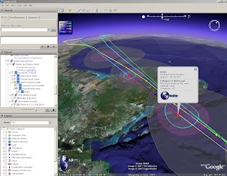
Hurricane Dean Tracked

View live updated content for Hurricane Dean with predicted courses based on category (currently 4).

The KMZ for Google earth comes with more information.
  • Oil and Gas Fields
  • Buoys (Windspeed, pressure etc)
  • Sea Temperatures (very important with hurricanes)
  • Clouds (Shows the scale of the hurricane)
  • Predicted Routes/Modeled Forecasts

more information from GraphOilogy Blog

Link to the KMZ (the latest release of Google Earth is required which is 4.1.1087.5048)

Labels: , , , , , ,

27 June 2007

Sky News - UK Flooding Map (Pics)

Update - if your looking for UK Floods in Southern, West and Midlands [20th July to 24th July 2007]
Go to the newer page
http://mapperz.blogspot.com/2007/07/uk-flooding-links.html


Sky News UK Flooding Map showing pictures of the Flooding in the North of England - News has Location.


Sky News UK

More and more Maps are Illustrating news events - giving the users a sense of the scale of the matter.
(other parts of the UK have been affected - though the North of England has had it very bad.)

Source: Google Maps Mania via Press Gazette

More Flooding Pictures from the BBC Site

Labels: , , , , ,

25 April 2007

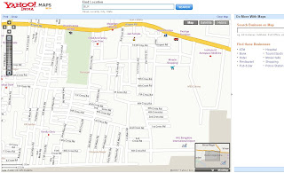
Yahoo Maps India

Yahoo Maps India

Yahoo found India now it is mapped

Yahoo Maps India
Yahoo Maps India

Mumbai Yahoo Maps India
Mumbai

Yahoo Maps India Bangalore
Bangalore Airport

So where is next?
Antarctica anyone...?

Labels: , , , ,

21 February 2007

Google Map Public Calendars

Google Maps Public Calendars

Google Maps Public Calendars
example
http://www.google.com/calendar/events?q=Marathon
&ql=London&qt=&qtd=&sa=N&page=vl&afp=393d85a865eecf88

A New Feature in Google Calender is to be able to search Public Calenders and Events

"Now you can search the web for events and add them directly to your Google Calendar. Within Google Calendar, type an event search into the search box like "Symphony in San Francisco" and click "Search Public Events". You'll see a list of events that you can easily add to your Google Calendar."

more new features
http://www.google.com/intl/en/googlecalendar/new.html

There is also a Google Calendar API

The Maps for calendar only work when the user has inputted the location of the event.
All Events should have a location, therefore should be mapped.

Source:Mapperz

Though please remember Google Calendar is still Beta.

Labels: , , , , ,

02 February 2007

MapQuest Map Gas (Fuel) Prices

Mapped Gas (Fuel) Prices - MapQuest USA

MapQuest Map Gas Prices
FAQ Help
  • How can I add a gas station that is not in the list?
    Click here to Add A Station
  • How can I add an alternative fuel station that is not in the list?
    Click here to Add An Alternative Fuel Station
  • How often are prices updated?
    Gas Prices are updated multiple times a day. Check back often for the most recent prices.
Gas is very cheap in North America!

UK Price
Petrol (Gas) 86.0p ($1.69) per litre
Diesel (Derv) 90.2p ($1.82) per litre

Labels: , , , ,

20 December 2006

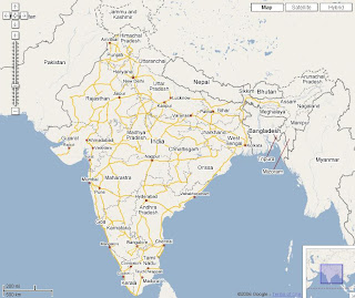
Google Maps India

Google Found India now it's mapped.
Google Maps India

and Singapore and Hong Kong
original source:Google Blogoscoped

Singapore:
Google Map Singapore
Image: Google Maps Mania

Hong Kong:
Google Map Hong Kong
Image: Google Maps Mania

Labels: , , , ,