OpenStreetMap Data in GlobalMapper - Fast!
OpenStreetMap in Global Mapper 9.0.3 - Fast!

OpenStreetMap Data (.osm) can now be loaded directly into GlobalMapper.
Global Mapper has had an update (now GlobalMapper v9.0.3)
You would think that this is a minor thing, but there have been some very interesting additions

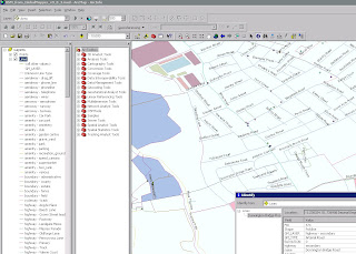
This is the Export from Global Mapper with the OSM Data - Full attribution has been preserved.
**This can be automated and projection assigned.
This method makes it very fast to get data from OpenStreetMap into ArcMap where edit and additonal attribution can be done.
What New? (Mapperz top picks)
- WHAT'S NEW IN Global Mapper v9.03
Added support for loading Tiger 2007 Shapefiles with full attribution and automatic styling and type assignment from http://www.census.gov/geo/www/tiger/tgrshp2007/tgrshp2007.html - Added support for loading Vulcan3D triangulation files.Added support for exported loaded gridded elevation data to Vulcan 3D triangulation (.00t) files.
- Added support for loading OpenStreetMap (OSM) format vector maps.
- Added support for loading NITF data sets using JPEG2000 compression.
- Added support for exporting loaded point features to TomTom OV2 format files for creating new point databases for loading onto TomTom GPS devices.
- Added option to KML/KMZ vector export to make labels for line and area features display on the map in Google Earth.Added option when generating elevation grids from vector data to ignore zero elevation values.
- Added new option to the File menu of the rectification dialog to allow easily saving a world file that represents (if possible) the transformation defined by the currently provided control points.
- Added yards and chains as available units of measure when using the Measure Tool.
- Improved accuracy of OSGB36 datum conversions by using the OSTN02 tables.
- Made Bonne projection work properly when the origin latitude is in the Southern Hemisphere.
- Added support for decoding Albers Conic projections from Ozi .map files.
- Added support for correcting the projection of multiple raster files at once (only if all of the raster files being corrected have the same projection to start with).
- Fixed problem with displaying the equator grid line when using the Van der Grinten projection.
- Fixed problems encoding and decoding Lambert Cylindrical Equal Area projection to/from GeoTIFF files.
- Added option to the Shader Options tab of the Configuration dialog to reverse the color order of the selected shader (previously only the HSV shader was reversible).Added support for reading the track style information written to GPX files by the ExpertGPS software application.
OpenStreetMap (Planet OSM)
http://wiki.openstreetmap.org/index.php/Planet.osm
Data (Index of)
http://planet.openstreetmap.org/
**Check dates
Labels: Arcmap, Data, Global Mapper, Open Street Map, Shapefiles, updated


0 Comments:
Post a Comment
<< Home