->

04 August 2011

New v4 Map Channels

New v4 Map Channels

update 10/08/2011
Map Channels 'Map Place Maps' is now available for mobile phone.

"Mobile Place Maps are a quick and convenient method of providing a place map, plus the route to get there."

Map Channels Mobile Place Maps
Map Channels Mobile Place Maps is available here: http://www.mapchannels.com/MobilePlaceMaps.aspx


The successful Map Channels has been updated once again with some more useful tools.

"Map Channels lets users easily embed maps into websites and blogs. A number of tools are available to create maps from KML, GeoRSS or spreadsheet map data. A range of features and options let you customize the map appearance to meet a range of mapping needs. "

New v4 Map Channels

What is Ne
w?
  • Search facility is now powered by the Google Places API.
  • User can define a list of localities, giving quick links to map locations.
  • The footer bar can be customized by using a HTML template to show categories, layers and localities.
  • An information panel can be used in addition to the info window to display detailed place information.
User Interface Improvements
  • A map is provided to (optionally) set the initial map centre and zoom level.
  • A preview of the feed data is displayed (useful to spot if an incorrect feed url has been supplied).
  • Additional help for setting up a data feed.

Map Channels Editor (users are required to login to create a map)
New v4 Map Channels Editor

Map Channels

View the v4 Demo Map (as above)
http://www.mapchannels.com/Mc4Edit.aspx?id=mc4_demo_1_1

Follow Map Channels on Twitter

Labels: , , , ,

16 May 2011

GeoServer 2.1

GeoServer 2.1 (Major Update)


"GeoServer is a Java-based software server that allows users to view and edit geospatial data. Using open standards set forth by the Open Geospatial Consortium (OGC), GeoServer allows for great flexibility in map creation and data sharing."

18 months in the making:

New Features

WMS Cascading

Something many users have asked for since the very addition of WMS support is cascading, the ability of GeoServer to proxy for another remote WMS server (be it GeoServer, MapServer, or ArcGIS). This feature has many uses, such as pulling in a remote base layer and overlaying local vector data onto it or securing a locally unsecured map server. Special thanks to the University of Perugia for sponsoring this feature.

Virtual Services

Anyone who has published a large number of layers or feature types with GeoServer has probably at some point been annoyed by the fact that every single layer is published by a single global service. WMS has the ability to group and nest layers but WFS and WCS have no such equivalent. Thanks to virtual services, one can create multiple service endpoints within a single GeoServer instance. Special thanks to Landgate for funding this work.

Layers from SQL

GeoServer has always been good at publishing a flat database table but users often need to do more—such as pre-filter the data in a table, join two tables together, or generate column values on the fly with a function. Before this feature, the recommendation was to create a view, yet views can be a maintenance burden and are at times problematic.

Now one can create a layer directly from an SQL query and query definitions can be parameterized to create dynamic queries on the fly. These parameters can be restricted with regular expressions to prevent an SQL injection security hole.

Special thanks to Andrea Aime for spending much of his personal time on this one and to OBIS for providing the funding for the parametric component of the work.

Web Processing Service (WPS)

With 2.1 and the arrival of WPS we welcome a new OGC service into GeoServer. The Web Processing Service is an OGC service for performing geospatial analysis functions over the web. The specification is extensible in nature and allows for simple processes ranging from buffering a geometry to more complex processes such as image processing.

Historically, GeoServer has been focused on data delivery and did not provide tools for performing analysis on spatial data. WPS fills that gap, making GeoServer a more compete solution for geospatial web services.

Thanks to Refractions Research for the initial contribution of the WPS module and to Andrea once again for taking personal time to bring WPS support to its current state.

Unit of Measure

Support for units in SLD allows one to specify values in measurements other than pixels such as feet or meters. This adds a very powerful capability to SLD that may alleviate the need for multiple scale-dependent rendering rules and may greatly simplify complex SLD documents.

Special thanks to Milton Jonathan for the initial GeoTools work to make unit of measure support possible and to Andrea for working with Milton to improve the initial patch. Note that this feature has also been backported to the stable 2.0.x branch thanks to support from SWECO and Malmö City of Sweden.

DPI Scaling

GeoServer renders images at a resolution of 90 DPI by default. While this is acceptable for most standard screen resolutions, it is unacceptable for higher-resolution printed materials. Now it is possible to supply a format option to a WMS request to control the DPI setting on the fly.

Special thanks again to SWECO and Malmö City of Sweden for sponsoring this work. Note also that this feature has also been backported to the 2.0.x branch.

Graphical File/Directory Chooser

Ever found it difficult to remember the full path when loading a shapefile or GeoTIFF? This new improvement brings an easy graphical file and directory selection tool for browsing the file system on which GeoServer resides. This is definitely a great enhancement to make GeoServer even easier to configure.

Core improvements to support a database-backed catalog

GeoServer’s core catalog interfaces received some tweaks to more easily support different backend storage formats. The current in-memory implementation has a number of drawbacks—the most notable being that it is memory-bound, meaning it cannot scale to accomodate large numbers of layers. Support for specific new storage formats is still only available as a community module but these core improvements make it possible to more easily swap between different backends.

Font Improvements

Adding new fonts to maps should now be much easier, as one can drop font files directly into the GeoServer data directory and have them be recognized by GeoServer. The admin interface will list all fonts that are currently available, including those made available by the Java Virtual Machine.

Upgrade to Spring Security 2.0.6

GeoServer has always had Acegi Security at its core but since that library was absorbed by the Spring community it has been improved and upgraded into Spring Security, the official security module of the Spring portfolio. This brings a number of new security protocols to GeoServer, including OpenID and Windows NTLM. With even more powerful options, it should now be easier to customize the security setup.

WCS Limits

While WFS and WMS have both had the ability to limit what a user can request, now similar controls are in place for WCS calls as well. Thanks to MassGIS for funding this improvement.

WMS 1.3.0

WMS 1.3.0 is the newest version of the Web Map Service protocol. Special thanks to Ordnance Survey, Britain’s national mapping agency, for providing OpenGeo with funding to complete its implementation in GeoServer. With WMS 1.3 mandated by the INSPIRE Initiative, Ordnance Survey opted to fund the GeoServer project so that other organizations in the UK and the rest of Europe could meet their INSPIRE requirements and everyone across the globe could benefit.

SLD 1.1 / SE 1.1 enhancements

Though not every new option is fully-supported, it is now possible to use most SE 1.1 documents in GeoServer. User feedback on which new options should be supported first is greatly appreciated. Also funded by Ordnance Survey is a community module to implement the WMS extensions for INSPIRE View Service compliance—namely the language parameter and several extended capabilities fields.

GeoWebCache Integration

GeoWebCache integration allows clients to enjoy the benefits of tile caching through the regular GeoServer WMS endpoint. This enables GeoWebCache to transparently proxy for the GeoServer WMS without the need for a separate service endpoint. Taking advantage of the recently-added disk quota functionality, GeoWebCache now provides the ability to set limits on the amount of disk space used for storing tiles, allowing users to control and limit the size of the tile cache on disk. Big thanks to Gabriel Roldán of OpenGeo for the great GeoWebCache improvements.

Improvements to RESTConfig

This release also brings some improvements to RESTConfig, which is now shipped with GeoServer by default. Improvements to the API include a file upload operation that now allows for uploading files into an existing data store. This addition allows users to upload a shapefile and have it automatically converted into a PostGIS database and published as a PostGIS layer rather than as a Shapefile layer. The API also supports recursive DELETE operations, making it more convenient to remove resources that contain other resources such as stores or workspaces. Thanks to David Winslow and Justin Deoliveira of OpenGeo for these improvements.

Improved Raster Reprojection Performance

Thanks to some great work from GeoSolutions, raster reprojection performance has been significantly improved by using linear appoximations of transformation functions.

WCS Request Builder

Thanks to Andrea Aime, there is now a Web Coverage Service request builder for graphically building WCS requests to test a coverage service. As clients for WCS have always been sparse, this tool goes a long way towards making the service more usable.

Run multiple GeoServer instances from a single data directory

There now exists a new parameter that will once again allow multiple GeoServer instances to run from a single data directory. This parameter, named “GWC_DISKQUOTA_DISABLED”, will disable the GeoWebCache disk quota module and prevent it from maintaining a lock on the data directory.

Source:
http://blog.geoserver.org/2011/05/12/geoserver-2-1/

Labels: , , ,

25 August 2010

ArcGIS Explorer (Build 1500) Released

ArcGIS Explorer (Build 1500) Released

ArcGIS Explorer Build 1500 Released

View OpenStreetMap in 3D (2d is default) via basemaps
ArcGIS Explorer Build Open Street Map in 3D

ArcGIS Explorer Build import your data
Import your .shp, .kml, .gpx, .txt, .csv or even File Geodatabases!

"KML improved; KML handling has been improved in both 2D and 3D mode, and regionated KML is now supported in 2D mode. KML interoperability has also been enhanced; notes can be shared (exported) as KML and KML can be shared (exported) as layer packages or converted to notes. The KML file association can be set to ArcGIS Explorer.

Symbols (more); ArcGIS Explorer symbols have been updated to improve appearance in 2D and 3D modes. Symbol management tools have been enhanced with improved support for custom (user) symbols."

Buffering a point by 100km is possible via Analysis

ArcGIS Explorer Presentation Slide
Create driving directions, add slide (like screen grabs) to presentation - playback is full screen and glides to various screen grabs.

ArcGIS Explorer features new capabilities that enhance interoperability with the ArcGIS system and KML. These features include:

ArcGIS Online integration
Support for ArcGIS Explorer Online maps, including presentations and notes
Share (export) to layer package or KML
Create notes from features
Create notes from KML
Add data directly from Excel spreadsheets

Download here [98.4mb]:
Useful Links

Source:

Labels: , , , ,

10 November 2009

Bing Maps Revamp - Draggable Routes

Bing Maps Revamp - Draggable Routes

Bing Maps Revamp
Routes can be picked up and moved around the current map - distances are shown on the fly.

Bing Maps Revamp Private Roads
Information on private roads and gated roads is much clearer now.

New Functions
  • Draggable Routes – Bing Maps now allows you to generate a route, then you can change the route, you can simply grab any part of it and drag it to where you want the route to actually go. To use draggable routes, click the directions link in the welcome pane or the car icon near the bottom of the welcome pane. Enter a start and end, generate a route, then grab anywhere on the route to move the route line. The route will regenerate for you.
  • Zoom Bar – No longer just a zoom in and zoom out button, the zoom bar allows you to jump to specific zoom levels within predefined settings.


  • Embeddable Map Cutomizer (EMC) – You can now take a map view right from Bing Maps and embed it into your site. To do this, you’ll want to click the Share button once your map is where you want it to be. You can copy the embed code from there; or, you can click the Customize View link which will take you to the embeddable map customizer (EMC). The EMC allows you to set a map to the map height and width (small, medium, large or custom); the map type (static or draggable); the map styles (road, aerial, aerial w/ labels); and, add links to Bing Maps for Viewing a Larger Map or Getting Directions. Once you’ve set everything the way you want it, click Generate Code and there is your code. You copy it, then paste it into your web page and you’ll have the map you wanted.
Backend:
Dynamic Compute – We’ve moved the processing power closer to the user. Using Microsoft’s ECN, we now have Bing Maps running in data centers in 7 locations around the world. This means wherever you are around the world, you will access Bing Maps from the closest geographic node to where you are physically located.

Front End
New Navigation – We also added a subset of features to a button bar along the bottom of the welcome pane. Each button loads features on Bing Maps. Welcome loads the welcome pane; the car loads the route planner; the star loads My Places, formerly called Collections; the envelop loads the ability to share the map with someone via email, copying a URL or embedding the map into a web page (more on that below); the printer icon is for printing; and, stoplight will load a traffic overlay with flow and incident information.

Faster Cold Start:
Diet Bing Maps - The default Bing Maps home page dropped from 678kb to 484kb. It zips through the pipes much faster now.

source:
http://www.bing.com/community/blogs/maps/archive/2009/11/10/bing-maps-gets-an-overhaul-and-some-new-features.aspx

Labels: , , , , , , , ,

03 July 2009

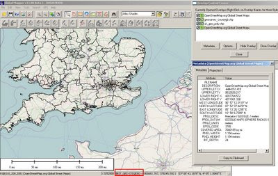
GlobalMapper v11 (Beta1) now with OpenStreetMap

GlobalMapper v11 (Beta1) now with OpenStreetMap

"Global Mapper just got even better."

Global Mapper v11 (beta1) with Open Street Map
Open Street Map as a background layer note: OSM Rasters are projected on the fly to British National Grid in this case.
But very useful now the Digitising Tool is updated and dock-able (also shown)


One of the best and affordable GIS software packages around just got a lot better.

Global Mapper v11 (beta1) now introduces OpenStreetMap as background layer for your map projects, It is also available to capture your own content.

New Features: summarised as the list is way too long

- Added free built-in access to global street-level maps from OpenStreetMap.org via the File->Download Online Imagery menu command.
- Added real-time display of current cursor information (location, distance, elevation) to 3D Path Profile dialog. In addition, you can now also click to define a sub-path on the 3D Path Profile dialog and get information about that sub-path displayed.
- Added support for scaling point symbols, adding custom point symbols from PNG, GIF, and JPG files, and easily creating symbols of custom sizes and colors for common shapes, like dots, squares, etc.
- Added toolbar for Digitizer/Edit Tool to make it easier to perform many commonly used operations.
- Added ability to create new line features by tracing them without clicking at each vertex with the Digitizer/Edit Tool.
- Added ability to rotate and scale features using the Digitizer/Edit Tool.
- Added support for numerous new formats, including Vertical Mapper (MapInfo) Grid, QCT, QED, HTF, SPS, BAG, and many others.

All of the other numerous changes are listed in the What's New document that is displayed during installation.

Prior to the v11.00 release we also plan on adding several other major features, including a map layout tool for more easily creating finished maps, PDF export, DWG export, access to better world-wide imagery, support for combining area features, and support for exporting new multi-band files.

Please visit this forum for the latest new and link to the download
A great way to allow many users to comment on new features and find potential bugs before a full released version
Download Global Mapper 11 (beta1) from here: (Includes
full version for a limited number of days '15th July 2009')
There is also a 64-bit version of Global Mapper for 64-bit versions Windows
http://www.globalmapperforum.com/forums/announcement-news/4301-global-mapper-v11-00-beta-1-now-available.html

GlobalMapper v11 with be officially released v11.00 in approximately 1 month.

Unregistered Versions do work with this software though you will not be able to export data or overlay more than 4 layers of data. But for the price $349 or $129 (upgrade from v10) you get a lot features for your money.

Well done to the GlobalMapper Team always surpassing expectations.

New Related Post:
In addition there is a very good blog post showing you how to make your own customised maps/imagery for bing maps
http://www.soulsolutions.com.au/Blog/tabid/73/EntryId/610/Getting-your-custom-imagery-onto-Bing-Maps-with-Global-Mapper-and-the-Cloud.aspx

Labels: , , , , , ,

12 March 2009

UMapper Routing

UMapper Routing

The video shows all the new and clever functions of the New Routing system implemented by UMapper


"After weeks of development and some rigorous testing, the new *Routing Tool* is available in the UMapper map editor. The new tool makes it easier than ever draw complex, multi-point routes. In a matter of seconds you can map your walk or drive without manually tracing each step. Once a route is created, it can be unlocked for further editing."

One the back-end, UMapper are using the powerful MapQuest routing service which is currently available in the United States, Canada, Australia, New Zealand and most of the Western Europe. More geographies are coming soon.

Also there is a new plugin for wordpress bloggers wanting maps on their blogs
http://wordpress.org/extend/plugins/umapper/

New version includes:
  • New provider added - Yahoo!
  • You can now import your feeds directly into map editor - acceptable formats are KML, GPX, GeoRSS
  • Link Data Feed
  • I18n support - currently work in progress (support for Russian language was added for beta)
  • WordPressMU is truly supported - just enter UMapper Integrator's Key as site admin and all your hosted blogs would be able to interact with UMapper.com - no other keys are required!
  • By popular request: custom map sizes are now available!
  • Ability to delete maps from within plugin w/o visiting UMapper site
  • Rewritten UI, should make map creation much more simple.

Supported map providers:

* Microsoft Virtual Earth
* Google Maps
* OpenStreetMap
* Yahoo!

Labels: , , , , ,

02 December 2008

Nokia Maps 3.0 (beta) - New! +Ovi Maps

Update: WOM World have just sent Mapperz a Nokia Nokia 6210 Navigator for testing the New Maps out.

Will do a honest roundup of the new map application with the next week or so.
[Thanks to WOM World for that surprise and the link]

Nokia Maps 3.0 (beta)
- New!

Nokia Maps 3.0 - New Features
3D Buildings, New Terrain Mode, and Faster... Nokia Maps 3.0 (beta)

Nokia are having a large launch of many mapping apps and plugins:

updates will follow...

Important bit of info:

"Finally some words about compatibility. Right now the Maps 3.0 beta is available only for Nokia devices based on S60 3rd Edition Feature Pack 2, but we haven’t forgotten the FP1 users either. The version for you will follow soon. Also we’ve seen compatibility issues with N96, so we don’t recommend using Maps 3.0 beta with it just yet. In Maps 3.0 beta old Maps 2.0 licenses are supported, so if you have Walk or Drive licenses on your device, they will continue working also after the update."

* What’s new: Enhanced car navigation, Drive*, through lane assistance, speed limit warners, improved sign post design and new ‘Route overview’ mode during navigation,
* Enhanced pedestrian navigation, Walk**, through shortcuts (virtual connections) in urban areas, straight line guidance for off-road terrain and beeps and vibrations before next turn,
* Significantly improved map data quality and content,
* 3D landmarks for over 200 cities – can be displayed in 3D and 2D map modes,
* New Terrain*** map mode,
* Hi-res aerial images for Satellite*** and Hybrid*** map modes,
* Nokia Maps Updater for PC, to update your Maps application and existing map data,
* Synchronisation of Favourites and Collections with MapsBeta on Ovi and vice versa (use in online mode, enable Internet connection).

# Coming soon in Maps 3.0 commercial release: Safety spot warners in selected countries
# Extended country coverage for Traffic info service
# Weather information
# Premium POI content for travel, selected events and cinemas


More info from
http://www.allaboutsymbian.com/news/item/8588_New_Nokia_Maps_plus_personalis.php

# Coming soon in the next Beta release: Route planner for Drive, car navigation, and Walk, pedestrian navigation,
# Traffic information,
# Weather information.

Download available from here

http://www.nokia.com/betalabs/maps/

Nokia maps comes to the Web Browser (plugin required)

Ovi Nokia Maps in IE8 Browser
You can now view Nokia Maps in Full Screen on your PC - The Plugin is available for IE and FireFox. (Shown here in IE8)

Plugin download from
http://maps.ovi.com/services/integrated

Labels: , , , , , , , ,

16 April 2008

Google Earth 4.3 (Beta) Now Available

updated
New Keyboard Shortcuts
http://earth.google.com/intl/en_uk/userguide/v4/ug_keyboard.html
(dependant on language selected)


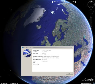
Google Earth 4.3 (Beta) is now available to download

Google_Earth 4.3 beta now available
Google earth 4.3 has new features...

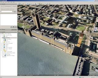
Google Earth 4.3 beta better 3D Buildings
3D buildings look more true 3D and real. (Can now view in daylight/shadows/nighttime)


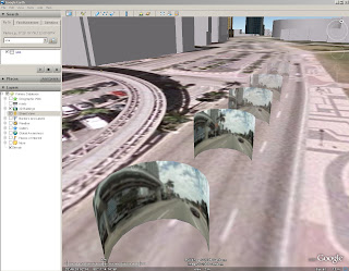
Google Earth StreeView

StreetView in Google Earth (See the 'Layers' >StreetView)
Click on the curved photographs zooms into a 'StreetView' Mode (Like in Google Maps)
See the Video for more details...


Video from the GEarthBlog http://www.gearthblog.com/

New Features

New navigational controls - New features enabling better ways to look around at 3D buildings - takes few seconds to get use to the new navigation but works well.

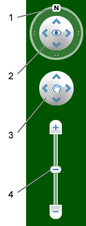
Google Earth navigation controls offer the same type of navigation action that you can achieve with mouse navigation. In addition, you can use the controls to zoom and swoop (perhaps for a perspective on terrain) or to rotate your view. The following diagram shows the controls and explains their functions.
New Navigation Controls

Click the north up button to reset the view so that north is at the top of the screen. Click and drag the ring to rotate your view.
Use the Look joystick to look around from a single vantage point, as if you were turning your head. Click an arrow to look in that direction or continue to press down on the mouse button and drag to change your view.
Use the Move joystick to move your position from one place to another. Click an arrow to move in that direction or continue to press down on the mouse button and drag to move.
Use the zoom slider to zoom in or out (+ to zoom in, - to zoom out). Double-click the icons at the end of the slider to reset the zoom all the way in or out. As you move closer to the ground, Google Earth swoops (tilts) to change your viewing angle to be parallel to the Earth's surface.
You can also use the keyboard to control navigation. See 3D Viewer Navigation in Keyboard Controls for more information.


  • Imagery Dates - You will now be able to easily see the dates when imagery was taken for most imagery (but, not all).

  • More 3D buildings, faster loading - Faster loading the 3D building models.

  • New photo-textured cities.

  • Day/Night Lighting - Real-time sunlight lighting option. Daylight/Time slider control of the sun's shadow position across the globe.

  • New Languages Support - even UK English!

Source:

http://earth.google.com/intl/en_uk/userguide/v4/

Download Google Earth 4.3

Labels: , , , , , ,

25 February 2008

What's New in ArcGIS 9.3?

What's New in ArcGIS 9.3?
ArcGIS 9.3 is expected to be available in the third quarter of 2008.

ArcGIS Desktop
The new Convert Graphics to Features dialog at ArcGIS 9.3
A new Convert Graphics to Features dialog has been added to allow you to create features by drawing graphics without using the editor.
For this function now go here ( Tools for Graphics and Shapes v. 1.1.76).
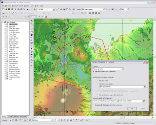

ArcGis 9.3 - Converting graphics to shapes

Pause Labeling
A new button in the Labeling toolbar lets you temporarily pause labeling to increase performance while you assemble the other layers in your map or do analysis. This saves you having to turn labeling off completely.

Manage Bookmarks
Bookmarks are much easier to access. You can also re-order and sort them, and export and load them between different data frames, maps and globes.

"Bookmarks are easier to access with the new Bookmarks pulldown menu. The 9.3 Bookmark Manager dialog lets you reorder bookmarks anyway you want and save bookmarks to a file for loading into other data frames, maps or globes. You can update the extent of an existing bookmark without having to recreate it. You can also save bookmarks into your My Places dialog so you can use the same bookmark in any map or globe you work with."

Data View and Layout Synchronised
Layer legends in the Table of Contents (TOC) and on your map layout automatically use lighter colors for symbols in layers that have transparency applied to them.

Full Table Joins
When you join tables, all of the field properties & field aliases, are now retained which makes working with joins much easier. You can now perform joins between layers or tables with definition queries defined and the definition queries are respected correctly.
There is now a toggle between showing field name aliases and showing the underlying field names. You can also sort a table on multiple attributes.

Full Identify Attributes
Identify window, the dialog will now respect all the field properties, such as primary display field, field aliases and field visibility, of any layer or table in your map that represents that related data in your map. Also when you identify a feature, you can now immediately launch the properties dialog and attribute table of the layer that the feature belongs to directly from the Identify window. This saves you having to look for a specific layer in the Table of Contents and is particularly useful when your map contains a large number of layers.

Address Geocoder and Reverse Geocoder
The new Address Inspector lets you click on a map to get the nearest address to any location
A new reverse geocoding tool called the Address Inspector lets you click on a map to get the nearest address to any location, and you can add that address to the map as a label.

Export & Clip Raster Data
It is now easier to export raster data. A new option within the Export Raster Data dialog in ArcMap lets you clip the output raster to the extent of the selected graphic(s) on your map.

Relative Scale Bar (1 in = 5 miles)
In 9.3 you can customize the scale control so that scales are always reported in relative format.

There is a now way to display map scales throughout the ArcMap user interface in relative format, such as 1 in = 5 mi, in the units of your choice, making scales easier to understand.

Double click Layer File (opens ArcMap)
Layer files are now registered with the ArcGIS Desktop applications. Double-click LYR files in Windows Explorer, Outlook, Windows Desktop to add them into your current map or launch ArcMap if it is not already running.
You can also click on LYR files presented on Web pages to add them into your maps, which provides internet data publishers with a simple way to provide ArcGIS Desktop users with access to their map services.

New Cartographic Tools
WYSIWYG (What You See Is What You Get) editing of cartographic representations has been added. When moving representations on a map, you'll be able to see the symbology instead of the wireframe outline so that you can better see how the edit will impact your map.
The new representation marker dispersal tool reduces the complex one-to-many relationship to a simple dynamic map

New Geoprocessing Tools
have been added to help with cartographic production. Disperse Markers has been added to allow you to spread representation markers apart which are coincident or nearly coincident. The new 'Set Representation Control Points at Intersect tool', you can now add a control point where coincident features share vertices.
New geometric effects
Move, Rotate, Scale, Wave, Tapered Polygon, and Regular Polygon.

*When exporting to XML, there is more information available about cartographic representations & rules.

Enhancements to Geoprocessing.
Within ModelBuilder, variables are more flexible in models and the 'Feature Record Set' and 'Record Set Controls' have been improved. More control over your geoprocessing model's parameters such as if a parameter is optional or required and what variable values are acceptable as inputs.

Script tools can now have multi-value outputs. The Results Window now shows environment settings. The Python scripting experience has also been improved. Python can now be run within an ArcGIS process.

**Error messaging has been revamped to make errors more descriptive and better linked to the help system. Messages are now standardized across all products, including ArcGIS Desktop extensions. These new, more informative messages will make it easier to build scripts and models.

Tool progress
messaging has also been improved and now more accurately displays actual progress. Not only will you be able to see how long an operation will take, but you'll know if the operation is proceeding as planned and not in some unknown state.

The 'Near' tool has been made more flexible and will now work with more than points and lines. It will perform calculations to all features within a given search radius. The ability to join to the closest feature has been added to the Spatial Join tool, making it easier to merge attributes.

New Spatial Statistics Tools

A new 'Generate Spatial Weights' tool in 9.3 gives you a new way to model spatial relationships. Its use results in a spatial weights file that is re-usable, editable, and sharable. A new 'Ordinary Least Squares Regression' (OLS) tool help you decide if your data is suitable for analysis using a global model that is the most commonly used regression statistic. The new 'Geographically Weighted Regression' (GWR) tool uses a local model for regional variations and helps you understand how processes vary of space.

ArcGIS Server
  • Improved performance
  • On-demand caching and improved caching geoprocessing tools will allow you to create faster mapping services.
  • New image services will let you quickly publish imagery that is optimized for the Web.
  • Better diagnostics
  • Precise logs will enable you to easily identify bottlenecks and points of failure and improve your installation and configuration experience.
  • New options in Manager will make it easier for you to secure Web services and Web applications
More documentation
Major additions have been made to the online help and SDK documentation.

A new ArcGIS Server Resource Center brings together the set of online resources to help make you successful including blogs, samples, and best practices information.

Mapping API
ArcGIS Server 9.3 also introduces several important new features:
New REST and JavaScript APIs
These APIs will dramatically simplify your development experience and enable you to deliver fast and user-friendly mashup GIS Web applications.

***The JavaScript libraries will also let you embed ArcGIS Server maps, geocoding, and geoprocessing services into Google Maps API and Microsoft Virtual Earth API.

OGC and industry standards
New Open Geospatial Consortium (OGC) services support
Additional support for OGC and industry standards, such as Web Coverage Service (WCS), Transactional Web Feature Service (WFS-T), and KML 2.1, will improve your ability to integrate with virtually all the commonly accepted GIS and IT standards.
New PostgreSQL support - thank you ESRI! :)
(This gives you the ability to store and manage spatial information in this open source database system without ArcSDE.)

"The 9.3 release of ArcGIS Server represents a complete and integrated server-based GIS with significant quality enhancements and several new features that will make it even easier for you to create and manage end-user applications and services for spatial data management, visualization, and spatial analysis."

The Geodatabase
The geodatabase continues to be the common data storage and management framework for ArcGIS. At ArcGIS 9.3, the geodatabase offers improved spatial data management and enhanced capabilities for integration with enterprise systems.

ArcGIS 9.3 geodatabase enhancements include:
  • Raster data management. New geoprocessing tools make the transfer of unmanaged raster catalogs (in Microsoft Access personal geodatabases and file geodatabases) from one location to another much easier
  • Geodatabase replication. Microsoft Access personal geodatabases and file geodatabases can participate in one-way replication as child geodatabases
  • ArcGIS 9.3 allows for more detailed logging of geodatabase replication activity.
Direct Connect backward compatibility (clients will be happy)
ArcGIS 9.3 clients can make direct connections to pre-9.3 enterprise geodatabases (e.g., 9.2, 9.1, and 9.0).
Backward compatibility allows easier implementation of phased migration strategies for new ArcGIS releases.

Versioned editing
The Merge Geometries option enhances conflict and reconcile management.The Version Changes Viewer tool allows a version to be compared with an ancestor version without performing a reconcile operation.

Support for PostgreSQL (Open Source DBMS)
Enterprise geodatabases can be implemented on PostgreSQL with full support of the geodatabase data model.Vector geometry is stored in the ESRI spatial type.
PostGIS Open Source spatial type is supported.

Support for SQL Server 2008

The SQL Server 2008 release will introduce two spatial types: Geography and Geometry. These will be supported in enterprise geodatabases implemented on SQL Server 2008.

Operating System
New 64-bit platform support
Enterprise ArcSDE technology is now available as a native 64-bit application for Windows and Linux.

Source: ESRI (Mapperz edited for this post)

Labels: , , , , , ,

11 February 2008

Nokia Maps 2.0 Beta (pre-release)

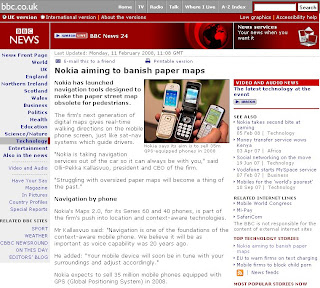
Two blogs in one.... "Nokia aiming to banish paper maps" & Nokia Maps 2.0 Beta (pre-release)

BBC News Nokia Maps
BBC News Technology

"Nokia expects to sell 35 million mobile phones equipped with GPS (Global Positioning System) in 2008"

Nokia Maps 2.0 Beta (pre-release)

What is new?
  • Pedestrian mode
  • Enhanced driving navigation mode
  • Satellite maps
  • Hybrid (satellite and important map features overlayed)
  • Vastly improved search
  • New real time traffic information

Official Release here
Nokia Beta Labs - Nokia Maps 2.0 Beta
http://www.nokia.com/betalabs/maps


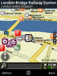
Screenshot of Nokia Maps 2.0
Nokia has launched Nokia Maps 2.0 - Allaboutsymbian
Image source: Allaboutsymbian

Beta means Beta! here are the known issues:

" We recommend you do not purchase or use Traffic info yet with this Beta release."

"New map data also still in beta and, for example, Taiwan, Hong Kong and Macau are not drawn correctly"

"N95 users, please make sure you have the latest firmware (v20.0.015)"

"The help texts have not yet been updated from previous Maps version"

"Localization is not completed in all languages so some menu items might still be in English"

"Please note that extra services like Drive and Walk navigation and City guides require" purchase."

Allaboutsymbian as ever releases some great screenshots and first impressions on the application.


Questions...
Navigation is now SIM locked not to the device.
If you have purchased a license (for example, for navigation) in Nokia Maps 2.0 Beta, you can transfer it freely from one device to another as long as you keep using the same SIM card.

In case you change your SIM card, you can regain your navigation license in the Nokia Maps application for the remaining time period of your navigation license.
(but you require your old SIM card to put in the licence onto the new one very the device)

Changed device and SIM card?
First, use your old SIM card (the one you used when purchasing the license in Nokia Maps) and insert it into your new device. You can now transfer your license by connecting to the license server. Go to
Options > Extras > Drive & Walk. Choose the region for which you purchased the navigation license
and go to Options > Update.

Well it better than using the IMEI code which means if the device is sold or given away you cannot move navigation license.

Look out for a review on this from here in a few weeks

Mapperz sources:

http://www.nokia.com/betalabs/maps

http://www.allaboutsymbian.com/news/item/6704_Nokia_Maps_20_hits_beta.php

http://news.bbc.co.uk/1/hi/technology/7230686.stm

and keep an eye on
http://www.womworld.com/nseries/
for more blog posts in the coming hours

Labels: , , , , , , , ,

02 February 2008

BBC Correspondents Map (v4.0)

update: 02/02/2008
The BBC Correspondents Map gets an Official blog post from Google Lat/Long
http://google-latlong.blogspot.com/2008/02/
all-news-thats-fit-to-map.html

1 February 2008 [v4.0]

  • Moved up to new version - with shiny new photos and RSS links to the latest three articles on the BBC News website. Enjoy!

31 January 2008 [v3.2]

  • Fixed layout bug in Firefox - thanks to it being entirely developed on BBC computers (and therefore in non-compliant Internet Explorer 6), it didn't display in browsers which are standards-compliant. This issue has now been fixed.
  • Design change to move the black bar to the top of the page instead of the bottom.

30 January 2008 [v3.1]

  • Fixed bug where correspondents based in bureaux were not displayed in the list.

30 January 2008 [v3.0]

  • Changed info bubbles to tabs - one for each correspondent - in preparation for future features.
  • Added links to BBC News search in order to find stories from the city, country and correspondent.


update: 31/01/2008
The BBC has taken a liking to this site:

http://www.bbc.co.uk/blogs/technology/2008/01/
bbc_reporters_mashed.html

"For more great news and maps mash-ups, take a look at this blog."
blog post by Darren Waters

Mapperz hopes that the BBC takes this on, as Geo-Spatial content is and will be a powerful media representation for BBC News.
maybe add latitude and longitude to RSS feed to get GeoRSS - http://www.georss.org
google already support this functionality
http://googlemapsapi.blogspot.com/2007/03/
kml-and-georss-support-added-to-google.html

"News has location and can be mapped." Mapperz


BBC Correspondents Map (v2.5)

BBC Correspondents Map v2.5
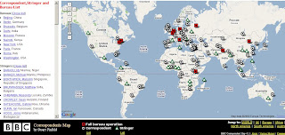
Version 2.5 of the BBC Correspondents sees new features based on user comments & feedback

A Great Mashup a few days old and moves on at a great pace...

Todays changes:

  • A distinction between correspondents and stringers, as requested by users

  • A full list of correspondents, stringers and bureaux, for users who have a name but not a location

  • 4 RSS feeds for others to mash up

  • Still to come: - More info on each correspondents- Links to correspondents' work on the BBC News Website from their location bubble

  • More as I (Stuart) thinks of features

Version History:
29 January 2008 [v2.5]
Added a full, clickable list of correspondents, stringers and bureaux.
Introduced 4 RSS feeds which makes use of all the data.
Added an information link to explain more about the map.
Added this version history!
27 January 2008 [v2.0]
Added a comments link for feedback.
Added stringer distinction following feedback on the comments.
Databased the correspondent data up, to make it easier to update and in preparation for future features.
Slight redesign of the bottom bar to accommodate new feature links.
22 January 2008 [v1.2]
Added plenty of new correspondents to the map.
21 January 2008 [v1.1]
Added key to the map and the 'Jump to' section to go straight to a specific region of the world.
20 January 2008 [v1.0]
Map launched.


The Mapper - Stuart Pinfold, Media Co-ordinator, Newsgathering Traffic.

"works in the department (unique to the BBC) which intakes calls from every BBC correspondent and either records their despatches for use across all radio and TV outlets (including the World Service) or connects them to the TV or radio studio for live two-way interviews with the anchor."

The Map Link:
http://www.stuart-pinfold.co.uk/bits/corrmap/
(and look out for new features, see 'Version History')

other useful links:
http://googlemapsmania.blogspot.com/2008/01/google-maps-mania-links-for-2008-01-27.html

Labels: , , , , ,

20 December 2007

Yahoo Maps Re-route Directions

Yahoo Maps have made a change to the directions function. You can now re-route by dragging the original route (similar to google maps directions).

Yahoo Maps Drag and Drop Routes - before

Yahoo Maps Drag and Drop Routes - after
Try it at
http://maps.yahoo.co.uk/ (UK Centred)
or
http://maps.yahoo.com/ (US Centered)

Labels: , , , ,

05 December 2007

Yell Maps - New Features

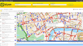
Yell Maps - New Features

Yell Maps - New Features

MultiMap Based Mapping
Microsoft Virtual Earth Birds Eye View Mode
Points of Interest (POI)
  • Car parks
  • Cash dispensers
  • WiFi Access
  • Railway stations
  • Speed Cameras
  • Blue Badge parking
  • Motorbike parking
  • Public toilets
  • Tube stations
  • Bus stops (Includes Bus Routes for that location)
  • Traffic news
  • Bicycle parking
  • Taxi ranks
  • River taxis
Note: POI Features are available in the Birds Eye View - Helps visually to users and builds a mental picture for when they get there.

Yell New Maps Birdseye with POI Overlayed

Yell New Maps Birdseye POI East Oblique View

Where to find these maps
http://www.yell.com/ucs/HomePageAction.do
and search with the 'Show on Map' ticked.

Think this is the first type of cross Mapping as using Multimap for the base mapping - but then Microsoft Virtual Earth is being used in the Birds Eye View.

Yell have done a good update and this will be the best mapping they have had on there website.
Prediction - 2008 Hybird Mapping API. Though check Terms and Conditions on using different mapping applications together, some prohibit use with 'competitors' mapping solutions.
i.e. Yahoo Geocoder is only allowed to be used with Yahoo Maps.

Labels: , , , , , ,

20 November 2007

Google Reverse Geocoder Update

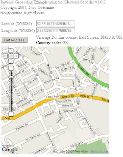
Google Reverse Geocoder Update New! v1.0.2

Reverse Geocoding is the inverse relationship where each geographical coordinate is mapped to the nearest known address. Currently this feature is not directly supported by the Google Map API. But can be done by Nico's Reverse Geocoder for Google Maps API using Google's Directions functionality.

Based on the Original Post by Mapperz


Nico has been keen to add some more useful functionality to the Reverse Geocoder.

Reverse Geocoding Updated - New v1.0.2

Pan and Zoom click your location and the address and country code is shown.

What is New?
  • all supported countries
  • house number support (experimental)
Test Country support here
http://nicogoeminne.googlepages.com/full2.html

Available Counties:

CountryGClientGeocoderGDirectionsGReverseGeocoder
Austria x x p
Australia x x p
Belgium x x x
Brazil x x x
Canada x x p
The Czech Republic x x p
Denmark x x p
Finland x x p
France x x x
Germany x x x
Hong Kong x n n
Hungary x x p
India x n n
Ireland x x p
Italy x x x
Japan x n n
Luxembourg x x x
The Netherlands x x x
New Zealand x x x
Norway x x p
Poland x x p
Portugal x x p
Singapore x x p
Spain x x p
Sweden x x p
Switzerland x x p
Taiwan x n n
Thailand x x p
United Kingdom x x x
United States x x x

(x=available, n=not available, p=probably available but not tested)

Experimental House Number Support

Since v1.0.2. Once the Reverse geocoder is set up experimental house number support is enabled by calling the setExperimentalHouseNumber method as shown in the example.

reversegeocoder.setExperimentalHouseNumber(true);

Important note:
THIS FEATURE IS EXPERIMENTAL AND USES MULTIPLE
GClientGeocoder AND GDirections
REQUESTS WHICH COULD EXCESS THE GOOGLE REQUEST LIMITS.
That's exactly why it is disabled (uncommented) in the full example.
Use it on own risk.

Labels: , , , , , , , ,

17 October 2007

Microsoft Virtual Earth Version 6 - Released

Microsoft Virtual Earth Version 6 - Released

What is it?
"Virtual Earth provides the power behind Live Search Maps, an online mapping service that enables users to search, discover, explore, plan, and share information about specific locations. By using traditional road maps, labeled aerial photo views, low-angle high-resolution aerial photos, and proximity searching capabilities, Virtual Earth provides unique opportunities for developers to incorporate both location and local search features into their Web applications."


(Finally the video uploads! - from Space to the Grand Canyon)
This is a Powerful 3D Engine - You can use it like 'Google Earth' but this is in a web browser (Firefox here with the 3D plugin already installed)

Whats is New? (lots)

Version 6.0 of the map control includes improvements in the following areas:
  • Enhanced accuracy
  • Additional functionality
  • Enhanced performance (it is a lot smoother
  • Enhanced Geocoding. Integrates multiple geocoders and datasets.
  • Rooftop Geocoding. Rooftop locations are the most precise geocoding.
  • Consistent Pushpin Accuracy. When switching between aerial and Birdseye views.
  • Multi-point Routing. A new method takes multiple points for a route
  • Switching from Miles/Kilometers available
  • Bulk Addition of Shapes. A new method to add multiple pushpins in one call.
  • Improved Shape Control. You can now specify how a shape object appears relative to other shapes or tile objects, providing greater control in viewing data and objects.
  • MapCruncher (Beta). MapCruncher Beta for Microsoft Virtual Earth makes it easy to publish maps overlaid in an application using the Virtual Earth map control. See the MapCruncher Web page for further information.
  • 3D Altitude Settings. Altitudes for three-dimensional objects can now be specified in meters.

There have been significant speed and accuracy improvements for pushpins and shapes in high numbers. Performance enhancements also include faster map panning.


MapCruncher Beta for Microsoft Virtual Earth makes it easy to publish maps overlaid in an application using the Virtual Earth map control. Once you are familiar with the tool, it will take you about ten minutes to generate a new tile layer. Just find 5 to 10 corresponding landmarks on your map and on the Virtual Earth map view, and MapCruncher will register your map to the global coordinate system, warp it to fit a Mercator projection, and generate a set of image tiles that can be seamlessly layered on top of Virtual Earth map control's standard road, hybrid, or aerial imagery. It even makes a sample HTML page for reference. MapCruncher accepts a variety of vector formats (PDF, WMF, EMF) and raster formats (JPG, PNG, TIFF, GIF, BMP). Where to get more information?
Start here http://dev.live.com/virtualearth/sdk/ test the functions out.
http://blogs.msdn.com/virtualearth/


Download the SDK Version from http://msdn2.microsoft.com/en-us/library/bb429619.aspx

More Blogs detailing the features
http://blogs.msdn.com/keithkin/archive/2007/10/17/virtual-earth-v6
-api-now-available.aspx

upgrading from version 5?
http://www.nateirwin.net/VirtualEarthMapControlV6Released.aspx


Labels: , , , , ,

22 August 2007

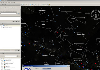
Google Sky Earth (inside Google Earth) New!

Update: As expected Ogle Earth does an excellent introduction to 'Google Earth 4.2'

One pointer that users should be aware is that it now supports KML 2.2 (beta)
http://code.google.com/apis/kml/documentation/kml_tags_beta1.html

now includes:
  • ExtendedData (replacement for metadata)
  • Atom feeds
  • AbstractView
  • ResourceMap
  • PhotoOverlay
  • Google Earth release 4.2, video is supported!
Official post on this http://google-latlong.blogspot.com/2007/08/sky-final-frontier.html

Google Sky is an addition to Google Earth New!

Google Sky Earth

You will need to download the newest version of Google Earth to use it.
version 4.2.0180.1134

http://earth.google.com/download-earth.html

More info
http://news.bbc.co.uk/1/hi/technology/6955787.stm

Works well so far - but only had 10 minutes...

Google Sky Button
The Google Sky button is here on the new version.

Labels: , , , , , ,

16 June 2007

New Faster Maploader - Nokia

New Faster Maploader - Nokia

New Maploader v1.1

Faster MapLoader 1.1 downloading map data has improved vastly :)

New Maploader Voices

Now comes with voice commands in 24 Languages.
English (UK) has 0.2mb more the English(USA).

Nokia Maploader v1.1 New Data UK

Checked UK differences in Data from the last upload.

England has more data was 90.3mb now 95.8mb (6% increase in detailed coverage)
Northern Ireland has more data was 6.6mb now 6.7mb (1.5%)
Wales has much more data was 12.7mb now 16.7mb (24% increase)
Scotland 18.4mb now 19.4 (6% increase)

New Maploader Speed is much better
England at 95.8mb was downloaded in less that 8 minutes, the software then transfers to the memory card and verifies the map data has been completed successfully.
Voice for English [UK] took 45 seconds to download and a minute to transfer and verify.

Smart2Go update coming very soon.
More on this over at
http://www.allaboutsymbian.com/

Tips- 1. BACKUP YOUR PHONE - VERY IMPORTANT! - Use Nokia PC Suite Backup to your PC and the backup function on your phone - backup phone to memory card.

2. FLASH YOUR FIRMWARE, v11.0.026..... is the latest *#0000# will show your version on screen on your phone.

Go get Maploader v1.1
and enjoy free digital maps on your phone.

Mapperz

Free Maps, Nokia,N-series,N95, Maploader,

Labels: , , , , , , ,

04 April 2007

New Version of Live Maps Launches

A new version of Live Maps Launches (Live Local, Virtual Earth, Microsoft)

Firefox 3D Live Maps Microsoft Officially Supported
In Summary
  • Firefox support (officially supported) for 3D mapping (hooray)
  • Ratings and Reviews of Business Listings and Details page enhancements (USA Only)
  • Subscribe to a Collection via RSS.
  • Area Calculations and Drawing Enhancements
  • Traffic and Driving Directions Enhancements
  • Address-Only Geocoding
  • Live Search Maps for Outlook is Updated
  • Twitter 3D map in Virtual Earth (see link)

In detail here

Labels: , , , , ,

14 February 2007

MultiMap API Updated - Includes UK Geocoding

MultiMap have updated their API (v1.2)
Lots of new features:
New Searching methods:

UK Geocoding
Multimap UK Geocoding Addresses
Source: Multimap

* Basic Example (Multiple Locations)
* Spatial Search Example
* Non-spatial Search (Filtering) Example
* Searching by Travel Distance or Duration (mapperz recommended)Multimap Routing Walking Duration
Source: Multimap
* Pagination
* Tailoring Search Results
* Compound Search Example
* Performing a Search with a Pre-search
* Combining Features of the Multimap API Searching Module (mapperz recommended)
* Basic Example
* Tailoring Route Outputs mapperz recommended
* Combining Features of the Multimap API Routing Module
* Routing - Searching along Route (mapperz recommended)Multimap Searching Along A Route
Source: Multimap
* Local Information Widget

Mapperz

Labels: , , , , , , , ,