->

24 July 2009

Where's Gary? Walkers Map Game Quiz

Where's Gary? Walkers Map Game Quiz

"The aim of the Game is to find Gary and give him a right clicking!"

He’s hiding somewhere in the Multimap map, and all you’ve got to do is find him.
Type in your answer to the question, click go and see if you have found Gary.
If you get stuck just click on the hints below and you’ll jump closer to his location.

When you find Gary, just click on him and then Gary will move to a new location,
where you’ll be able to look for him again.

Where is Gary Linker Map Quiz Game
Walkers Crisps and Multimap have join together to create a fun game.

Find Gary three times in a day and you can claim one ‘Gary’s Great Trips’ point.
You can boost your points total playing ‘Where’s Gary’
by one point each day.

If you’ve already claimed today’s point you can still continue to practice your Gary
hunting skills for tomorrow!

Try Finding Gary Lineker
http://explore.multimap.com/Walkers/quiz.html

or
http://www.walkers-crisps.co.uk/garysgreattrips/video/wheregary.html

Who is Gary Lineker?
http://en.wikipedia.org/wiki/Gary_Lineker
(was a good football player now a sports presenter/pundit for BBC Sport)

Promotion is by Walkers Snacks Limited

Labels: , , , , , , ,

28 January 2009

Internet Explorer 8 (RC1) - Accelerator Mapping

Internet Explorer 8 (RC1) - Accelerator Mapping


Internet Explorer 8 RC1 Accelerators Mapping

As you would expect IE8 (RC1) renders Live Search Maps very fast (faster than the IE8 beta versions).

Google Maps in Internet Explorer 8 RC1
So this new browser finally displays Google Maps correctly and with the Release Candidate 1 version. Users of Google Earth 'Earth' Mode (tested with the lastest version of the API here http://mapperz.googlepages.com/LargeMapControl3D_GE.html (click earth) will notice the biggest performance difference - it's much better at rendering the globe at high and low altitudes.

Multimap in Internet Explorer 8 RC1
Multimap does a good job in IE8 (RC1) - panning is smoother tiles are loading faster.

**based on Mapperz 'user experience' only.

on you can add in 'Accelerator' Add-ons
http://www.ieaddons.com/en/mapping/

These 'mapping tools' can help speed up access to Mapping via highlighting a place name, address (including zip or postcode) in Internet Explorer 8 (RC1).

Un-answered questions...
Will FireFox 3.2 be able to compete?
So what will the rumoured Google 'Ocean' be like?
Will Multimap be the better Mapping Portal even after Google Street View launches for the UK?

Old Related Post with Internet Explorer 8 (beta)
http://mapperz.blogspot.com/2008/03/internet-explorer-8-beta-mapping.html

Labels: , , , , , , , ,

05 December 2007

Yell Maps - New Features

Yell Maps - New Features

Yell Maps - New Features

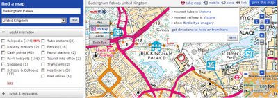
MultiMap Based Mapping
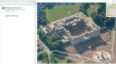
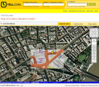
Microsoft Virtual Earth Birds Eye View Mode
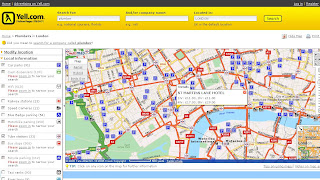
Points of Interest (POI)
  • Car parks
  • Cash dispensers
  • WiFi Access
  • Railway stations
  • Speed Cameras
  • Blue Badge parking
  • Motorbike parking
  • Public toilets
  • Tube stations
  • Bus stops (Includes Bus Routes for that location)
  • Traffic news
  • Bicycle parking
  • Taxi ranks
  • River taxis
Note: POI Features are available in the Birds Eye View - Helps visually to users and builds a mental picture for when they get there.

Yell New Maps Birdseye with POI Overlayed

Yell New Maps Birdseye POI East Oblique View

Where to find these maps
http://www.yell.com/ucs/HomePageAction.do
and search with the 'Show on Map' ticked.

Think this is the first type of cross Mapping as using Multimap for the base mapping - but then Microsoft Virtual Earth is being used in the Birds Eye View.

Yell have done a good update and this will be the best mapping they have had on there website.
Prediction - 2008 Hybird Mapping API. Though check Terms and Conditions on using different mapping applications together, some prohibit use with 'competitors' mapping solutions.
i.e. Yahoo Geocoder is only allowed to be used with Yahoo Maps.

Labels: , , , , , ,

25 September 2007

MultiMap Open API + Ordnance Survey Data

MultiMap Open API + Ordnance Survey Data

Ordnance Survey 1:50,000 Data is now accessible to API developers

is it true?

You can Zoom in and Pan.

A bigger version is available here
http://mapperz.googlepages.com/Multimap_Sample_OS50k_bigger.html

"At Multimap we’re [they are] very proud of the wide range of local and global mapping data available on our website and through our API, and are committed to providing as much of this data via the Open API as we [they] can. To that end, we’re very pleased to announce the availability of Ordnance Survey Landranger maps (at 1:50000 scale across zoom levels 13, 14 and 15) through the Open API.

The Landranger data covers England, Scotland and Wales and provides a wealth of topographic features, such as contour lines, tourist attractions and historic features such as Roman roads. These maps are great for walkers, cyclists, or for providing detailed maps of rural areas. We can’t wait to see how people make use of them through the Open API."


http://blog.multimap.com/


A good but probably expensive (regards to licensing) move by Multimap.

Mapperz

Labels: , , , ,

29 May 2007

192.com Mapping - High Resolution Images

192.com Mapping - High Resolution Images

192.com St_Paul's Cathedral Hi Res

More Mapping Competition from 192.com - with transitional action from the cartographic map to aerial imagery a nice implementation.

The main advantage with this is that the aerial imagery is constant across the UK.
Google Maps, Microsoft Live Local, Multimap mapping has patchy areas that are poor resolution in places.

On par with Micosoft Live Local resolutions however the tiles appear faster in 192.com with the added transitional effect makes the user aware of the fact that data is loading.
Data source is cities revealed and overview mapping.

Mapperz back in the UK

more information on this at Guardian Unlimited: Technology

Labels: , , , ,

20 April 2007

Multimap - Rolls Out API Services to Businesses

Multimap API - Rolls Out new services to businesses

How do you improve a mapping service?
(with over 10 million unique users 190 million page impressions a month)

The API was reported back in February 2007. By Mapperz
http://mapperz.blogspot.com/2007/02/multimap-api-updated

-includes-uk.html

With a few updates and lots of testing of the service, multi-map launch this service.

API Chart

The Multimap API v.1.2 is routing, mapping, geocoding, using POI data and imagery into a single one-stop mapping service.

Multimap Map Widget
One new change - the Map Widget can show how the API can show points of interest of various kinds around a location on a map.
more on this

Summary (there is quiet a bit)

• Mapping - draggable maps with ‘fast fill’ smooth zooming; suite of widgets (including location breadcrumbs, overview map, map tools, zoom slider); custom menus, map interactions and events; custom markers with automatic ‘de-clutter’, tabbed info boxes, dynamic text and icons; and choice of map types (map, aerial imagery*, hybrid*) and styles (local*, global) – (* where available).

• Searching - choice of search modes, including search by radius, location ID, bounding box, donut and driving distance, search along route and non-spatial search; custom result ordering, pagination and display; fuzzy searching (including starts with, ends with, contains, sounds like); and plug-and-play POI data.

• Routing - point-to-point, multiple via points and ‘travelling salesman’ optimization; multi-language directions; multi-modal routing (e.g., drive to here, then walk to here) and avoid specific road types; choice of outputs (text, highlight, ‘expense claim’, summary); enabled for route animation.

• Geocoding - single point of access to Multimap’s full, best-in-class geocoding capability; high-accuracy, high-performance geocoding; and Javascript and HTTP access.

• Local Information - Points of Interest (POI) can be easily displayed on maps, and routed to and from. Multimap provides access to a large range of POI, including schools, transportation, restaurants and bars, ATMs, car parks and more.

“We are proud to offer the latest version of our API service to the industry. Ease and speed of implementation are key considerations driving many businesses to embrace the new service, with the ability to be up and running with a highly interactive, signature site in a matter of hours."
Sean Phelan, founder of Multimap

Source of Press Release: Directions Magazine

Labels: , , , , , ,

14 February 2007

MultiMap API Updated - Includes UK Geocoding

MultiMap have updated their API (v1.2)
Lots of new features:
New Searching methods:

UK Geocoding
Multimap UK Geocoding Addresses
Source: Multimap

* Basic Example (Multiple Locations)
* Spatial Search Example
* Non-spatial Search (Filtering) Example
* Searching by Travel Distance or Duration (mapperz recommended)Multimap Routing Walking Duration
Source: Multimap
* Pagination
* Tailoring Search Results
* Compound Search Example
* Performing a Search with a Pre-search
* Combining Features of the Multimap API Searching Module (mapperz recommended)
* Basic Example
* Tailoring Route Outputs mapperz recommended
* Combining Features of the Multimap API Routing Module
* Routing - Searching along Route (mapperz recommended)Multimap Searching Along A Route
Source: Multimap
* Local Information Widget

Mapperz

Labels: , , , , , , , ,

04 December 2006

New Yell.com Maps

New Yell MapsNew Yell Maps Hybrid Mode
Yell have released new mapping for their search. Using Multimap and AJAX (smooth panning without refreshing). Looks much better and easier to use than the old clunky html mapping.
Asynchronous JavaScript (AJAX) seems to becoming the default for web mapping applications.


Here is the link you can see for yourself.


update: a good blog post here

Labels: , , , ,