Tiger Data 2008 Released
Tiger Data 2008 Released
update 20/01/2009
A new potentially good source is for Road Linework [editable in a GIS]
is the National Transportation Atlas Database
http://www.bts.gov/publications/national_transportation_atlas_database/2008/
Now Available in ESRI Shapefile format

(Topologically Integrated Geographic Encoding and Referencing system)
The US Census Bureau has recently released the Tiger 2008 data to the public to download and use freely.
Shapefiles (most GIS Software can view them)
http://www2.census.gov/cgi-bin/shapefiles/national-files
Don't have a GIS?
A free Open Source GIS is Quantum GIS
Technical details are available
http://www.census.gov/geo/www/tiger/tgrshp2008/TGRSHP08.pdf
FTP available
ftp://ftp2.census.gov/geo/tiger/TIGER2008/
This updates the earlier post (April 2008)
http://mapperz.blogspot.com/2008/04/tiger-2007-data-release-esri-shapefile.html
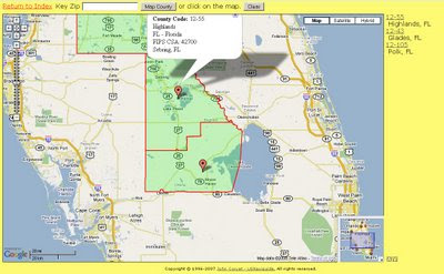
The one thing the US Census website lacks is a geographical way of selecting the data.

Maps Huge helps users find neighbouring (neighboring) counties
Need to know an area in a visual way?
try
http://maps.huge.info/county.htm
or
http://maps.forum.nu/gm_main.html


0 Comments:
Post a Comment
<< Home