->

09 February 2010

New Street View Coverage for Norway & Finland

New Street View Coverage for Norway & Finland

update:
Canada has large coverage updates too
Canada Streetview Expands
New Canadian Coverage (substantial)
Yukon (Whitehorse)
Northewest Terroritories (YellowKnife)
Alberta (example Grande Prairie)
Bristish Columbia (example Prince George) (also includes Snow Mobile Streetview)
Saskatchewan (Example Prince Albert)
Manitoba (Lake Winniepeg)
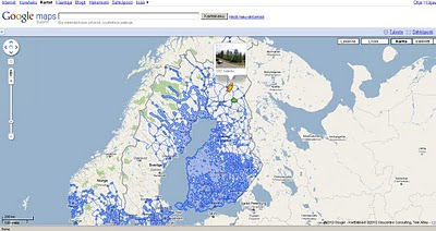
Google Maps Street view Finland
New Suomi (Finland) Street View Coverage

View the New Coverage
and drag the yellow pegman, drop on anywhere that is blue.


Google Maps Street view Norway

Norge (Norwegian) Street View Coverage

View the Norge Streetview


Also available on the Desktop via Google Earth see
http://www.gearthblog.com/blog/archives/2010/02/streetview_added_to_norway_and_finl.html

Source:
http://googlemapsmania.blogspot.com/2010/02/street-view-arrives-in-norway-finland.html

Labels: , , , , , , , ,

15 January 2009

Embed Google KML/KMZ On Your Webpage or Blog

Embed Google KML/KMZ On Your Webpage or Blog

update 20/01/2009
Thematic Mapping Blog has a good example with an extruding polygons based on world mortality.
http://blog.thematicmapping.org/2009/01/thematic-mapping-with-google-earth.html


* Earth Plugin Required
**Wait a few seconds for the Canada Provinces KMZ file to load

KMZ
source:
http://mapperz.kml.googlepages.com/Canada_Provinces.kmz
(3mb compressed KML file)

Source:
http://googlegeodevelopers.blogspot.com/2009/01/recent-kml-and-earth-developments.html

Labels: , , , , , ,

11 August 2008

Where is the Path? - 3D

Where is the Path? - 3D

A recent update which includes the option of 'Earth' (Google Earth inside the web browser)


Allows the user to create a route of their choice and view it in 3D - attribution of the points is available.
Export to GPX for input into a GPS device.
*Earth plugin must be installed to view the content.
In the drop down list select OS+Earth

There is a limit on the number of Ordnance Survey tiles per a 24 hour period (30,000 tiles) - keep an eye on the percentage bar in the bottom left corner.
OS please raise this limit to 50k or higher.

http://wheresthepath.googlepages.com/wheresthepath.htm

Full credit goes to Bill Chadwick for producing this nifty side-by-side mapping application.

Labels: , , , , , ,

29 August 2007

Flash Earth inside Google Earth

Flash Earth inside Google Earth

The amazing Flash Earth is a great application on itself.

Now combined it with the Desktop Google Earth (4.2)

and it becomes a very useful and powerful resource for users to compare areas where imagery and digital coverage is 'blurred'.

Layers available in Flash Earth are
  • Google Maps
  • Microsoft Virtual Earth (VE) Aerial
  • Microsoft Virtual Earth (VE) Labels
  • Yahoo Maps
  • Ask Maps
  • Ask Aerial
  • Open Layers
  • NASA Terra (Daily)
*NASA shows the smoke from the fires that have swept across Greece (BBC News Link)

Flash Earth inside Google Earth

Even Google Earth Rotation is maintained when the Flash Earth is activated inside Google Earth.

"What if the current view in Google Earth was quickly viewable in other maps, such as those made accessible by FlashEarth? Well, now it is. As you move around the globe a little white arrow follows you around, simple click it to get an approximation of the current view in FlashEarth in a popup balloon."


Total credit to Valery35, for the concept (including a screenshot) on the Google Earth Community and to all the people made all the bits that could be pieced together in this 15min hack.

Google/Flash Earth Network Link by Barry Hunter Nearby.co.uk

The Original Flash Earth http://www.flashearth.com/


Labels: , , , ,

29 November 2006

Google Earth vs ArcGIS Explorer

Google Earth vs ArcGIS Explorer which is better?

Google Earth Wins

Well this was one of the quickest tests mapperz has ever done.

Google Earth Wins! by a mile.

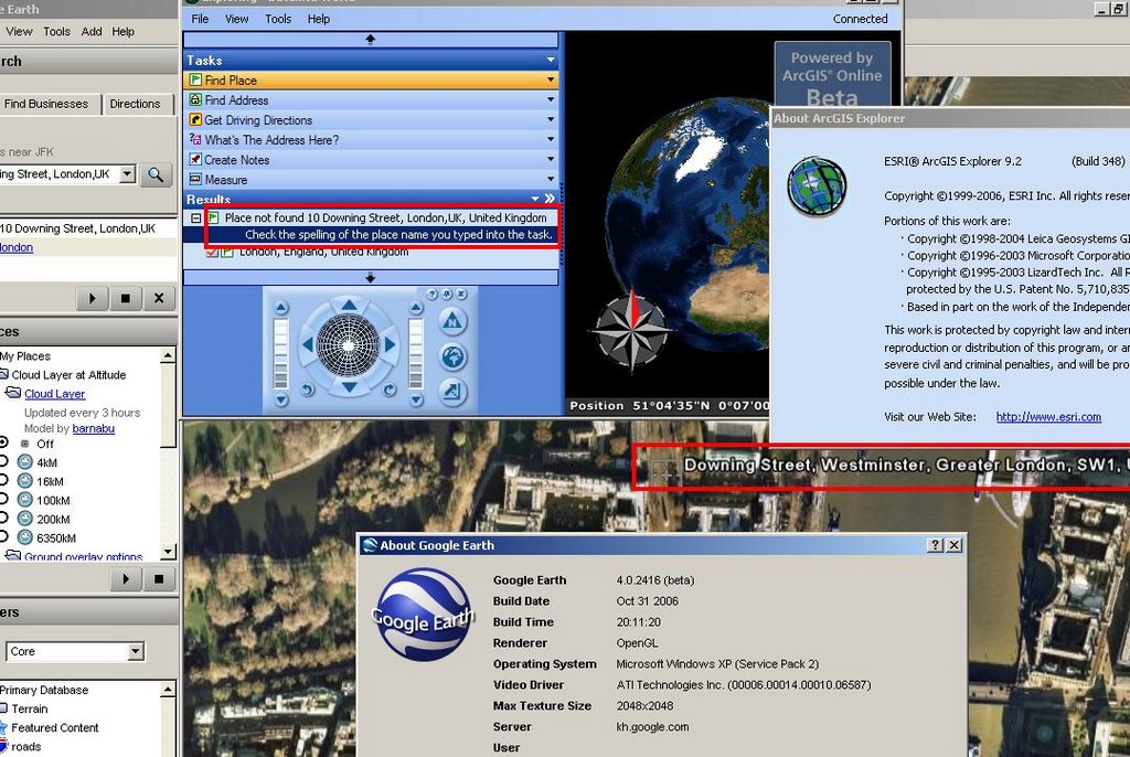
The simplest of tasks - search for '10 Downing Street, London, UK'

Google Earth - 3 seconds to rotate the earth and zoom right into Downing Street and display the aerial photographs at full resolution.

ArcGIS Explorer - Place not Found, Please check your spelling....
(login needed)

ESRI can we please have ArcGIS service pack 1 before the end of the year?
(ESRI software users know about the x.0 curse)

Mapperz recommends Google Earth for the time-being.

Update:
Is it 10 Downing Street, London?
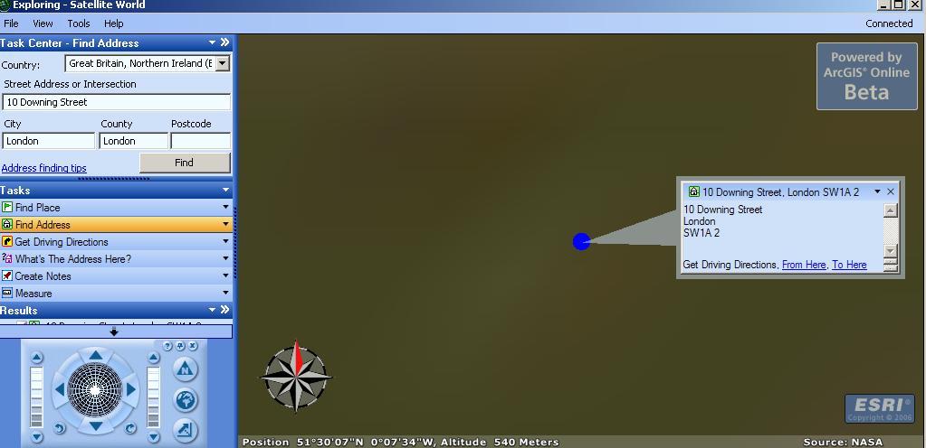
Okay so now you can find 10 Downing Street, London, UK
After entering 3 Input Boxes and Scrolling through a long list to Find Great Britain and Northern Ireland.
Then it did not actually find it after asking for conformation.

But look at the image it's not clear and does not show the real location.
Took 34 seconds to do this in ArcGIS Explorer and this result is not really what the 'User' wants.

Google Earth still wins... in our book.

The other very annoying feature is you cannot add personal geodatabases to ArcExplorer.

Time to convert .mdb into .kml??

Labels: , , , ,

23 November 2006

Animated Features in Google Earth

Using the Time Element it is possible to Animate features within Google Earth 4 (Beta 6).
version 4.0.2091+

Time Animation (4D) in 3D - Google Earth
This Ferris wheel in Vienna is animated by time in Google Earth
KMZ for Google Earth Beta 4 here

Top Tip
Select the clock button on the left of the time slider to bring up a panel to adjust the Animation Speed.

Labels: , , , , ,

02 November 2006

New Features in Google Earth 4 Beta

New Features in Google Earth 4 Beta (4.0.2416+)

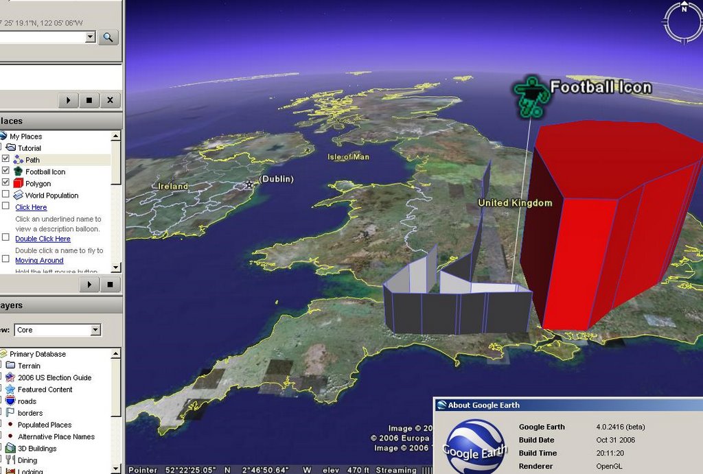
Google Earth 4 Point Line Polygon

Now Supports:
Drawing of paths and polygons (was only available in Google Earth Plus)
Point Lines and Polygons can be Extruded with elevation or made floating in space.
New Icons for Placemarkers
Faster 3D model rendering
Improved lighting for models
Print of driving directions

More info
Google Earth Blog

Download Google Earth 4 beta (Free)

Official update

Labels: , , , ,