Google Earth vs ArcGIS Explorer
Google Earth vs ArcGIS Explorer which is better?
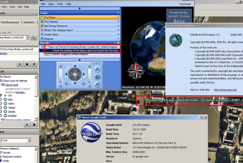
Well this was one of the quickest tests mapperz has ever done.
Google Earth Wins! by a mile.
The simplest of tasks - search for '10 Downing Street, London, UK'
Google Earth - 3 seconds to rotate the earth and zoom right into Downing Street and display the aerial photographs at full resolution.
ArcGIS Explorer - Place not Found, Please check your spelling....
(login needed)
ESRI can we please have ArcGIS service pack 1 before the end of the year?
(ESRI software users know about the x.0 curse)
Mapperz recommends Google Earth for the time-being.
Update:
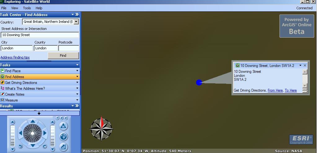
Okay so now you can find 10 Downing Street, London, UK
After entering 3 Input Boxes and Scrolling through a long list to Find Great Britain and Northern Ireland.
Then it did not actually find it after asking for conformation.
But look at the image it's not clear and does not show the real location.
Took 34 seconds to do this in ArcGIS Explorer and this result is not really what the 'User' wants.
Google Earth still wins... in our book.
The other very annoying feature is you cannot add personal geodatabases to ArcExplorer.
Time to convert .mdb into .kml??
Labels: ArcGIS Explorer, compared, Earth, ESRI, Google
posted by Mapperz @ 5:46 pm
5 comments





