->

14 September 2009

MapQuest Static Maps with POI's (advanced features)

MapQuest Static Maps with POI's (advanced features)

Interesting update from Mapquest API's

De-cluttering Points of Interest [POI] with the static maps api
MapQuest Static API with POI - advanced features - de-clutter
Creating Static Maps with your own POI- this example show how to use the de-clutter option (when points of interest are too close to each other and maintaining a pre-defined zoom level)

This static map is create with the url request

http://platform.beta.mapquest.com/staticmap/v3/getmap?type=map&center=51.044600,-1.3413100&size=800,600&zoom=10&pois=1,51.044900,-1.3413450,-51,-51|orange-100,51.044900,-1.3412700,51,-51|green,51.044200,-1.3413450,
-51,51|yellow-s,51.044200,-1.3412700,51,51
|&key=[YOUR_KEY_HERE]*

live link tinyurl'ed - http://tinyurl.com/declutter-poi

pois=1,51.044900,-1.3413450, centred locations by latitude/longitude
51,51 (with +/-) is the de-clutter default
(more info on this see http://platform.beta.mapquest.com/staticmap/index.html#advancedoptions

*copying and pasting the long url will work - though for geocoding and other controlled functions require an api key.
API keys are free - they can be created by signing up to Mapquest API via
http://developer.mapquest.com/

Mapquest Static Maps API
http://platform.beta.mapquest.com/staticmap/

source:
http://devblog.mapquest.com/2009/09/14/geocoding-and-static-map-web-services-now-in-beta/

Labels: , , , , ,

26 August 2009

Google Map Static Map Upgrade (v2)

Google Map Static Map Upgrade (v2)

New Features Encoded Paths, Polygons & Geocoding

update:
here is a useful tip or two using 'MyMaps' created features:
http://imagine-it.org/google/staticmap/encodemymap.php
(thanks to @pamelafox)

Google have made some changes - many top requested features have been included, but due to these feature requests there are some changes required for you code.

  • Locations (in center, markers, or path parameters) can now be specified as addresses instead of latitude/longitude coordinates.
  • Paths can be specified as encoded polylines.
  • Paths can be filled and rendered as polygons.
  • Colours can now be specified as any 24-bit or 32-bit colour.

Use of the Google Static Maps API is unchangedwith a query limit of 1000 unique (different) image requests per viewer per day
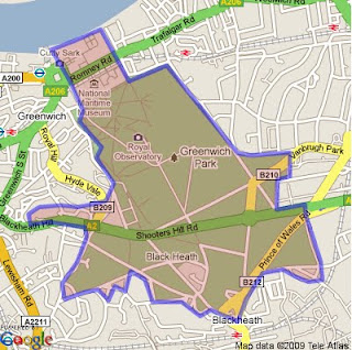
Google Static Maps v2
encoded polygon in Google Static Maps v2

http://maps.google.com/maps/api/staticmap?size=400x400&path=fillcolor:0xAA000033|color:0000ff|enc:ykfyHln@bBtLhJkI|JyGdChAzHiL
|BfBvH}IlEvCl@tG%60@rGYjIXbLpApEbC_@a@kJ~@cUpB_@tH~D~FzG%60Eg@
qAeK[iGvBgEeDwB%60A}EuFwA|AqGvG_D?_QdDiJgAiElCuOkGuC_I_Is@iK|
AuFz@_GYuGuEj@{PtG_CTbA~OsJKa@sFcH?XrVQhGi%60@dj@zDdVwRdPrCbO
&key=YOUR API KEY&sensor=false


Note: The fastest way to create an encoded polygon is to create a polygon in Google Earth then right click the polygon and copy & paste into this site

http://facstaff.unca.edu/mcmcclur/GoogleMaps/EncodePolyline/encodeForm.html
check your polygon is located correctly. The click then 'Show Code'
The line {points:
contains the encoded polygon. use this for your static map.

Having been re-written The Static Maps API v2 changes are:

red=old green=new
  • Instead of specifying maptype=mobile, specify the desired map type (like maptype=hybrid) and the parameter mobile=true. This way, we can provide mobile optimised tiles for every map type.

  • The colour for a path is now specified using "color", not "rgba":

    For example:
    &path=rgba:0x0000FF80,weight:5|37.40303,-122.08334|37.39471,-122.07201|37.40589,-122.06171
    becomes:
    &path=color:0x0000FF80|weight:5|37.40303,-122.08334|37.39471,-122.07201|37.40589,-122.06171

  • Similar to how the path styles were specified before, the marker styles are now specified using key:value pairs, separated by pipes [|]. Marker labels are now denoted using uppercase alpha characters instead of lowercase alpha characters.

    For example:
    midreda
    becomes:
    size:mid|color:red|label:A

  • Instead of specifying the marker style after each marker parameter, specify the style at the beginning of the markers= parameter, and that style will apply to all of the markers proceeding. If you want to show markers with different styles, just supply a new markers= parameter for each one.

    For example:
    markers=37.400465,-122.073003,midreda|37.437328,-122.159928,midreda|37.369110,-122.096034,smallblue
    becomes:
    markers=size:mid|color:red|label:E|37.400465,-122.073003|37.437328,-122.159928&markers=size:small|color:blue|37.369110,-122.096034

  • Marker labels now require uppercase alphanumeric characters in the label parameter. This will allow us to later supply lowercase characters if we wish.

    For example:
    markers=37.400465,-122.073003,midreda
    becomes:
    markers=size:mid|color:red|label:E|37.400465,-122.073003

  • Instead of using the span=parameter to make sure that your static map shows a particular viewport, use the visible= parameter instead, and specify a list of coordinates that must be shown.

    For example:
    center=0,0&span=20,20
    becomes:
    visible=10,-10|-10,10

  • The frame parameter is no longer supported.

After upgrading your existing functionality, you might be interested in adding some of the new API functionality to your website.

Tools: Make A Static Map Wizard (V2)

http://gmaps-samples.googlecode.com/svn/trunk/simplewizard/makestaticmap.html

Source:

http://code.google.com/apis/maps/documentation/staticmaps/upgrade.html

Labels: , , , , , , ,

29 July 2009

Why is Open Street Map Brilliant?

Why is Open Street Map Brilliant?

PCPRO author Jonathan Bray explains his
comment:

"The OpenStreetmap is a venture, started in 2004 by Steve Coast, similar to Wikipedia, only with maps."

"I remember looking at it three years ago and being distinctly unimpressed at the level of detail. But, it’s improved beyond recognition, with maps of London, in particular, that are just as detailed, if not more so, than Google maps. And as time goes on, its accuracy and usefulness can only increase"
But the is more to Open Street Map than you think.

Most don't know about the other projects using Open Street Map #OSM (twitter)

So here a some that have been successful

OpenSea Project
http://www.openseamap.org/


OpenRouteService
http://www.openrouteservice.org/


http://www.opencyclemap.org/


OpenStreetMap data for Garmin GPS devices
http://www.mkgmap.org.uk/page/main


Cloudmade - Customise the map colours


map styled by tripgeo development team

OpenStreetMap Static maps (early development) - please see previous post
http://mapperz.blogspot.com/2009/07/open-street-map-static-api-development.html

For more information and details (and source:)
http://www.pcpro.co.uk/blogs/2009/07/29/why-open-street-map-is-brilliant/

Labels: , , , , , ,

17 July 2009

Open Street Map - Static API (Development)

Open Street Map - Static API (Early Development)

"Main idea of the project is to create an web application which will provide an easy way of embedding maps into web pages. Application is going to be deeply configurable and easy to install by anyone on his server. It is being implemented in PHP5.

Mapperz first static osm map:

This an Open Street Map generated image live from the osm development server
The url that created this image is
http://dev.openstreetmap.org/~pafciu17/?module=map&center=-1.877589,50.7224&zoom=14&width=400&height=400type=cycle

Required parameters:

&center=latitude,longitude
&zoom=14 (can be 1 to 18)
&width=400 (400px)
&height=400 (400px)
type=cycle (can be mapnik, osmrender or cycle)

optional &imgType=gif or jpg (png is default)

Paths can be created (Google Maps API static maps lacks this function currently)


http://dev.openstreetmap.org/~pafciu17/?module=map&bbox=-100,45,-67,5&width=400&paths=-74,40.34,-82.3,23.1,-85,35,-87.2,32.12;-90,40,-80,40

(green is the first zigzag lines then after the semi-colon ; is the second line)


Suggestions and reporting errors:
During first month of work scaffold of application has been created with its basic functionality. Now it is time for improvements and adding new features. I would be very grateful for any feedback about API. You can send comments, information about errors etc. to osm.static.maps.api(at)gmail.com."

Mapperz has a couple of suggestions:
Can annotation be added? Like "you are here" anno=you%20are%20here;-90,180
Can polygons be added? poly=-90,180;-80,180;-80,90;-90,180&fillcolour=R255G123B0
icons - icon=basic1&3 (a circle with 3 in the middle)?

Full details
http://dev.openstreetmap.org/~pafciu17/


Your area missing map data?
Then contribute to the Open Street Map database - you be surprised how easy it is to add your own collected data. You might even get hooked like with 125,000 other osm contributors.
http://wiki.openstreetmap.org/wiki/Main_Page

Looks very promising.

Labels: , , , , , ,

27 April 2009

Microsoft 'Static' Birds Eye View [Staging Preview]

Microsoft 'Static' Birds Eye View [Staging Preview]

Virtual Earth April 2009 update:

"This release is a mere 9+ TB of data; however, it covers over 1 million square kilometers of Earth"

http://blogs.msdn.com/virtualearth/archive/2009/04/28/virtual-earth-imagery-release-april-2009.aspx


The Microsoft Virtual Earth Web Service SDK now allows you to access images in a static way

The are advantages to this including:
  • Creating seamless 'stitched' images
  • Generation for mobile devices (non-javascript or flash based)
  • Inserting into documents

Birds Eye View - Static


Getting Static Birds eye Images Using Microsoft's Virtual Earth Web Service

try it here
http://cp.cloudapp.net/GetBirdsEyeImage.aspx

Search Birds Eye View Static
courtesy of Chris Pendleton

Also available for road, aerial, hybrid tiles for use in desktop and mobile access.
see
http://blogs.msdn.com/virtualearth/archive/2009/04/23/rendering-static-virtual-earth-bird-s-eye-images.aspx
for more information

Labels: , , , , ,

21 February 2008

Google 'Static' Maps API

Google 'Static' Maps API

"The Google Static Maps API lets you embed a Google Maps image on your webpage without requiring JavaScript or any dynamic page loading."

Pro's:
  1. No Javascript
  2. Works on standard webpages
  3. Designed for mobile/cell device developers
  4. Normal and Mobile Map Types

Con's

  1. Limited to only 1000 unique image requests per user per day.
  2. Limited function, non interactive
  3. GIF-format only
  4. Very long urls


Greenwich, England


Source:
http://googlemapsapi.blogspot.com/2008/02/google-maps-without-scripting.html

Labels: , , , , ,
