ESRI Resource Centre - New
ESRI Resource Centre - New
or Center

http://resources.arcgis.com/
ArcGIS 1o products included (intentionally?)
ArcGIS 10 includes a redesign of the ArcGIS Desktop interface and additional and improved functionality throughout the ArcGIS product line.
The following sections summarize changes in the software in different functional areas. Each section includes links to topics with more information for that specific area of the software.
Documentation
The resource centers and Support Web sites are merged into a single Web site and user experience.
Product documentation is reorganized and improved.
- Over 75 percent of the help has been rewritten and updated.
- Topics have been organized based on skill sets. The Essentials library contains core GIS concepts. The Professional library contains information about software functionality, how to use it, and more advanced GIS concepts.
- The Administrator library contains information for people who install software, manage licensing, and administer servers and databases. The Developer library contains information for people who want to customize ArcGIS, create their own custom applications, or access data outside of ArcGIS clients.
- Workflows and tutorials have been added to the ArcGIS installed and Web help.
- The installed help files take up less space on your computer.
- Videos have been added to the Web help.
Mapping and visualization in ArcGIS Desktop
http://help.arcgis.com/en/arcgisdesktop/10.0/help/index.html# /Mapping_and_visualization_in_ArcGIS_Desktop/00660000042t000000/
Deeper Examples:
Exercise 1: Learning the fundamentals of representations
http://help.arcgis.com/en/arcgisdesktop/10.0/help/index.html#/Exercise_1_Learning_the_fundamentals_of_representations/008t00000073000000/
source:
http://geo.geek.nz/esri/redesigned-esri-support-centre-website-now-available/
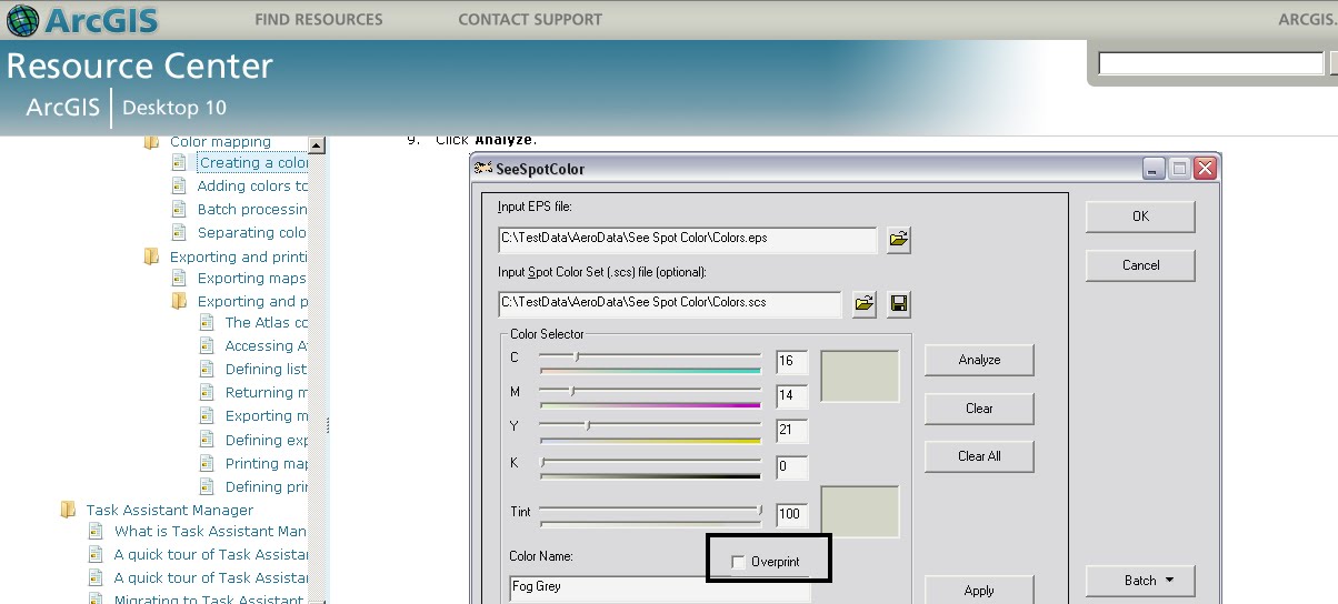
and a surprise Overprinting is now supported!
(after 8 years of asking)
Labels: ArcGIS 10, Center, Centre, ESRI, Open, Overprinting, Resource, Spot Tool
posted by Mapperz @ 12:30 am
0 comments





